Daniel Boone
-
Posts
3,542 -
Joined
-
Last visited
Content Type
Profiles
Blogs
Forums
American Weather
Media Demo
Store
Gallery
Everything posted by Daniel Boone
-

January 15th-17th 2024 Arctic Blast/Snow Event
Daniel Boone replied to John1122's topic in Tennessee Valley
-
January 15th-17th 2024 Arctic Blast/Snow Event
Daniel Boone replied to John1122's topic in Tennessee Valley
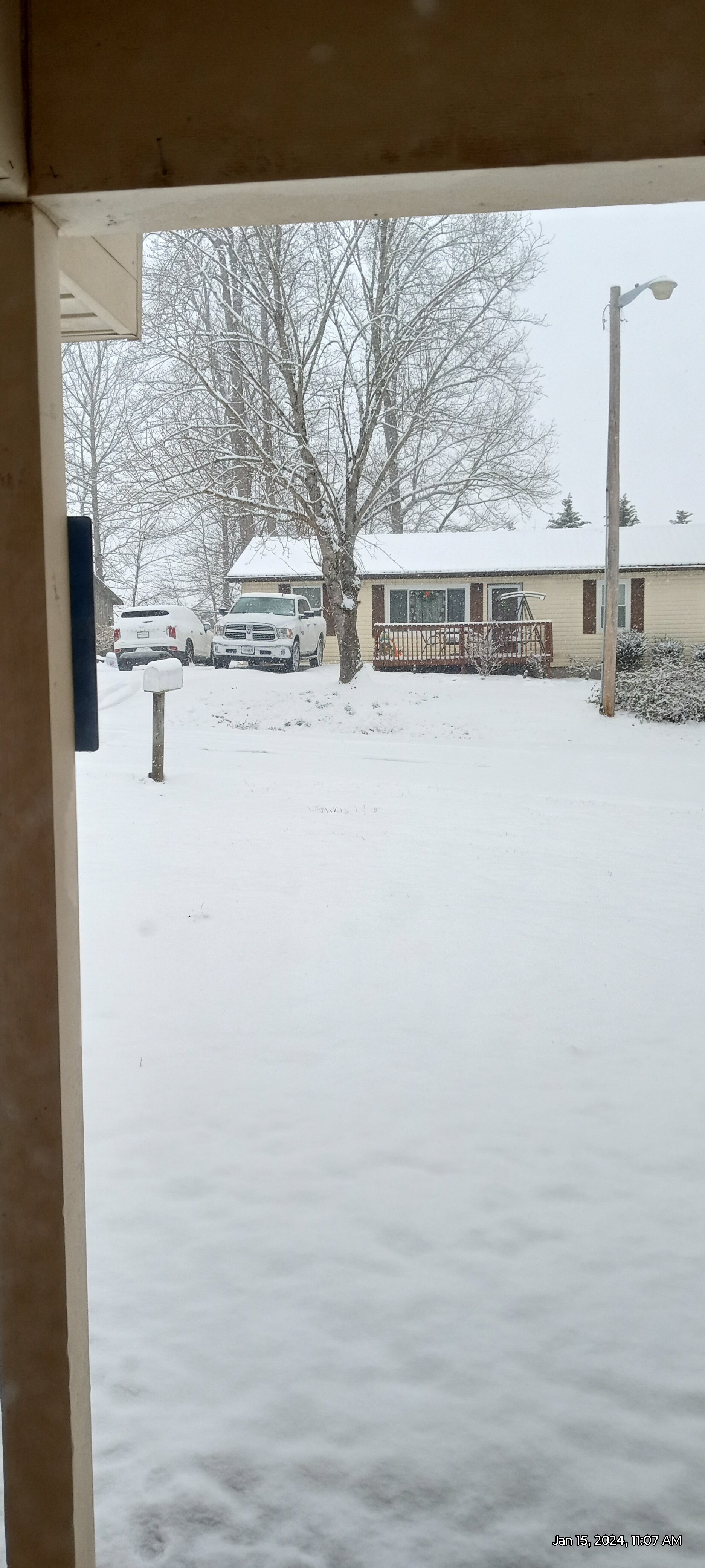
Totalled 7.2" with this one . All snow. High yesterday was 28.5. Low this Morning was 13. Currently 17. Got official measured reports of 8 inches near Pennington gap and 7 in Dryden, eastern Lee County. -
January Medium-Long Range Discussion
Daniel Boone replied to Holston_River_Rambler's topic in Tennessee Valley
Agree completely. -
If they're seeing a strong push of mild air ahead of the System that's why. However, the entrenched lower level cold should spell sleet/freezing rain with still snow northeastern sections (upper valley) as cold from the valley lifts and mixes with the waa ahead of the system.
-
Agree. I looked over alot of the goings on last night and if right, we're probably looking at maybe 60's as early as next week. If that big SER materializes and we're stuck in the MJO warm phases .. ugh. The SSW is probably needed this go around for sure. Hopefully, guidance is off on the MJO.
-
January 15th-17th 2024 Arctic Blast/Snow Event
Daniel Boone replied to John1122's topic in Tennessee Valley
Amazing the difference between you and there irt snow and cold most of the time. -
January 15th-17th 2024 Arctic Blast/Snow Event
Daniel Boone replied to John1122's topic in Tennessee Valley
Really strange that mid layer warm tongue still shooting up the Valley. It's as if an ULL is sitting to our West. -
January 15th-17th 2024 Arctic Blast/Snow Event
Daniel Boone replied to John1122's topic in Tennessee Valley
Hopefully, that'll survive up through here. Sounds like Lee side Low at work. -
January Medium-Long Range Discussion
Daniel Boone replied to Holston_River_Rambler's topic in Tennessee Valley
Yeah, I'm a bit concerned about February as well as the MJO has me skiddish. It may set off that Firehose into Canada again. Probably not but, possible. IF it were to, would probably delay cold till later in February. Hopefully, that won't happen. Otoh, maybe the warm phases get knocked off kilter by other Drivers as happened in some Winter's of yore. -
January 15th-17th 2024 Arctic Blast/Snow Event
Daniel Boone replied to John1122's topic in Tennessee Valley
Expect 8-10 brother. -
January 15th-17th 2024 Arctic Blast/Snow Event
Daniel Boone replied to John1122's topic in Tennessee Valley
That's what I was thinking, maybe some larger flakes with those Shower's. -
January 15th-17th 2024 Arctic Blast/Snow Event
Daniel Boone replied to John1122's topic in Tennessee Valley
6" here. Suddenly stopped as broken area coming through. Some of those showers with the batch coming off eastern plateau are heavy and may put down a quick inch or two. I expect you to get 8-10 at least Carver. -
January 15th-17th 2024 Arctic Blast/Snow Event
Daniel Boone replied to John1122's topic in Tennessee Valley
Yeah, it does. -
January 15th-17th 2024 Arctic Blast/Snow Event
Daniel Boone replied to John1122's topic in Tennessee Valley
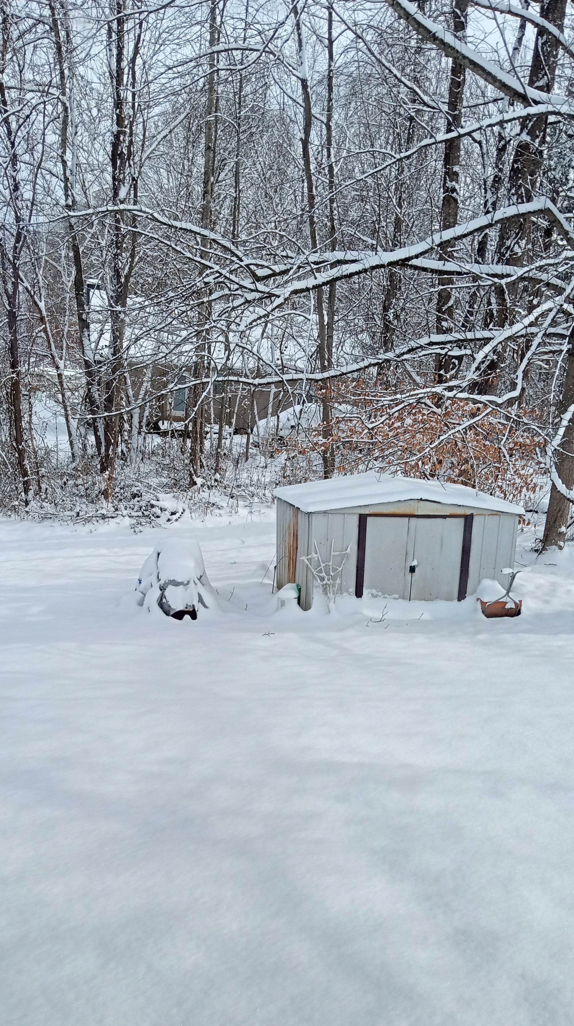
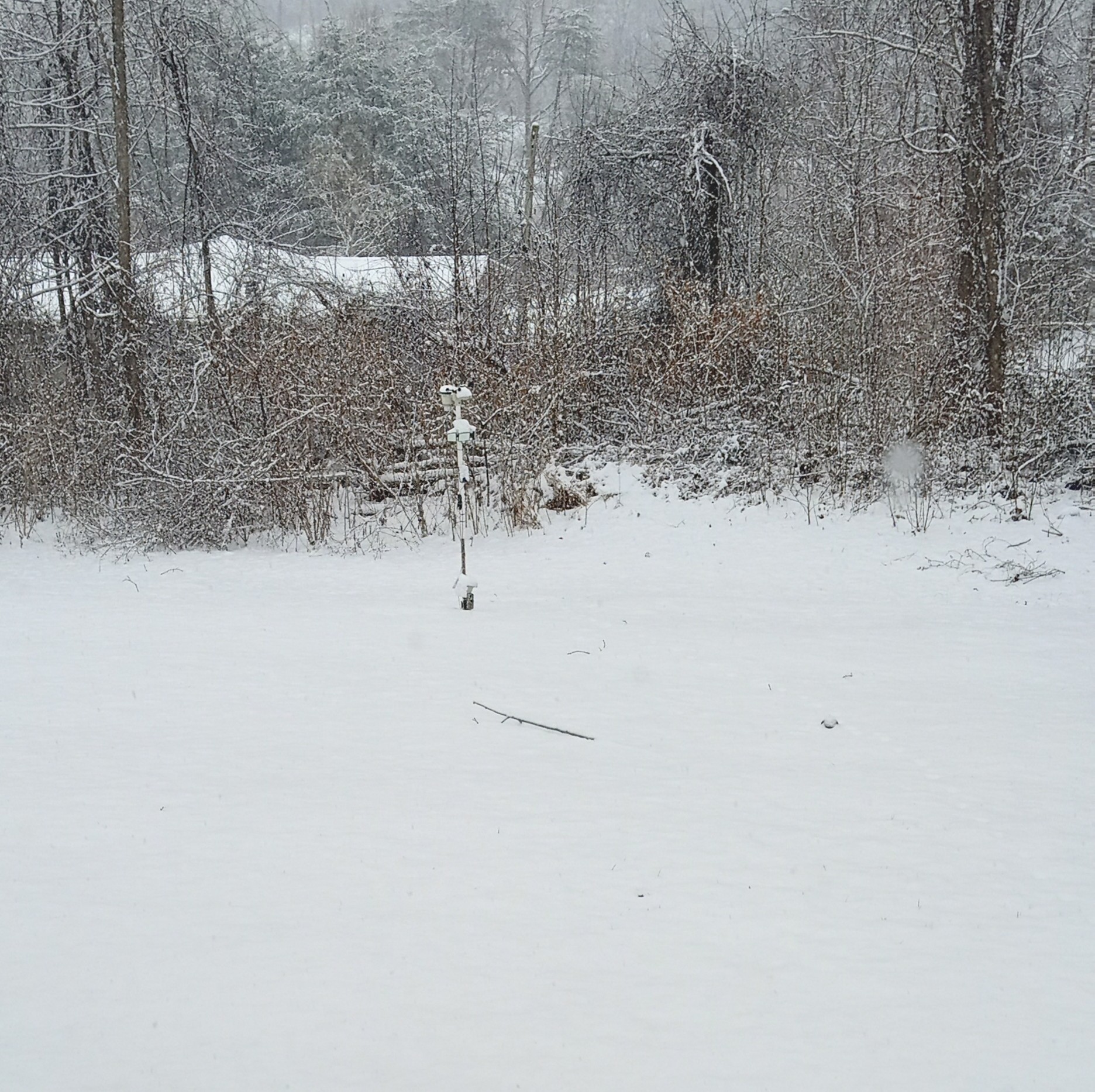
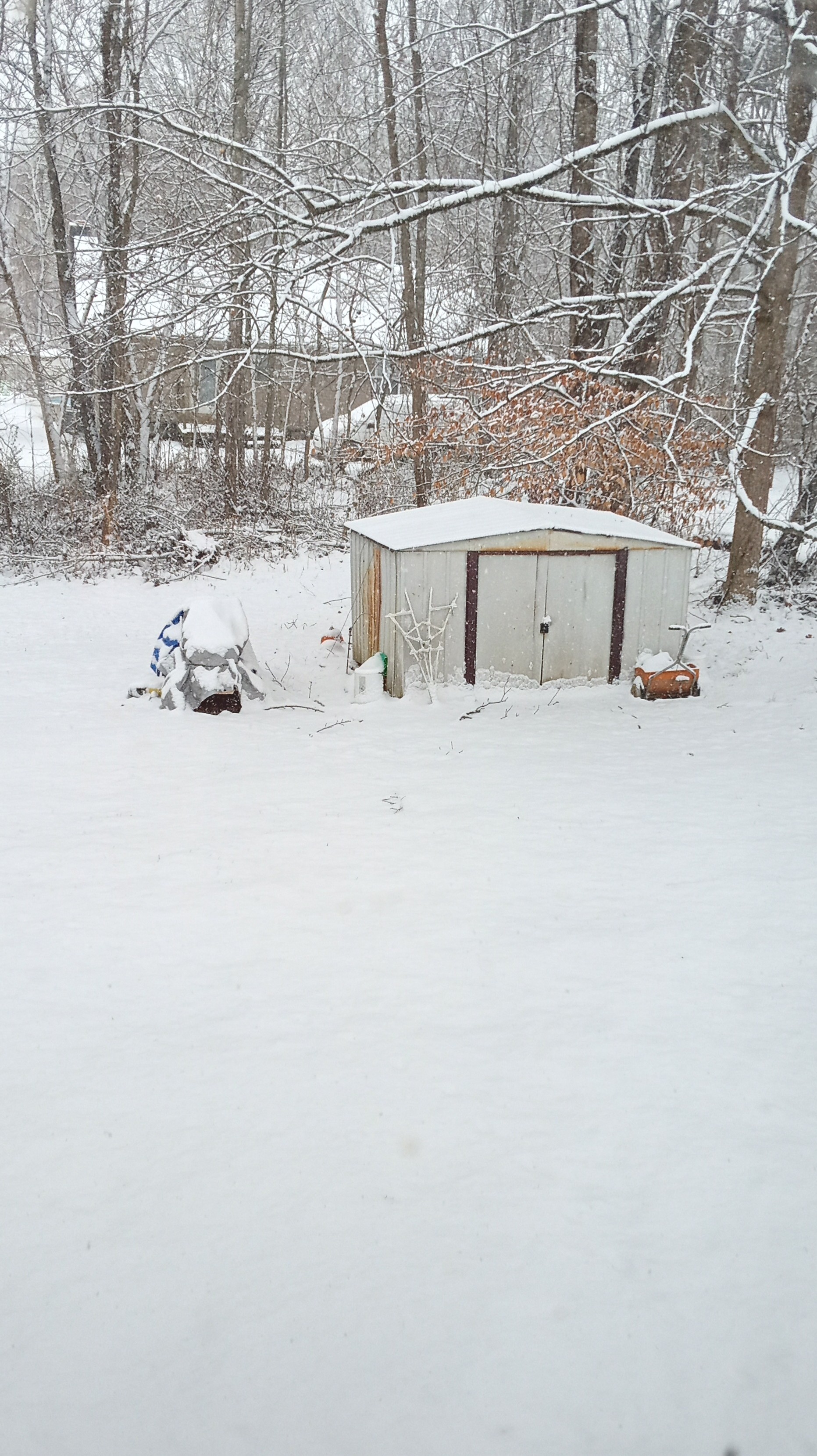
Excellent post man ! I agree on your reasoning on all points. We were fortunate here in that we were colder than TRI and Ratios better but, rates have been light for the most part as flakes have been small. Portions of the County have been experiencing larger flakes, generally near mountains. I currently have about 4.5 inches. -
January 15th-17th 2024 Arctic Blast/Snow Event
Daniel Boone replied to John1122's topic in Tennessee Valley
4" now with moderate Snow. 26 F. -
January 15th-17th 2024 Arctic Blast/Snow Event
Daniel Boone replied to John1122's topic in Tennessee Valley
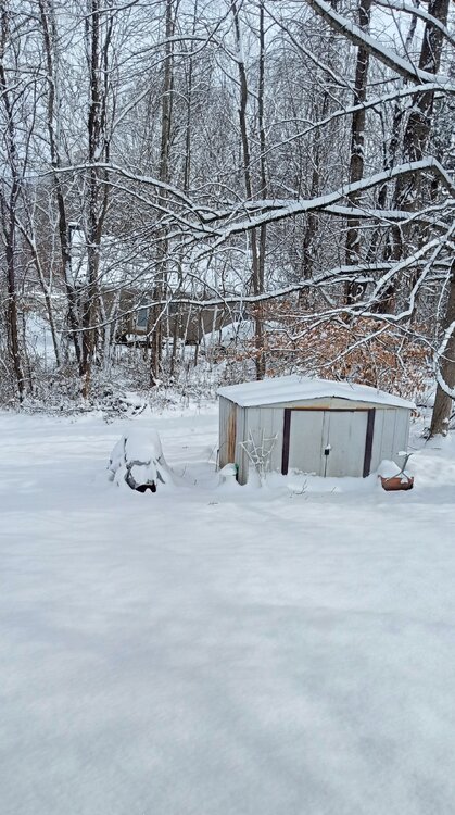
One more...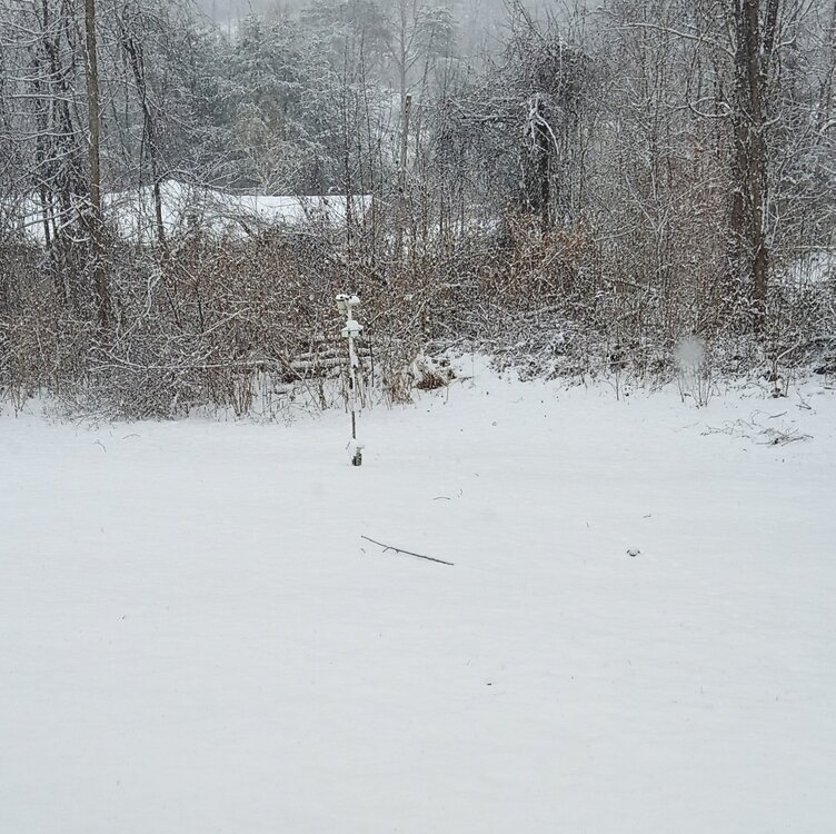
-
January 15th-17th 2024 Arctic Blast/Snow Event
Daniel Boone replied to John1122's topic in Tennessee Valley
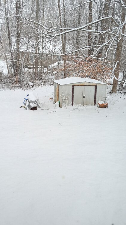
-
January 15th-17th 2024 Arctic Blast/Snow Event
Daniel Boone replied to John1122's topic in Tennessee Valley
I think you and my area will stay snow but will probably crack 30-31 for a High then start falling. -
January 15th-17th 2024 Arctic Blast/Snow Event
Daniel Boone replied to John1122's topic in Tennessee Valley
A little over 3" here with steady lt Snow falling.
-
January 15th-17th 2024 Arctic Blast/Snow Event
Daniel Boone replied to John1122's topic in Tennessee Valley
All jokes aside, probably a coding issue causing that there Carver. -
January 15th-17th 2024 Arctic Blast/Snow Event
Daniel Boone replied to John1122's topic in Tennessee Valley
It has to be the Elk ! -
January 15th-17th 2024 Arctic Blast/Snow Event
Daniel Boone replied to John1122's topic in Tennessee Valley
My Stations are KVAJONES4, KVAJONES1 and COOP DW6569. -
January 15th-17th 2024 Arctic Blast/Snow Event
Daniel Boone replied to John1122's topic in Tennessee Valley
28.5 here in Jonesville VA. -
January 15th-17th 2024 Arctic Blast/Snow Event
Daniel Boone replied to John1122's topic in Tennessee Valley
Those ads drew my attention away, lol -
January 15th-17th 2024 Arctic Blast/Snow Event
Daniel Boone replied to John1122's topic in Tennessee Valley
Yeah, basically 6-8" Knoxville north and 4-6 Johnson City east.