gymengineer
Members-
Posts
3,363 -
Joined
-
Last visited
Content Type
Profiles
Blogs
Forums
American Weather
Media Demo
Store
Gallery
Everything posted by gymengineer
-
Without going too far back, DC also had notable (WSW criteria) snowstorms 12/31-1/1/71, 1/4-5/80, and 1/8/88. 1/77 had a 3-day sequence early in the month that would total WSW as well but they weren’t all one storm.
-
Are you sure you meant to go all the way to January 9th?
-
Top analog was 12” at IAD and the second one was DCA’s highest Christmas Day snow depth of 7”, eventually tied by 12/09.
-
For those who like looking back at snow maps, 850 and 500 mb analyses, etc from past events, just a reminder that Ray Martin’s winter storm page covers a lot of the events we experienced from 1993-2013. His is NJ centered, but most of our events are there: http://www.raymondcmartinjr.com/weather/
-
Mobile Regional Airport: another 90+ gust, now well east of the center.
-
And add Biloxi to the list. A Cat 1 hurricane would not likely be generating 90+ mph gusts in numerous sites 4 hours after landfall across a west to east swath of coastline. Yes, the strengthening was key.
-
Both Waveland and Gulfport MS gusting over 90 mph— not something many would have predicted this morning.
-
Orleans parish at 70% outage now. Once again (happened with Delta too), a rainless south side of a halfacane delivers on the winds.
-
And FOX8 just recorded 90 mph on the rainless back side.
-
New Iberia/Arcadiana Regional Airport has been reporting 80+ mph gusts at the top of the hour for three straight hours now, including two without any precipitation. Other locations have also reported hurricane force gusts without any precipitation. This half-a-cane has a transport mechanism for pockets of upper level winds to reach the ground even without any precip.
-
That poster was referring to Frances and Jeanne in 2004, and like only 2 miles apart in landfall location.
-
Actually Delta has laid a pretty big footprint of recorded hurricane force gusts stretching from eastern TX through central LA. KBPT (Beaumont/Port Arthur) gusted above 80 mph as did KARA (Arcadiana Regional Airport), and plenty of sites in between.
-
The “predict” numbers are the baseline, no water rise values that simply show the daily high tide/low tide water heights. You can see “forecast guidance” is a different category in the graph. When you click on the difference between observed and predicted, it’s showing how much higher the water is than where it “should” be. It’s not being compared to any forecast.
-
Observed minus predicted water levels are already more than 4’ from Sabine Pass, TX to Eugene Island, LA. Already more than 6’ at Freshwater Canal Locks in LA. https://tidesandcurrents.noaa.gov/inundationdb/storm/Delta.html
-
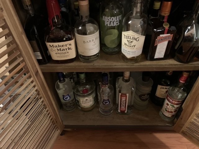
It’s not a competition, fellow school system instructional specialist But I didn’t show what’s already in the cabinet underneath in my previous post.
-
We realized we could get Instacart liquor delivery from Costco two days ago. That’s a game changer for us as the liquor store was worse than anywhere else we’ve been in terms of people being able to maintain distance inside. We taste tested the two types of vodkas, the gin, and the wine. Kirkland brands will do fine for us, and now we can cross off the liquor store as the last remaining destination.
-
2020 Mid-Atlantic Severe Weather - General Thread
gymengineer replied to Kmlwx's topic in Mid Atlantic
Have there been widespread 50 mph+ gusts across the area from a *southerly* direction since Isabel (03)? -
I’m following a curated meteorologist twitter list for Dorian. I’ve never seen meteorologists rage tweeting like right now.
-
It can’t be a bad sign heading into an even better pattern that the two serviceable windows this season have so efficiently given our subforum two 10”+ snowstorms. Richmond wasn’t locked in for their 11” heading into the event either. These are some juiced up storms.
-
Just came across this from Typhoon Jebi. The Hong Kong videos earlier this season got a lot of attention, but this stuff out of the Osaka area is pretty dramatic too. Kansai International Airport gusted to 130 mph and even the downtown business district of Osaka had a 106 mph gust.
-
Southern MD / Lower Eastern Shore weather discussion
gymengineer replied to AnEndlessMaze's topic in Mid Atlantic
Great to see. I've really appreciated your posts, particularly reminding the subforum that the past two winters weren't a 'disaster' for many parts of the lower Mid-Atlantic. -
As its just south of Tokyo 24 HRS, VALID AT: 221800Z --- 34.1N 138.8E MAX SUSTAINED WINDS - 105 KT, GUSTS 130 KT WIND RADII VALID OVER OPEN WATER ONLY EXTRATROPICAL RADIUS OF 064 KT WINDS - 070 NM NORTHEAST QUADRANT 070 NM SOUTHEAST QUADRANT 075 NM SOUTHWEST QUADRANT 060 NM NORTHWEST QUADRANT RADIUS OF 050 KT WINDS - 220 NM NORTHEAST QUADRANT 215 NM SOUTHEAST QUADRANT 180 NM SOUTHWEST QUADRANT 180 NM NORTHWEST QUADRANT RADIUS OF 034 KT WINDS - 445 NM NORTHEAST QUADRANT 410 NM SOUTHEAST QUADRANT 340 NM SOUTHWEST QUADRANT 395 NM NORTHWEST QUADRANT
-
For me, it would be a radar loop of Carol making landfall. Perhaps the most purely tropical hit of the famous New England storms?
- 46 replies
-
- historical tropical cyclones
- hurricanes
-
(and 3 more)
Tagged with:
-
That Sampit River boat reading of 120 mph (~60 ft elevation) would again support a higher maximum gust estimate in the RMW zone. Since I support the NHC's assigned landfall intensity, the other data indicating Category 4 is what made his wind map based on damage to trees and structures stand out as an outlier. Hmm, to add some more confusion, this other map does not match the original one I imbedded. It's somehow tied to Fujita as well, but has a zone of 145 mph+ gusts:
- 46 replies
-
- historical tropical cyclones
- hurricanes
-
(and 3 more)
Tagged with:


