beanskip
-
Posts
2,064 -
Joined
-
Last visited
Content Type
Profiles
Blogs
Forums
American Weather
Media Demo
Store
Gallery
Everything posted by beanskip
-
February 18-19 MAJOR Ice Storm Threat
beanskip replied to NorthHillsWx's topic in Southeastern States
Heads up guys, I just talked with Larry Cosgrove, he says the cold air damming is waayyyyy overdone by the models. Should be a cold rain for most .... ;-) :-0 (got to be a board oldtimer to appreciate that one)- 970 replies
-
- 19
-

-

-
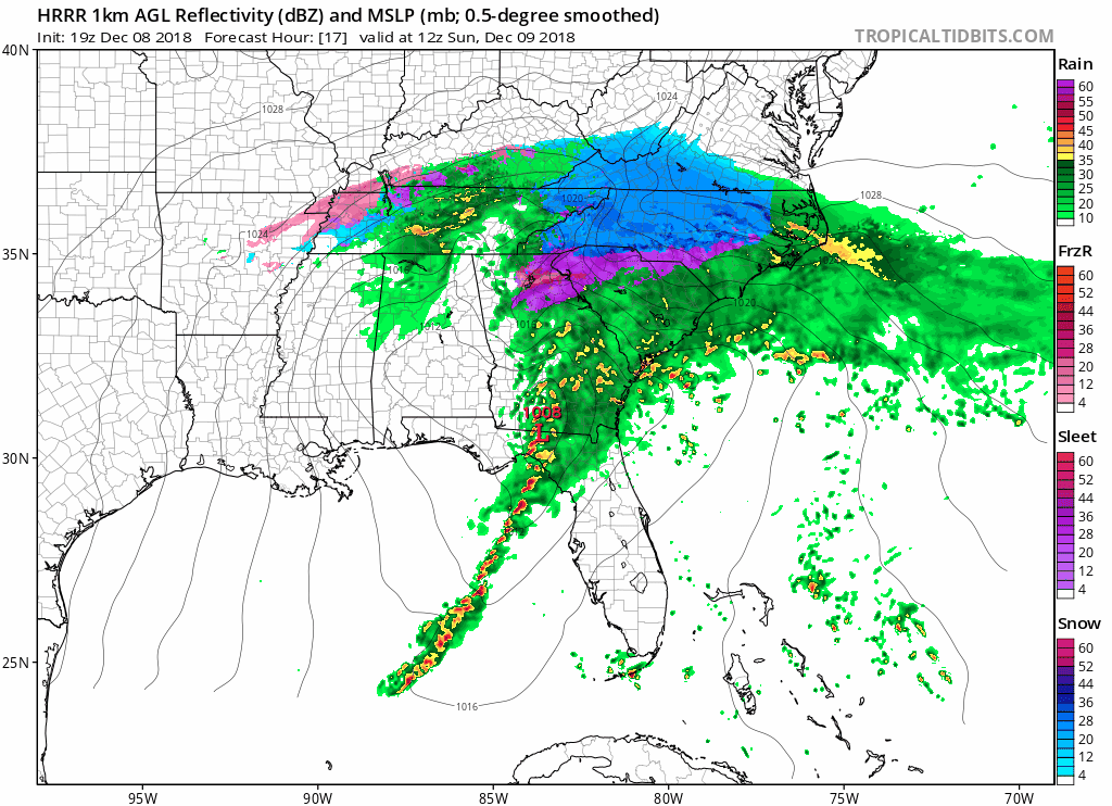
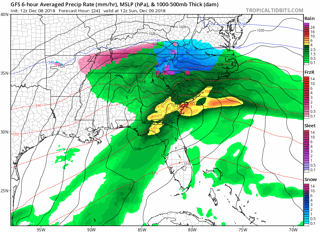
Man, 18z RGEM just plastered the mountains of NC/TN/VA.
-
Greetings to my SE friends -- I'll be rooting hard down here in the panhandle for every one to hit the jackpot. I must say, though, I would exercise caution on this one for a couple of reasons: 1) this ULL is not very strong and thus will not necessarily drive high QPF rates which means ... 2) Boundary layer issues will be real -- the latest Euro run, for example, never gets it below 36 in my old stomping grounds of Shelby -- even during the highest times of precip. That's no bueno. If I were in the mountains/northern foothills of western N.C., I'd feel good about this and with ULLs you just never really know what's going to happen in more marginal areas. But it looks very very borderline for the I-85 corridor. That won't stop me for wishing for a Hail Mary though! Good luck!
-
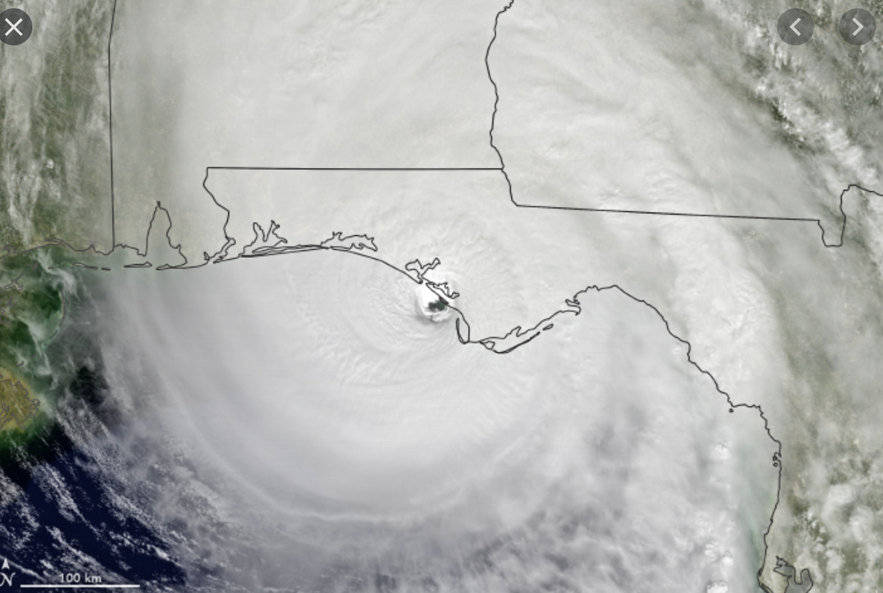
A worst-case track for New Orleans -- Zeta comes "ashore" right up Terrebonne Bay, keeping it over water for as long as possible.
-
Still strengthening, per latest recon pass -- yikes.
-
Yeah that half-a-cane Michael was really pathetic. Could barely even tell it was a storm. #facepalm
-
How much value can these model runs have that are initializing the surface pressure 20-40 mb too high?
-
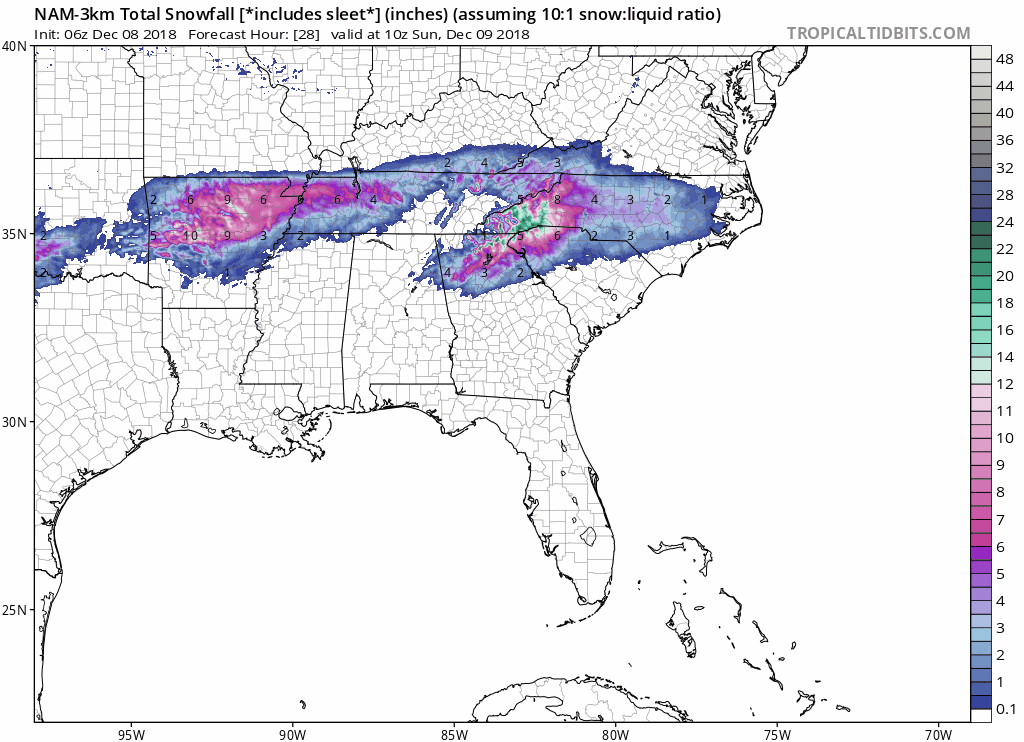
22 HRRR actually reverts back to a snowier solution for Southern NC piedmont.
-
21z HRRR continues trend of switching I85 and US 74 corridor over to sleet sooner.
-
Early in the 21z HRRR, the high pressure is a mb stronger and further southwest. As a result, western piedmont switches over to snow an hour earlier at 1z.
-
18z GFS hopping on the I85 sleet express.
-
Much “sleetier” look along I-85 corridor on this HRRR run than prior run.

-
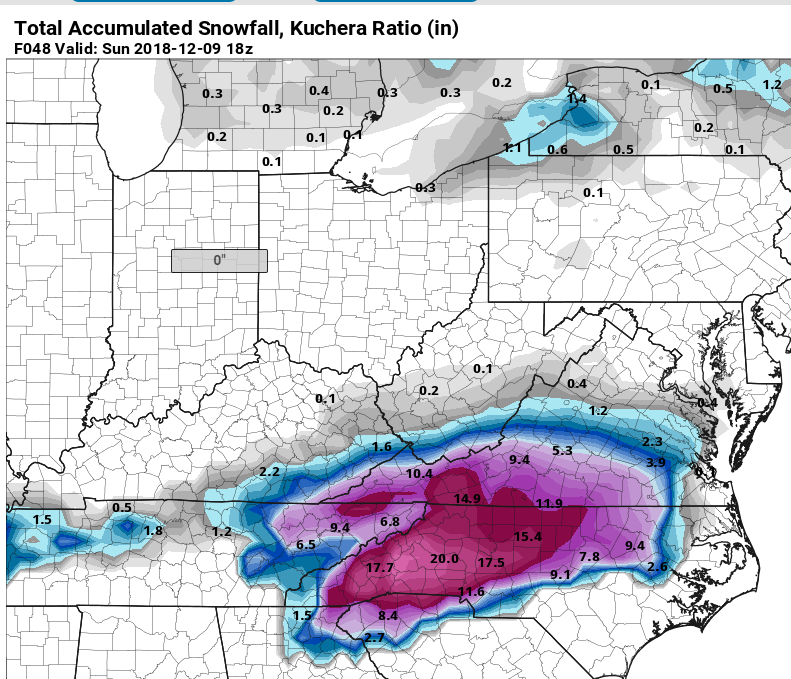
Did Euro Kuchera map ever get posted? Would be appreciated.
-
Can’t see model name??
-
Anybody have the Kuchera maps for Euro?
-
Surprised given how good 850s looked at 24 hours.
-
Upstate should be smiling from first frame of euro.
-
Just at 6 hours, the 12z GFS 850s improved the entire length of York and Cherokee counties in SC.
-
It seems to me the only way to forecast this storm is to start with QPF and move backward. So, if you are projecting, say, 2 inches is liquid and you are projecting 2 inches of snow, you’ve still got 1.8 of QPF to spend.
-
It must be nice to speak so authoritatively on a subject so few have been able to fully grasp. I envy that. True clarity is much harder for me. By the way, you opened a parenthesis and didn’t close it.
-
Evidence of the 12z shift to colder.
-
But it trended better than 6z run. More snow before changeover to sleet/zr, at least per radar graphics.
-
Strange NAM run — much less precip in most of NC. Also went back to raging sleet storm for I 85 and even I 40 corridor.
-
Actually, as most of the other models did today -- it mainly EXPANDED north. The southern periphery is roughly he same, but the northern periphery grew.
-
Even the Kuchera numbers are insane.