Spartman
-
Posts
1,219 -
Joined
-
Last visited
Content Type
Profiles
Blogs
Forums
American Weather
Media Demo
Store
Gallery
Everything posted by Spartman
-
Spring 2023 Medium/Long Range Discussion
Spartman replied to Chicago Storm's topic in Lakes/Ohio Valley
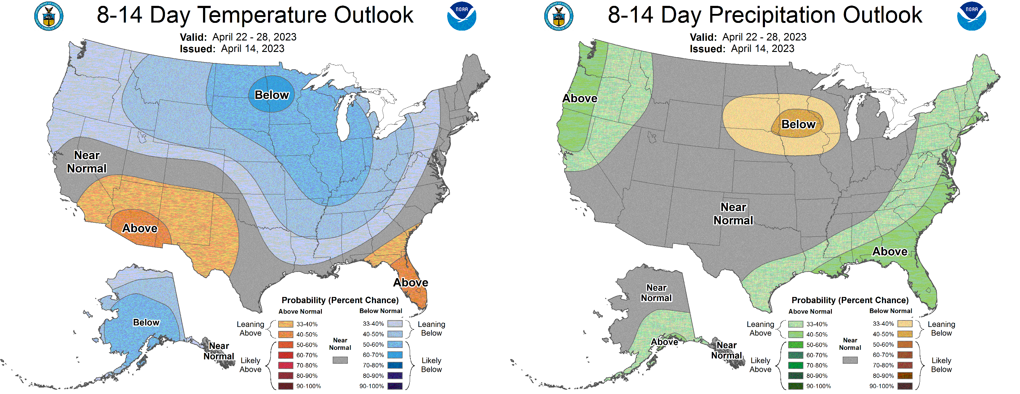
The NAO and AO go negative while the PNA goes neutral to slightly positive around mid-month. -
Feels like we're tracking a winter storm with the upcoming system
-
Looks like a short stretch of Fall weather is in store starting tomorrow.
-
That much rain? That's just the GooFuS talking.
-
-
Yesterday was the first day of measurable rainfall since May 20th. Only 0.12", though.
-
1st 90 of the year
-
12th consecutive day without measurable rainfall
-
It was the 8th driest May on record, though it was cooler than normal.
-
89'd today to kick off June. Possibly the highest we'll go for at least the 1st third of this month.
-
Spring 2023 Medium/Long Range Discussion
Spartman replied to Chicago Storm's topic in Lakes/Ohio Valley
-
Tomorrow's going to suck. With the upper low around, some places may not get out of the 60s. Some will be stuck in the 50s. Some spots may brace for suicide weather. GFS: NAM:
-
-
Spring 2023 Medium/Long Range Discussion
Spartman replied to Chicago Storm's topic in Lakes/Ohio Valley
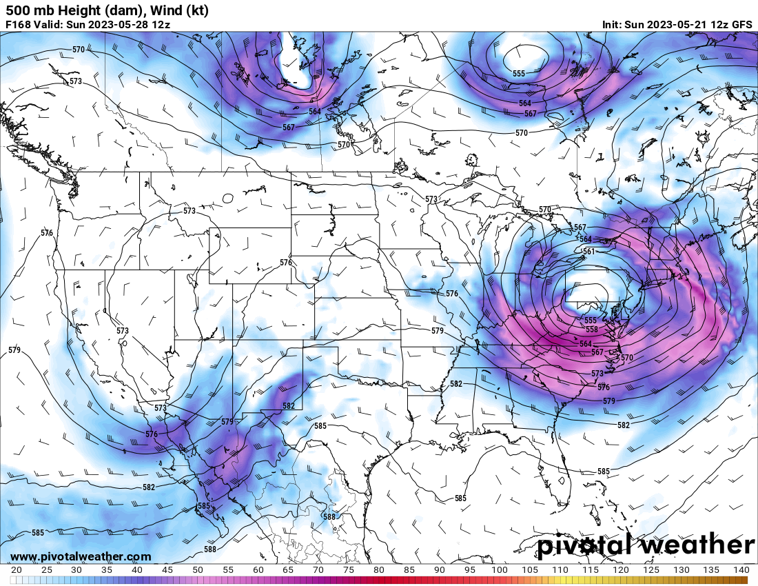
Well, there is another cooldown later this week. GFS is hinting a cutoff low for Memorial Day weekend. 12z: 18z:
-
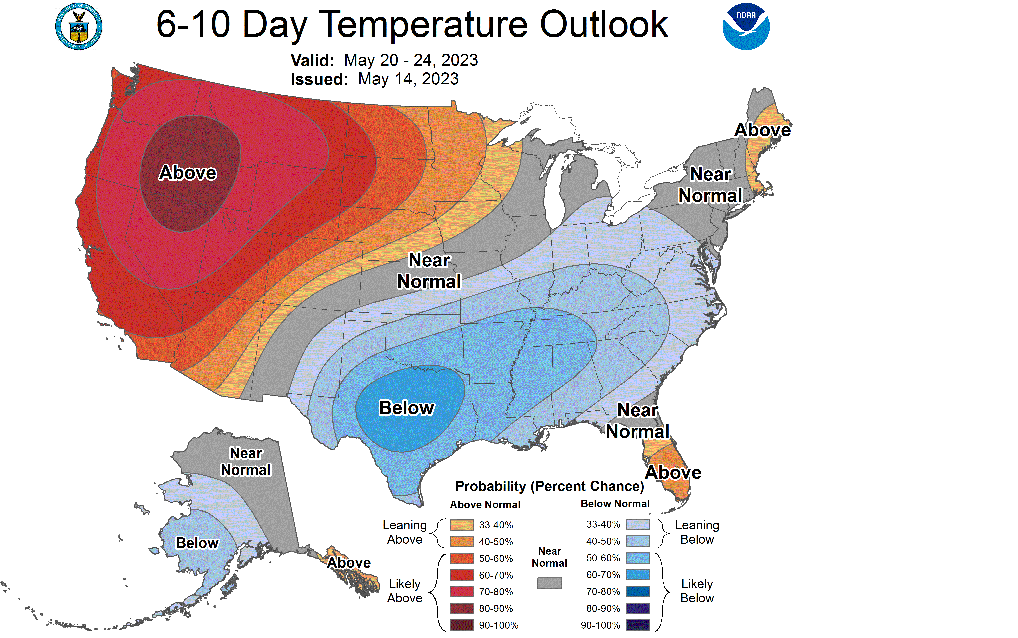
Below-normal temps look to be the rule for the upcoming week.
-
Spring 2023 Medium/Long Range Discussion
Spartman replied to Chicago Storm's topic in Lakes/Ohio Valley

-
MJO looks a bit messy for the next couple of weeks. After the middle of May:
-
Coldest start to May, ever. 000 SXUS71 KILN 020540 RERDAY RECORD EVENT REPORT NATIONAL WEATHER SERVICE WILMINGTON OH 140 AM EST TUE MAY 02 2023 ...RECORD LOW MAXIMUM TEMPERATURE SET AT DAYTON OH... A RECORD LOW MAXIMUM TEMPERATURE OF 45 WAS SET AT DAYTON OH YESTERDAY, MAY 1ST. THIS BREAKS THE OLD DAILY RECORD OF 50 SET IN 1994. $$
-
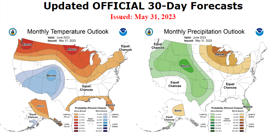
CPC sticks a fork in May
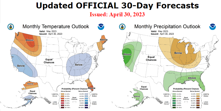
-
Can be worse, right? I mean, the first half of May looks trainwrecky. Won't even be able to reach 50 for the first day or two of the month.
-
Only reached 60. Gonna be a long crappy weekend to close out April.
-
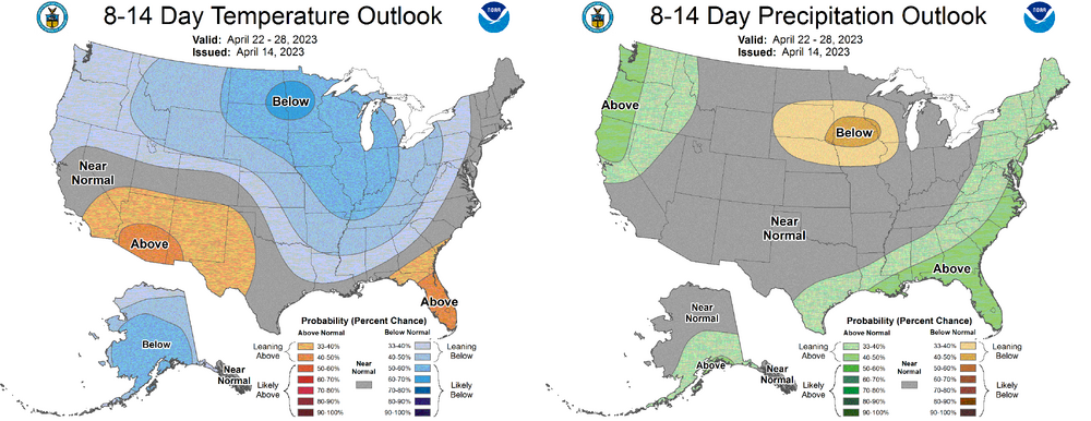
The rest of the month is shot. Not one day above normal for the upcoming week.
-
Changes start tomorrow. Won't get out of the 40s on Monday.
-
Spring 2023 Medium/Long Range Discussion
Spartman replied to Chicago Storm's topic in Lakes/Ohio Valley