Spartman
-
Posts
1,219 -
Joined
-
Last visited
Content Type
Profiles
Blogs
Forums
American Weather
Media Demo
Store
Gallery
Everything posted by Spartman
-
The 12z GFS would mean some places like Indy or DAY wouldn't get any more snow until around Valentine's Day weekend. The GooFuS is really wanting a repeat of February 1-2, 2011 for late next week. Wonder how long until the Euro, Canadian, and UK models all cave to the GFS.
-
Plunged to 1F this morning, the coldest temperature of the season, without any snowpack. January 1997 vibes this month, anyone?
-
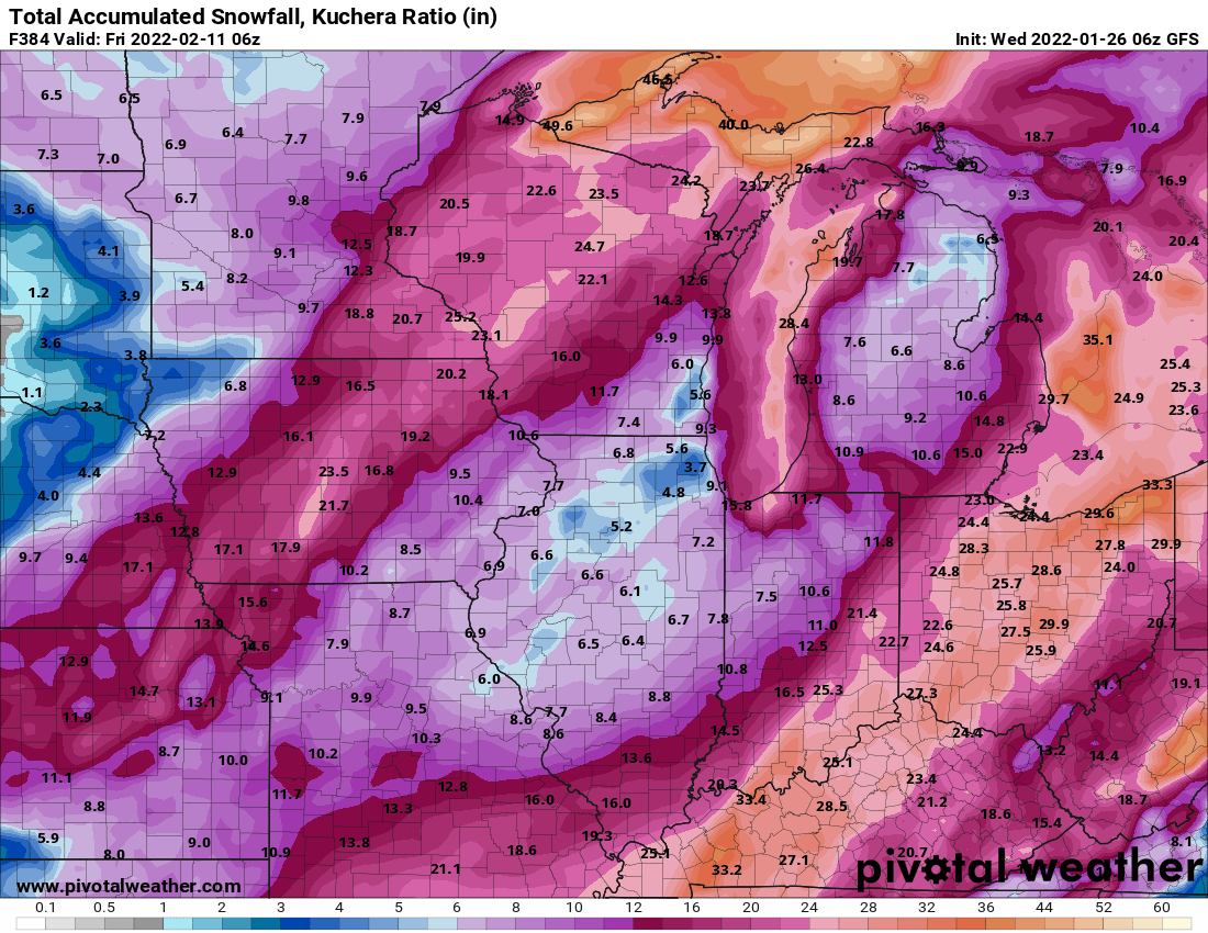
What a clown map on the 06z GFS!

-
DAY is at 3.2" for the season. The highest snowfall of the month AND this season is 0.8" on both the 16th and yesterday. Based on trends, heading into February without a 1+" snowfall event is a lock. Last time this happened was 1982-83. Besides 1982-83, the other seasons where not one 1+" snowfall event occurred through the end of January are 1949-50, 1927-28, and 1918-19. The latter is the only one without any 1+" snowfall the entire season.
-
Winter 2021-22 Short/Medium Range Discussion
Spartman replied to Chicago Storm's topic in Lakes/Ohio Valley
The only saving grace during next month would be a SSWE like what the Tennessee Valley forums just discussed about the long range 06z GFS this morning. -
Only got 0.4" from today's "clipper".
-
Winter 2021-22 Short/Medium Range Discussion
Spartman replied to Chicago Storm's topic in Lakes/Ohio Valley
Won't be this Feb. Feb is 100% done. It'll have to wait until March for at least one more snowfall opportunity, but it's otherwise time to punt until 2022-23. -
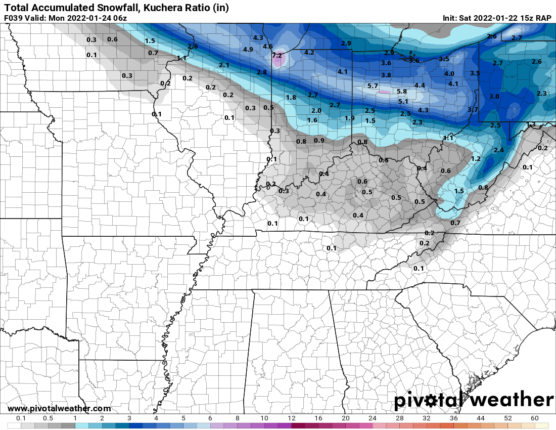
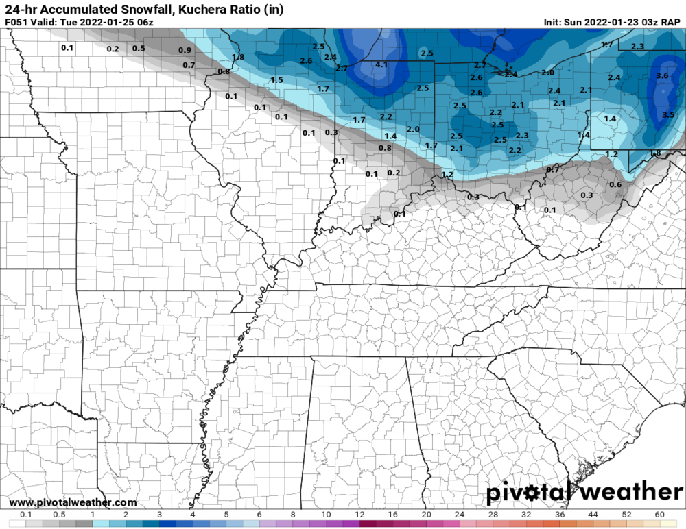
03z RAP:


-
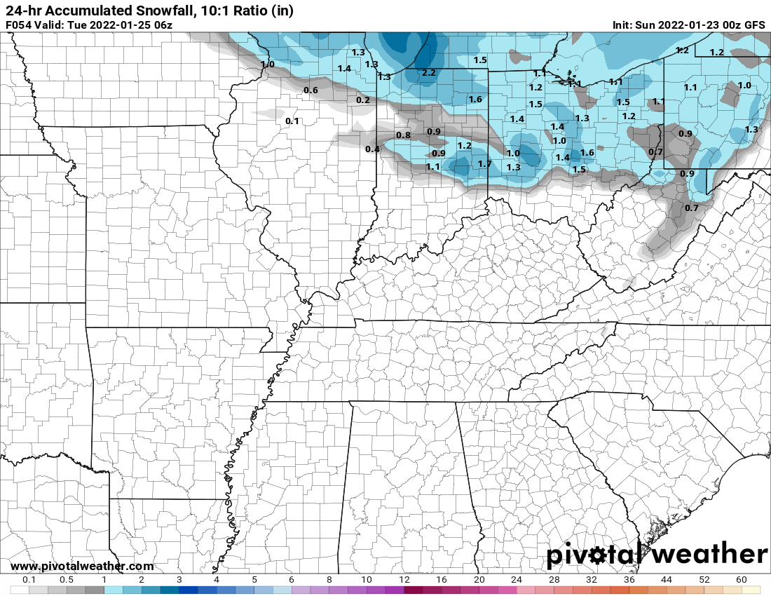
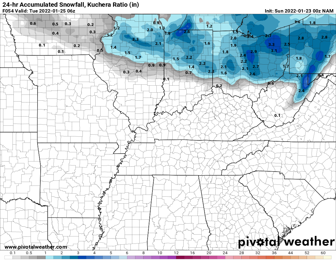
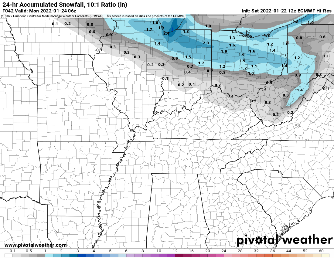
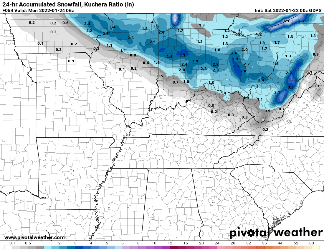
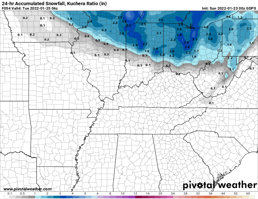
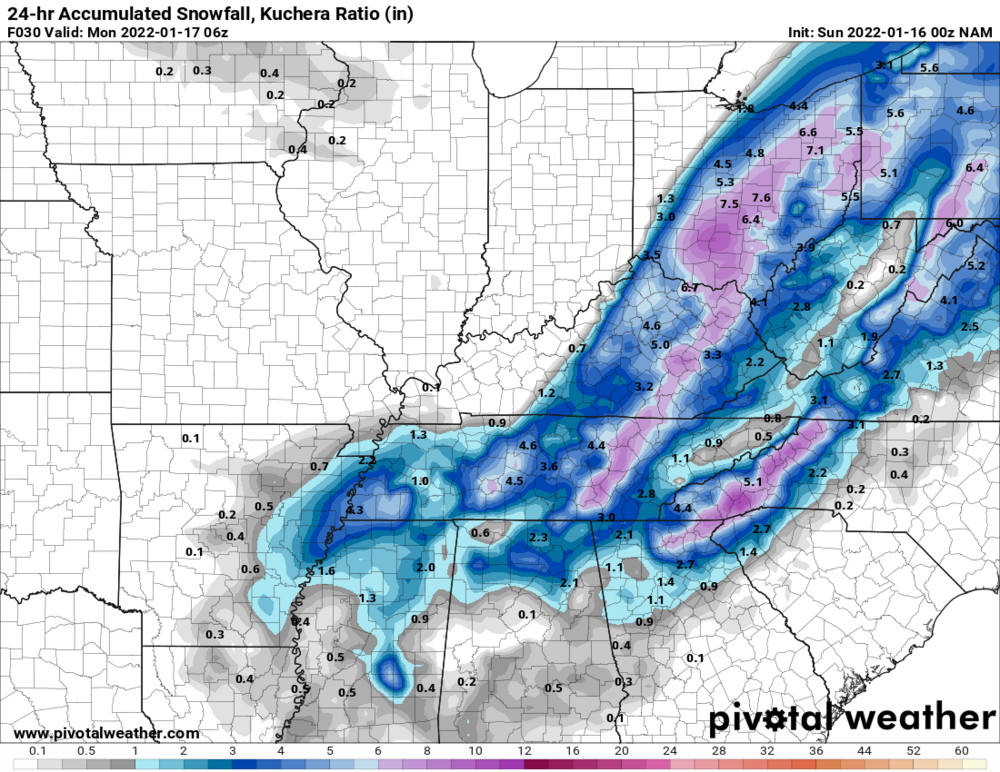
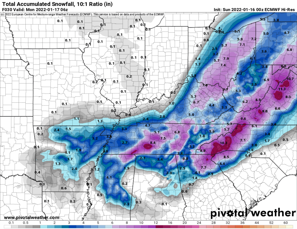
Models are now wanting to sneak in another clipper for Monday. 00z GFS: 00z Euro: 00z NAM: 00z Canadian:
-
NWS ILN still looking good:
-
Winter 2021-22 Short/Medium Range Discussion
Spartman replied to Chicago Storm's topic in Lakes/Ohio Valley
-
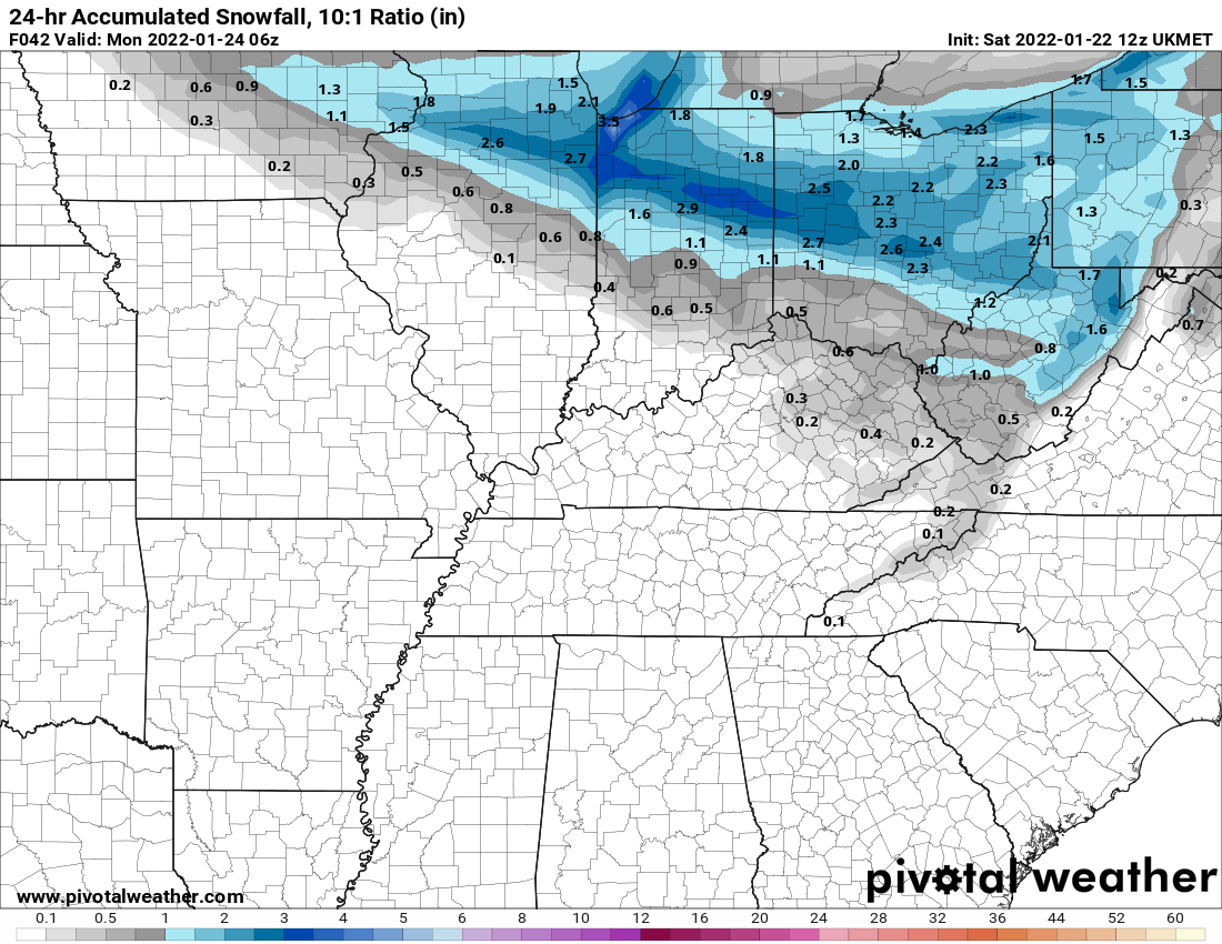
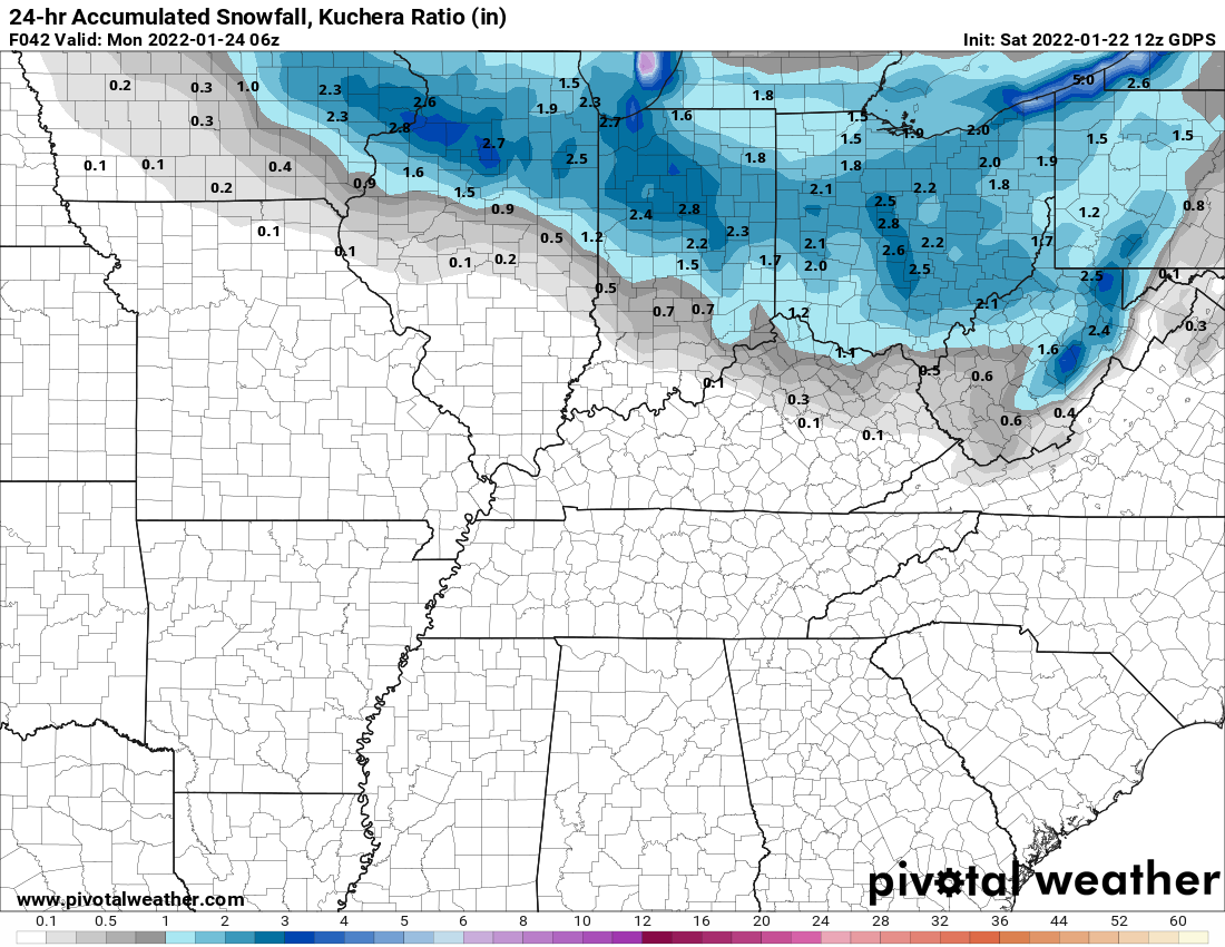
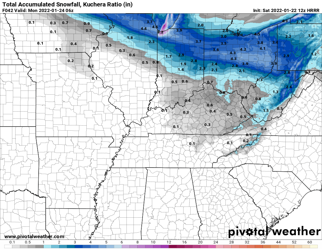
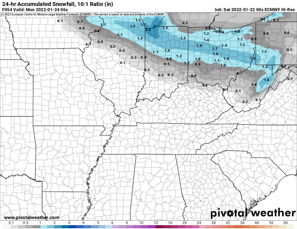
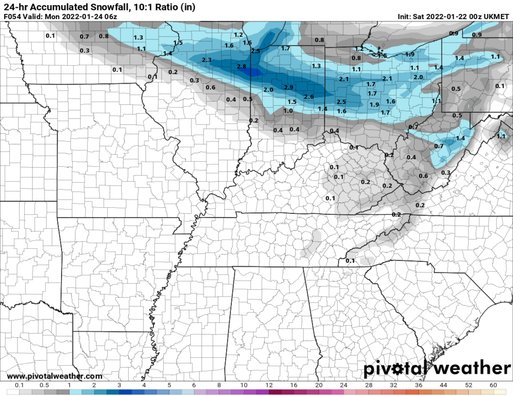
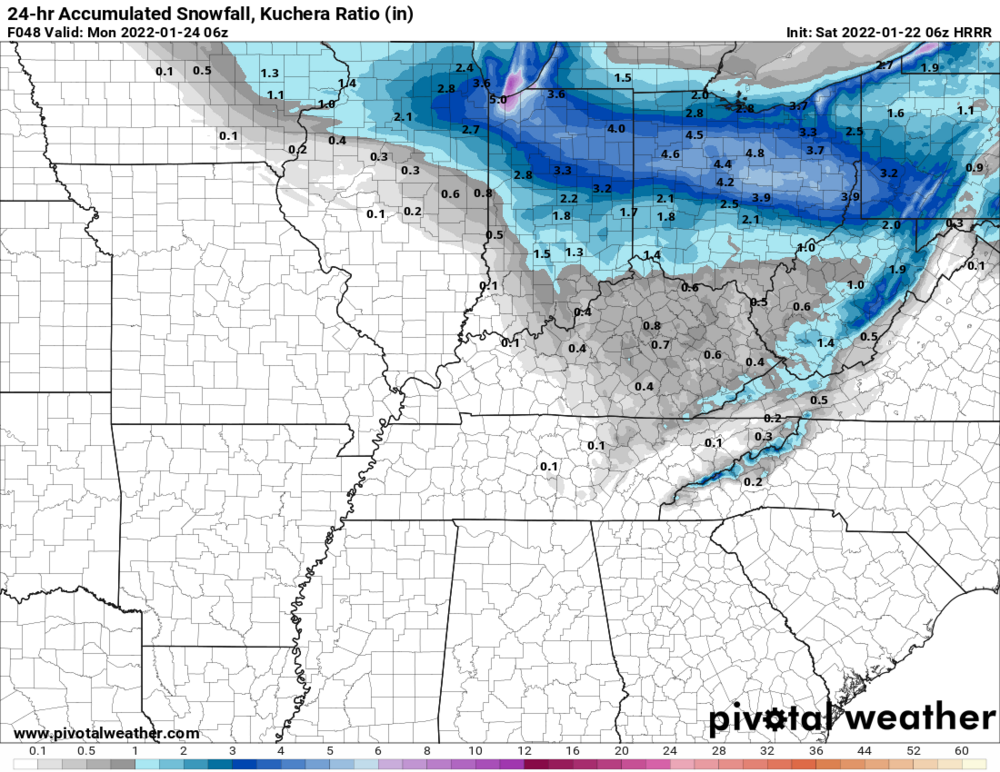
12z Euro: 12z UK: 12z Canadian: 15z RAP: 12z: HRRR:


-
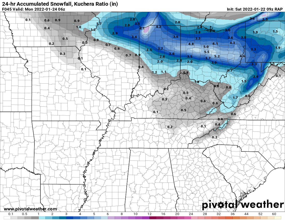
06z HRRR: 09z RAP:


-
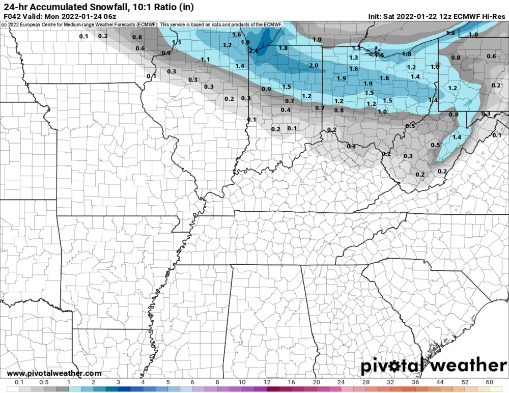
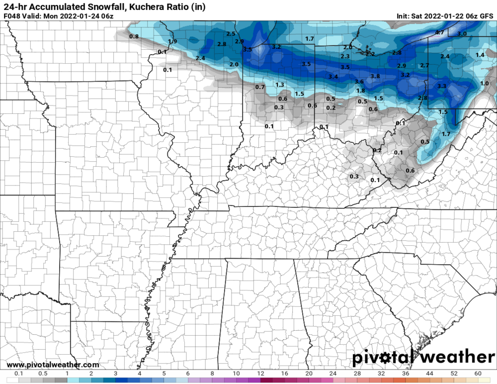
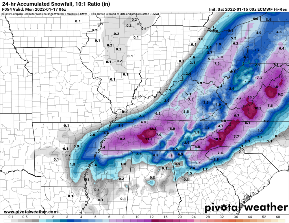
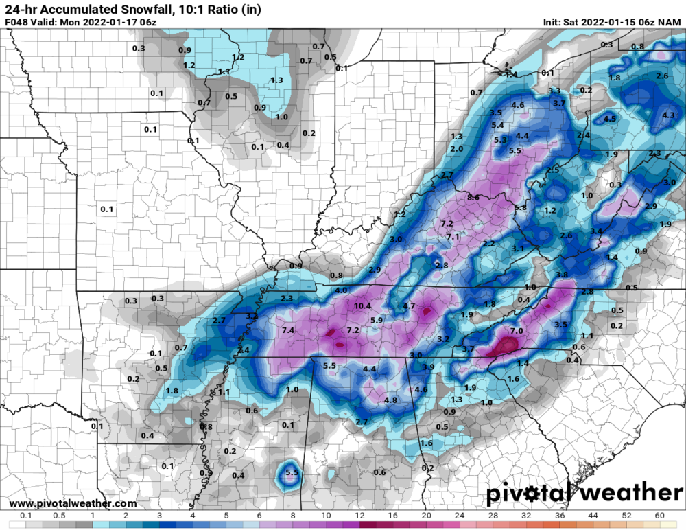
Clipper keeps getting shifted northward on the latest GFS, Euro, and NAM. 06z GFS: 00z Euro: 06z NAM: Still good on the latest UK and Canadian runs, as well as the recent extended HRRR (06z) and RAP (09z) runs. 00z UK: 00z Canadian:
-
DAY got 0.8" of snow, highest snowfall of the season. Now at 1.7" for the season. Still waiting for the first 1+" snowfall.
-
Winter 2021-22 Short/Medium Range Discussion
Spartman replied to Chicago Storm's topic in Lakes/Ohio Valley
CPC has finally updated their MJO today. After recently reaching Phase 8, we have fallen into the COD for at least the remainder of this month.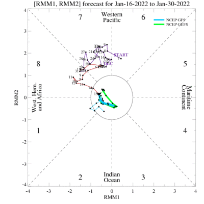
-
Shifted back West a little bit on 00z runs of the NAM, Euro, and Canadian models. 00z NAM: 00z Euro: 00z Canadian:
-
Winter 2021-22 Short/Medium Range Discussion
Spartman replied to Chicago Storm's topic in Lakes/Ohio Valley
Heading into the end of January, lock it in. :sarcasm
-
February is supposed to suck next month. There have been a lot of talks about next month being very mild. We'll be paying for that next year.
-
Already around the middle of the month, and I'm stuck with only 0.1" of snowfall for this month. This currently ties 1989 for 2nd least snowiest January.
-
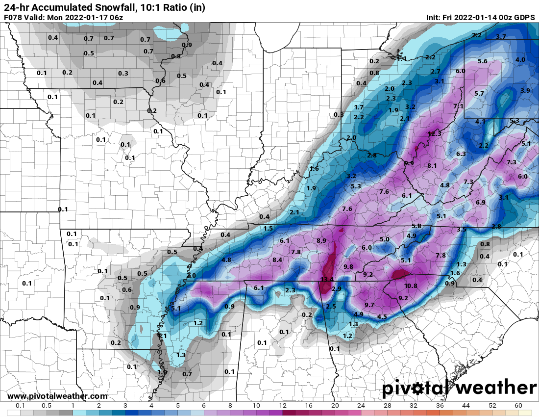
00z Euro: Shifted back East on the 6z GFS: 6z NAM:

-
Very little improvement on the 00z Euro: 00z Canadian:


-
Winter 2021-22 Short/Medium Range Discussion
Spartman replied to Chicago Storm's topic in Lakes/Ohio Valley
Regarding the final third of this month, according to Scott Sabol: -
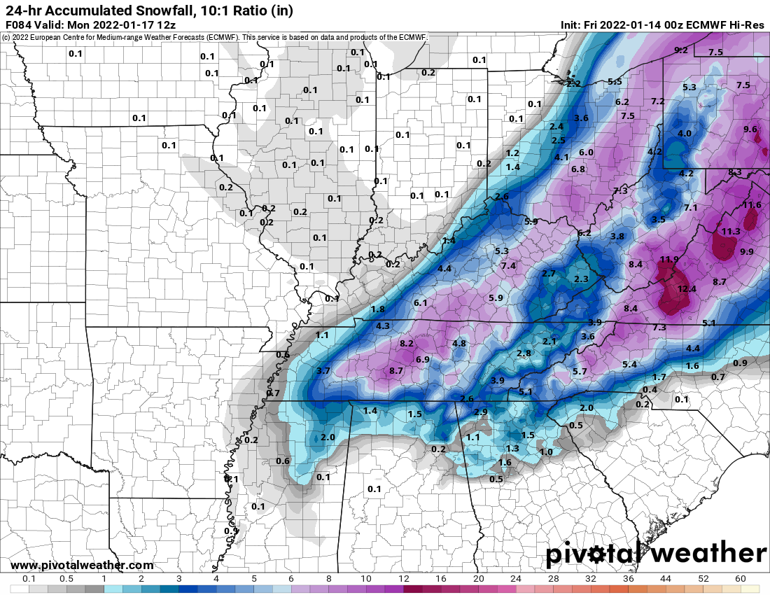
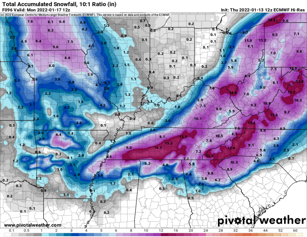
12z Euro caved.
-
Nor the 0z Euro