Chinook
-
Posts
10,674 -
Joined
-
Last visited
Content Type
Profiles
Blogs
Forums
American Weather
Media Demo
Store
Gallery
Everything posted by Chinook
-
I'm glad I didn't have to fly before and after Christmas. The cold wave blizzard plus 17000 flights cancelled by Southwest Airlines! There's probably a low chance I would have been on Southwest, but I have had flights with them before. From what I have heard, the problems with Southwest started in Denver, where the significant temperature drop caused them to start cancelling or delaying flights, I believe. Then their scheduling problems became so much larger. Also, I would have probably scheduled a Denver to Detroit flight close to that cold wave day(s).
-
Models generally have Larimer/Weld counties with pretty low amounts of snow. I believe it is due to mainly downsloping from the north at the surface. Also I think a lot of the lift will be towards southern Colorado.
-
The models predict a significant snow storm next Wednesday. As usual the GFS is loving the 11.8 to 18.1" near Denver, as it always loves forecasting high amounts of snow for the roughly 5-day forecast. Lots could change before the NWS issues a winter storm watch, but I do expect a winter storm watch at some time.
-

February 8-9 Should There Be a Thread For This Storm
Chinook replied to Hoosier's topic in Lakes/Ohio Valley
This 500mb chart makes me think of tornadoes in March. As for now, SPC has 10% enhanced outlook for tornadoes today (-not- enhanced for wind/hail)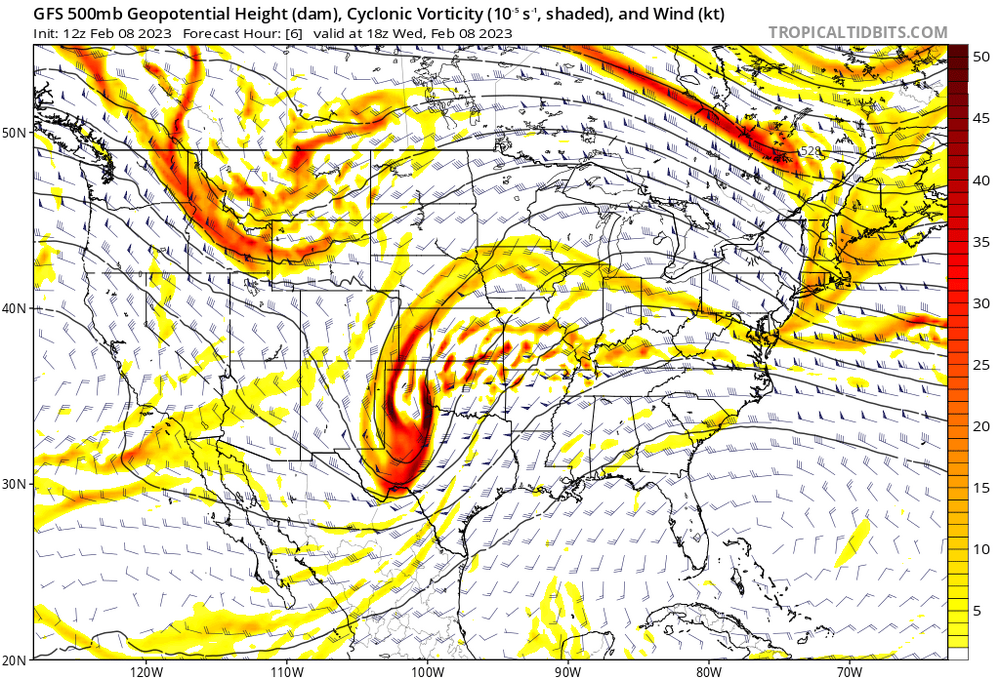
-
Under "Anatomy and Physiology of Frosty the Snowman"
-
It's so snowy, you can't even see the prediction
-
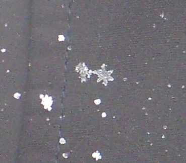
snowflake pic that I put on my web page
-
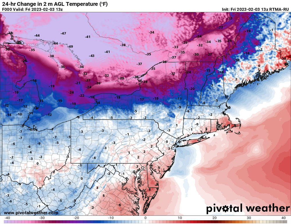
54 degrees warmer for Ontario
.thumb.png.0e655aaa450496dfabc9c936a0651b92.png)
-
My place had 4 sunny days in a row with snow on the ground. The last time my place had 4 sunny days within maybe a span of 5 days was probably November or October, with nearly summertime temperatures.
-
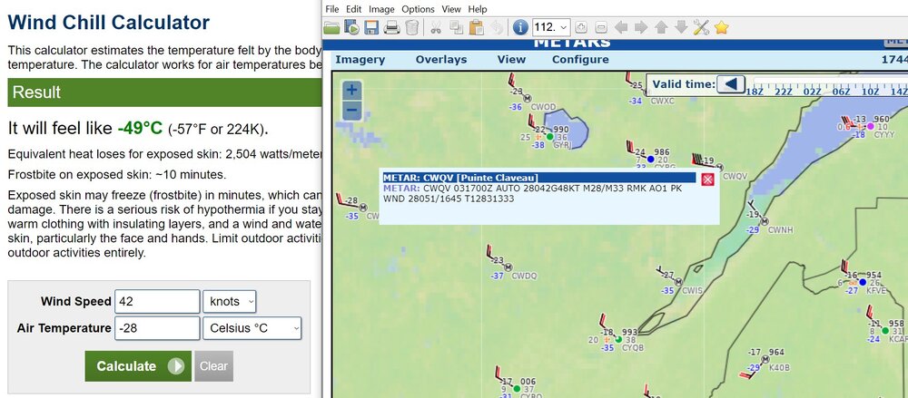
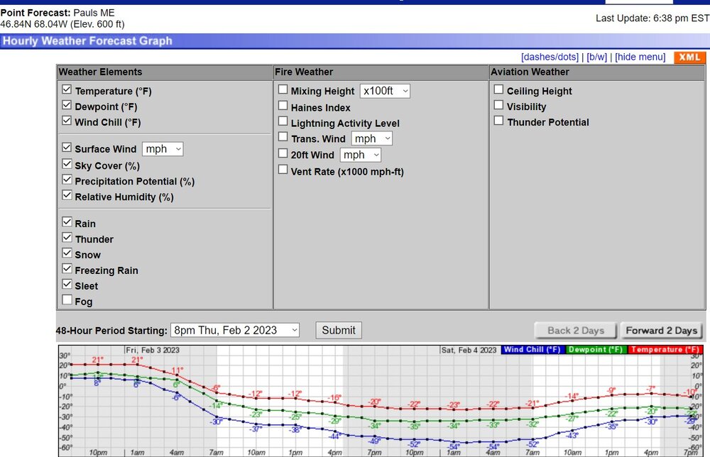
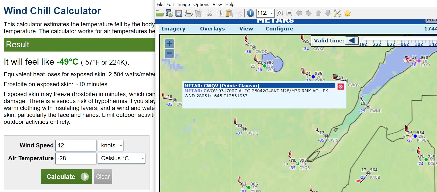
As I mentioned in the Lakes/Ohio Valley banter thread, I have a hard time imagining a -44 degree value without radiational cooling and a valley with lighter winds, or at least some localized low spot. It's truly a once-in-a-generation 850mb temperature up there and also the same for wind chills for some.
-
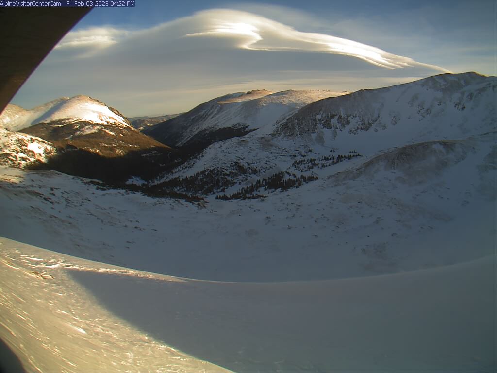
finally caught a good cloud

-
I can't imagine -44 without radiational cooling and mostly calm winds.
-
The wind gets faster over mountain peaks and some mountain passes. The air is forced into a smaller- volume space: the mountain, and other air above it. You get a faster wind by conservation of mass flow. And maybe extra turbulence.
-
Here a note on the Northeast wind chill blast. The GFS has -40C temps at 850mb for the Caribou, Maine area. I think it will be very close to a record or record-breaking at Caribou. The record coldest 850mb temperature is -39.40 Celsius as per the SPC page that has this stuff. The "median" would be -11.7 Celsius.
.thumb.png.a6266f530a8396feef4c5731fbd786e0.png)
-
Here is other note on the Northeast wind chill blast. The GFS has -40C temps at 850mb for the Caribou, Maine area. I think it will be very close to a record or record-breaking at Caribou. The record coldest 850mb temperature is -39.40 Celsius as per the SPC page that has this stuff. The "median" would be -11.7 Celsius.
-
Part of Ontario near Sudbury is 49F degrees, or 27.2 C degrees, lower than yesterday. Sudbury went -4C to -33C in about 23 hours.
-
Texas/Oklahoma Discussion & Obs Thread 2022
Chinook replied to It's Always Sunny's topic in Central/Western States
48 hrs of storm reports. I have changed the colors a bit so you can read the freezing rain reports.
-
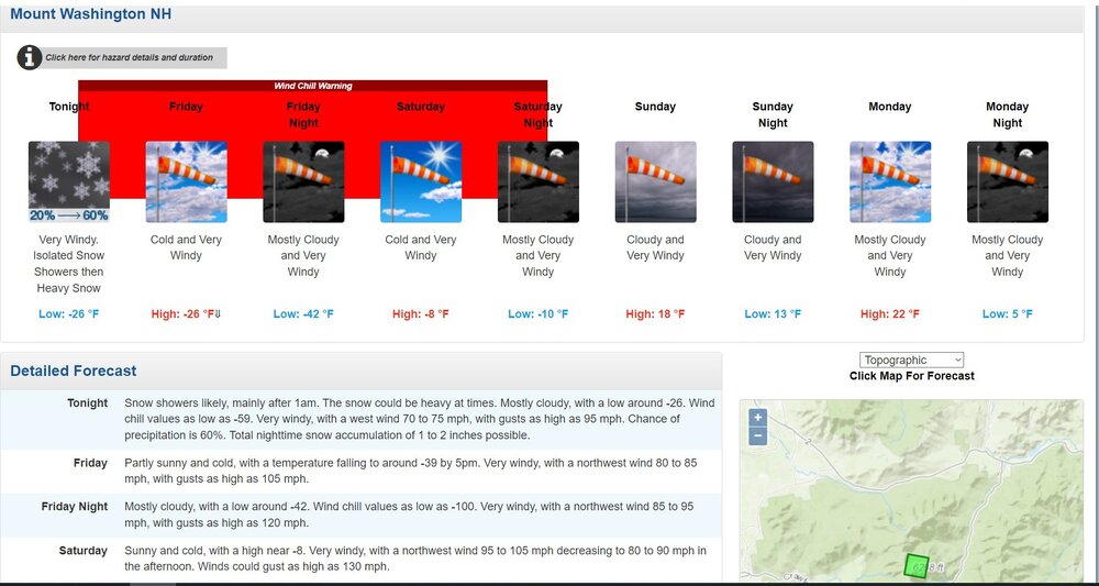
The world's windiest place

-
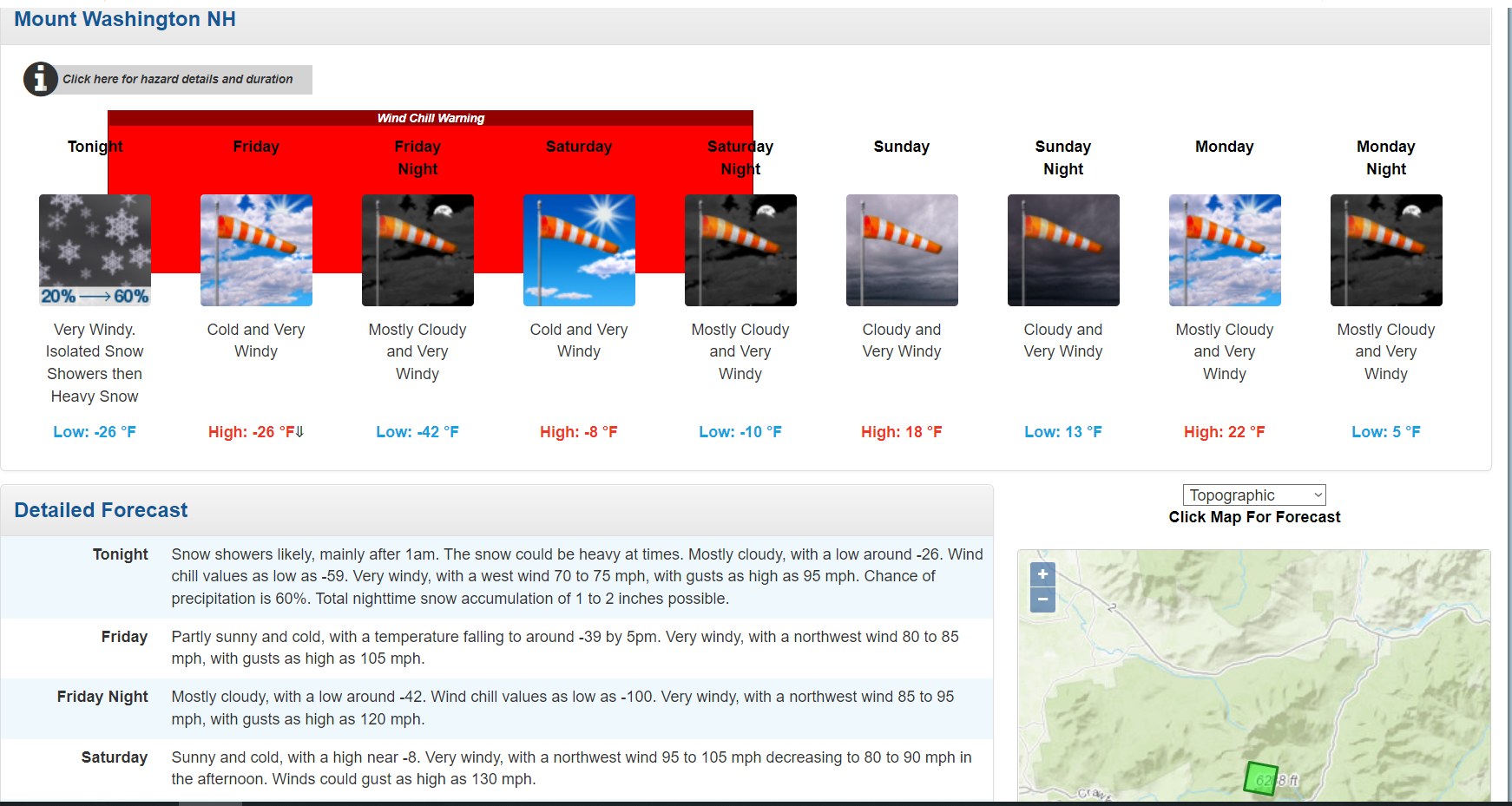
This is a rare wind chill index (Maine), also with winds of 30kt immediately above the surface.
-
Texas/Oklahoma Discussion & Obs Thread 2022
Chinook replied to It's Always Sunny's topic in Central/Western States
This would scare me
-
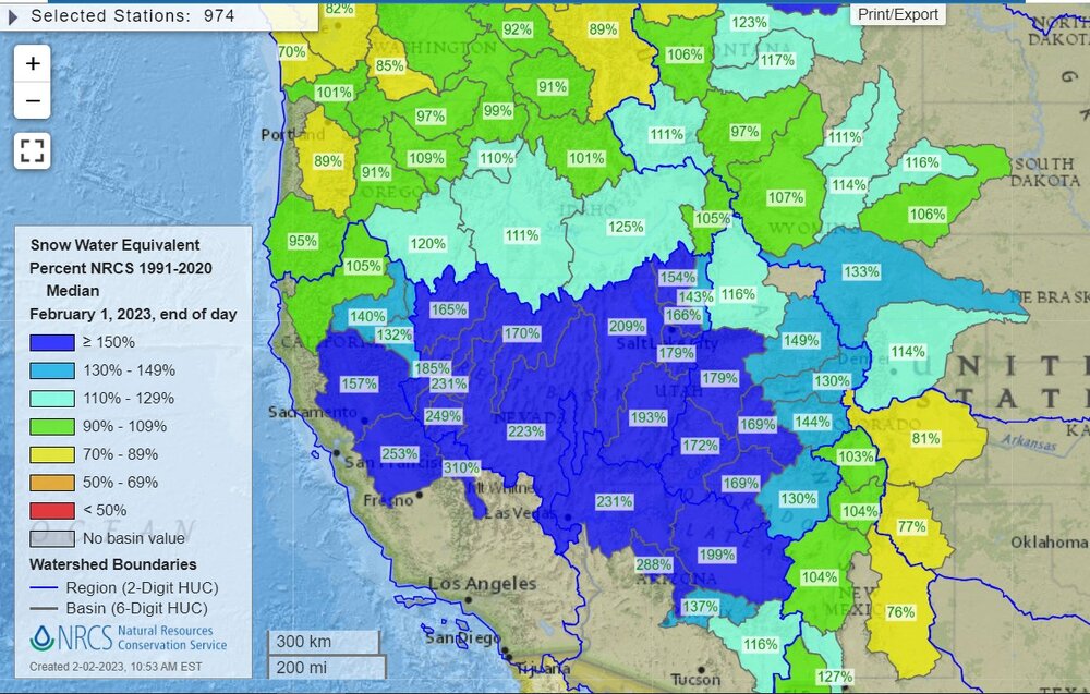
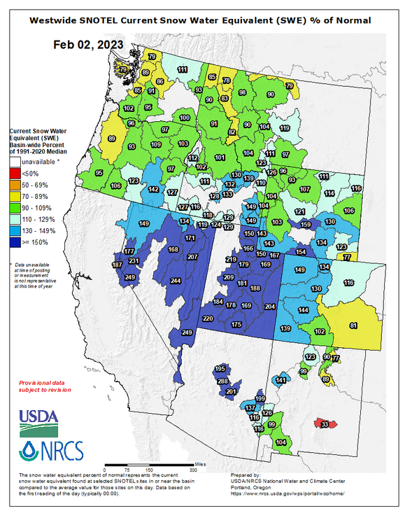
Now that a lot of the West is in a non-active pattern, I'll post this
-
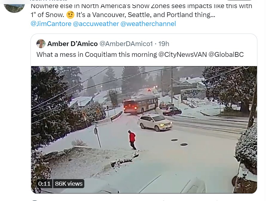
this bus went out of control at 5-10mph and swiped a car
-
Anybody from Toronto in here? The GFS says -14F (-26C) with a wind of 10 knots (19 km/h) on Friday morning. The NAM has some temperatures that are not quite so cold.
-
Texas/Oklahoma Discussion & Obs Thread 2022
Chinook replied to It's Always Sunny's topic in Central/Western States
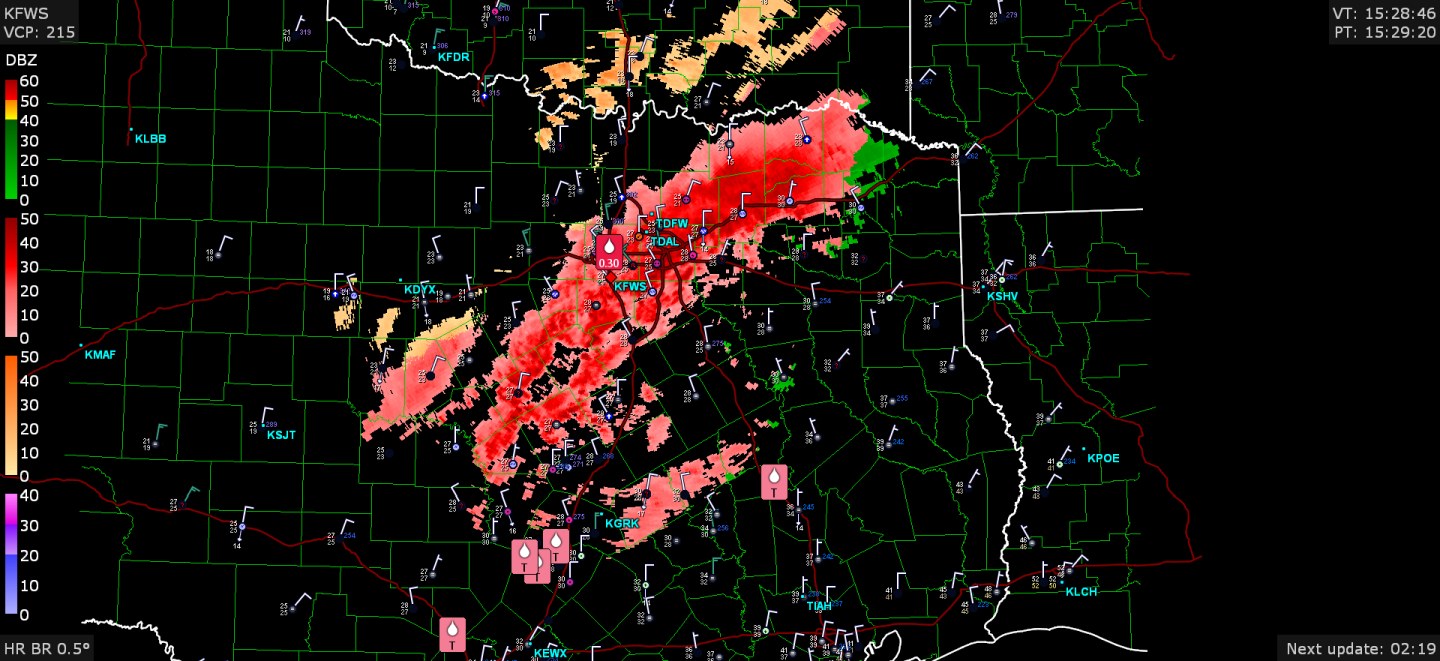
Fort Worth had 0.30" reported freezing rain. Other note: thunder recently reported at the Dallas area and also Poteau, OK (temps below freezing on both)

-
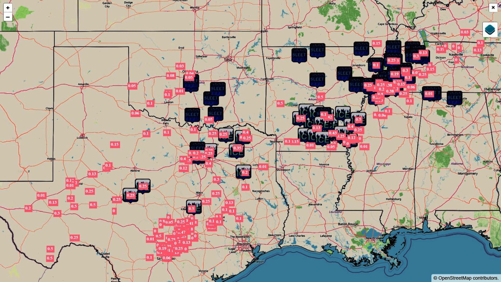
1.4" of sleet at Bentonville is an impressive storm report tonight when you've got 4 precip-type colors on radar
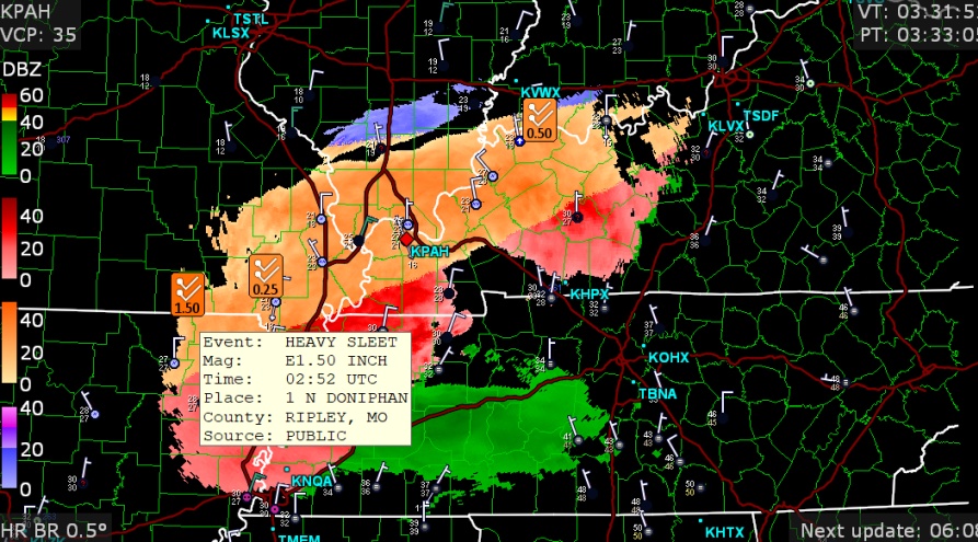


.png.97ee624b3cc015687ad7747dcb6f950d.png)
.png.fa56544f0bfb3e88d88d468bedc05be7.png)