mgerb
-
Posts
335 -
Joined
-
Last visited
Content Type
Profiles
Blogs
Forums
American Weather
Media Demo
Store
Gallery
Everything posted by mgerb
-
 Maybe so, but still 100+ hrs out, so too early for "definitely." As for tonight, HRRR (14Z below) keeps keying in on this area. FWIW (perhaps not much), it seems to have a good handle on the southern extent of the convection in NW PA, whereas some other mesos are further north.
- 527 replies
-
- 6
-

-

-
- flash flooding
- river flooding
- (and 2 more)
-
Another 0.78" in the bucket today. 1.86" over the past 3 days. Nothing excessive, but a nice soaking to break the dry spell.
- 1,764 replies
-
- 4
-
-
- hurricanes
- tropics
- (and 5 more)
-
Not much thunder here, but was just far east enough to take advantage of the late intensification. 0.45". Seems like the storms caught up with the outflow (which had surged far ahead earlier), and maybe some extra kick from the old sea breeze boundary (which at least some of the mesos seemed to suggest once the storms got around the Turnpike and east).
- 1,764 replies
-
- 1
-
-
- hurricanes
- tropics
- (and 5 more)
-
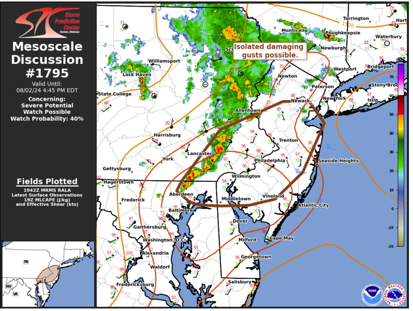
https://www.spc.noaa.gov/products/md/md1795.html
- 1,764 replies
-
- 1
-
-
- hurricanes
- tropics
- (and 5 more)
-
Looking good for storms with further development out west, and starting to see some activity fire along the sea-breeze.
- 1,764 replies
-
- 1
-
-
- hurricanes
- tropics
- (and 5 more)
-
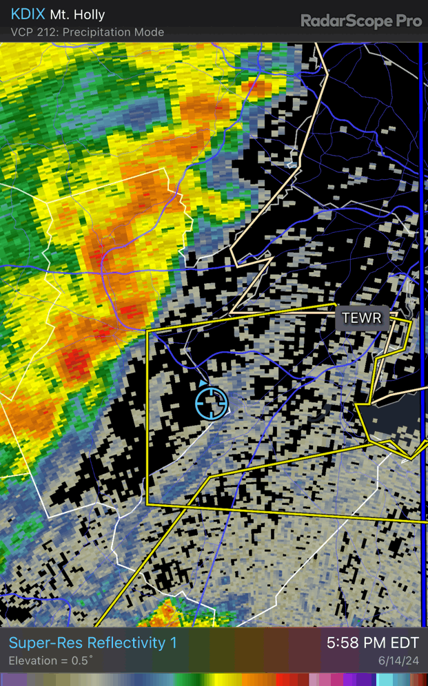
There has definitely been some new development on the southern flank around Lancaster over the past 30-60 mins.
- 1,764 replies
-
- 1
-
-
- hurricanes
- tropics
- (and 5 more)
-
My experience remains that whenever I leave home, I miss the best storms. Really never fails. Missed Ida, missed a severe thunderstorm last year and arrived home to a huge part of a tree in my driveway (never happened before since I've lived here), and so many others (which is amazing, since I don't travel much and mostly work from home!).
- 1,764 replies
-
- 1
-
-
- hurricanes
- tropics
- (and 5 more)
-
Yup. This was what it became. Nice tiny heavy shower.
-
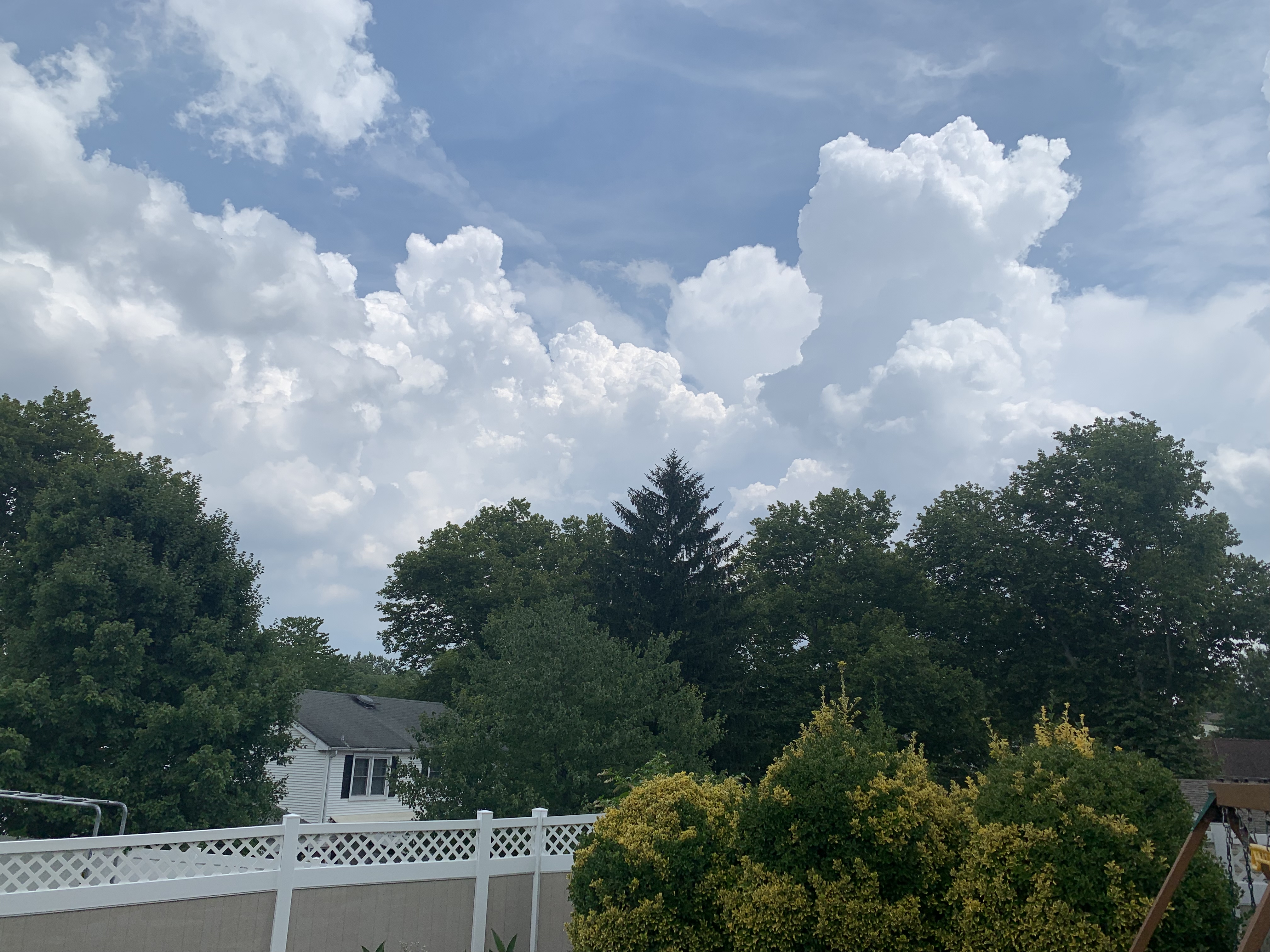
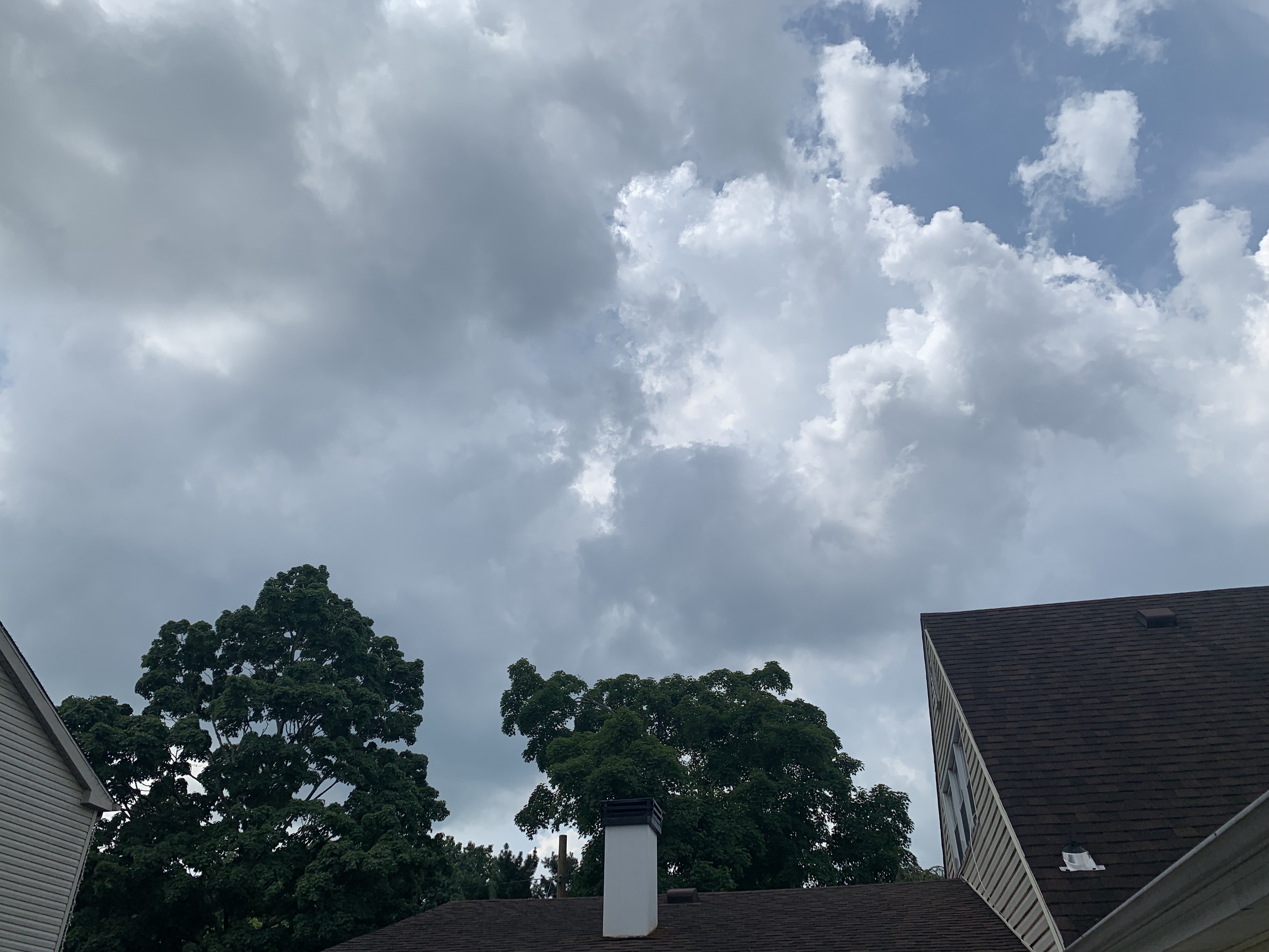
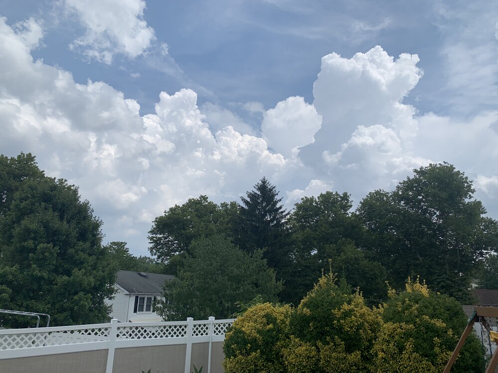
Towering cu base right outside my window. Let's see if anything comes of it. But think this portends a relatively active afternoon.
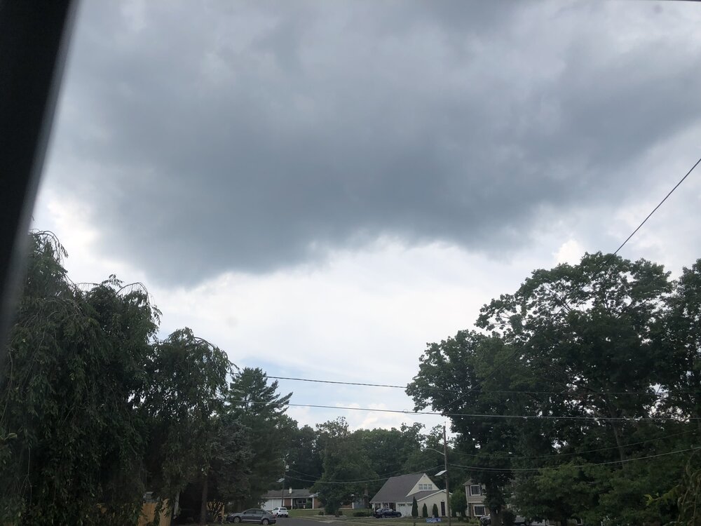
-
Lots of towering cu and some rapid th understorm development now along the old outflow boundary.

-
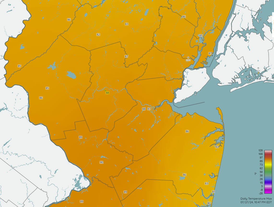
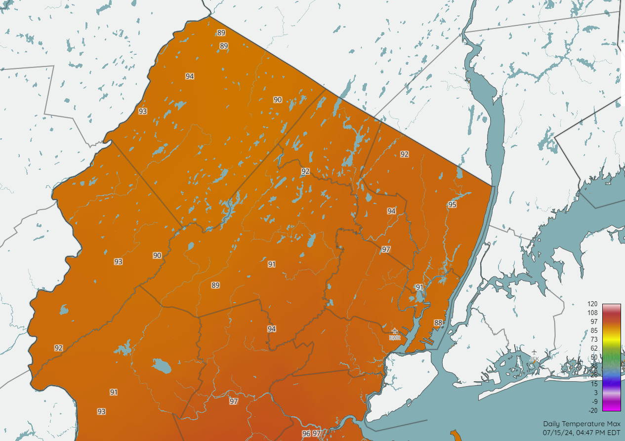
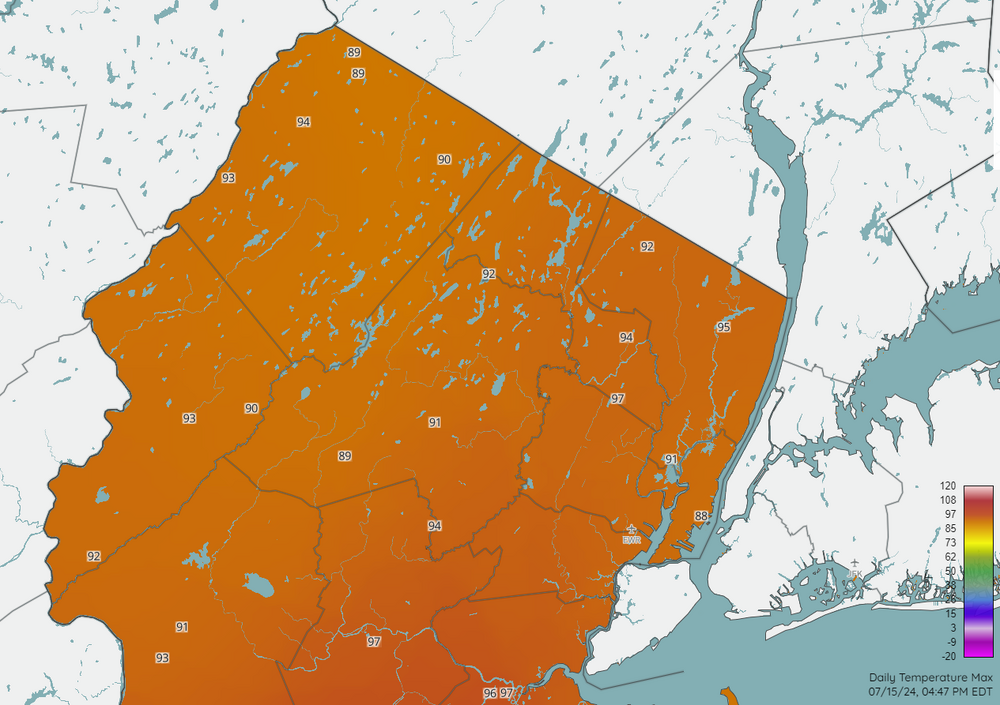
And 98 at New Brunswick, so pretty well in line. I think the dry conditions as of late may be playing a role in that regard.
-
Yes, I have noticed and wondered myself. But it's not a new issue. Ever since it was installed, it seems to be a local warm spot on the hottest of days. And often noticeably warmer than New Brunswick (same sensor type, btw). Aside from any sort of subtle senor bias (which I doubt, but can't preclude with 100% certainty), I think it's probably site related, as the station sits on wide open (and often dry) grasslands, whereas New Brunswick tends to be a more foliated environ. But we'll keep an eye on it. FWIW, it was well in line with other area stations today (granted, not a super hot day).

-
0.06" here. Heavier rain missed to the north and the south.
-
Definitely straight. Microburst no doubt.
-
Mostly missed to my north. 0.01" and some gusty winds with the outflow. Ah well.
-
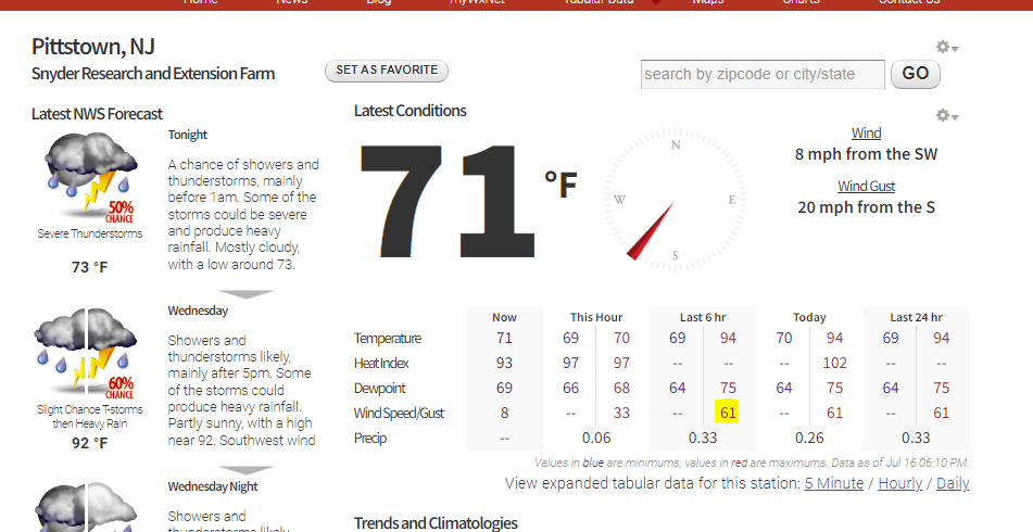
61 mph gust at Pittstown (Hunterdon County).
-
We'll see, but southern flank looks to be strengthening a bit so we may get a good hit here too. Probably will be brief, but very gusty.
-
Just posting the same, but zoomed in a bit, as there was at least one site that was not displayed (97 at Little Falls), so did get pretty hot west of the GSP.
-
About the same for me over in Somerset. My Davis shows a maximum rain rate of 13.40"/hr, which may be the highest I've ever seen! Obviously, that magnitude doesn't last very long, but impressive nonetheless.
-
Got about 0.15" just across the river in Somerset. Blew up at the right time to drop some modest heavy rain, but no thunder or any legit torrential rain. Very pulse-y storms and run of the mill.

-
Dumping pretty good under this band on Somerset. Very fluffy, high ratio. Less than a half inch so far, but let's see this can stick around.

-
Two Mdt to high impact events NYC subforum; wknd Jan 6-7 Incl OBS, and mid week Jan 9-10 (incl OBS). Total water equiv by 00z/11 general 2", possibly 6" includes snow-ice mainly interior. RVR flood potential increases Jan 10 and beyond. Damaging wind.
mgerb replied to wdrag's topic in New York City Metro
1.9" in Somerset upon the changeover to rain (which occurred with no sleet or indication on correlation coefficient). Pleasently surprised as was mainly expecting a dusting or maybe a few tenths.- 3,610 replies
-
- 2
-
-
-
- snow
- heavy rain
- (and 5 more)
-
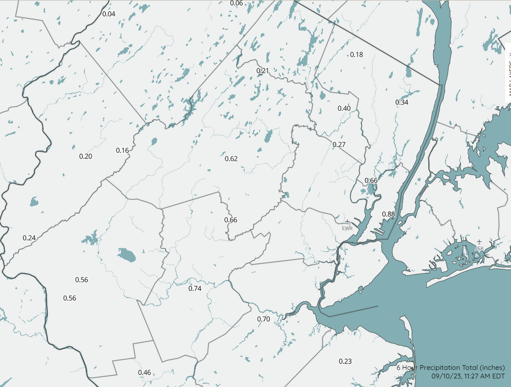
Not airport sites, but there are brand new 1, 3, 6, and 24 precip maps on the new NJWxNet map page here: https://www.njweather.org/maps/ Just select the desired maps in the "map layers" sidebar. Here's 6 hr precip. Over an inch at my home in Somerset from this morning's rain:
-
Hey, I know where that is! That's Landing Lane bridge, right? Just a few miles from me. Was just thinking how awesome it would be to watch today's storm roll in from the southeast way up in one of those buildings. Anyway, strong winds here too (sporadic downed branches), and 5+ minutes of hail, though most was rather small (smaller than dime from what I could tell). Around 0.70" in the bucket. Fun storm.
-
Yup, I'm familiar. I work in the state climate office and sometimes help service the stations. It's mostly a mix of Campbell Scientific EE181 and HC2S3 (more of the former). Then there are 14 stations that use Peet Bros equipment, which is more akin to backyard-type weather stations. With one exception (Harrison) and aside from the Peet Bros stations, we don't pull in any PWS data. We also bring in other professional networks, such as ASOS, AWOS, RAWS, some USGS, and a few others. If you go to any station page (e.g., Little Falls here), near the bottom of the page you can see photos of the site and a list of installed equipment.