mgerb
-
Posts
335 -
Joined
-
Last visited
Content Type
Profiles
Blogs
Forums
American Weather
Media Demo
Store
Gallery
Everything posted by mgerb
-
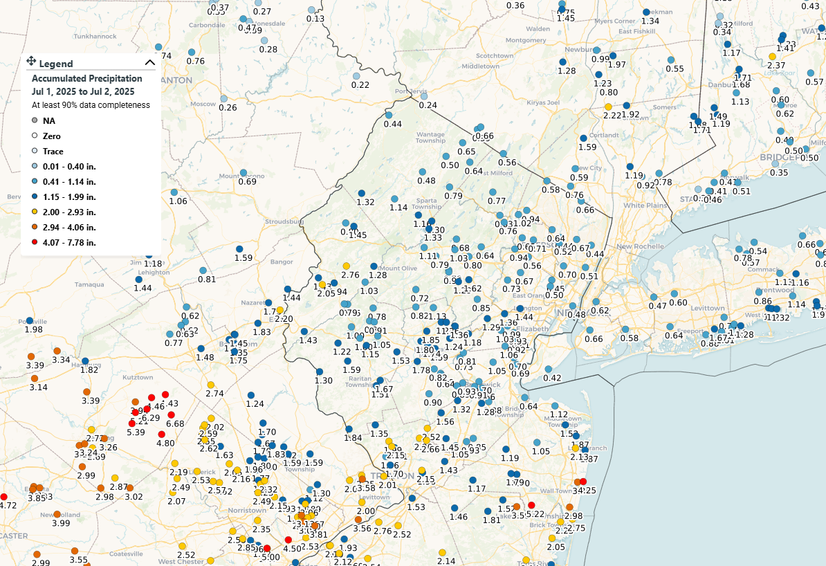
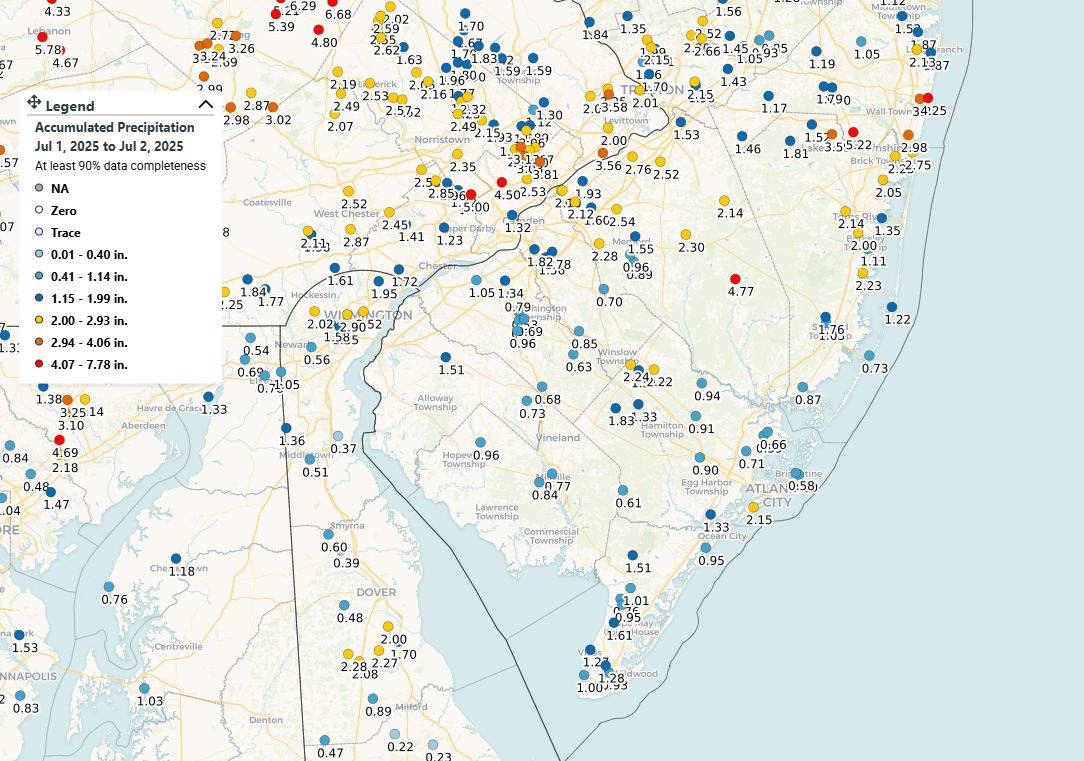
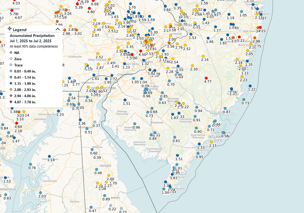
 Two drownings in Plainfield, unfortunately: https://www.nj.com/weather/2025/07/flooding-kills-2-women-in-vehicle-swept-into-brook-during-fierce-nj-storms.html 3.29" final total here.
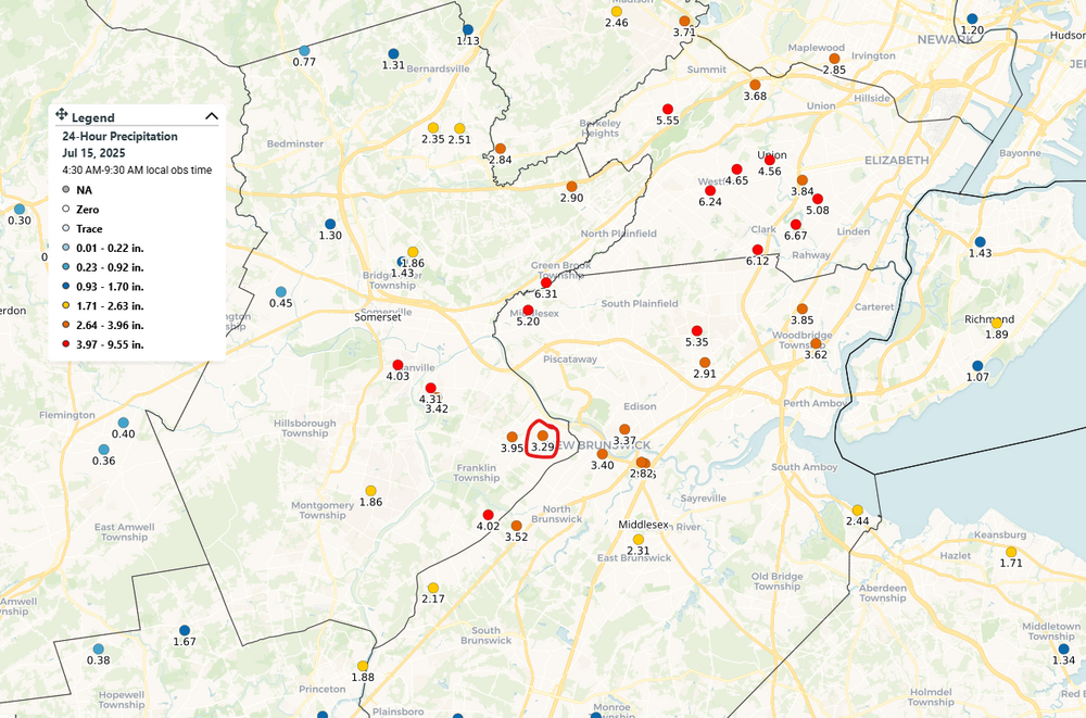
-
Just a touch under 3.00" in Somerset near New Brunswick.
-
July 2025 Discussion-OBS - seasonable summer variability
mgerb replied to wdrag's topic in New York City Metro
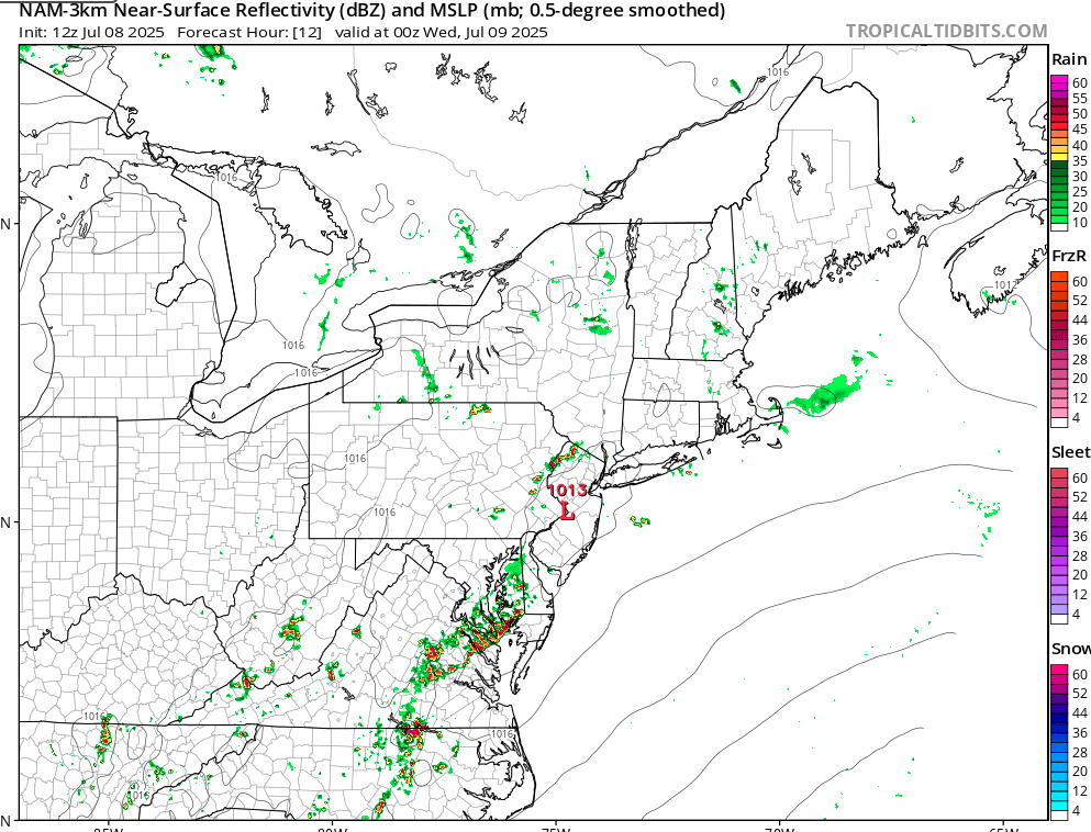
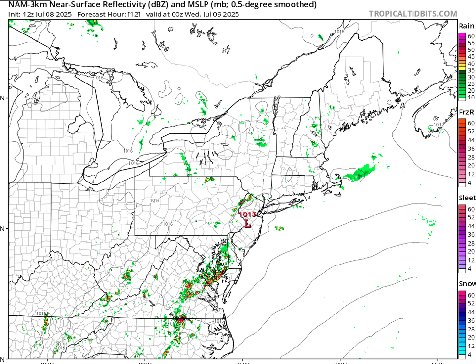
Sure. I just mean more coverage than 12Z, when there was basically nothing. -
July 2025 Discussion-OBS - seasonable summer variability
mgerb replied to wdrag's topic in New York City Metro
Looks like the NAM got a clue between 12Z and 18Z.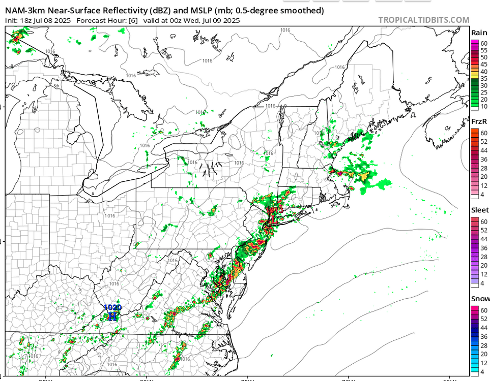
-
July 2025 Discussion-OBS - seasonable summer variability
mgerb replied to wdrag's topic in New York City Metro
Click link to zoom in: https://maps.cocorahs.org/?maptype=precip&units=us&base=std&cp=BluYlwRed&datetype=custom&displayna=0&from=2025-07-01&to=2025-07-02&dc=0.9&key=dynamic&overlays=state,county&bbox=-76.93176269531251,38.63189092902837,-72.31750488281251,40.44276659332215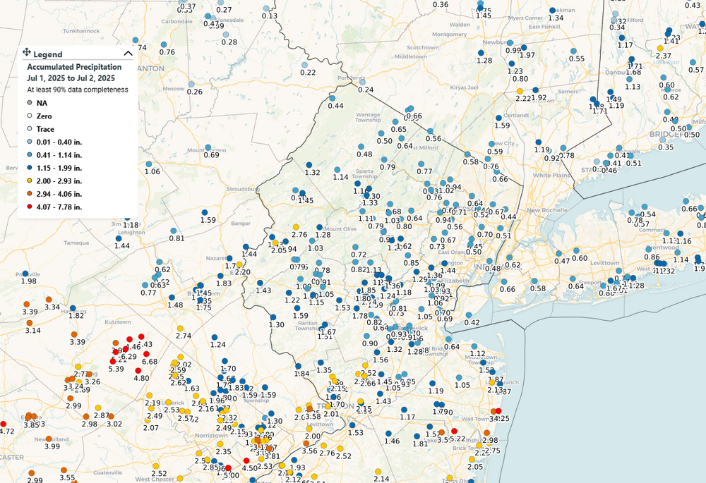
-
Exactly the same here. Storms generally fizzled on approach (what else is new), but glad to have a decent soaking given the dry June.
-
This is probability of severe wind, not general wind conditions.
-
About 1.80" for the month here, so yes, would like some rain. Haven't really had a legit thunderstorm yet this year either.
-
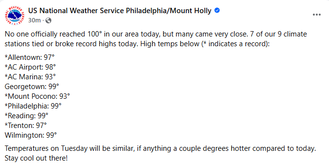
Recent posting by WFO-PHI confirms that 99 was the high at PHL.
-
I mean, 94 is the high so far. Yeah, not sure what the deal is with that. I know what you mean.
-
94 at New Brunswick, FWIW.
-
OBS-Nowcast Noon Saturday 2/15-Noon Monday 2/17
mgerb replied to wdrag's topic in New York City Metro
Right. With the strong inversion, there's no winds mixing down north of the warm front. That's why it's been so calm. That will change once the cold front passes. -
It really would affect both, but would expect to see it more at night when increased moisture and (perhaps) clouds could reduce overnight cooling. During the day, temps are largely driven by solar insolation, and the presence or lack of can overtake other factors. Just spitballing though; it's all very complicated and depends on many factors. Point is, the GLs contain huge thermal inertia that greatly affects climate within the 50-100 miles downwind. Less clear as you get down towards our area and I'd agree that any effect is likely very subtle.
-
But there IS research on this topic that quantifies climate with/without the Great Lakes. For example, see the paper below. Doesn't answer how much the GLs affect NYC-area climate specifically (falls just outside the "Great Lakes Basin" domain), but it's apparent that the large thermal inertia of the GLs has a notable effect on regional climate. That wouldn't completely disappear outside the domain, but no doubt it's reduced compared to areas closer to the lakes. https://journals.ametsoc.org/view/journals/clim/26/3/jcli-d-12-00140.1.pdf
-
Never said that. I'm referring to air mass modification vis-à-vis the transport of polar air masses over the Great Lakes, particularly just downwind. The effect is reduced the further you travel from the lakes, but it's not zero.
-
OK....don't know what you mean. It is quantifiable. Look at a DP map during the winter upwind vs downwind of the Great Lakes.
-
A likely factor: besides imparting sensible heat to the lower atmosphere, the lakes also impart moisture. Slightly increased boundary layer moisture->higher dew points (and perhaps more clouds)->warmer TMINs. This definitely happens, especially closer to the Great Lakes. Down here, to a much lower degree.
-
Minor correction: 30 years, not 20.
-
Hope he's not basing a "broken record" on his own measurement in a pile/drift of snow (like, what? and it doesn't quite reach 10"!). Not sure what the airport is up to though (last saw 6" but that was a while ago, so bet it's at least close to or beaten the record).
-
1.1" over in Somerset. Satisfied with that all things considered!
-
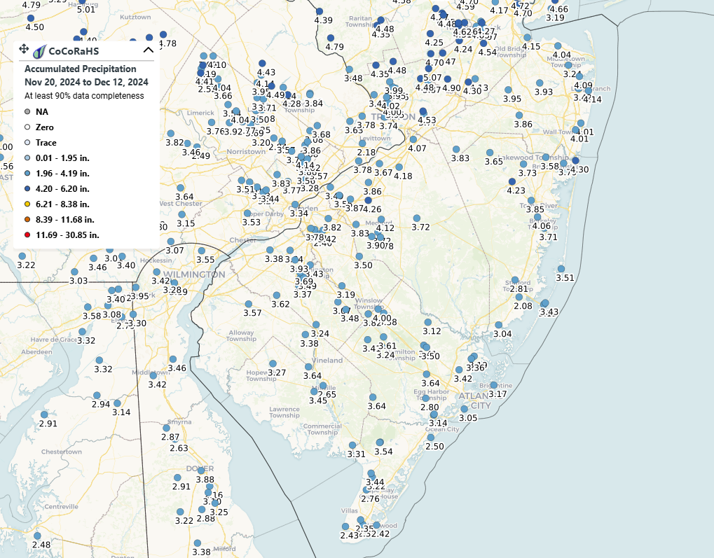
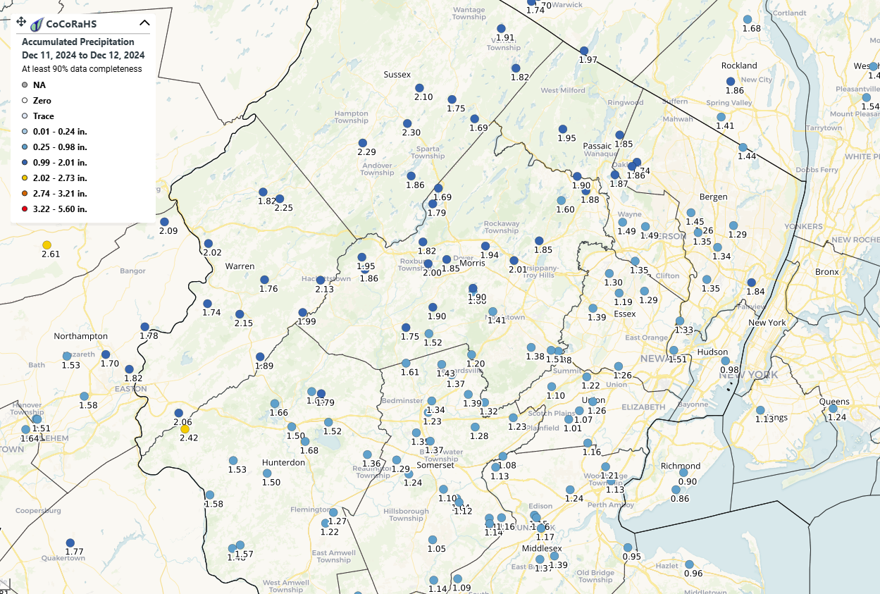
One thing I'll mention about your last point is this week's DM map was valid through 12Z 12/10, before the ~2" fell in northern NJ, thus wasn't accounted for in the decision to leave things status-quo in the 12/12 map. I'd expect next week's map should show some improvement up north (esp northwest of I 287 in NJ); less sure about areas further south, where precip over the last week has been around or slightly above normal, but not enough to support much improvement. At least it appears that we'll continue seeing regular precip events to keep things from degrading further, but the hope obviously is to have some above-normal months this winter/spring to help prepare for the warmth/demand of the spring and summer.
-
Would add the caveat that this really applies for the area north of I-78. Central and especially southern NJ have seen less, and drought severity is higher there anyway, so need to see more to start to claw out. Yeah, largely outside "NYC metro", but know we have plenty of posters south of I-78.

-
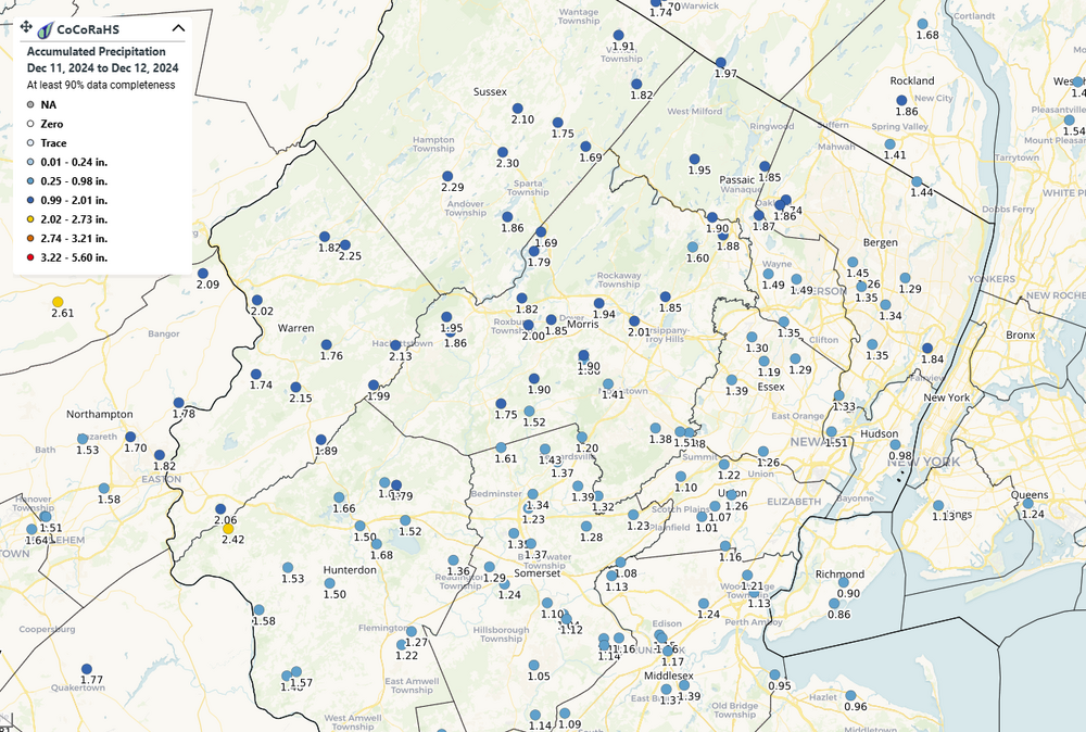
Last 2 days here: https://maps.cocorahs.org/?maptype=precip&units=us&base=std&cp=BluYlwRed&datetype=custom&displayna=0&from=2024-12-11&to=2024-12-12&dc=0.9&key=dynamic&overlays=state,county&bbox=-75.57083129882814,40.295239085867614,-73.26370239257814,41.193123075718695
-
Reverse that. Drought Watch to a Drought Warning.