

CAPE
-
Posts
36,289 -
Joined
-
Last visited
Content Type
Profiles
Blogs
Forums
American Weather
Media Demo
Store
Gallery
Everything posted by CAPE
-
I was about to turn it off then I was like wth. Crazy.
-
LOL Ravens defense.
-
Apparently something was going around among other players on the team this week- flu maybe? but none of them are missing the game.
-
No Hollywood either today. Hopefully they can run it a little. Defense needs to have a big game. They sure are due.
-
No Lamar today- non COVID related illness. Well, he already had that twice. For a world class athlete, he sure gets sick a lot.
-
Low of 31. 37 now.
-
Beautiful morning with an early winter feel. Couple shots I just took from the end of the driveway.
-
27 here this morning. First legit freeze.
-

December 2021 Medium/Long Range Discussion Thread
CAPE replied to North Balti Zen's topic in Mid Atlantic
-PNA. -
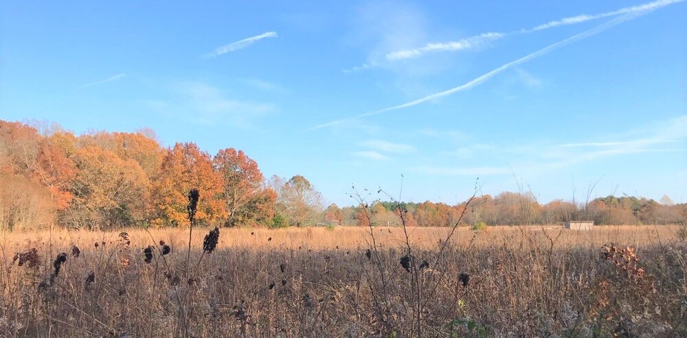
A couple from Tuckahoe State Park from yesterday.
- 71 replies
-
- 10
-

-
He seemed to fit in, team player, etc. But at some point production is required. Now maybe we will see what the deal is with Ty'Son Williams. If he doesn't get playing time now then clearly there is something they don't like about him.
-
Le'Veon Bell was waived.
-
He means that the Ravens had sort of a 'mini bye' because they did play on Thursday, and it turned out well with the Steelers tie and Browns getting destroyed yesterday.
-
Not a problem with that anomalous ridge in the NAO space. Hopefully it ends up more than just model fantasy, and a fixture a month down the road.
-
And the Steelers fail to tie the Ravens for first place, by playing to a tie against the Lions at home lol.
-
Great to see that.
-
Pretty decent h5 look on the GEFS heading into December.
-
Y'all still don't know the deal with flip flopping op runs beyond day 8? It is to be expected. Why we have ensembles.
-
Wow that should be incredible. I have had the Velvet and Parabola, both of which are very good. Looks like those 2 should be quite prominent in the overall composition. Enjoy!
-
Latest CFS runs have been looking meh for December, but January
-
The fundamental problem is the offensive line is THAT bad right now. Hopefully Boyle is back next week, and maybe Mekari. Boyle could have/ should have played last night. They could have used him. Best blocking TE there is when he is healthy.
-
The Ravens really needed to take care of business against the lowly Dolphins. Week 11: at Chicago Bears, Nov. 21, 1 p.m. Week 12: vs. Cleveland Browns, Nov. 28, 8:20 p.m. Week 13: at Pittsburgh Steelers, Dec. 5, 4:25 p.m. Week 14: at Cleveland Browns, Dec. 12, 1 p.m. Week 15: vs. Green Bay Packers, Dec. 19, 1 p.m. Week 16: at Cincinnati Bengals, Dec. 26, 1 p.m. Week 17: vs. Los Angeles Rams, Jan 2, 2022, 4:25 p.m. Week 18: vs. Pittsburgh Steelers, Jan 9, 2022, 1 p.m.
-
Harbaugh- "Bottom line, this falls squarely on me as a head coach," Ravens coach John Harbaugh said of the loss. "We were not prepared the way we needed to be prepared. Our schemes were not up to snuff. We weren’t prepared to execute the way we needed to." So, there actually was a scheme?
-
The O-line is atrocious, but Roman made no adjustments to what the defense was doing. Dolphins just kept playing man to man with no deep help. They didn't disguise the extra blitzer(s). Somehow, the Ravens never adjusted, nor could they take advantage, mostly because the pocket was quickly collapsing, when there even was one.


