CAPE
-
Posts
36,292 -
Joined
-
Last visited
Content Type
Profiles
Blogs
Forums
American Weather
Media Demo
Store
Gallery
Everything posted by CAPE
-
Awesome. I have found that in many cases it is a waste of time trying to get plants to grow and thrive here in the woods (plus the silty/sandy soil), if they aren't native. I was looking for something native that got BIG- to serve as a demarcation between my back lawn/garden area and the edge of the actual woods. The big bluestem can get up to 8 ft tall, plus they turn a pretty red/orange color in the Fall. They self-seed and also spread via rhizomes, so it will be interesting to see how this ends up lol.
-
Big Bluestem.
-

Cold +PNA, could be the start of more +PNA's.
CAPE replied to Stormchaserchuck1's topic in Mid Atlantic
Overwhelmingly -PNA overall though, in a Nina. We had very transient periods of "favorable" Pac with the -NAO, but it didn't work out. -NAO during a Nino (with an actual STJ) gives different outcomes than in a Nina when the PNA is negative. -
Cold +PNA, could be the start of more +PNA's.
CAPE replied to Stormchaserchuck1's topic in Mid Atlantic
There are degrees of -PNA. Slightly negative to neutral PNA with a -NAO, esp in a Nino with a STJ present, should still be a good pattern. It better be if we still want snow here. -
70/42. Just wow. Clone this day and give it to me for the next 3 months, with some cool rain every 4 days.
-
Perfection. Been outside all day soaking it up. Planted some perennial native grasses this morning when it was misty and temps in the 40s. Now sipping a margarita and placing some annuals in the pots on the deck.
-
Latest CFS runs now go out to Feb. Jan and Feb looking similar to CanSIPS. Favorable Pac, -AO/NAO. Dec isn't bad either. Fwiw ofc.
-
5ofMay HH- Homemade guac and a Margarita ofc. Cheers!
-
We can hope. Health and production from the new additions, as well as Lamar and Bateman.
-
-
Nice. He is better than Peters at this juncture, and the Ravens CB draft pick(Kelly) isn't a plug in starter at this point. They could still sign Peters, which would be ideal. Can never have enough CBs.
-
Picked up 0.18" of rain with the showers this morning. Getting some sun now. Temp is 52. Chilly day.
-
52 here after a high of 57. Not hating this at all given how easily we do 80s and humid this time of year.
-
7.15" for April here. 5"+ fell over the last 10 days
-
I agree the -EPO is probably a key feature, and will likely be needed more going forward in order to inject enough cold into the pattern. The domestic variety doesn't seem to be getting it done nearly as much these days.
-
New edition of CanSIPS for Dec. Bigger EPO ridge for Jan and esp Feb, plus -NAO.
- 921 replies
-
- 10
-

-
0.65" total for yesterday.
-
0.36" so far Half inch or so will probably be it for this event based on radar, after just about 3" for round 1. Mostly missed in all directions today other than light stuff. Plenty of rain the last 7+ days though.
-
A NA blocking pattern isn't a miracle worker. We need anomalous cold in the pattern(somehow) for snow to occur at our latitude/relatively low elevation. In a warming climate with a potentially stronger/persistent NPJ + warmer Atlantic, that probably means a mechanism that injects cross polar flow(+PNA/-EPO). The days of a -AO/NAO/ -PNA being a good setup for snow in these parts is probably on the wane. 220, 221. Whatever it takes. (for snow)
-
0.23" here so far. It's been a mostly rain-free morning/early afternoon. Probably safe to drop the flood watch.
-
Moderate rain here with this initial SE to NW moving line. Shouldn't last too long.
-
I notice this a lot more by early June. Beyond that it can rain its ass off here but the soil will be parched a few days later. Grass will be withering away by mid June.
-
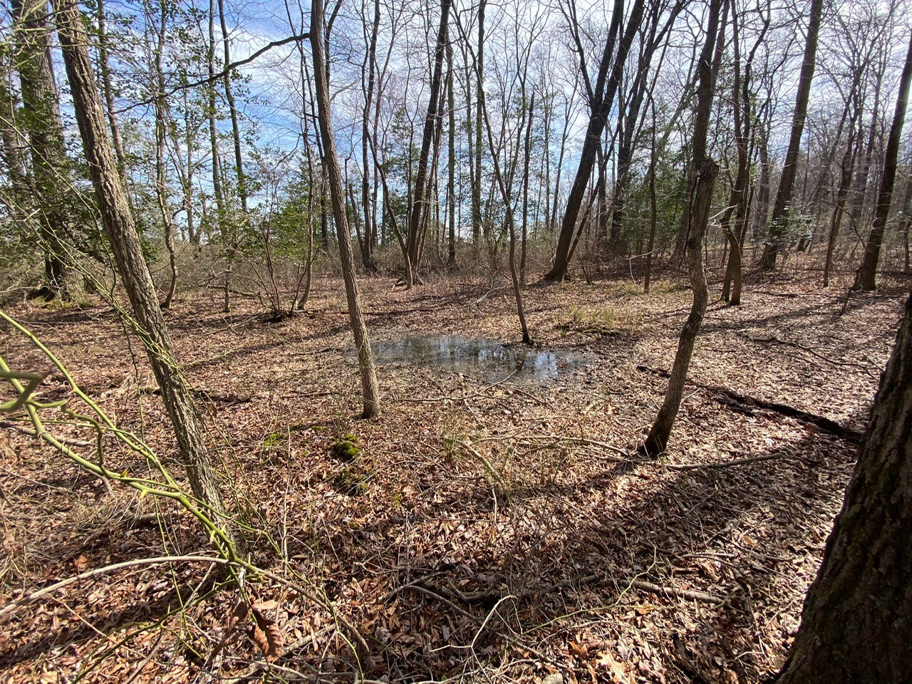
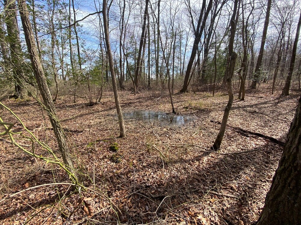
My wetland a month ago, which looked the same 10 days ago, save for more green. Very usually dry. Same area today- more typical for this time of year. Changed in a hurry since last weekend.
- 233 replies
-
- 13
-
-
That's a place I have been wanting to go. Seems to have a cool vibe and very scenic.
-
Drove to Kent island today. Remarkable to see flooded areas near creeks and major ditches, and farm fields with broad/ shallow pools of water, given how things looked just a week or so ago. Rooting for the under tomorrow.