All Activity
- Past hour
-
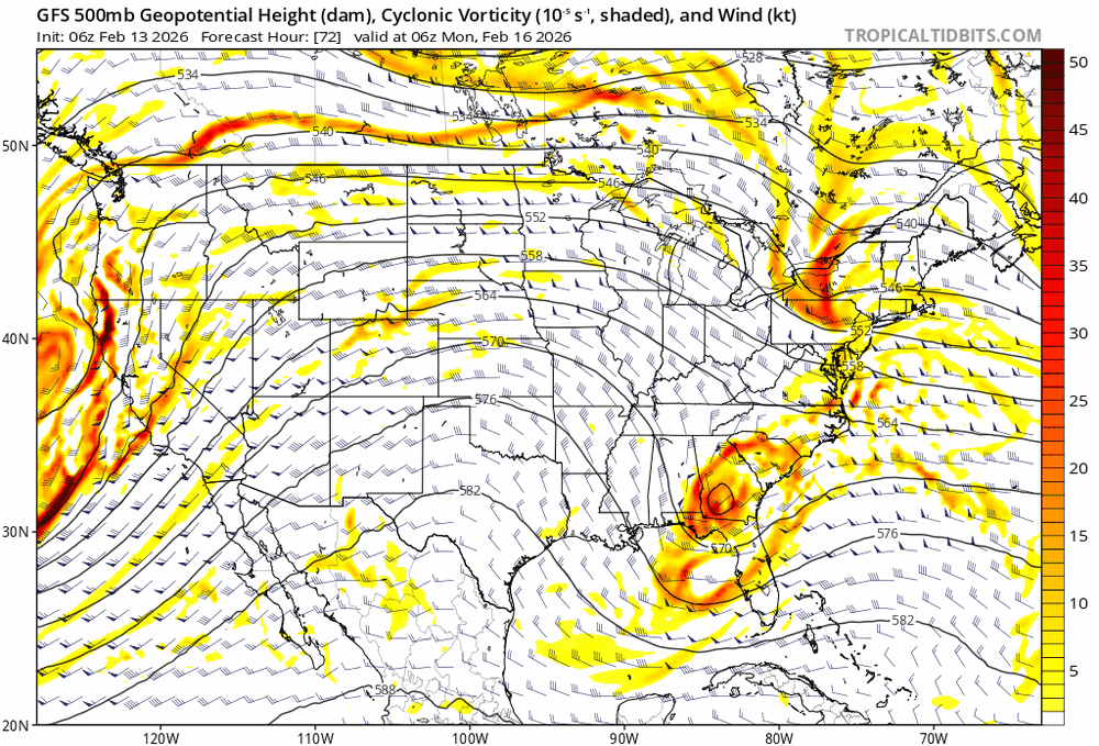
Models are clearly jumping on the more phased trend.
-
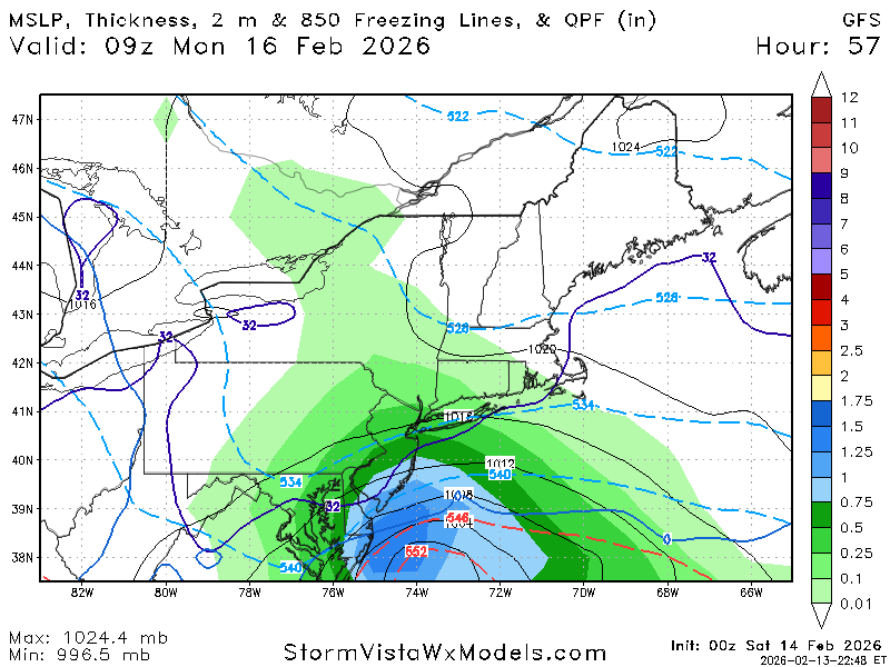
This storm is different for us due to the phasing; which dramatically increases the chances of decent temperature shifts (either colder or warmer) depending on degree of phasing. Since the NAM continues to trend towards more of a phase, I think it could adjust colder if that trend continues. It should have a better handle on things later tomorrow.
-
One of the weirdest run ups to a storm in a long time
-
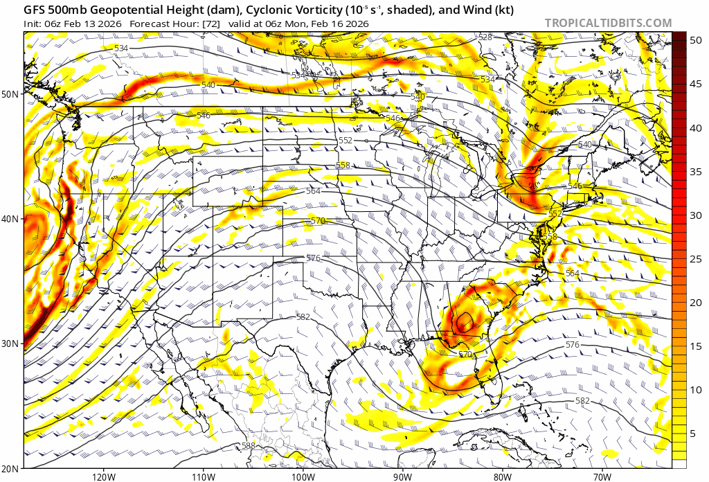
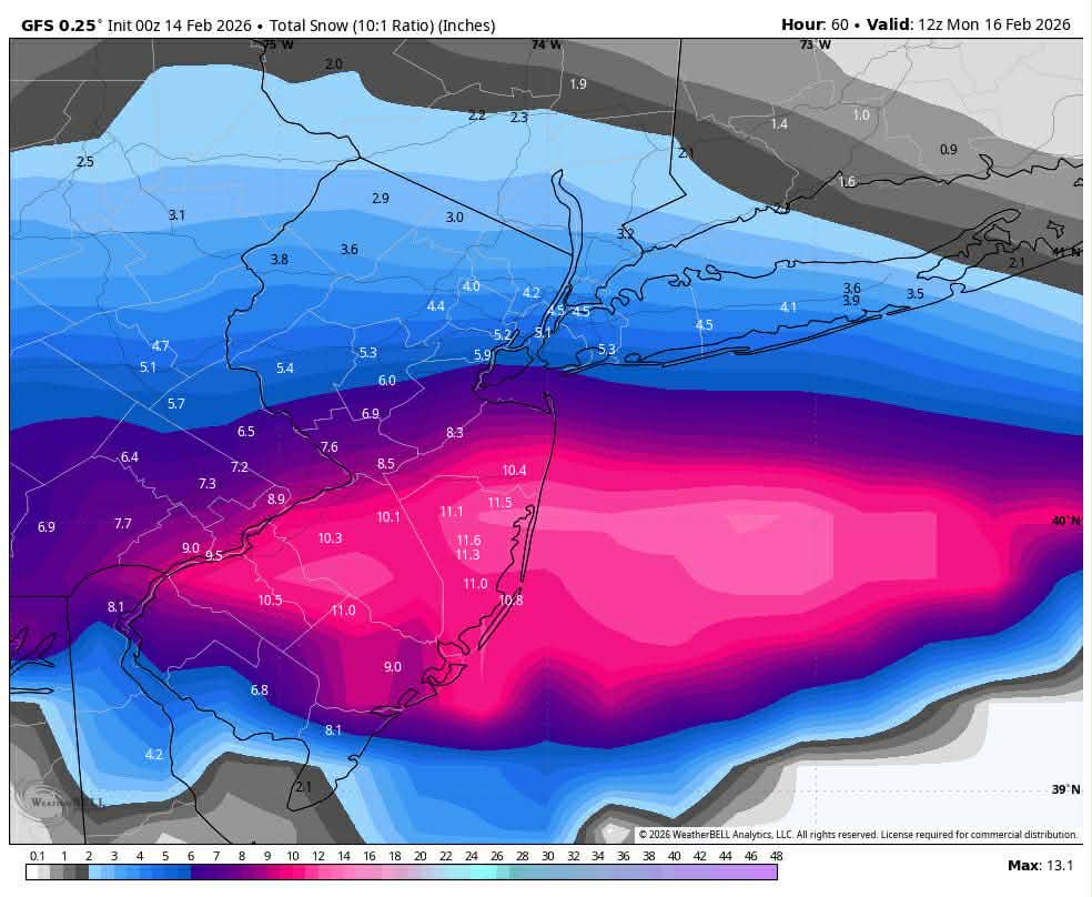
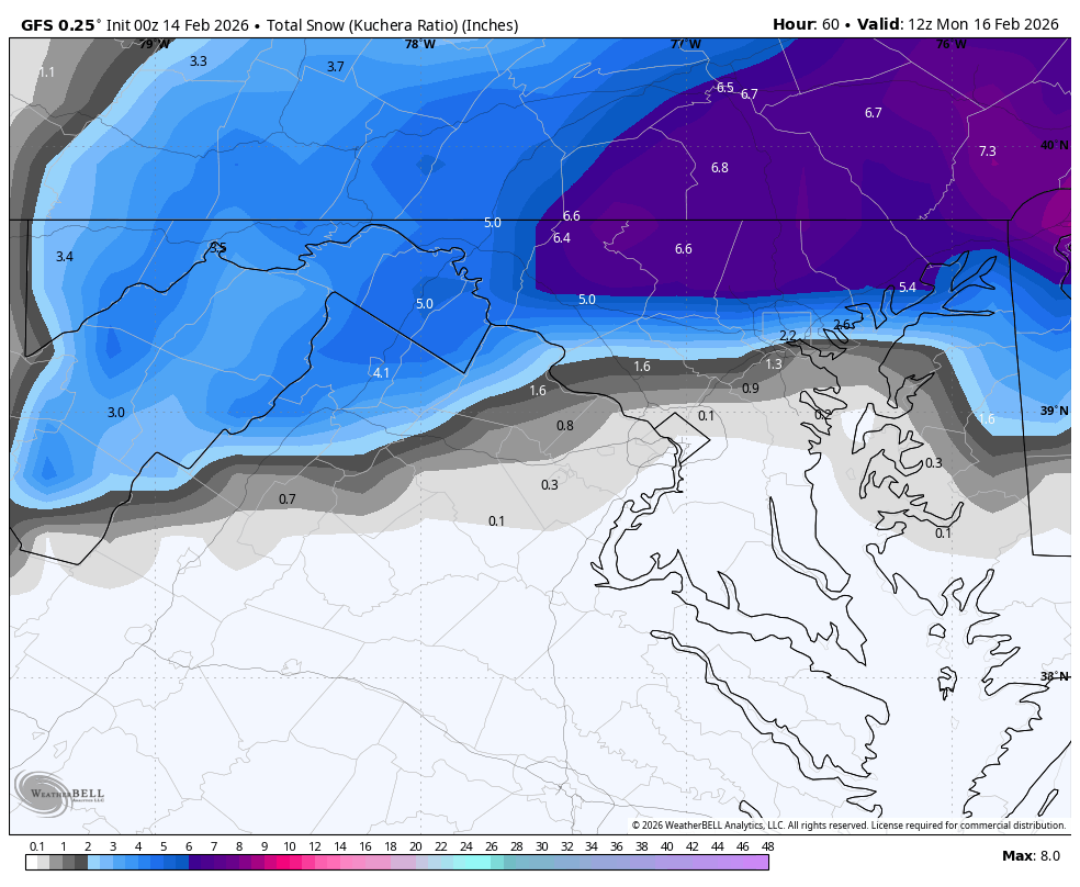
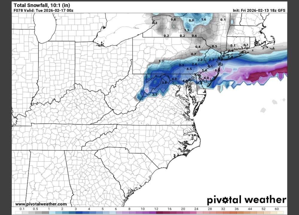
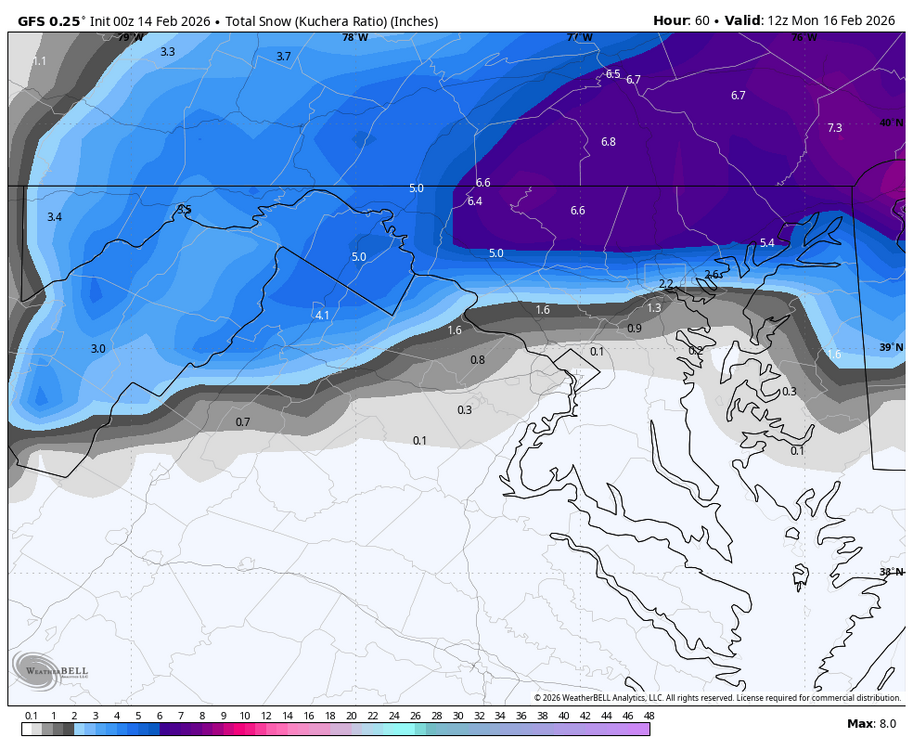
GFS is a tick or two away from being a full snowstorm here. The model that was furthest south and wanted nothing to do with this storm is now the most aggressive
-
Gfs is more impressive all around and a lot less flat. If this keeps ticking I can see it being fun on Long Island. Couple more ticks and I might get measurable snow!
-

Is we back? February discussion thread
Prismshine Productions replied to mahk_webstah's topic in New England
Ai Goofus bumped north Sent from my SM-S166V using Tapatalk -
"Will exceed?" That is unwise to forecast an all-time record storm w/ absolute wording. It is so hard to say "may approach?" That is the more reasonable thing to do, rather than go all out. This sets one up for big failure in the eyes of the public if it does not happen esp, when comparing it to a benchmark storm for a region. The psychological impact here is huge. Was 40-50" explicitly forecast by any model for parts of SNE? Were storm tides forecast to match or exceed the Bliz of 78? Was there a 1055 mb high in place NW of New England w/ a 70 mb plus high/low difference? Was the synoptic pattern over NAMR similar to the Biz of 78, b/c that 500 ridge/trough evolution was exceptional, unlike anything in the KU cases. You not only had a massive cut-off low form just S of New England, but a massive cut off high form at the same time over western Canada. The worst case scenario is the least likely to happen in any given storm situation, so you better have a darn good reason to go for it. The notion "better safe than sorry" is a tired and invalid excuse. Going for worse all the time has real world consequences and impacts, and you will be wrong more often than not. Extraordinary events require extraordinary circumstances.
-
lol
-

E PA/NJ/DE Winter 2025-26 Obs/Discussion
Joshb32689 replied to LVblizzard's topic in Philadelphia Region
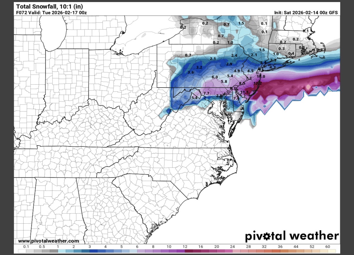
Quite the trend from 1am - 7pm. South Jersey went from 0 to over a foot in some spots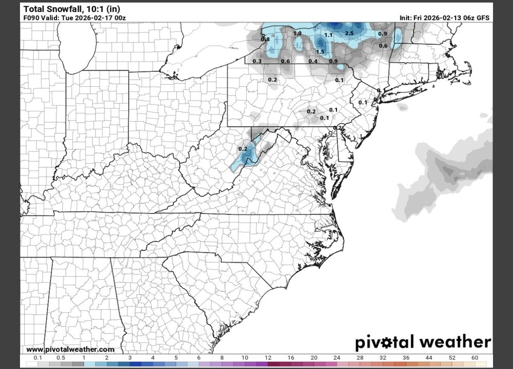

-
Is we back? February discussion thread
Prismshine Productions replied to mahk_webstah's topic in New England
Slight bump north on Goofus Sent from my SM-S166V using Tapatalk -

E PA/NJ/DE Winter 2025-26 Obs/Discussion
MJO812 replied to LVblizzard's topic in Philadelphia Region
Northern stream is better sampled -
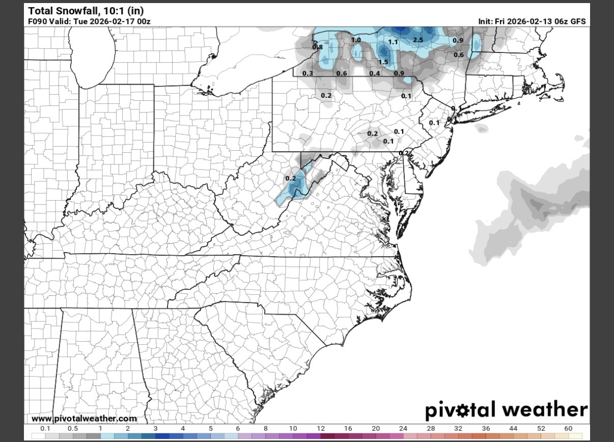
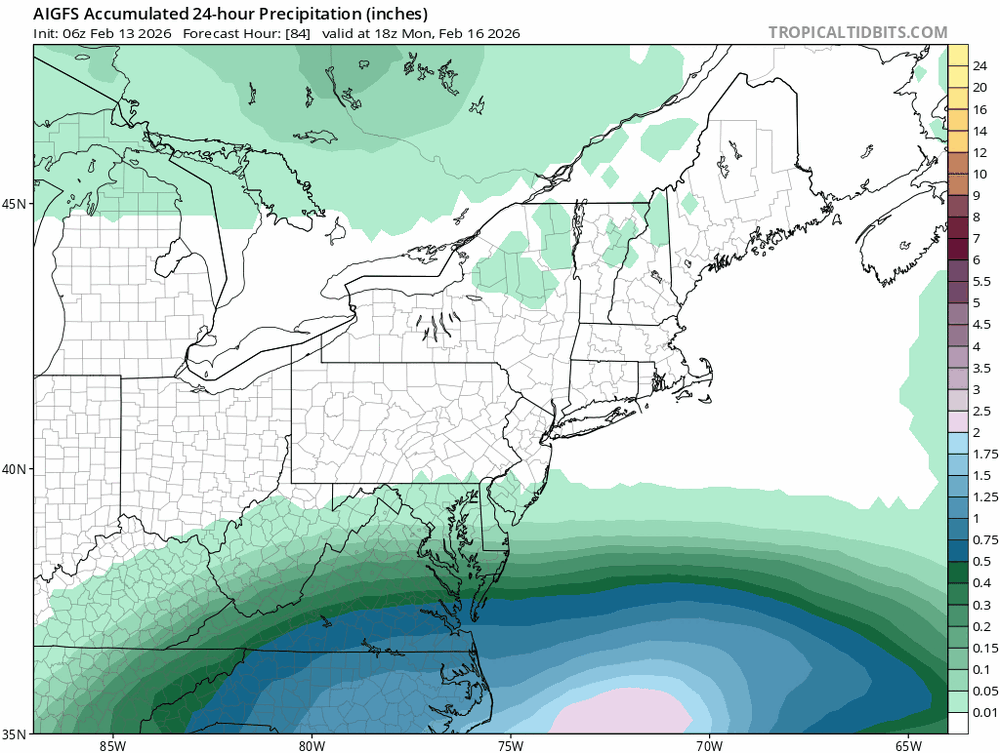
AIGFS trend
-
Did we just get GFS’d??
-
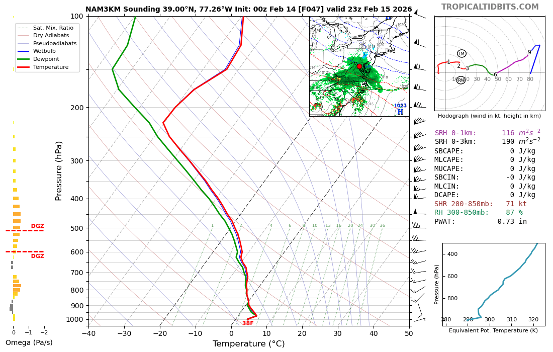
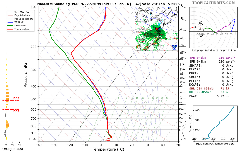
Nam 3k thermals did well on Jan 25.
-
Just got home - holy crap, GFS! And the ICON and 3km NAM were decent too. I'll still take 1-3", but the GFS and AIFS make me want more, lol.
-

February 2026 OBS & Discussion
CPcantmeasuresnow replied to Stormlover74's topic in New York City Metro
Now it's starting to get interesting. The north trend is catching on with the big guys. -
Roughly an inch of slush. I take
-

E PA/NJ/DE Winter 2025-26 Obs/Discussion
LVblizzard replied to LVblizzard's topic in Philadelphia Region
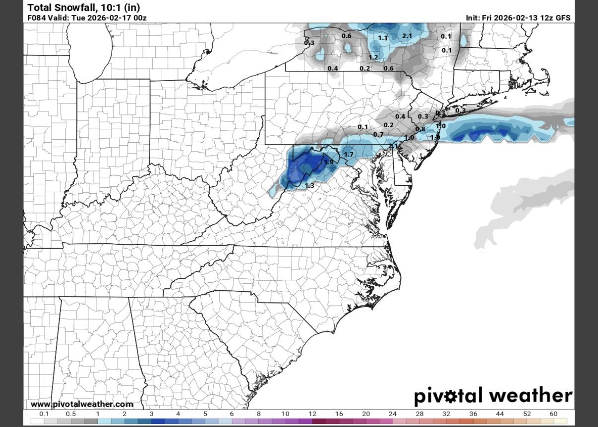
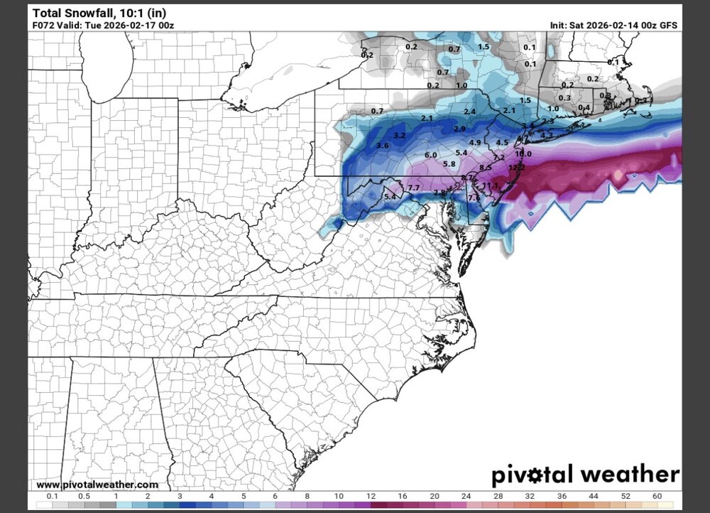
GFS just went full weenie. Over half a foot for most of us. What on earth is going on? -
For Mitch and TSSN.
-
-
And "boom"
-

E PA/NJ/DE Winter 2025-26 Obs/Discussion
Duca892 replied to LVblizzard's topic in Philadelphia Region
This is insane GFS continues the trend -
Gfs !

-
GFS phasing that northern stream more at 42...