All Activity
- Past hour
-
Going back 12 months I've had 26.84" of rain Sent from my SM-G970U1 using Tapatalk
-
Lol .. oh I've been on here a long long time. I'm just busting his chops. Sometimes Kev just throws shyte out that makes no sense.
-
Welcome to AmWx. You will meet some interesting characters here.
-
They did a number on my dogwood a couple of weeks ago. Not sure what they were eating. Plenty of acorns to get fat on.
-
You know, you gave me a big X on my comment about where did you see 3"-6". Am I missing something? Even if it's more CNE / NNE The highest I saw I was 3". Hey, maybe I'm missing something. Instead of giving the big X, help me understand what I'm missing
-
Rained for about three minutes here today.
-
Piss-scat-away
-
 Debbiewx joined the community
 -
Gfs lost it
-
I think I'll be lucky to hit 0.50". Sent from my SM-G970U1 using Tapatalk
-
I feel this rain slipping away Sent from my SM-G970U1 using Tapatalk
-
We got all the way to 77F today! A nice 40-ish diurnal swing. Dew points up to 55F, and it’s funny you can kind of feel a bit more moisture in the air. Crazy how fast the body acclimates to those things… a couple days of dews in the 20s and 30s, and all the sudden 55F feels slightly heavier air.
-
Finished with 27 90 degree days here. MLI had 24.
-

Central PA Summer 2025
Mount Joy Snowman replied to Voyager's topic in Upstate New York/Pennsylvania
Guess what…..that’s exactly what our road trip is for next year. I hear the scene out there is stunning. It will be our first time flying to a game. We love driving out together, whether it be Iowa City or Auburn, but these new west coast schools obviously require air travel. -
The squirrels are picking up and eating every single acorn this year. Overall it’s a small yield year as many of them are already done dropping their acorns. Squirrels super annoying this year chewing limbs and leaves off and littering lawn but very few acorns left in lawn . No worries like we had last year
- Today
-
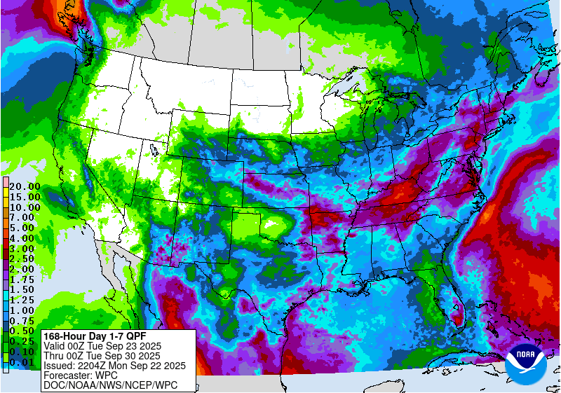
Probably by the 3rd or 4th beer I could see 3-6” on that map.
-

September 2025 OBS-Discussion centered NYC subforum
Sundog replied to wdrag's topic in New York City Metro
Is there a reason why that in the year 2025 Pivotal doesn't have a mobile version of their website? -
RGEM shifted south and jacks rt 2 for midweek.
-

September 2025 OBS-Discussion centered NYC subforum
WestBabylonWeather replied to wdrag's topic in New York City Metro
What about around Xmas time a couple of years ago. I kinda remember hitting 4 degrees I need to look it up. -
Euro. At any rate . This is more a CNE/ NNE deal. Thursday might be better for SNE
-
You should go to the Washington game next year Sent from my SM-G970U1 using Tapatalk
-

September 2025 OBS-Discussion centered NYC subforum
LibertyBell replied to wdrag's topic in New York City Metro
January 1985 had our deepest arctic outbreak though and that's the one I remember. The last time JFK went below 0. The high was in the single digits too, which is extremely rare here. -
September 2025 OBS-Discussion centered NYC subforum
LibertyBell replied to wdrag's topic in New York City Metro
Sounds like April 1982 when EWR had 13 inches of snow and the rest of us had 8-10 lol. I do recall some place on Long Island had 16 inches, but I don't remember where. -
September 2025 OBS-Discussion centered NYC subforum
LibertyBell replied to wdrag's topic in New York City Metro
Weird and NYC only had 1? 1993-94 was better in that regard, NYC had 3. -
3-6 cases
-
Hurricane Gabrielle Discussion Number 24 NWS National Hurricane Center Miami FL AL072025 500 PM AST Mon Sep 22 2025 Gabrielle has continued to become better organized this afternoon, with very cold cloud tops in the eyewall and a warm eye. Data from both NOAA P-3 Hurricane Hunter aircraft confirm satellite estimates that Gabrielle is a category 4 hurricane, with peak 700-mb winds of 129 kt in the eastern quadrant a few hours ago. Additionally, tail-Doppler radar data showed maximum 0.5 km winds of 135-140 kt on the last pass, and the double eyewall structure has consolidated into a single eyewall again. These data supported an intensity of at least 115 kt at 18Z, and with the slight improvement on satellite since that time, the initial wind speed is set to 120 kt. The hurricane is moving to the north-northeast at about 10 kt. There are no important changes to report to the track forecast, with the subtropical ridge providing a seemingly reliable steering for the next several days. Gabrielle is forecast to turn northeastward overnight and then move at a more rapid pace to the east-northeast during the next few days due to stronger mid-latitude flow. The new forecast remains on the faster side of the guidance, closer to the Google DeepMind and GFS model. Extratropical transition is expected late on Friday while the system is in the vicinity of the Azores. Little significant intensity change with Gabrielle is expected as the cyclone begins to move into a less conducive environment, though the overnight diurnal convective max should help the hurricane maintain its strength in the short term. A combination of cooler waters and increasing shear should cause Gabrielle to start to weaken by late tomorrow. While SSTs drop off notably by midweek, an upper-level trough is likely to provide extra divergence aloft, keeping the hurricane stronger than other environmental conditions might suggest. The new NHC intensity forecast is quite similar to the previous one, showing a gradual weakening during the long-range forecast and near the model consensus. KEY MESSAGES: 1. Swells generated by Gabrielle will continue to affect Bermuda and the east coast of the United States from North Carolina northward, as well as Atlantic Canada, during the next couple of days. These swells are likely to cause life-threatening surf and rip current conditions. Please consult products from your local weather office. 2. Gabrielle is forecast to approach the Azores late on Thursday. Interests in the Azores should monitor the progress of Gabrielle though it is too soon to specify the magnitude of potential wind, rainfall, and wave impacts. FORECAST POSITIONS AND MAX WINDS INIT 22/2100Z 31.7N 61.8W 120 KT 140 MPH 12H 23/0600Z 32.8N 60.4W 120 KT 140 MPH 24H 23/1800Z 34.2N 57.5W 110 KT 125 MPH 36H 24/0600Z 35.2N 53.0W 100 KT 115 MPH 48H 24/1800Z 35.7N 47.3W 90 KT 105 MPH 60H 25/0600Z 36.3N 40.7W 80 KT 90 MPH 72H 25/1800Z 37.7N 34.0W 70 KT 80 MPH 96H 26/1800Z 42.8N 22.9W 60 KT 70 MPH...POST-TROP/EXTRATROP 120H 27/1800Z 44.5N 15.0W 45 KT 50 MPH...POST-TROP/EXTRATROP $$ Forecaster Blake


