All Activity
- Past hour
-

2026-2027 Super El Nino
PhiEaglesfan712 replied to Stormchaserchuck1's topic in Weather Forecasting and Discussion
People forget that our coldest winter CONUS in the 21st century happened during a strong el nino. -
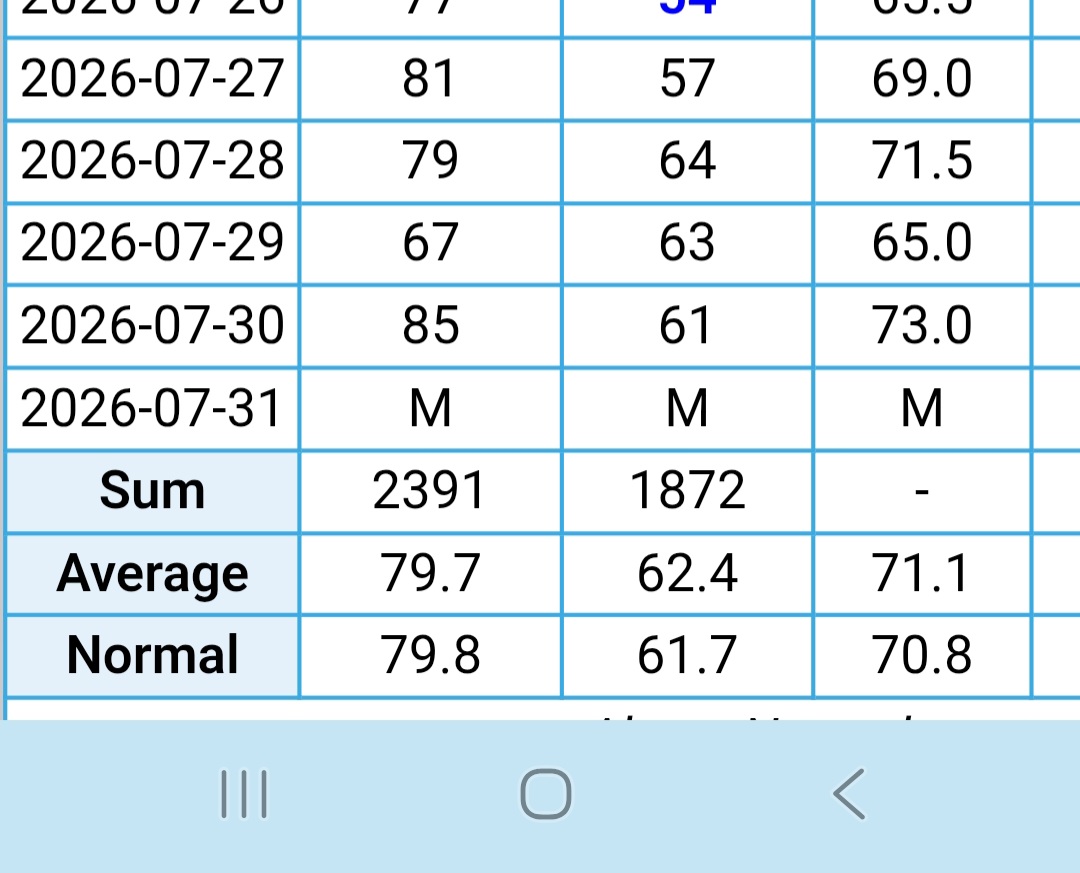
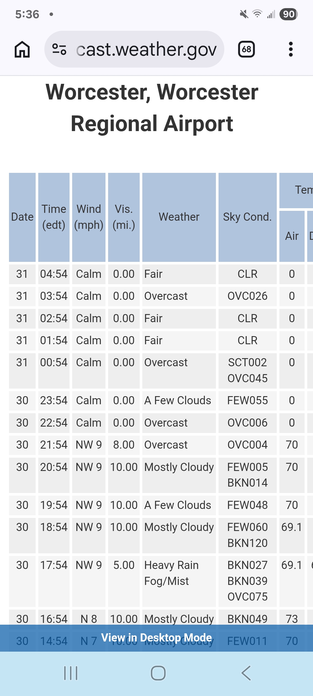
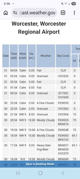
 Strange. The CLI says the error happened at 840am, but the 6hrly max at 18z looks ok. I assume the daytime observer augmented the bad data out. But yeah, the ASOS crapped the bed after that. Only problem is the 85° was apparently still stored for the 24hr max at 5z. The high should be 74°.
 -
 sildenafil 50 mg price or Buy Viagra online cheap Cheap generic Viagra https://www.google.com.nf/url?q=https://medmennews.com best price for viagra 100mg and http://bbs.ebnew.com/home.php?mod=space&uid=782550 sildenafil 50 mg price [url=https://maps.google.cd/url?q=https://medmennews.com]Cheap Viagra 100mg[/url] Cheap Viagra 100mg and [url=http://clubdetenisalbatera.es/user/wiaoxzjcqt/]Generic Viagra for sale[/url] buy Viagra online
 -

Occasional Thoughts on Climate Change
donsutherland1 replied to donsutherland1's topic in Climate Change
World Weather Attribution has now released an analysis concerning the wildfires in France and Spain. https://www.worldweatherattribution.org/climate-change-increases-likelihood-of-compounding-drivers-of-severe-wildfire-conditions-in-france-and-spain/ -

Central PA Summer 2026 Discussion/Obs Thread
mahantango#1 replied to Voyager's topic in Upstate New York/Pennsylvania
NWS State College: July goes out like a lamb after a record-setting month. Our office issued 12 Tornado Warnings in July, which is the most since 1996 when we issued 25. 95 Severe Thunderstorm Warnings is the 3rd most in any July on record, behind 1996 (96) and 2021 (122). Year-to-date, 226 Severe Thunderstorm Warnings is the most on record, passing 2019 (221), and 24 Tornado Warnings is 4th most behind 1998 (55), 2011 (37), and 1996 (30). 250 total Severe Thunderstorm Warnings + Tornado Warnings is the most on record year-to-date, passing 2019 (241). -
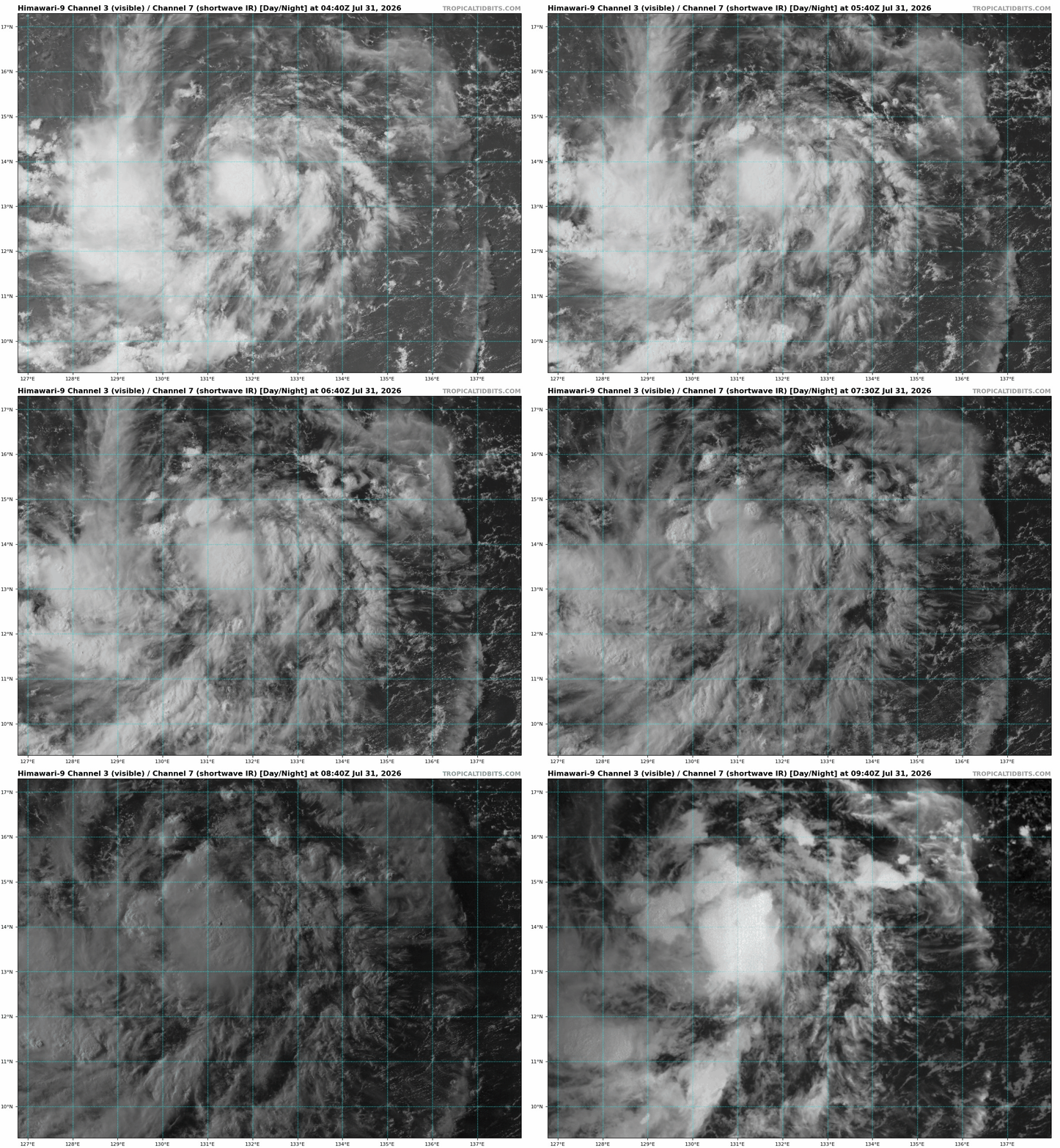
 94W E of the Philippines is clearly a TD, if not a min TS. LLCC is well-defined and core convection is persistent. JTWC does not even acknowledge it as "low" for a chance of development, probably b/c the models don't do anything w/ it, but so what? It is what is in the here and now, and so what if it exists only for a short time as a TC?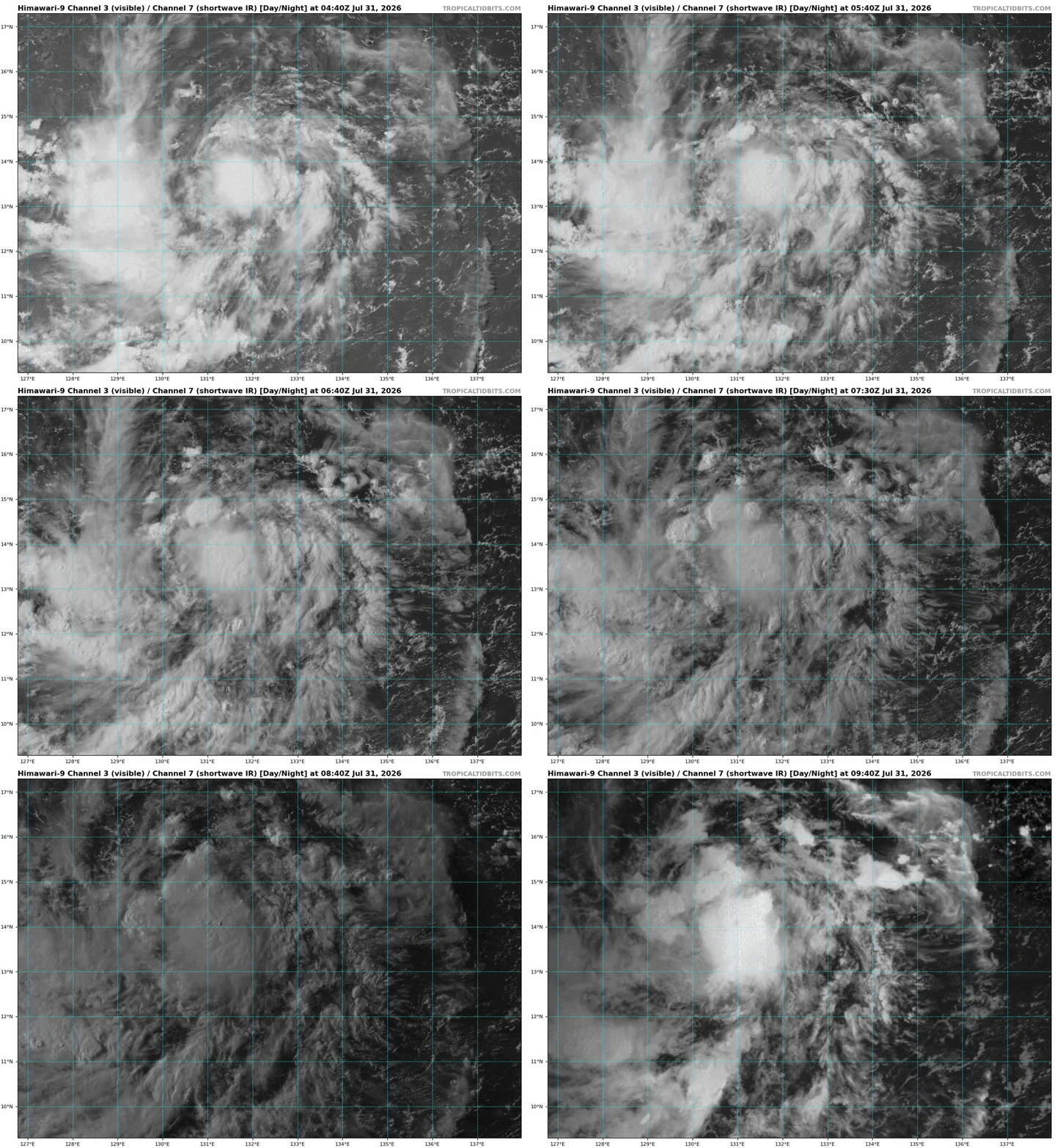
- Today
-
 Ocean State needs to make a service call to Worcester. Pretty sure it didn't reach 85 yesterday.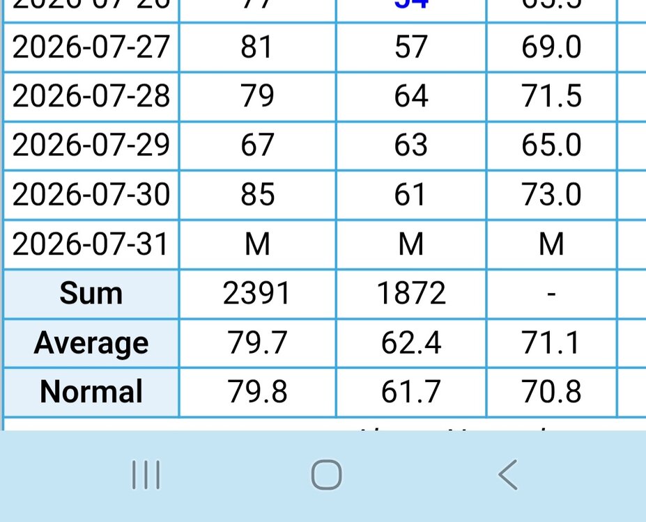
-
sildenafil online: Generic Viagra for sale - Sildenafil 100mg price
-

Central PA Summer 2026 Discussion/Obs Thread
pawatch replied to Voyager's topic in Upstate New York/Pennsylvania
58 degrees this morning. Looks like my record high for the month is going to be 102 degrees. 3.22” precipitation for the month. Normal precipitation is 4.47” That 1.79” sure helped this week. -
Feels like summer.
-
There's zero indication that the wet pattern will end. In fact the super Nino guarantees a stormy pattern.
-
Buy Viagra online cheap: MedMenNews - viagra canada
-
 DCA: +1.7 NYC: +1.6 BOS: +1.4 ORD: +1.6 ATL: +1.0 IAH: +0.5 DEN: +1.3 PHX: +1.0 SEA: +0.8
 -
Sildenafil Citrate Tablets 100mg [url=https://medmennews.com/#]Sildenafil 100mg price[/url] buy Viagra over the counter
-
SAL is another big factor, esp. in recent years. 2024, the SAL was dominant in the MDR. The 700 and 500 temp anomalies were impressive, and that why the heart of the season was squashed and why we did not get the fcst "2005 redux" in 2024. I recall seeing 0 C at 500 in part of the MDR in Aug-Sep 2024, and this was w/ no ridging present. It is not often you get 0 C at 500. In the core of a Cat 1 hurr or higher and under the hottest continental ridges. So to have 0 C at 500 just "there" w/ nothing atypical synoptically, you want to take about "extreme?" The SAL was so strong in 2024, it extended to the EPAC and that suppressed things big time initially, resulting in the latest first NS in the EPAC since reliable satellite records (1970). In 2025, what stood out was the African dust outbreaks. They usually peak in June and wane in July, but they went on into Sep, again knocking down MDR formation big time. 2025 was unique b/c all the major hurricanes except Melissa peaked and got intense outside the deep tropics. So what happened in just the last two seasons in the ATLC were non-trivial as to suppression of TC activity, and something that needs to researched more and included in the discussion. It is esp. important b/c of all the TC basins in the world, the ATLC is the most variable.
-
Far too much focus on SSTs -- column TPW (and by extension instability) and shear is what it is all about. All the anomalously high SST/OHC is meaningless if the atmosphere does not cooperate. Something that seems to elude many -- "but the ocean is SO hot!!!" TCs are more tenuous that the MSM thinks. A lot has to line up for one to form, and even more for one to get intense. SSTs are more than warm enough around the globe in much of the tropics and subtropics year-round to support strong TCs, and how many named storms form each year and how many get intense? And formation is confined to distinct parts of the year in each basin, again showing how what goes on in the atmosphere dictates things. Of all the 3 primary factors, SSTs are least important. You can get hurricanes up to Cat 2 status w/ SSTs below the 26 C threshold, and min hurricanes as low as 20 C as long as the TPW and shear are favorable. But if the wind shear is high and/or the column is dry, you get nothing to even develop in the first place, despite torch SSTs! You don't need to do research or run a model to see this, Empirical observations alone over time clearly show this. That's a sig problem these days, some are so caught up in "what the models say" they forget to look at what actually happens in the real world, currently and in the past. Empirical. real-world observations override what models say every time. Basic common sense and logic!
-
 Pattern would really have to change to bring something up.. but I wouldn't mind a NC trip
 -
https://medmennews.xyz/# MedMenNews buy Viagra online
-
Generic Viagra for sale: MedMenNews - generic sildenafil
-
Yah, but maybe we can get a grazing PRE like Arthur from July 2014!
-
"But, but, the ECMWF is now at least showing a disturbance that recurves!" @CoastalWx needs to be reminded this is a "home grown" type of hurricane season. Last 'cane to hit New England was a super El Nino based on RONI 1991-92 -- no, not the Bobby Brown song! LOL.
-
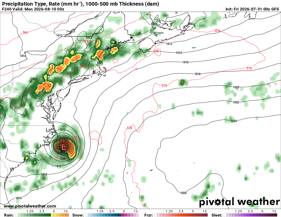
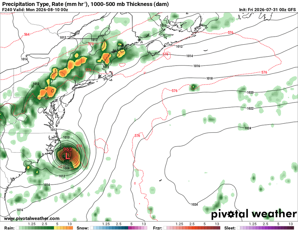
GFS has been persistent in showing this thing for many days now, but that mean little b/c it is the GFS and it is beyond a week. However, the recent ECMWF runs now show a distinct wave moving W S of the subtropical ridge and then recurving offshore. But @ineedsnow *only* cares about this I bet from the 00z GFS! "It's just GOTTA come up!"
-
Fell just short. 12.33" Unless they happen to get TRW+ today.
-
@ineedsnow wants this!
-
I used to go McDonalds. But I can not go there out of good conscience b/c of the ridiculous prices. Funny, Taco Bell and Little Caesars, there prices have not gone up much at all over the last 5 years. So I do not want to hear inflation or min wage mandates excuses.