All Activity
- Past hour
-
Terrible post 2010-2011 wasn't a below normal winter. Even 2015 wasn't bad. You must be related to snowman19.
-
I’ll take my 1” and love it. We’re back.
-
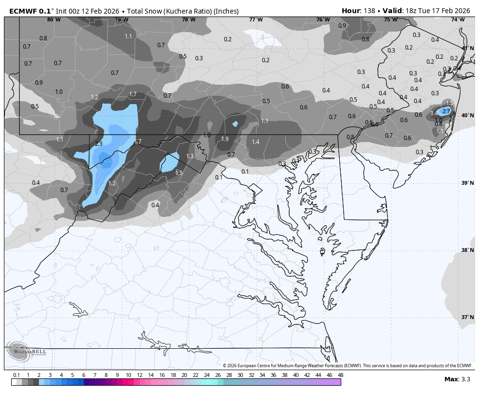
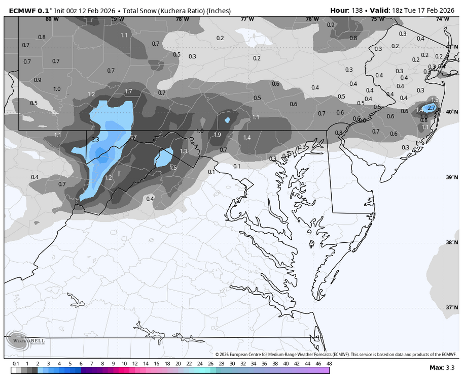
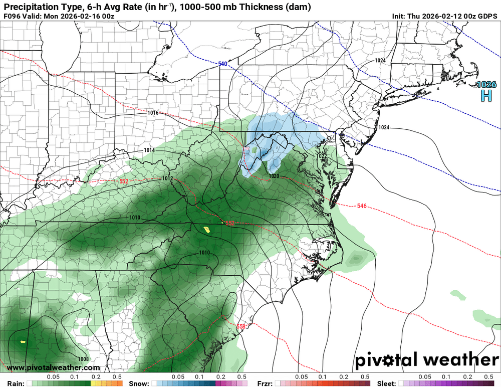
WB 0Z EURO
-
 All of the models are too warm with their surface temps for this weekend..and here's why: Their snow cover estimates are too aggressive with melting. They're assuming typical snow density and compaction. They can't handle the slow pace of north facing snowcrete melt-off. Please hit the hot dog emoji
 -
 Spunky for a newbie to open a thread; but we need some new energy!!!!
 -

2025-2026 ENSO
Stormchaserchuck1 replied to 40/70 Benchmark's topic in Weather Forecasting and Discussion
There are other indexes, stronger correlated than the WPO, that are not favorable at the end of ensemble mean runs -
Nothing Earth shattering here but just continued picturesque powder that gradually adds up. Snow depth approaching 2'. Would love to pass it.
-
Much needed too! I’m at about my wits end with trying to slowly break up some of the ice on the roof. It was cool as hell though seeing a huge flock of robins drinking from a few tiny melted drops the other day on the shingles. They must be so desperate right now for any unfrozen sources they can get their claws on!
-
Dude what? March 2015 was a legit winter month the whole month here on Long Island. Snow on the ground almost every day of the month and some decent events too
-
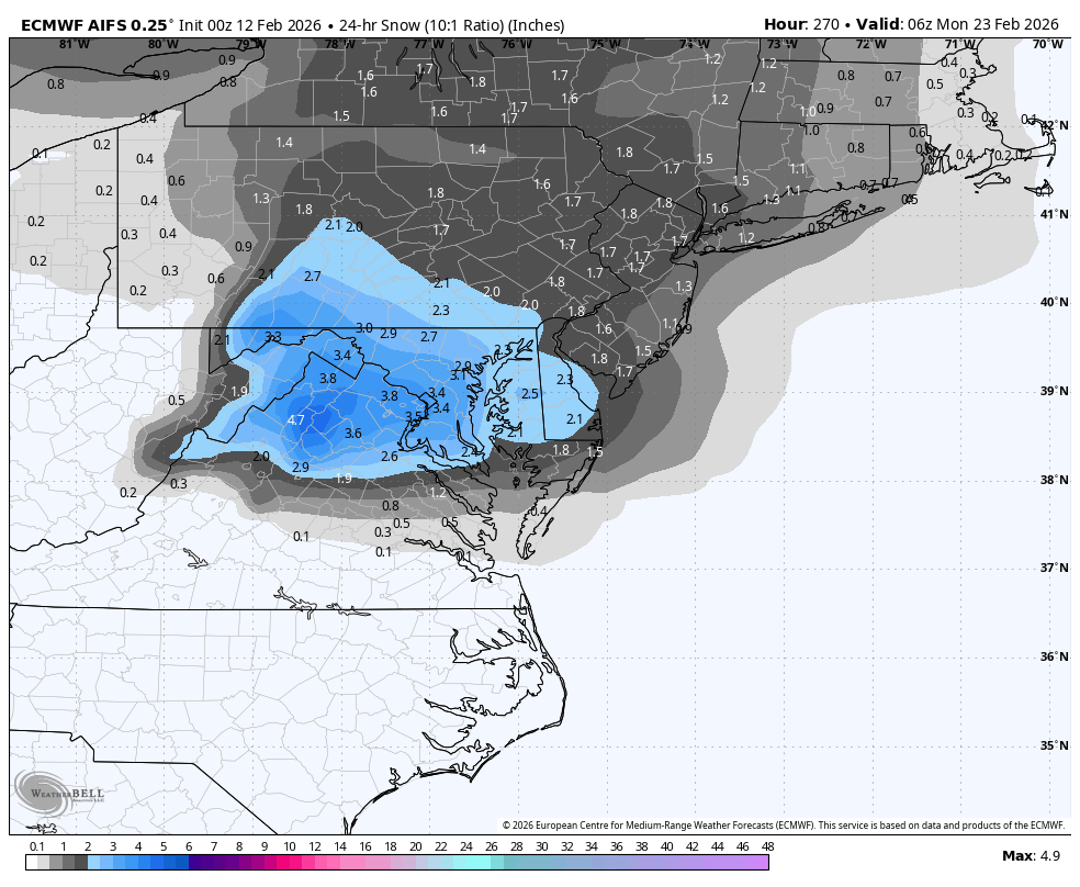
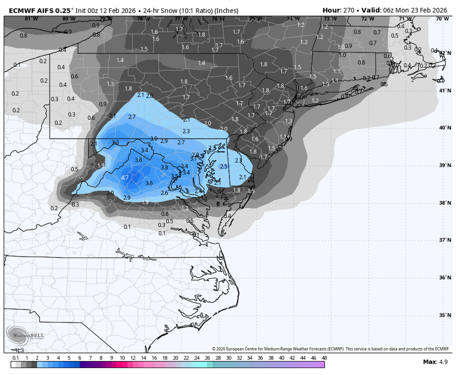
WB 0Z AI!!!
-
I had snow on the ground every day of March 2015.
- Today
-
That would be the second most exciting event of the winter.
-

Is we back? February discussion thread
Boston Bulldog replied to mahk_webstah's topic in New England
It was pretty clear this was never coming. The setup was a thread the needle act given the rossby wave configuration, widespread synoptic support was never there for such a coup. Models provided a little excitement but the ensembles stood pretty firm. Next! Potential blocky gradient look at the end of next week. Playing with fire a bit but I'll take it for now -
Queue the it’s coming posts after the next run showing a scrape
-
Theme of the winter now you see it now you don’t. It’s all IVT and OE other than the one big storm
-
It would have to come back on the Euro for pinnage. Now we are tracking light rain withbthe chance if moderate rain.
-
Did the GFS come out already?
-
Storm is done Euro is a terrible model
-
What a waste
-
I doubt this since the WPO will become negative again. Take the weeklies with a grain of salt.
-
We can’t even get this thing pinned. What a disgrace.
-

Central PA Winter 25/26 Discussion and Obs
Itstrainingtime replied to MAG5035's topic in Upstate New York/Pennsylvania
Some models indicate warmer than that. 70s up into central MD. -

Is we back? February discussion thread
40/70 Benchmark replied to mahk_webstah's topic in New England
Tell it to join the club. -
-

Central PA Winter 25/26 Discussion and Obs
canderson replied to MAG5035's topic in Upstate New York/Pennsylvania
50s are possible middle of next week I’m still holding out hope for rain Sunday to wash salt away but decent precip seems …. Skeptical