All Activity
- Past hour
-
Deerfield.
-
Maybe this extreme and historic heatwave will break the pattern. I, for one, am excited to get 2010, 2011 heat back into the region!!
-
And on it goes this morning. Had light rain, mist and drizzle all day yesterday. Pea soup fog ongoing this morning. Seems temperatures at my location have been stuck between 58 -62 degrees for days. Rainfall totals since last Friday = .28"/.36"/.07" and .23". Total = .94".
-
That really is an unusual streak for Philly, is that their all time longest? I can't imagine why Philly hasn't hit 100 over 13 years lol. Can't use the sea breeze excuse.
-
You're catching on.
-
today I learned that "the next 6 days aren't very nice" is the same as "6 straight days of clouds and rain"
-

2025-2026 ENSO
40/70 Benchmark replied to 40/70 Benchmark's topic in Weather Forecasting and Discussion
I think it could... -
2012 for Philly with 99 in 2022, 3 98 last year and 3 98 in 2022
-
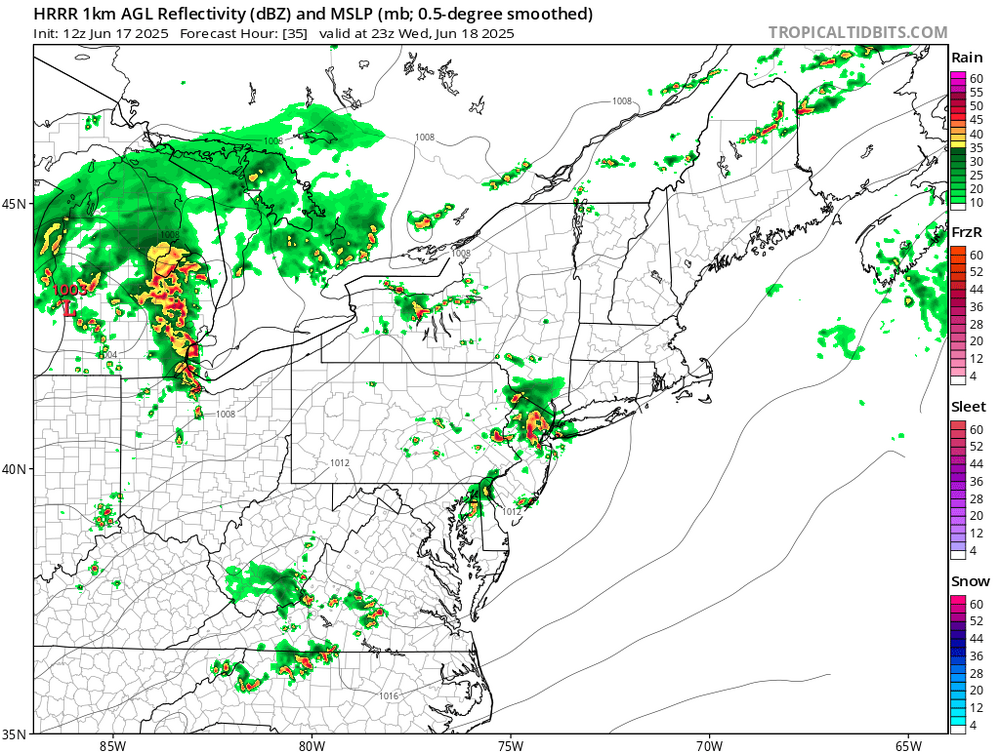
mcs potential along the warm front tomorrow

-
Since Friday evening, 1.33” here in Lebanon, MTD is now 3.47” and YTD is up to 23.08” .
-
From what I read that massive August 2003 outage was caused by a squirrel chewing on the power line up near Buffalo that caused a power cascade across the entire region from Michigan to the east coast and up to Canada, 55 million without power because of one hungry squirrel lol.
-
Thanks again. All of your suggestions look interesting. Which I had more time to play more. I am an avid, but not a good golfer, and all the courses look like they would be fun to play.
-
If a front never moves how long until it rains itself out and the clouds dissipate? I've always wondered about this.
-
and NYC too their streak also goes back to 2013. PHL has not hit 100 since 2013 either?
-
Some chinks in the armor detected in the cloud magnet pushing into W / PA
-
I wish. The power had gone out (yet again) and that time they fixed it they must have done something to premanetly fix the issue.
-
The models have 850 mb temps near 22-23C and 500 mb heights around 597+ DM. So that should easily translate into 100°+ at the usual warm spots. But still uncertain if JFK will break their no 100° streak since 2013.
-
It's starting to get biblical here. Another 2.5in last night. I have serious flood issues now. Creeks over its banks. Waters about 6ft from the back deck. I just dropped 150ft of new fence posts Sun/Mon. Those are damn near floating, gonna have to be redone damn it. Fields around here are drowning. Kinda wacky as its fairly isolated to just this area. 9 inches since Friday. Thats half a summers worth in 4 days. Man the muggles are gonna suck this weekend when we start hitting 90/70 dews. South Carolina low country is chasing me. Had enough of this shit.
-
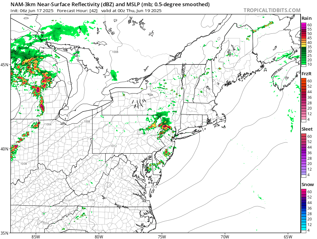
At least on the NAM anyways...pretty big differences between GFS/NAM with the thermodynamic environment due to whether we can get that EML plume to move through. It's possible the environment across the Great Lakes/Ohio Valley region becomes convectively overturned but NAM has ~1500 J MUCAPE traversing the region overnight...not bad
-
Looks like Thursday may start cloudy but will eventually clear.
-
I was going to say, it might hit 90 as soon as Thursday even with limited sunshine. We won't have a sunny day before Friday though.
-
Our high pressures just haven't been strong enough to push the sea breeze offshore=\
-
Just noticed that. Yeah could be a few bangers.
-
Warmer spots may hit 90 Friday and Saturday as well before the big heat gets here. Could be a prolonged heat wave starting Thursday
-
Central Park was probably 100° to 101° on the Great Lawn. But the ASOS under the trees only made it to 98°. JFK had a strong sea breeze so was much cooler.