All Activity
- Past hour
-
Also isn't there a whole week at the end of July when NYC has never hit 100 (I think it's July 24-30).
-
That's perfect for Easter or Memorial Day, definitely not July 4th.
-

July 2025 Discussion-OBS - seasonable summer variability
LibertyBell replied to wdrag's topic in New York City Metro
It depends on how extreme it is. If it goes below zero then it's interesting (same as 100+). There does need to be activity around the bookends though (just like with winter.) January 1994 was much more fun than January 1985. Both went below zero, but January 1994 had much more activity. -
12z Euro is 75/48 on July 4th.. looks perfect!
-
July 2025 Discussion-OBS - seasonable summer variability
LibertyBell replied to wdrag's topic in New York City Metro
The heat was just getting started in the final week of the month and lasted into September A nice dress rehearsal for 1983 -
Cloudy, though pretty dewy today.. 72.3°/67.3°
-
Yes. That's correct about 1925.
-
An organizing area of low pressure in the Bay of Campeche now has 70% odds of development, with tropical storm headlines likely later today or tonight. Although it will be short lived, a landfall is expected Monday along the coast of Mexico. Recon is en route to investigate. Tropical Weather Outlook NWS National Hurricane Center Miami FL 200 PM EDT Sat Jun 28 2025 For the North Atlantic...Caribbean Sea and the Gulf of America: Bay of Campeche (AL91): Recent surface observations, satellite imagery, and radar data from Mexico suggests a well-defined surface circulation is developing with the area of low pressure located in the Bay of Campeche near the Mexican coastline. In addition, shower and thunderstorm activity is also starting to show signs of organization. If these trends continue, a tropical depression is likely to form, possibly as soon as this afternoon, in the Bay of Campeche. This system is forecast to continue moving west-northwestward this weekend towards eastern Mexico, ultimately moving inland by Monday. An Air Force Reserve Hurricane Hunter aircraft is en route to investigate the system, and interests in southeastern Mexico should monitor the progress of this system. Tropical Storm Watches or Warnings could be required for portions of the Mexican Gulf coast as soon as this afternoon. Regardless of tropical cyclone formation, locally heavy rains are ongoing over portions of Guatemala and southeastern Mexico, and will continue during the next few days. * Formation chance through 48 hours...high...70 percent. * Formation chance through 7 days...high...70 percent. $$ Forecaster Papin
-
We “breaking out” too. A brighter cloudiness.
-
After a quiet start, the basin is starting to heat up with homebrew opportunities. For the first time we have tangible areas to look at close to land. 1. Invest 91L--Bay of Campeche magic is at it again, this time with a developing low taking shape this afternoon. Invest 91L is increasingly likely to become our second named storm of the year--a short lived one as it makes landfall along the Mexico coast on Monday. 2. Gulf/SE Coast--There are growing signals that a trough will get hung up off the Gulf/SE Coast in the coming week, which could spark tropical development. This is a classic way to get early season homebrew off the SE coast or in the northern Gulf, and it's worth watching especially if it ends up in the Gulf. The SST anomalies across the basin are unlike recent years, but in much of the Gulf and off the East Coast, temperatures are very warm.
-
66/61 cloudy
-
Over the last few days I set up a drip irrigation system for the garden because we'll be out of town for a week. Now we're out and it feels weird to be turning it on when I'm 4 hours away. I sure hope the critters didn't mess with it too much and the water is going where it's supposed to.
-
72/68. Very sticky and awesome out here
-
58.2°
-
awesome!!
-
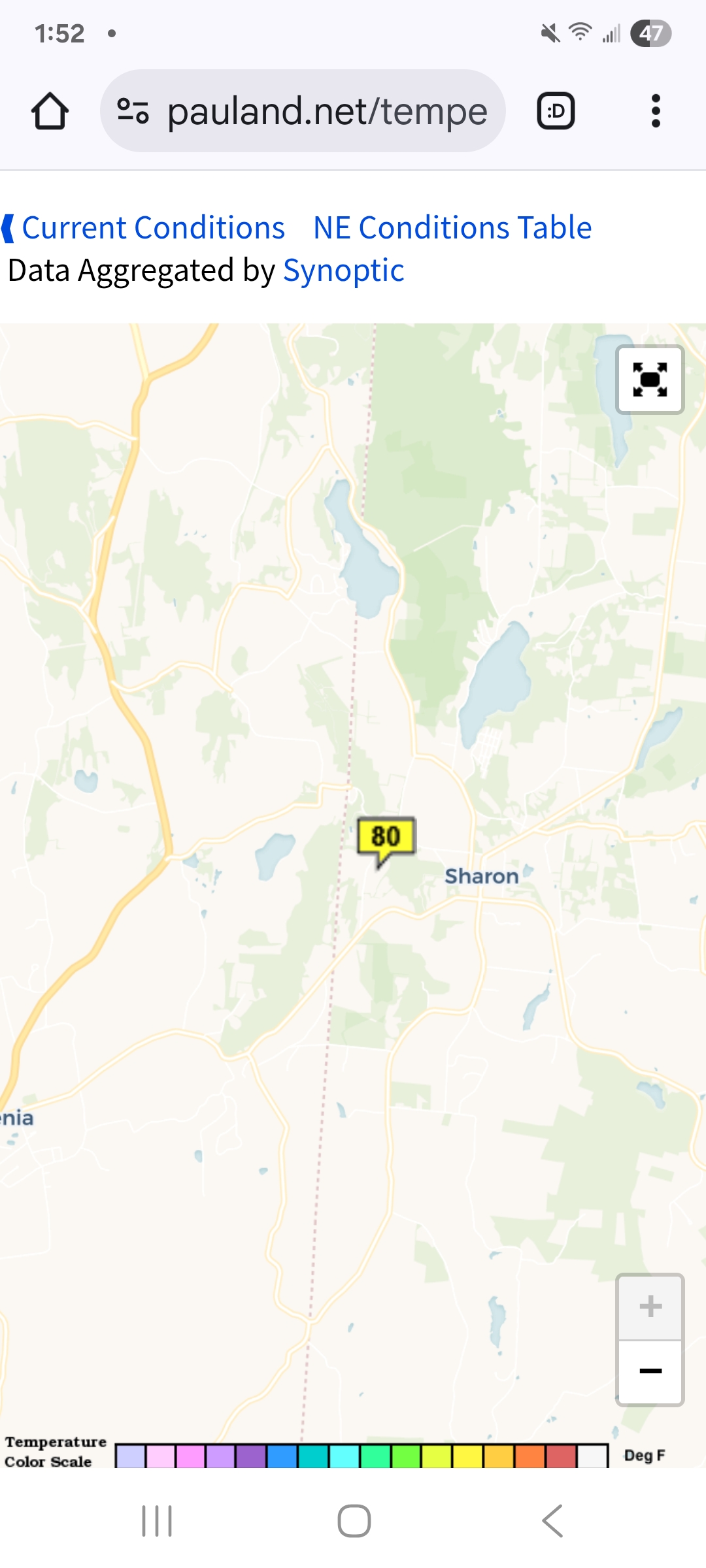
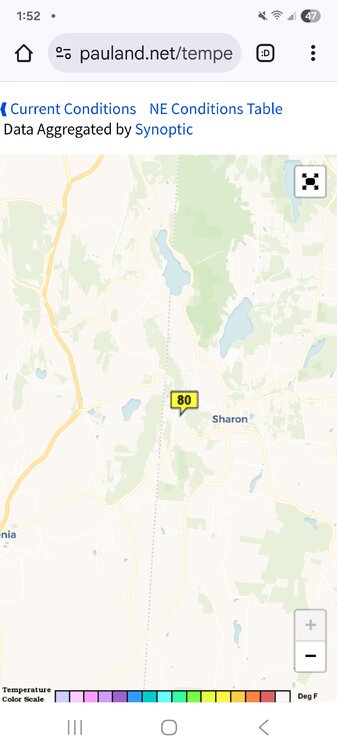
Already 80 in Sharon Connecticut ! What a day!
-
I'm not a huge fan of temperature anomaly maps. They're useful but terrible for communication purposes.
-
We had a brief bout as well. Was at a family reunion. Everybody huddled under canopies in fleeces because it’s 63°. Nice!
-
Suns been in and out . Should be fully out within the hour. Enjoy the rains
-

2025-2026 ENSO
CP_WinterStorm replied to 40/70 Benchmark's topic in Weather Forecasting and Discussion
Where does this chart come from? I'd like to be able to monitor this myself but can't seem to find it on my own. -
Awesome! I hope it's a good dog.
-
Heat maps are posted at 4:00 p.m. and cold maps are posted at 2:00 a.m. . Are you new here?
-
Can’t wait to post pics of her bombing around in the snow. Welcome Willow to NORH county

-
You got a problem with that?
-

July 2025 Discussion-OBS - seasonable summer variability
forkyfork replied to wdrag's topic in New York City Metro
june 1980 was below average with a few nights getting into the 40s