All Activity
- Past hour
-
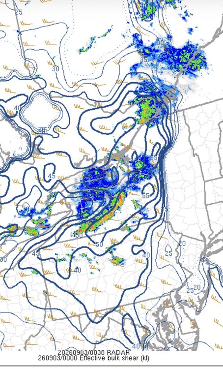
This tells the story for now at least.
-
 Because of the high to our east . They always try to scour out the door airmass too quickly. It’s exactly as I described
 -

Central PA Summer 2026 Discussion/Obs Thread
Blizzard of 93 replied to Voyager's topic in Upstate New York/Pennsylvania
.56 rain today in Marysville. 1.25 total for the week. -

Monday, August 31 - Thursday, September 3, 2026 Convective Episodes
CoastalWx replied to weatherwiz's topic in New England
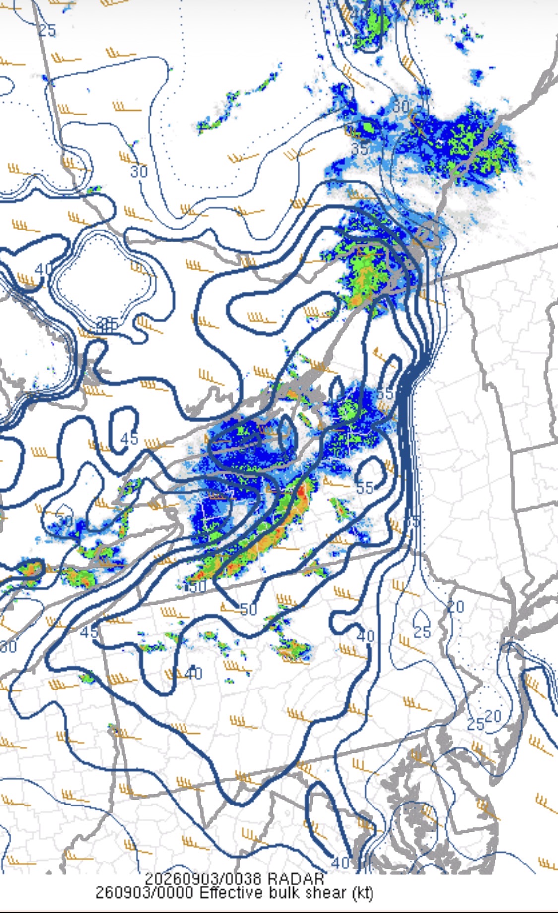
Models had decent dynamics with warm air advection generating storms over us a day ago, but now it seems to be diving more into PA and SE NY where better instability is. This is the theme all season. -
 Let me ask the question in a non-contentious manner...will the maritime air over us now destroy these storms?
 -
It also has redrawn the state borders of the SE
-
Then go buy some
-
Tomorrow and Friday will see temperatures top out mainly in the lower 80s. Showers and thundershowers are possible. Excessive heat with highs in the middle and upper 90s will be just south of the region in such cities as Baltimore and Washington tomorrow and Friday. A cooler air mass will move into the region for the Labor Day weekend. In its wake, temperatures will generally peak in the middle and upper 70s. The ENSO Region 1+2 anomaly was +4.2°C and the Region 3.4 anomaly was +2.6°C for the week centered around August 26. For the past six weeks, the ENSO Region 1+2 anomaly has averaged +3.93°C and the ENSO Region 3.4 anomaly has averaged +2.50°C. The ongoing strong El Niño, which has reached super El Niño threshold, will continue to strengthen through the summer. The SOI was -10.63 today. The preliminary Arctic Oscillation (AO) was +0.219 today.
-
Thanks, im going to do a long post in Oct or Nov going over all the new additions and changes. There is a ton of new stuff on the site including two new seasons, 10 new historic storms, new Lower Northeast maps and ERA5/ECMWF reanalysis maps...still working on it.
-

Septorcher 2026 Discussion - Endless Summer
Lava Rock replied to Damage In Tolland's topic in New England
Local mets touting 0.5-1.0". Lost track of how many times this has happened in last 2 months. I'll predict 0.2" or less for our hood. Sent from my SM-S921U using Tapatalk -
Mine is 2020 at 80.8 degrees, 1999 was 77.9 here
-

Septorcher 2026 Discussion - Endless Summer
tunafish replied to Damage In Tolland's topic in New England
Man, did that fall apart quickly. Can't make this shit up. -
I imagine the storms will weaken considerably. Maybe a decent light show but upton really only mentioning showers
-
Monday, August 31 - Thursday, September 3, 2026 Convective Episodes
CoastalWx replied to weatherwiz's topic in New England
No, beer? -
According to that map San Francisco and LA will have a snowy and icy winter.
-
 order medicine from mexico or mail order pharmacies mexican pharmacies that ship https://www.google.co.th/url?q=https://mexiph.com online mexican pharmacy or http://www.garmoniya.uglich.ru/user/uexzycwkqp/ online pharmacy in mexico [url=http://www.3reef.com/proxy.php?link=https://mexiph.com]medication in mexico[/url] mexican pharmacies online drugs and [url=https://www.liveviolet.net/user/vwfhxkcion/videos]mexico rx[/url] pharmacy in mexico that ships to us
 -
order medicine from mexico or mail order pharmacies mexican pharmacies that ship https://www.google.co.th/url?q=https://mexiph.com online mexican pharmacy or http://www.garmoniya.uglich.ru/user/uexzycwkqp/ online pharmacy in mexico [url=http://www.3reef.com/proxy.php?link=https://mexiph.com]medication in mexico[/url] mexican pharmacies online drugs and [url=https://www.liveviolet.net/user/vwfhxkcion/videos]mexico rx[/url] pharmacy in mexico that ships to us
-
online drugs order: mexico pharmacy list and pharmacy in mexico city
-
It sure does. Stable atmosphere from the backdoor . We just can’t get into warm sector with instability. Same issue all summer . Even tomorrow will be a struggle
-
Monday, August 31 - Thursday, September 3, 2026 Convective Episodes
CoastalWx replied to weatherwiz's topic in New England
Nothing to do with that -
Yeah that’s what I’m thinking. They tend to take a long time to ramp down, so we could see what ever is left all the way to the coast .
-
Septorcher 2026 Discussion - Endless Summer
Lava Rock replied to Damage In Tolland's topic in New England
Fully expecting Sent from my SM-S921U using Tapatalk - Yesterday
-
Large scale derecho look to that system currently making a mess of western NY.
-
looking southeast:
-
Your N Atlantic ruining it for everyone tonight