All Activity
- Past hour
-
This month is all AN to date
-
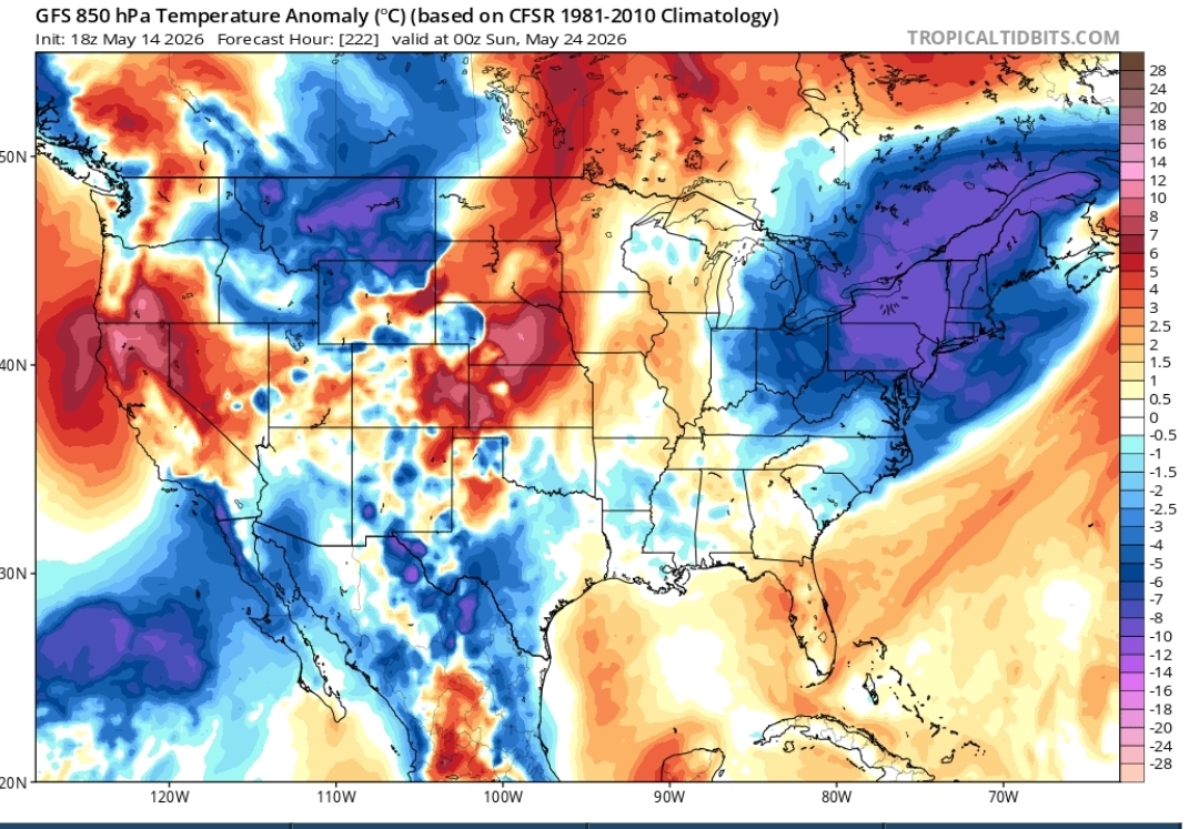
Yeah not sure why he’s forecasting cold rains like his map depicts . ACATT grasping after failed cold May
-
its going to be.. a few warm to hot days wont cut it
-
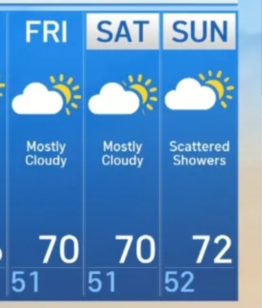
Exactly, It's from what he posted. Warm and then cool and cloudy over the weekend.
-
lets keep trending the cooler air south.. still 5 days to go
-
Sister ?
-
Didn’t they also have this month WBN?
-
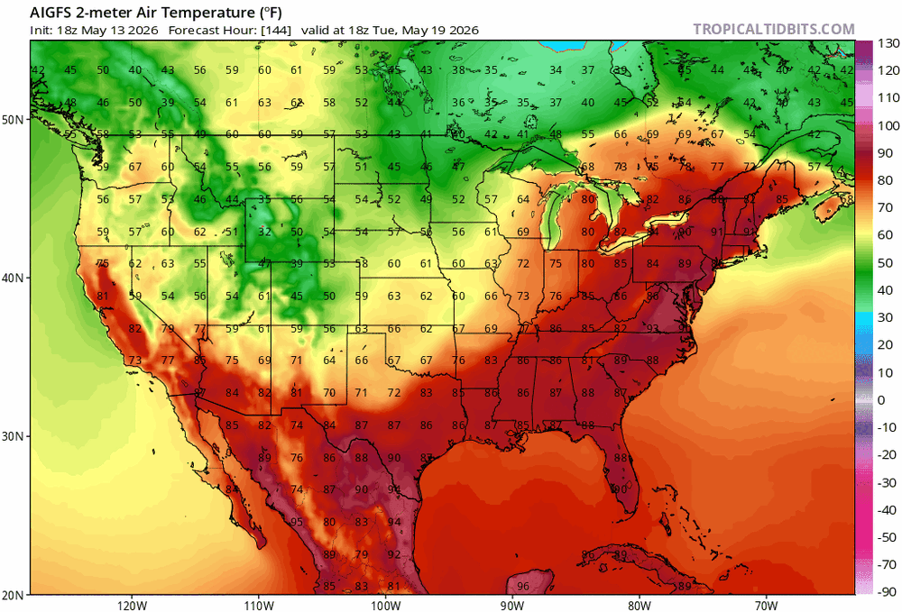
Aren’t those both showing similar things? Admittedly don’t know climo as well, but is BDL like mid-70s around then? So goes from like almost +20 to -5 or so for highs between Tuesday/Wednesday and the weekend?
-
.23 don’t get it twisted
-
High today didn't make 50 at 49.9 degrees, plus 20-30 mph gusty NW winds felt more like March. This will be a new 'cool max' when I do the 7 am CoCoRaHS report. Old record was 53 degrees in 1999.
-
Ya'll acatt never learn
-
This storm was so scrubbed from memory that when it got pulled up in forum I had the thought of “what blizzard?”.
-
18z Euro AI and the 18z GFS has upper 60's to low 70's Memorial day
-
The temperature will top out in the middle and upper 60s tomorrow. t will turn noticeably warmer during the weekend. Parts of the area could reach or exceed 80° on Saturday and especially Sunday. The warmth will likely continue through the middle of next week. Temperatures could rise into the upper 80s and perhaps the lower 90s on Tuesday and Wednesday. Wednesday will likely be the hottest day so far this year. Thursday will still be warm. Afterward, it will turn much cooler. The ENSO Region 1+2 anomaly was +1.6°C and the Region 3.4 anomaly was +0.9°C for the week centered around May 6. For the past six weeks, the ENSO Region 1+2 anomaly has averaged +1.50°C and the ENSO Region 3.4 anomaly has averaged +0.55°C. El Niño conditions are rapidly developing and will likely be in place in the next few weeks. The SOI was -15.45 today. The preliminary Arctic Oscillation (AO) was +1.456 today. Based on sensitivity analysis applied to the latest guidance, there is an implied near 60% probability that New York City will have a warmer than normal May (1991-2020 normal). May will likely finish with a mean temperature near 63.7° (0.5° above normal). Supplemental Information: The projected mean would be 1.2° above the 1981-2010 normal monthly value.
-
Yeah looks frigid and awful . Fake tweets ftl
-
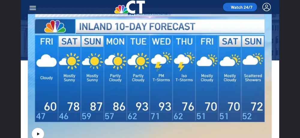
Memorial Day weekend looks nice huh? Aaaahhh

- Yesterday
-
-
Ooh, that smell Can't you smell that smell? Ooh, that smell The smell of rain that surrounds you
-
I imagine him in the freezer playing with the freezer burn and saying “we take” all night.
-

Central PA Spring 2026 Discussion/Obs Thread
mahantango#1 replied to Voyager's topic in Upstate New York/Pennsylvania
Was mowing for 2hrs. On the riding mower this afternoon. I got cold out there. It felt like I was mowing in November with a temp of 53. Then got a surprise rain shower which put down .02 rain. Have to finish mowing tomorrow since the grass got all wet. -
Nice! Sit in the cooler and wander over to the beer section by accident.
-
44 here now after a bone chilling, for end of Spring, 48 for the high today with wind chills frequently dipping down into the 30's. Summernista's had a tough spring (despite a few very warm days) and summer is only 2 weeks away now but they can fancy the next 4-6 days.
-
.22 in S Wey
-
This evening it was warm (mid to low 80s), but dewpoints were only in the upper 30s, something sometimes hardly seen in an entire May in this area. So, that along with a decent breeze meant enjoyable walking vs what’s typical for mid May. It was 100% sunny.


.thumb.gif.f92b16c631a1d15d405ed77b33f0710d.gif)