All Activity
- Past hour
-

2026-2027 Record-breaking El Nino
40/70 Benchmark replied to Stormchaserchuck1's topic in Weather Forecasting and Discussion
Yea, right.......but even considering that logic, you would think that there would be some additional give relative to 2023, whereas that former regime even more deeply entrenched....I mean, El Nino is stronger...PDO is less negative and the warm pool is further east. This is why I believe there is more wiggle room for a window later in the season. -
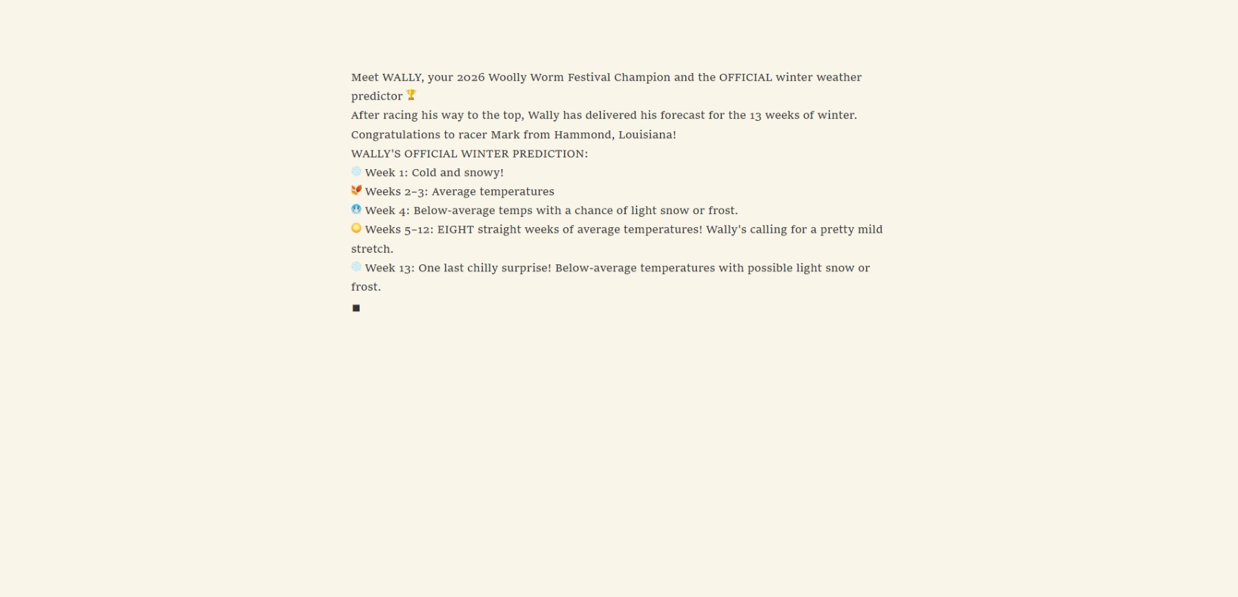
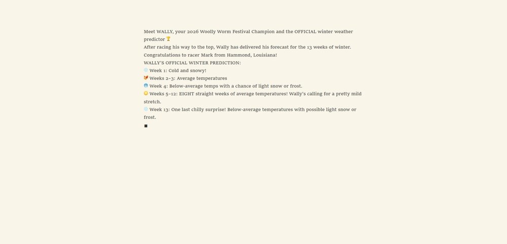
I was at the Woolly Worm Festival this weekend and here it is-----
-
2026-2027 Fall/Winter Mountain Thread
Met1985 replied to BlueRidgeFolklore's topic in Southeastern States
29 degrees again here this morning with a heavy frost. -

2026-2027 Record-breaking El Nino
Typhoon Tip replied to Stormchaserchuck1's topic in Weather Forecasting and Discussion
Yup ... and I realize we've been over this aspect before. But these signals don't turn an entire planetary system on it's head that quickly. There's momentum stored in the other mode and takes time to move away. It's sort of analogous to a seasonal change ... ex, we don't observe Aug 15 --> Nov 15 on a straight 45 deg downward angular trajectory. It goes back and forth while accumulating the lower height state over that span... in theory. We can always count on a complete systemic rollback to July 15th on Xmas Eve! So, as we go from a cool-->warm(vice versa) ENSO state, the atmosphere will tend to a kind of 'non-Markovian' echo of the form mode. It complicates matters further these days when/since previous modes became increasingly more disrupted ..heh. However, in this case since the -PDO is significantly correlated to the -ENSO, and the PDO is really a reflection of the longer term SS wind stressing in the quasi-coupling of the air-sea environment out there (therefore, atmospheric mode-), there's decent enough confidence that we actually had an NINA hemisphere last winter. -
2 frosty mornings in a row, 32 Sunday morning and 30 this morning.
-
2026-2027 Record-breaking El Nino
40/70 Benchmark replied to Stormchaserchuck1's topic in Weather Forecasting and Discussion
Maybe latter January...I think we all agree that the seasonal mean will be tough sledding, no pun intended lol -

2026-2027 Record-breaking El Nino
MJO812 replied to Stormchaserchuck1's topic in Weather Forecasting and Discussion
Relying on February to produce is a bad sign for the winter. Hopefully we get lucky with an event this winter -
2026-2027 Record-breaking El Nino
40/70 Benchmark replied to Stormchaserchuck1's topic in Weather Forecasting and Discussion
I was just speaking of the image Chris posted. -
2026-2027 Record-breaking El Nino
40/70 Benchmark replied to Stormchaserchuck1's topic in Weather Forecasting and Discussion
Every intense EL Nino has had it...only that was fairly neutral was 1982.....but I think that +WPO is part of the reason why February maybe somewhat better. -
-
36.5 at mi casa. It was clearly closer to freezing outside of my neighborhood though because I saw frost as soon as I got a half a mile from the water. Barring any super strong front, it’ll prob be mid-Nov before my station sees freezing or lower. Quite a bit of smoke on the water though (hits guitar solo), so the step down process is underway.
-
We can hope
-

2026-2027 Record-breaking El Nino
LakePaste25 replied to Stormchaserchuck1's topic in Weather Forecasting and Discussion
Like I said, we need to ditch the +WPO. Probably as we approach mid November would my guess, once the Siberian High can flex east of the Himalayas while the MJO exits the Indian Ocean. Would force a more equatorward pac jet and an organized Aleutian/GOA Low. -

2026-2027 Record-breaking El Nino
mitchnick replied to Stormchaserchuck1's topic in Weather Forecasting and Discussion
So you are disregarding last night's Eps that pulls the west coast trough wnw off the coast toward the GOA as well as the last 4 weeklies runs (at least) that has the Aleutian low and trough developing in the SE? -
Min 29.0° Atmospherically fake. Vegetatively real.
-
Second sub-freezing morning in a row. Low of 30 with heavy frost.
-
2026-2027 Record-breaking El Nino
LakePaste25 replied to Stormchaserchuck1's topic in Weather Forecasting and Discussion
Need to get rid of that +WPO. Always bad news for Ninos, let alone any ENSO. -
2026-2027 Record-breaking El Nino
40/70 Benchmark replied to Stormchaserchuck1's topic in Weather Forecasting and Discussion
Has to be mainly attributed to daily mins...just guessing....although certainly the past couple have been cold. -
2026-2027 Record-breaking El Nino
40/70 Benchmark replied to Stormchaserchuck1's topic in Weather Forecasting and Discussion
Seems as though the mid latitudes are just mired in this cool ENSO residue regardless of how pervasive El Nino grows in the tropics...and any assertion of El Nino in the mid latitudes just conspires with antecedent La Nina flavor to foster this even warmer, hybrid regime of sorts with the bifurcated Aleutian low...each node in an awful spot INVO the Bering Sea and SW CONUS, respectively. -
2026-2027 Record-breaking El Nino
Typhoon Tip replied to Stormchaserchuck1's topic in Weather Forecasting and Discussion
It's not a bad idea ... about the time of year when the west Pac TC teleconnector becomes more significant. I'm noticing that we are being sort of "cheated" from realizing a stunningly warm October along 80W over the continent, due to "pinch low" phenomenon and/or sneaky llv cool inserts, despite the fact that a truer polar branch of the westerlies (jet) has been situating N-W. Technically a -PNAP baseline. It just one with limited warm benefits, because anticorrelary/anomalies are taking place within the more typical ridge region of the -PNAP... Thus masking the former warmer signals to some degree. The present extended out look has positive anomalies in the 500 mb non-hydrostatic heights ~ 70 % of the time over the eastern mid latitude continent. This has been going on for awhile actually. In fact, we are like that now... yet have pervasive frost/freeze headlines throughout the OV and it's 25 to 30 F this morning throughout NE. We've seen temperatures 80/60 with these heights in November before! it's really interesting, this masking aspect. yet, despite ... the longer term temperature anomaly distribution still probably end up decimals warmer than normal. That's been a leitmotif going back ... years actually. We end up above normal against the 30 year base while being below normal relative to daily metrics. -
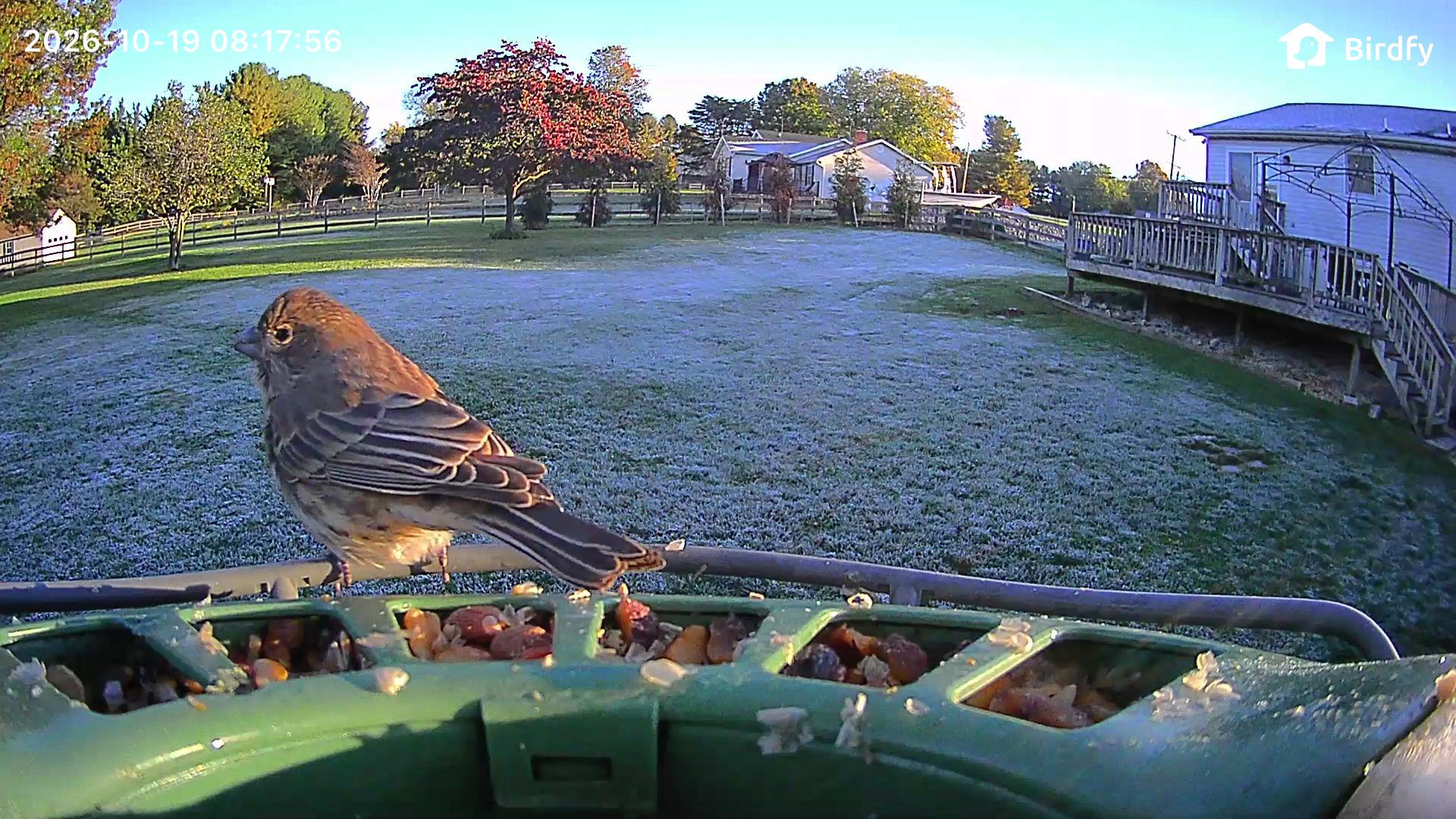
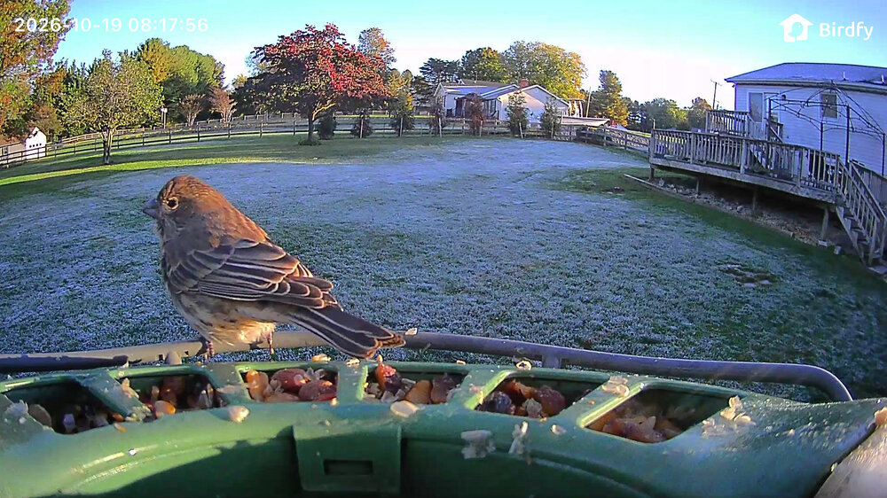
Fun to watch the frost melt away as the sun reaches more of the backyard
-

2026-2027 Record-breaking El Nino
qg_omega replied to Stormchaserchuck1's topic in Weather Forecasting and Discussion
Horrific -
Good morning Don. Ironically the name of the rose, at least the J&P version, is Chicago Peace. When I was young it was considered one of the most beautiful ever developed. As always ….
-
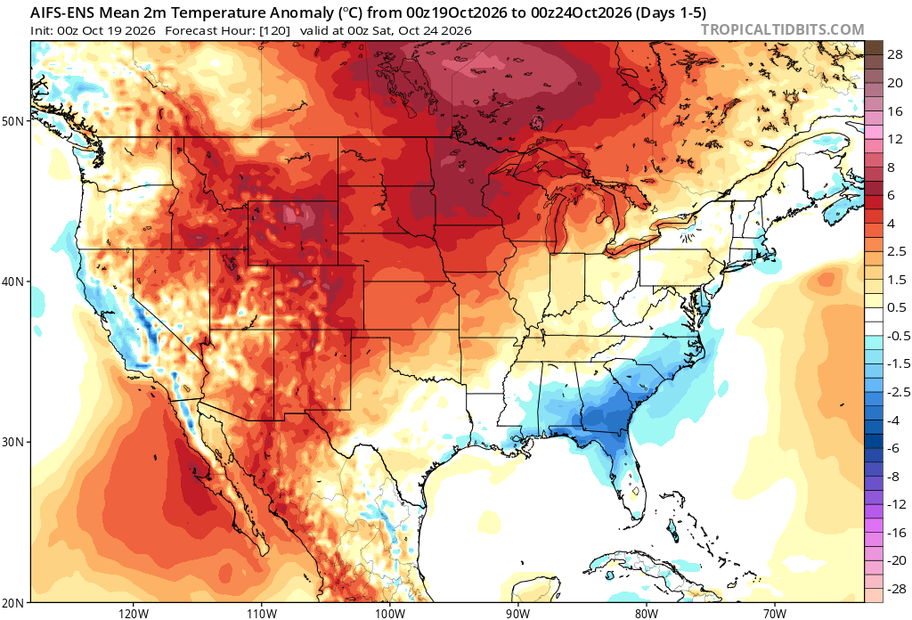
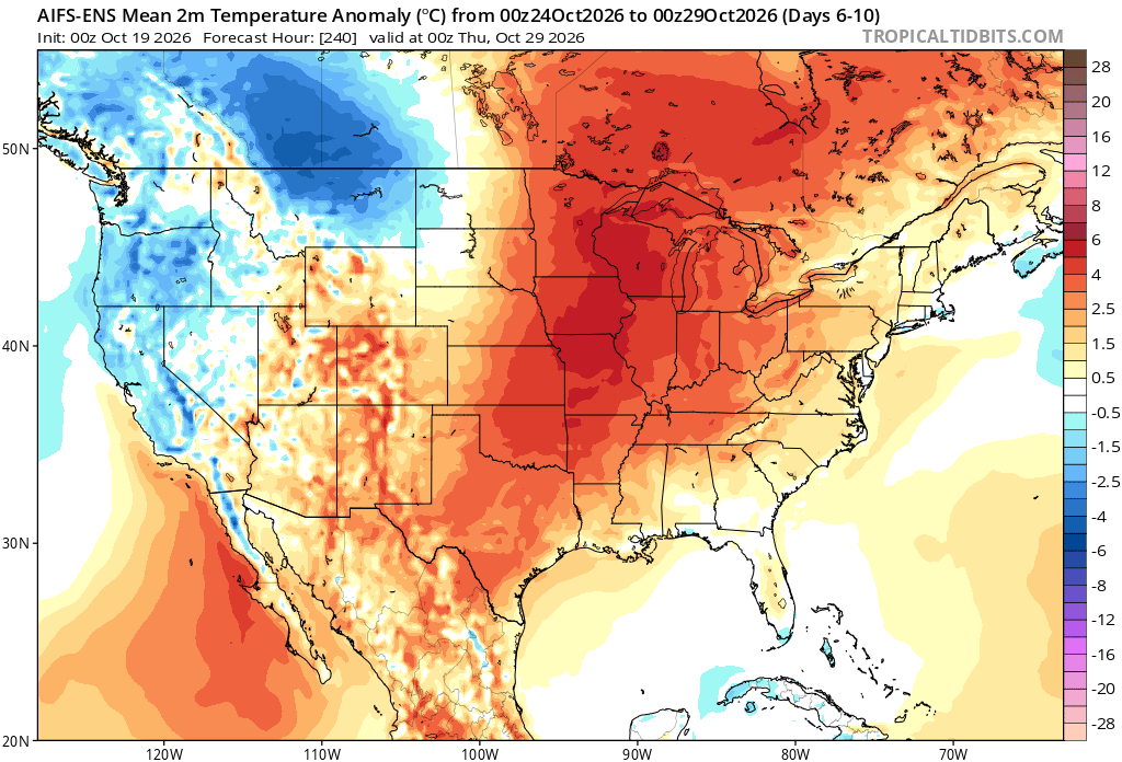
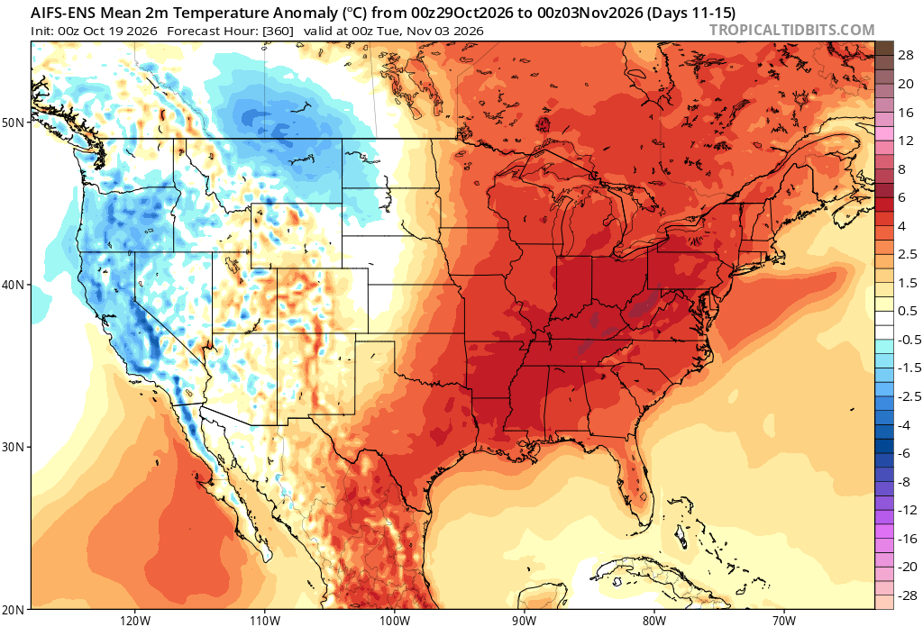
Looks like a fairly average temperature pattern over the next 5-10 days. As the historic El Niño continues to intensify, the ridge axis is forecast to shift closer to our area. So the core of the warmth which has been to our west in early fall is forecast to shift east from late October into early November.
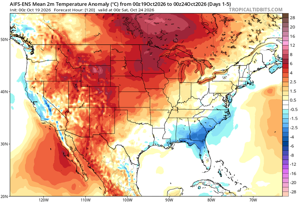
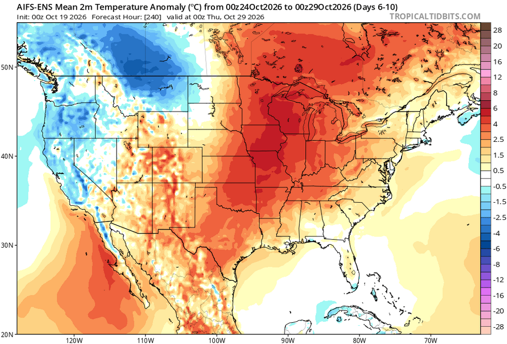
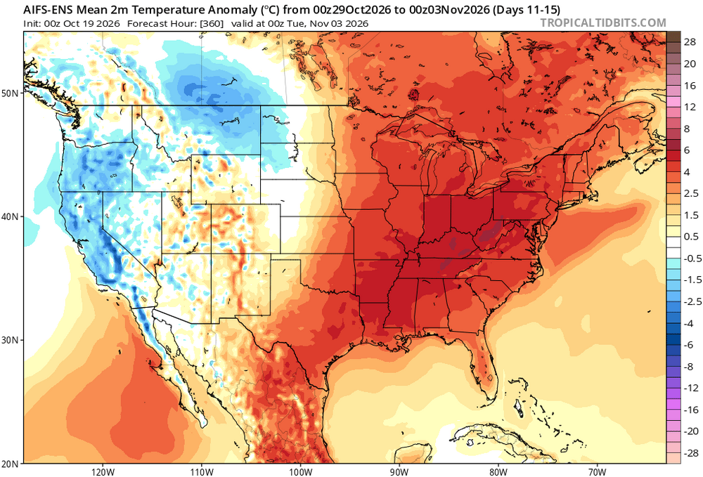
-
Low of 36.3 with some light frost.