All Activity
- Past hour
-
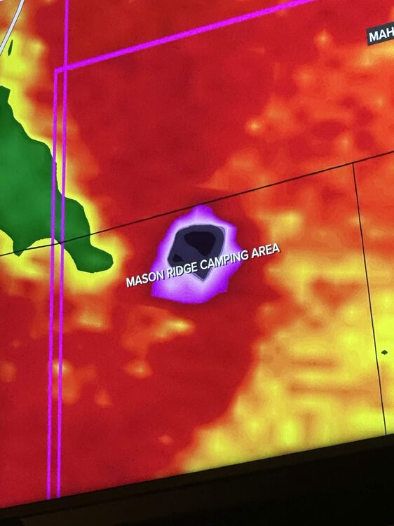
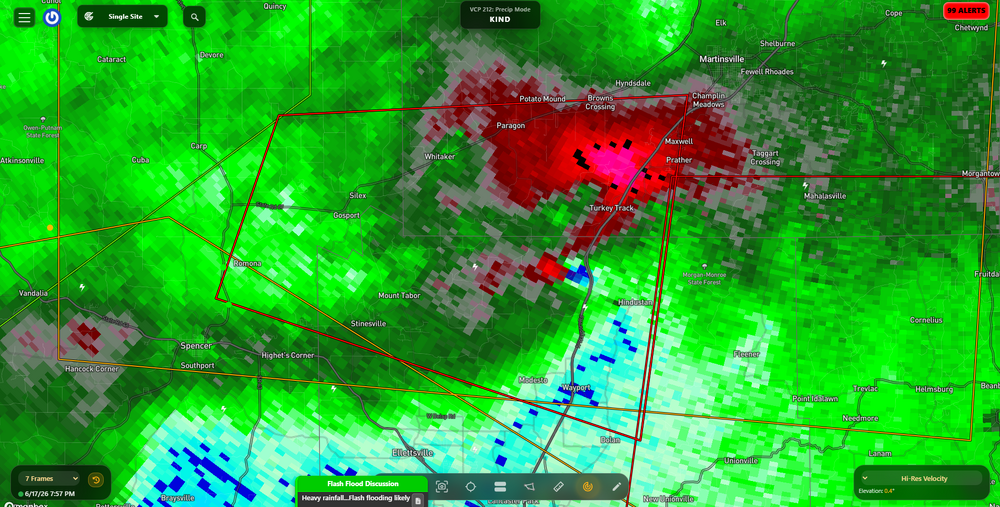
Is this thing throwing debris 5-10 miles away? Is that what's showing on radar?
-
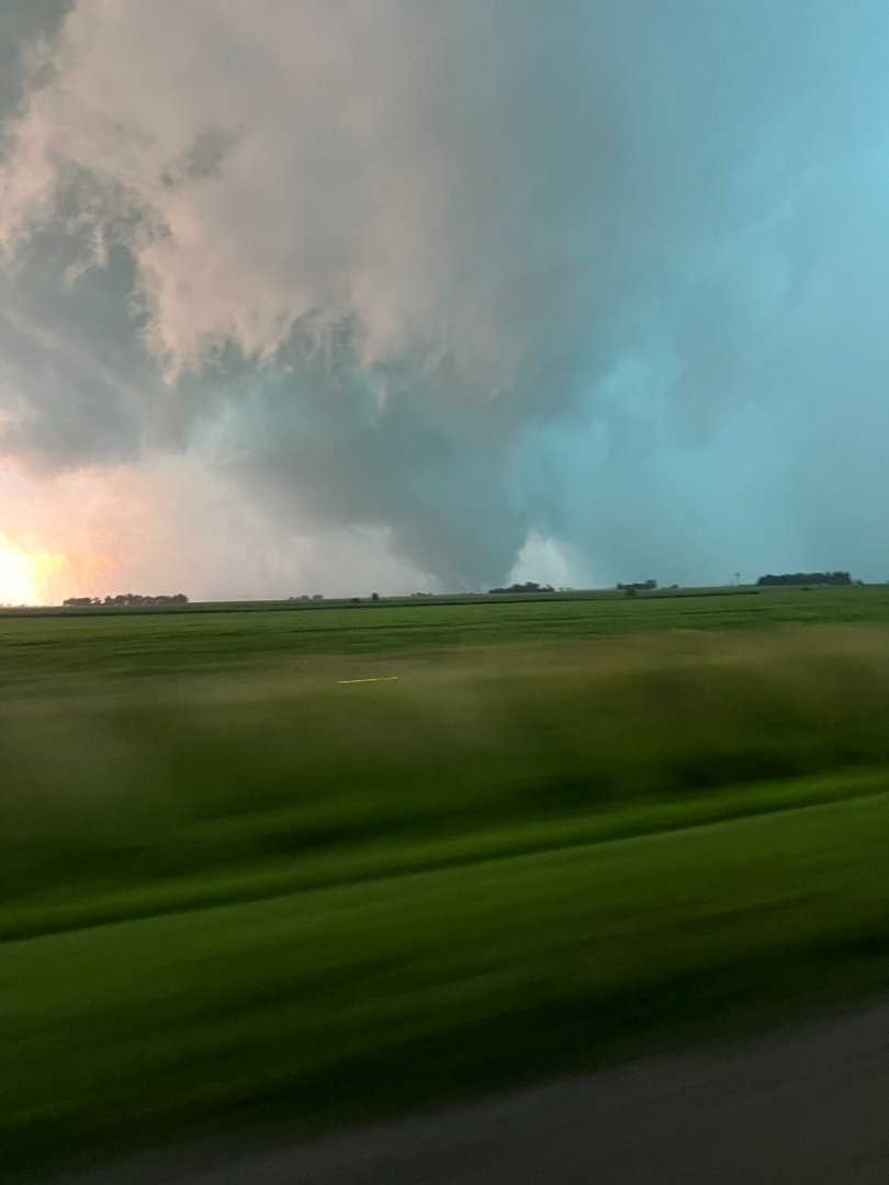
Looks like it direct hit a campground
-

Central PA Summer 2026 Discussion/Obs Thread
Jns2183 replied to Voyager's topic in Upstate New York/Pennsylvania
Watching the Great outdoors I am one with the racoons Sent from my SM-S731U using Tapatalk
-
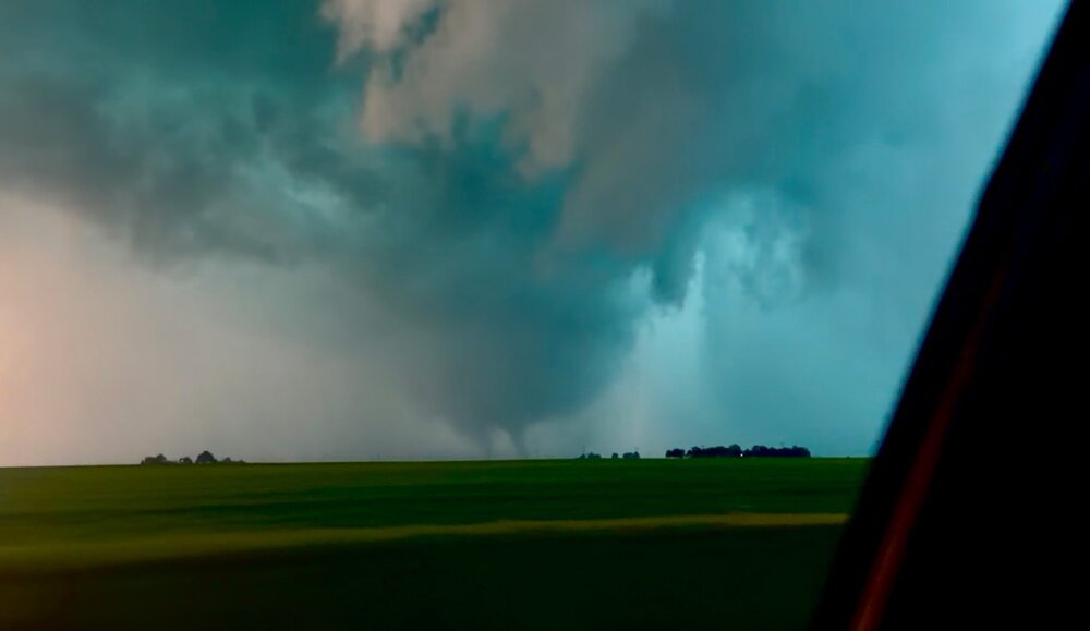
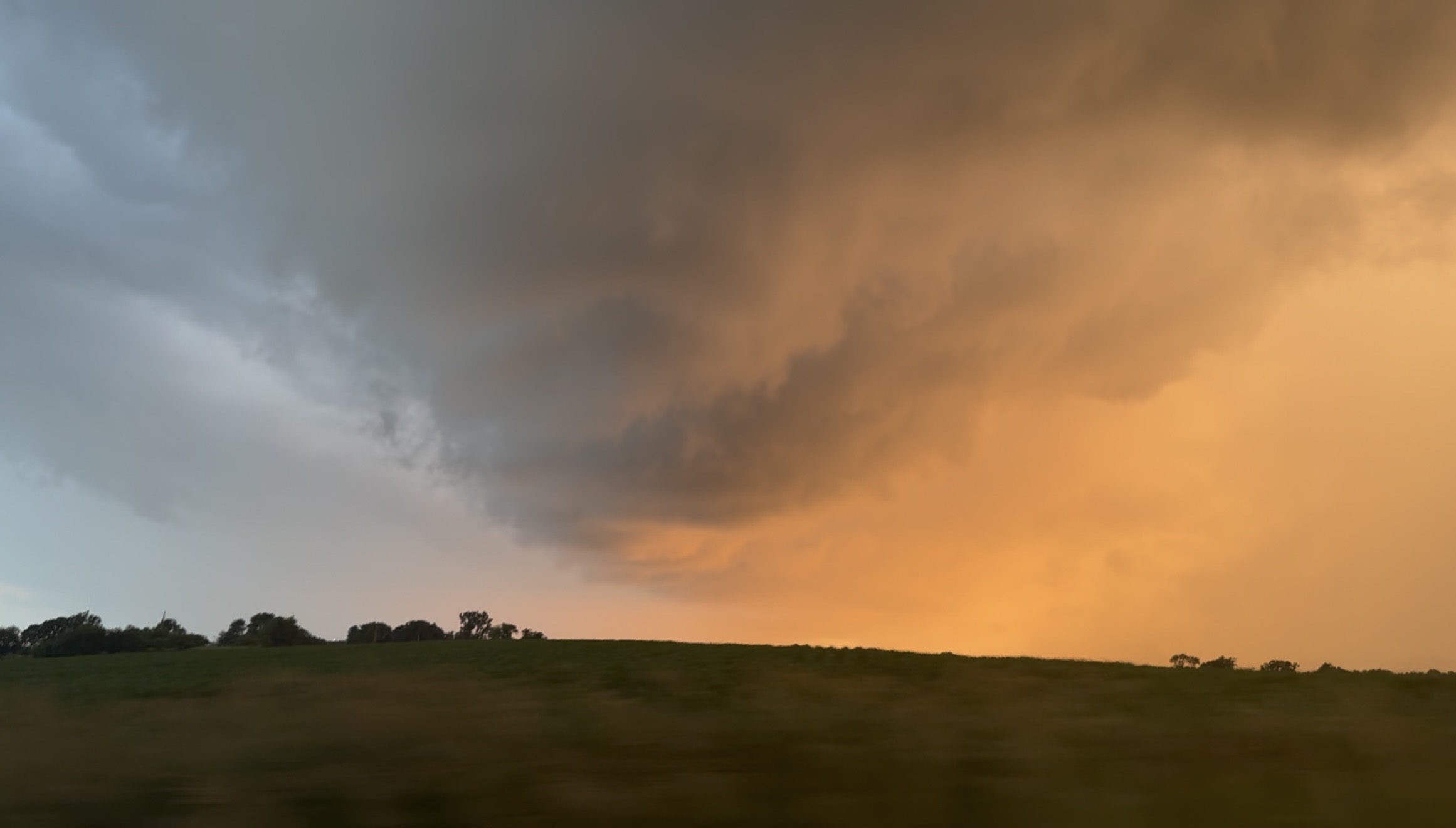
Still from video I took of the warned rotation in the notch in SE Rock County WI around a half hour ago, the greened up corn + the sunset made it majestic.

-
Spc discussion on it says the environment out ahead of it has fully recovered, this might be the storm of the event, definitely a violent tornado.
-
This is unreal
-
The amount of trees that thing has to be lifting is insane. Absolutely unreal debris ball.
-
Charleston IL spinner PT.

-
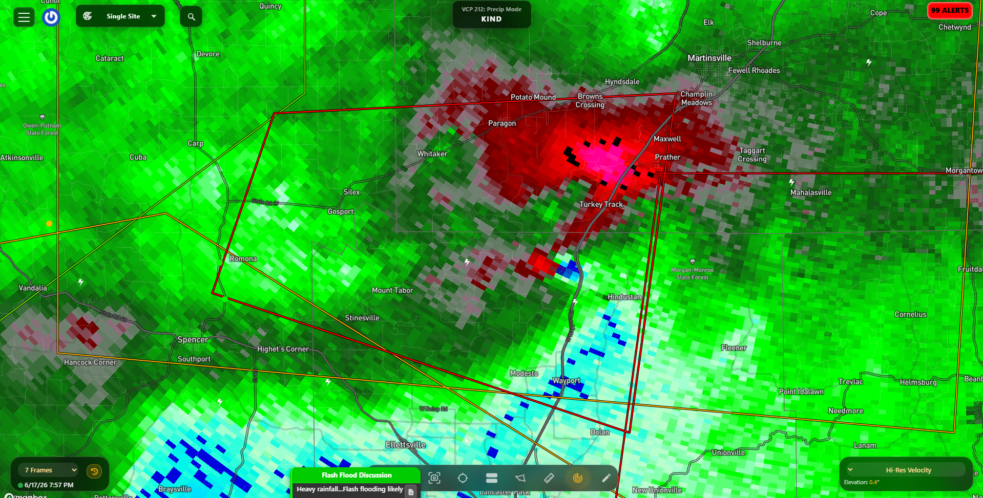
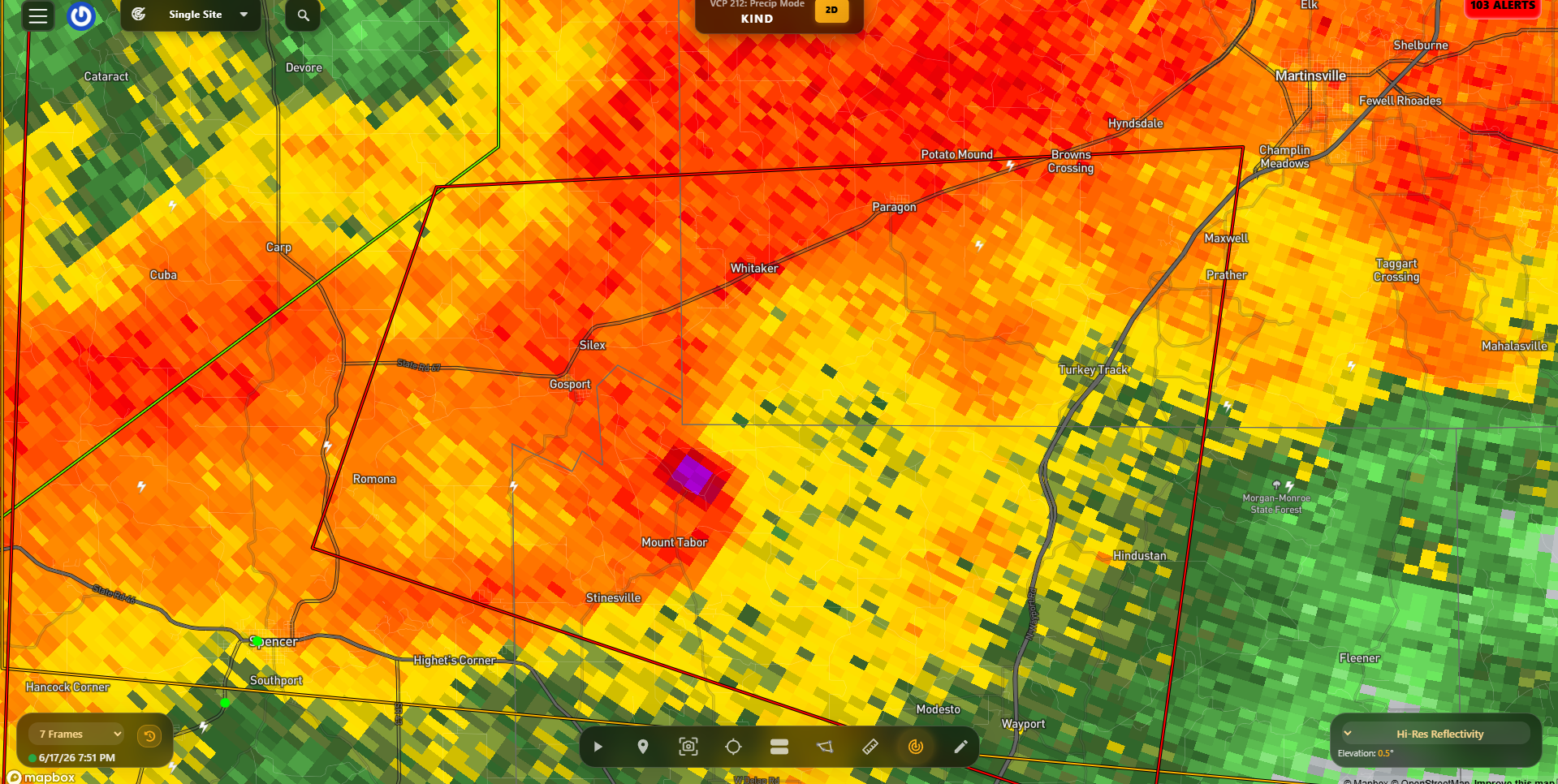
72 dBZ debris ball south of Indy, that is a mean tornado.
-
Wow that debris ball and growing
-
What the fuck
-
Monster debris ball and cc drop near Gosport IN
-
Yes, on the shore.
-
Pink debris ball on that cell near mount tabor

-
Bloomington IND college webcam for sickos like myself who love to watch frequent lightning. (time sensitive of course) https://cpf.iu.edu/weather-camera/index.html
-

-
-
Bingo. Without the MCS we probably have a Palm Sunday level outbreak
-

Late May/June 2026 Medium/Long Range
Stormchaserchuck1 replied to JenkinsJinkies's topic in Mid Atlantic
Nino 1+2 is +2.8c! July in strongly warm Nino 1+2 years August and September are near average historically, for most of the country. Maybe not enough examples. Let's see if we get a cool October. If the PDO doesn't shift to neutral by then, it counteracts this. -
Spinner paradise!
-
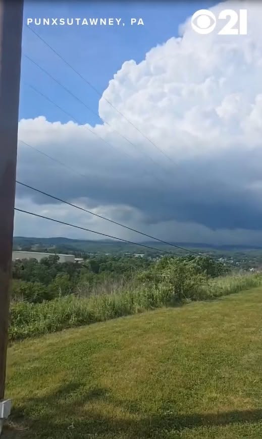
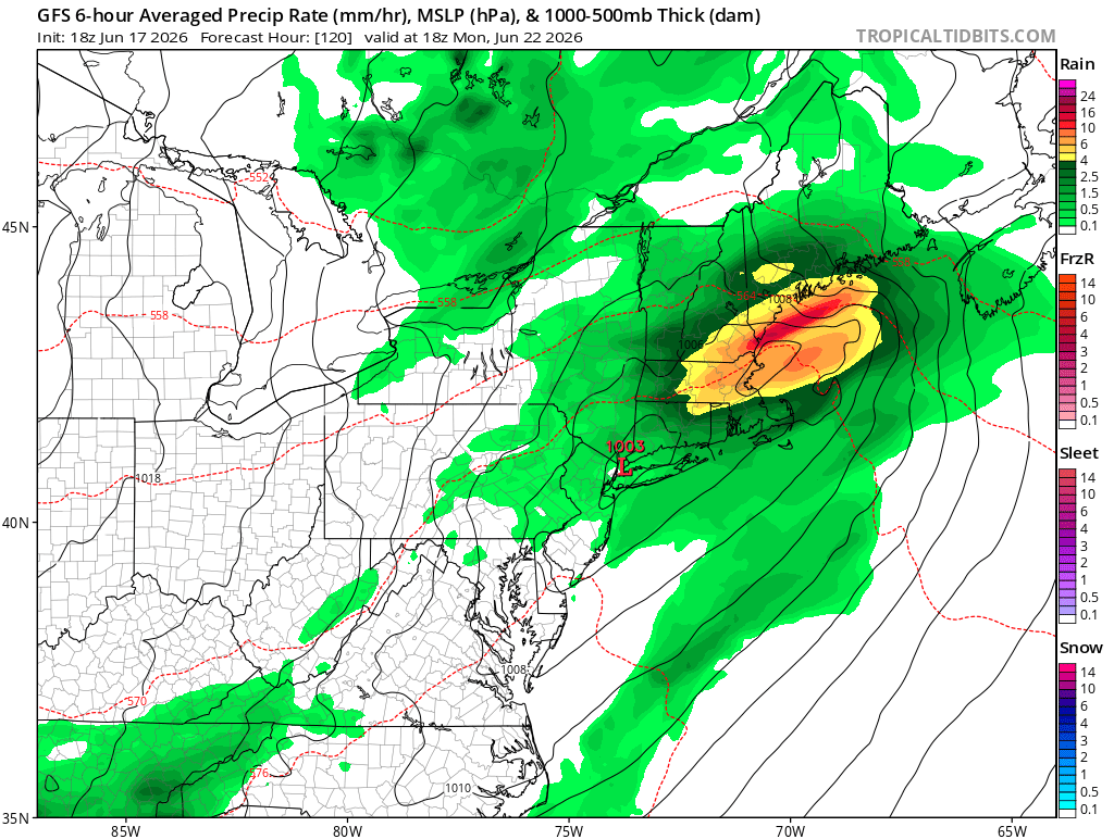
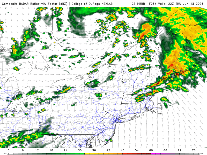
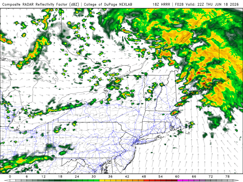
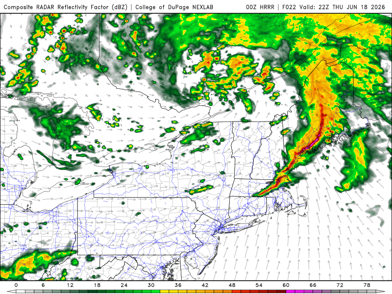
So here are the last 3 runs of the HRRR 12/18/00z all valid 6pm Thu. Which one will be right? It's impossible to tell. Small details on the mesoscale can make a big difference as to storm mode. Either way, the timing for this is ideal. 0-3 km CAPE from central NH to CT is high as 150 at 6pm. And that is big for spinner potential and 150 is more than enough. Perhaps this is what we will get Thu. Li'l spin-ups w/ nice crisp titled CB vistas! Punxsutawney PA spinner 6/14/26. https://www.facebook.com/reel/1355336163205600

-
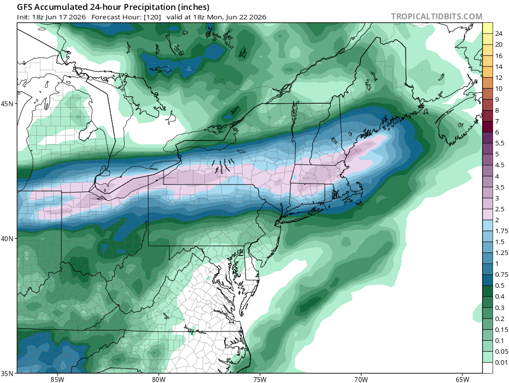
If this was winter I’d be stressing here, even at Day 5, ha. I can’t imagine the forcing would be this widespread but a couple strong systems for the time of year, tomorrow and Monday.
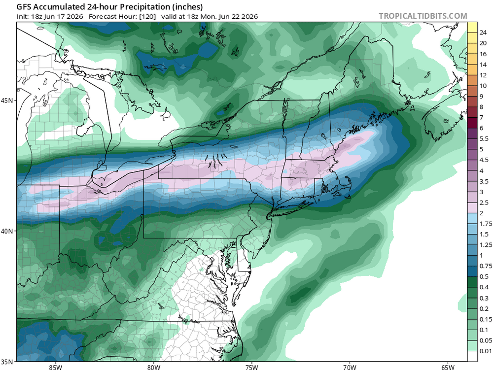
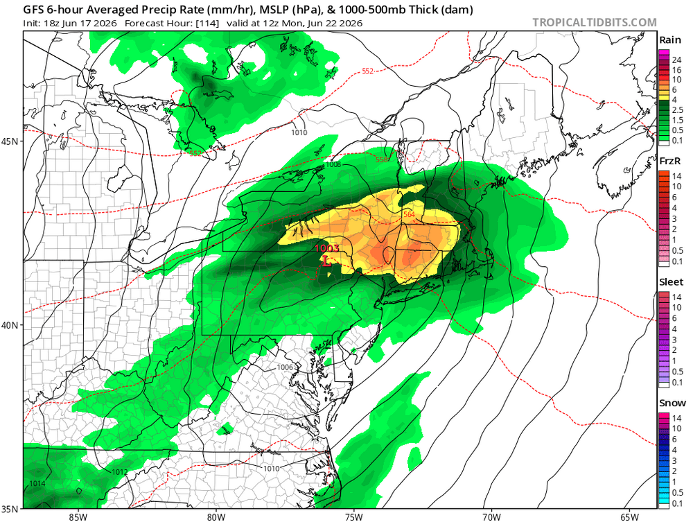

-
00z better. Seems like we’ll get temps near and over 80 which is key imo. Hodos are nice.
-

Junorch obs and discussion 2026
Damage In Tolland replied to Damage In Tolland's topic in New England
I’m worried about convection Rob. That happens so often in summer . Need to get this to noon Saturday still showing this to buy . -
The fact we've managed to get a couple of big ones in what should have been a completely rained out event just shows how this event could've been something historical if things went a little differently


.thumb.jpg.5af6c8520bd26ab0d13e24b2747484e1.jpg)