All Activity
- Past hour
-
Always tough to get blamed for someone else's actions. I enjoy both his AFD's and his posts here.
-
And what do you bring to the table?
-

December 2025 regional war/obs/disco thread
Ginx snewx replied to Torch Tiger's topic in New England
Jesus.png.764ccb82200d578e68c39eb64769bc3d.png)
.png.c63459e8c58bb264183643e1f367ea98.png)
.png.fdc519bc1f9f33dfe068d2af574ffe08.png)
-
18z ICON has snow now on 12/23
-
Rain to PA
-

2025-2026 ENSO
michsnowfreak replied to 40/70 Benchmark's topic in Weather Forecasting and Discussion
You have today and yesterday mixed up. -
Big changes coming to the gfs model, new datasets, etc including AI stuff. Talking about it right now on weather channel with new guy in charge of noaa
-
Normal

-
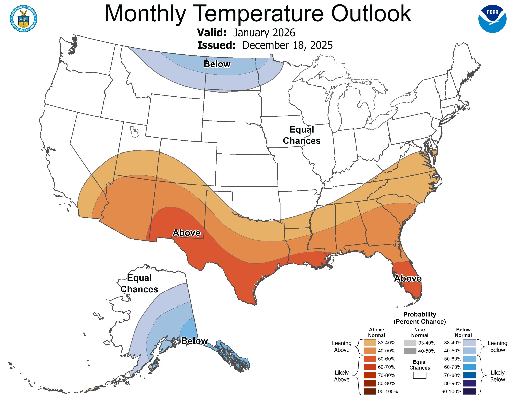
Todays Euro Weeklies are still not great by any means but they are a bit colder/less mild during 3 weeks of the 4 weeks starting with week 2: 12/29-1/4 yesterday 12/29-1/4 today 1/12-18 yesterday 1/12-18 today 1/5-11 was also a little colder today **Edited for corrections needed in my captioning because I had “today” and “yesterday” reversed. Today’s are less mild as I said.


-
You two love being wrong . Keep it up.
-
What happened? You said 9 before, now we're down to 7?!
-
Non the less, if the 1 met who says there's a chance of a L forming of the coast giving most east snow, is correct then snow not rain. But I believe what he says with a grain of salt lol Around new years*
-

December 2025 regional war/obs/disco thread
Torch Tiger replied to Torch Tiger's topic in New England
thats what we like to hear! -
it's one run, but it's certainly possible. Winters like 2005-06 had something similar. Need to see if it holds or not...
-
You are more annoying then Tony saying every winter storm threat will snow and "we track". @MJO812
-
Shocking no major storms enough to put a damper or stop festivities in NYC area.
-
lol only destroyed by those who continue to expect op runs to be consistent 10-15 days out. I'll stop contributing to the stupidity by not making anymore posts about what is possible based on an op run. It's pretty ridiculous how so many long time members of a weather forum still don't understand how this works.
-
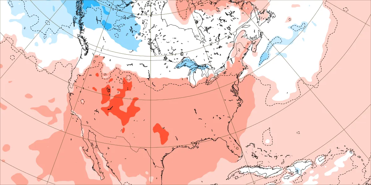
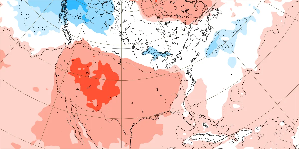
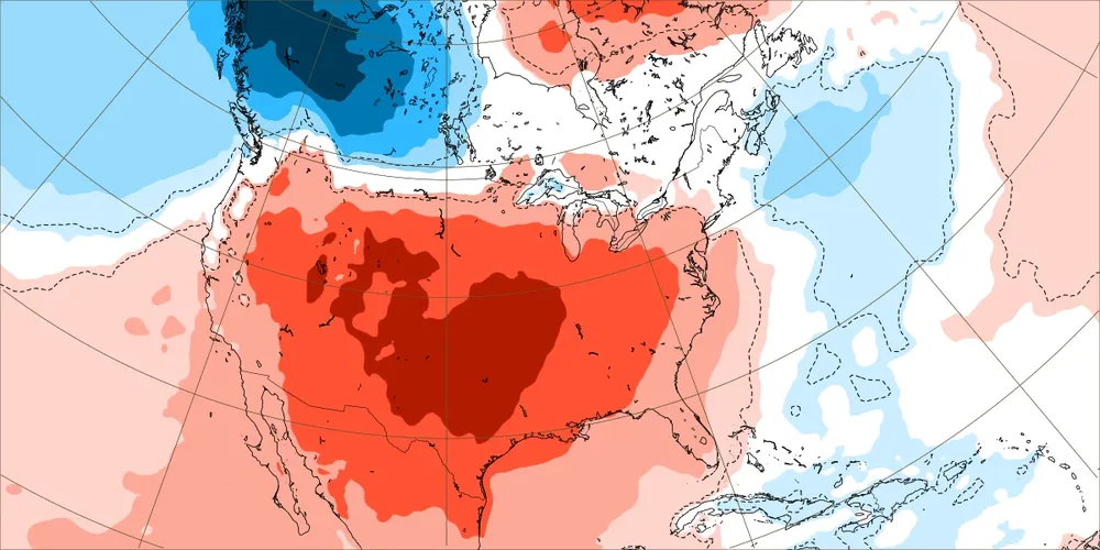
I think the ridge over the central US is just too powerful and at some point the negative PNA will force storms into the West Coast, causing the ridge to roll over into the east. By then ,the ridge will be less powerful but still give us above normal temperatures and dryer conditions
-

December 2025 regional war/obs/disco thread
metagraphica replied to Torch Tiger's topic in New England
Delayed but not denied? Or is this just more of the same from the models showing a big warm up in the extended range only to keep pushing it further out as they have been doing since early fall? -
Winter 2025-26 Medium/Long Range Discussion
michsnowfreak replied to michsnowfreak's topic in Lakes/Ohio Valley
Not sure how long the more hostile pattern will last, but definitely dont see any pattern sustaining itself the rest of winter. One analog year that Ive not seen thrown around, but this winter is somewhat resembling so far (at least through the forecasted end of December) is 1964-65. -

December 2025 Short/Medium Range Forecast Thread
Carvers Gap replied to John1122's topic in Tennessee Valley
The one thing that makes the Weeklies(any brand) fallible is that they tend to perpetuate the week two pattern - true feedback. That is why it is important not to put to much stock in LR ext modeling unless IMHO they change from that two week pattern. In other words, if the model doesn't continue in perpetuity...that is worth paying attention to. I have seen cold patterns modeled for all six weeks...not even make it into week 3. That also works for warm air masses. So, that is why I like looking at the control which is basically just one big deterministic run. -
Over the last few days been some pretty big gust in here ha ha.
-
Remember when 1/2 of this forum cancelled winter back in October?
-
Absolutely abysmal for any winter weather prospects. Only storminess will be heading to west coast because of the -PNA. I don’t think we should discount a January 2023 scenario. Cold and snow across conus for most of December 2022, and then late in the month we flipped to a torch and the east stayed like that for rest of winter. The west got record snowfall because of a deep -PNA
-
December 2025 Short/Medium Range Forecast Thread
Carvers Gap replied to John1122's topic in Tennessee Valley
Cherry picking some stuff from the Euro Weeklies, though I didn't think the ensemble was half bad!