All Activity
- Past hour
-
lol….I was thinking of that scene.
-
 mexican pharmacy online ordering: FronteraCareDirect - mexican rx pharm
-

2026-2027 Record-breaking El Nino
donsutherland1 replied to Stormchaserchuck1's topic in Weather Forecasting and Discussion
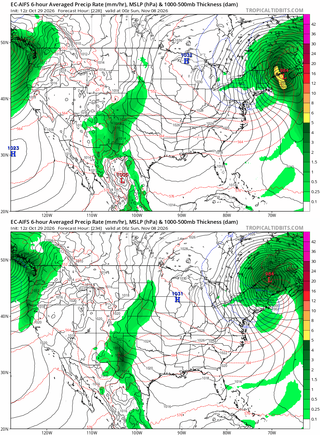
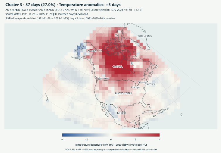
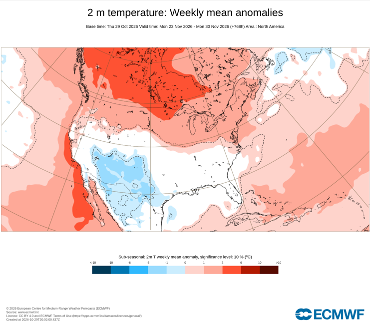
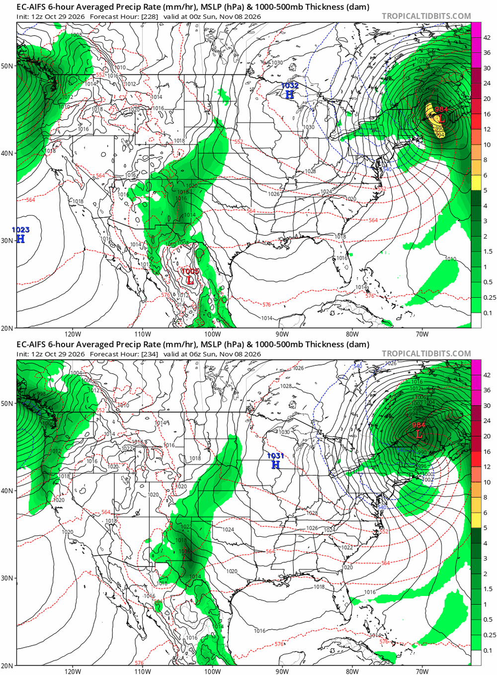
Currently, the extended range shows the development of an EPO+/WPO+/AO-/NAO-/PNA+ pattern. The ECMWF-AIFS is shows temperature anomalies consistent with such a pattern at 240 hours. Its solution is especially close to a cluster of past teleconnection cases. When rolled forward 5 days, the cluster matches up quite well with the 360-hour ECMWF-AIFS forecast. I narrowed the temperature range so the anaomalies are easier to see. So far, there's nothing truly eventful. However, five days out, one see a lot more cool air in the CONUS. Canada remains mild. That would be at odds with the powerful El Niño in the run-up to December. However, it could be a hint of how the potential early-season stratospheric warming event impacts North America. What that suggests is that November 20 +/- a few days might be a reasonable timeframe to begin to see effects from the stratospheric warming event, should it occur. For now, that's speculative. The El Niño will likely remain the dominant factor shaping North American patterns, so even a cooldown might not necessarily mean unseasonable cold. The ECMWF weekly forecast for November 23-30 shows this quite well. The true area of cool anomalies is smaller, while a large part of the southern half of the CONUS has near normal readings. Finally, for those who track teleconnections, NOAA is no longer updating daily EPO and WPO values.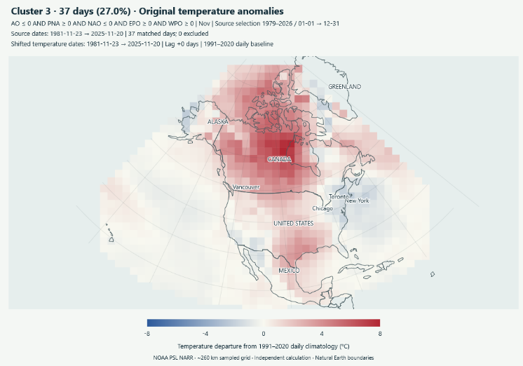
-
https://fronteracaredirect.shop/# buying prescriptions in mexico
- Today
-
I have a feeling this winter will feature plenty of cold air outbreaks that stay 2-4+ weeks in the future.
- Yesterday
-
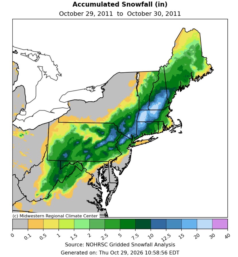
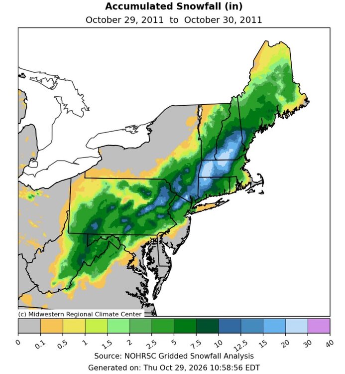
Exactly. I was standing outside at midnight just listening to nonstop branches snapping…it was a truly historic event. Out of school for a week. Crazy part…the official forecast was for rain starting about 11am, with rain throughout the day, maybe changing to some snow after sunset here…depending on when, and if the transition occurred, would determine any accumulation. Well, needless to say it never rained lol, started right out as snow. And surprisingly the wet cement snow-it stuck immediately. A foot of concrete as you said, on fully leaved trees was bad news. At 3” the trees were already screaming…and then it just got real ugly from there. But an afternoon of rain never materialized at all. Straight snow from the get go.
-
online generic medicine india [url=https://zenithindusrx.com/#]online medicine home delivery[/url] medicine purchase online
-
Yep snow then a year later sandy
-
It seems odd that smoke would have created the phenomenon, but it's tough to be sure.
-
Tomorrow will be another unseasonably mild day. Much of the region could approach or reach 70°. Unseasonable warmth will continue into the first week of November. Dry conditions will likely persist until late next week. The ENSO Region 1+2 anomaly was +5.2°C and the Region 3.4 anomaly was +3.4°C for the week centered around October 14. For the past six weeks, the ENSO Region 1+2 anomaly has averaged +5.08°C and the ENSO Region 3.4 anomaly has averaged +3.22°C. ENSO Region 3.4 breaks the all-time record most recently set in the prior week. The ongoing strong El Niño, will continue to strengthen through the mid-fall. The SOI was +10.31 yesterday. The preliminary Arctic Oscillation (AO) was +0.842 today. Based on sensitivity analysis applied to the latest guidance, there is an implied near 100% probability that New York City will have a warmer than normal October (1991-2020 normal). October will likely finish with a mean temperature near 59.2° (1.3° above normal). Supplemental Information: The projected mean would be 2.3° above the 1981-2010 normal monthly value.
-
Still nothing going on around here so anyone have memories of this one: Power outages in my area of NNJ were brutal. Lasted about a week in most spots and it was COLD. https://x.com/Danbury_WX/status/2115785053150089670
-
Gonna be hard to get something wintery out of this
-
Oh yeah we never forget that beast. A foot of concrete in the valley on fully leafed trees was a disastah. Shotgun blasts and power flashes throughout the night. Long lines waiting at gas pumps and fights breaking out in Springfield. A solid week plus without power for many.
-
reputable canadian pharmacy or best online canadian pharmacy legit canadian online pharmacy http://images.google.com.gi/url?q=http://canpointerx.shop online canadian pharmacy and http://www.garmoniya.uglich.ru/user/rrhcommeqe/ online pharmacy canada [url=https://date.gov.md/ckan/ru/api/1/util/snippet/api_info.html?resource_id=a0321cc2-badb-4502-9c51-d8bb8d029c54&datastore_root_url=http://canpointerx.shop]canada pharmacy world[/url] canadian pharmacy compare and [url=https://boyerstore.com/user/nsxvhlsrvf/?um_action=edit]canada online pharmacy[/url] canada online pharmacy
-
Yeah, warmest March on record at DCA as well. Days and days in the 80s. 78 for the high here today.
-
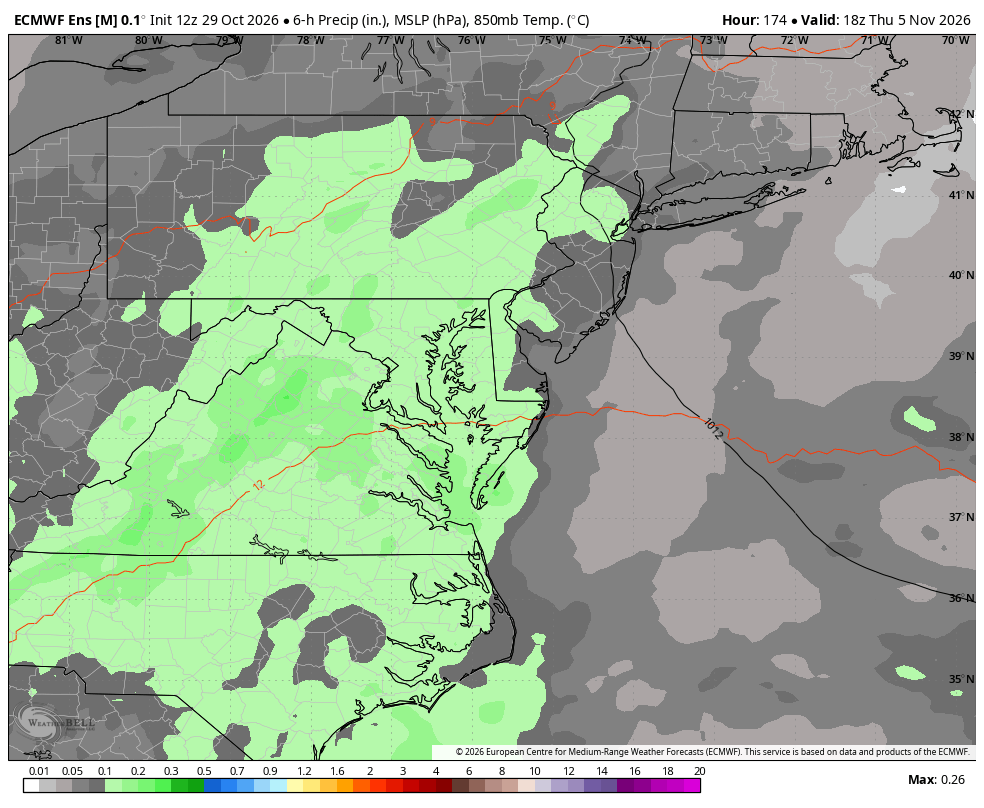
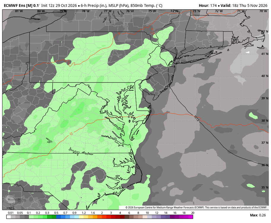
WB 12Z EPS. Rain chances always seem a week away now....
-
I just took this picture. A rain shower was at my place. It was the first rain in weeks. There were these cool pink clouds for sunset.
-
Yep in about a week. Though still mild
-
Yup…not cold, but not warm either…the real temp is a beautiful thing.
-
-
50 degrees was the real temperature, both morning and afternoon.
-
Ya, nothing different than most every year.
-
I feel like we're gonna pay for this.
-
Impressive. But Were either of those real? I mean it wasn’t really a warm airmass, or a cold one either? Right? Maybe you just imagined it all?