All Activity
- Past hour
-

Septorcher 2026 Discussion - Endless Summer
CoastalWx replied to Damage In Tolland's topic in New England
Just pillaging my reputation. Hate to see it. -
Septorcher 2026 Discussion - Endless Summer
CoastalWx replied to Damage In Tolland's topic in New England
I mean in SNE. Better chance down by DC where it doesn’t take much. -

Septorcher 2026 Discussion - Endless Summer
Damage In Tolland replied to Damage In Tolland's topic in New England
Man… Vort95 gone wild overnight .. scolding after scolding of Scoots -
Is that stuff out west supposed to expand or trigger new storms? The trajectory sure looks like it's heading south and west of my location
-
Graf updates every hour. It still says 100% rain for Augusta between 10:30 and noon.
-
September 3-4 were a disappointment imby/Columbia. 9/3 - 0.04” 9/4 - 0.05” Fortunately I received almost a 1/2” rain on September 2, so the month is off to a relatively reasonable start.
-

Central PA Summer 2026 Discussion/Obs Thread
mahantango#1 replied to Voyager's topic in Upstate New York/Pennsylvania
Three more tornados confirmed 287 NOUS41 KCTP 050026 PNSCTP PAZ051-050430- Public Information Statement National Weather Service State College PA 826 PM EDT Fri Sep 4 2026 ...NWS Damage Survey for 09/01/2026 Tornado Event... .Derry Township Tornado... Rating: EF-1 Estimated Peak Wind: 100 mph Path Length /statute/: 0.87 miles Path Width /maximum/: 250 yards Fatalities: 0 Injuries: 0 Start Date: 09/01/2026 Start Time: 05:40 PM EDT Start Location: 2 ESE Washingtonville / Montour County / PA Start Lat/Lon: 41.0343 / -76.648 End Date: 09/01/2026 End Time: 05:41 PM EDT End Location: 2 ESE Washingtonville / Montour County / PA End Lat/Lon: 41.0322 / -76.6321 Survey Summary: During the evening of September 1st, 2026, a supercell thunderstorm moved southeastward through Montour County, resulting in a brief EF-1 tornado, which impacted southern portions of the county in Derry Township. We also found damage due to a downburst that occurred on the north side of the tornado, associated with the forward flank downdraft of this supercell. Maximum wind speeds from this tornado were estimated to be 100 mph, and the tornado had a maximum path width of 250 yards. Tornadic damage was first noted in the woods between Steffens Rd and Indian Run Rd, with a start time of 5:40 PM local time. The tornadic damage was primarily on Stable Ln and the hairpin turn on Indian Run Rd. In this location, two large trees snapped and fell on a shed, with a trail of snapped and uprooted trees into the woods beyond the property. The tornado continued eastward before dissipating near Fossil Hill Rd at 5:41 PM local time. Surrounding this track, numerous trees were snapped and uprooted from straight-line winds, making a broadly divergent pattern particularly to the north of the tornado path. We would like to thank Montour County Emergency Management, local homeowners, and other members of the local community for their assistance in this damage survey. && EF Scale: The Enhanced Fujita Scale classifies tornadoes into the following categories: EF0.....65 to 85 mph EF1.....86 to 110 mph EF2.....111 to 135 mph EF3.....136 to 165 mph EF4.....166 to 200 mph EF5.....>200 mph NOTE: The information in this statement is preliminary and subject to change pending final review of the event and publication in NWS Storm Data. 857 NOUS41 KCTP 042221 PNSCTP PAZ006-037-050230- Public Information Statement National Weather Service State College PA 621 PM EDT Fri Sep 4 2026 ...NWS Damage Survey for 09/01/2026 Tornado Event... .Gaines Township Tornado... Rating: EF-1 Estimated Peak Wind: 110 mph Path Length /statute/: 6.5 miles Path Width /maximum/: 150 yards Fatalities: 0 Injuries: 0 Start Date: 09/01/2026 Start Time: 05:33 PM EDT Start Location: 4 W Gaines / Potter County / PA Start Lat/Lon: 41.794 / -77.6155 End Date: 09/01/2026 End Time: 05:48 PM EDT End Location: 4 ESE Galeton / Tioga County / PA End Lat/Lon: 41.7082 / -77.5748 Survey Summary: On September 1, 2026 at approximately 5:33 PM EDT, an EF-1 tornado impacted areas of eastern Potter County and western Tioga County in the vicinity of Gaines Township. Maximum wind speeds were estimated at 110 mph with a maximum path width of 150 yards. Damage associated with the tornado began north of Galeton near Phoenix Run in Pike Township, where multiple hardwood trees were snapped along with numerous large branches on both sides of Phoenix Road. There was more extensive damage just east of Phoenix Road, where a larger swath of EF-1 damage was observed with some uprooted trees alongside snapped trees and large branches. Damage continued southeastward on Phoenix Road in Potter County with more sporadic damage including broken large branches and snapped trees. There was an area where the tornado potentially lifted as it approached US Route 6 with damage being largely sporadic and not as concentrated as it crossed the roadway. Once crossing US Route 6, more widespread damage was observed across Hanky Panky Road in Gaines Township, Tioga County. Numerous uprooted and snapped trees were observed across approximately a 150 yard segment with eyewitnesses mentioning that there were trees across the roadway in a convergent pattern. This damage continued towards the intersections of Dingman Road and Bloody Run Road, where concentrated areas of snapped and uprooted trees continued to be observed. There was another eyewitness that noted multiple trees uprooted at their residence on Dingman Road with what appeared to be a convergent pattern. As the storm continued into Marshlands, multiple large branches as well as uprooted and snapped trees were in a convergent pattern, with surrounding vegetation also outlining a convergent pattern. The tornado likely continued to parallel Elk Run Road just south of the roadway before dissipating on the north side of the intersection with Straight Run Road. We would like to thank Gaines Township Emergency Management, Tioga County Emergency Management, multiple first responders, and the multiple eyewitnesses from Gaines Township for their assistance with this damage survey. && EF Scale: The Enhanced Fujita Scale classifies tornadoes into the following categories: EF0.....65 to 85 mph EF1.....86 to 110 mph EF2.....111 to 135 mph EF3.....136 to 165 mph EF4.....166 to 200 mph EF5.....>200 mph NOTE: The information in this statement is preliminary and subject to change pending final review of the event and publication in NWS Storm Data. $$ Beaty/Krantz - Today
-
Central PA Summer 2026 Discussion/Obs Thread
mahantango#1 replied to Voyager's topic in Upstate New York/Pennsylvania
090 NOUS41 KCTP 050042 PNSCTP PAZ066-050445- Public Information Statement National Weather Service State College PA 842 PM EDT Fri Sep 4 2026 ...NWS Damage Survey for 09/01/2026 Tornado Event... .Salisbury Township Tornado... Rating: EF1 Estimated Peak Wind: 90 mph Path Length /statute/: 1.08 miles Path Width /maximum/: 100 yards Fatalities: 0 Injuries: 0 Start Date: 09/01/2026 Start Time: 07:44 PM EDT Start Location: 4 NNE Gap / Lancaster County / PA Start Lat/Lon: 40.034 / -75.9802 End Date: 09/01/2026 End Time: 07:48 PM EDT End Location: 3 NE Gap / Lancaster County / PA End Lat/Lon: 40.0189 / -75.9781 Survey Summary: At 7:44 p.m. local time on September 1, 2026 an EF-1 tornado, with maximum wind speeds of 90 mph, touched down in Salisbury Township northwest of the Mount Vernon Road and Old Philadelphia Pike intersection with a width of 100 yards. It traveled south as it ripped off the roof of a barn and threw sections through the Old Road Mennonite Church graveyard before crossing Old Philadelphia Pike and paralleling Mount Vernon Road. It ripped a roof off another barn and snapped many larger limbs from a tree in the neighboring pasture. Continuing south it took some sections of roof and loose items from three farm outbuildings and ejected them throughout the fields. As it continued along Mount Vernon Road, a clump of trees was hit where many trees were uprooted and large branches snapped. Farther south, a barn sustained some minor roof damage before a one room school house was impacted with its whole roof torn off. At the intersection of Buena Vista Road and Mount Vernon Road, another tree was uprooted and a telephone pole was bent. It continued south to the east of Mount Vernon Road where it crossed Pequea Creek, snapping many large branches and uprooting a few more trees. Past the creek, another clump of trees saw large branches snapped before the tornado dissipated in a field. We would like to thank Lancaster County Emergency Management and Salisbury Township officials for their assistance in this damage survey. && EF Scale: The Enhanced Fujita Scale classifies tornadoes into the following categories: EF0.....65 to 85 mph EF1.....86 to 110 mph EF2.....111 to 135 mph EF3.....136 to 165 mph EF4.....166 to 200 mph EF5.....>200 mph NOTE: The information in this statement is preliminary and subject to change pending final review of the event and publication in NWS Storm Data. $$ Krantz -
 buy cytotec in usa: CytoCarePharma or п»їcytotec pills online
 -
-
Scottsville received 3.20" yesterday evening! Augusta received 4 sprinkles. Today, NWS says 30% and Graf says 100% for Augusta!! This will be a real test for Graf.
-
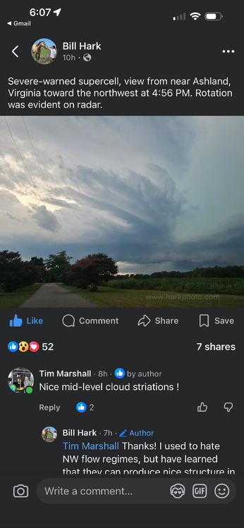
Excellent photo!!
-
https://hairguardrx.shop/# buying generic propecia online
-
cost of cheap propecia without rx [url=https://hairguardrx.shop/#]HairGuardRx[/url] and get generic propecia prices
-
.thumb.jpg.6a4895b2a43f87359e4e7d04a6fa0d14.jpg)
Central PA Summer 2026 Discussion/Obs Thread
Yardstickgozinya replied to Voyager's topic in Upstate New York/Pennsylvania
Ring of fire pattern returns later next week ? I was reading over tonight's Nws forecast discussion and was delighted to hear that we may return to a ring of fire pattern later next week. The good news for most of you reading this is that I haven't heard mention of that possibility anywhere else to this point. The spc does mention the return of thunderstorms in the northeast and mid atlantic next thursday but doesn't give any mention of any anomalous ridge and believes the best large scale assent will remain north of the continental border. -
https://cytocarepharma.com/# buy cytotec
-
https://cytocarepharma.com/# buy cytotec
-

Septorcher 2026 Discussion - Endless Summer
vortex95 replied to Damage In Tolland's topic in New England
"from the annoying guy and how some of the stuff he says doesn't seem to make sense." "favoring increased winter threats in the deep South because the jet will be shifted south." These are the kind of things one needs to monitor in discussions/posts. Put on your critical thinking hat! It all can sound great, then you catch one item that does not make sense that is biggie. Yes, it could be typo or honest mistake, but not always. Proof/authority by obfuscation or pontificating is a common tactic on some social media posts. And then we have AI-queries that are cut/pasted that can make it even harder to spot! -
Septorcher 2026 Discussion - Endless Summer
vortex95 replied to Damage In Tolland's topic in New England
"Linear logic" -- solid term, esp. as it applies to wx/climate! Linear logic does not work well for a coupled, chaotic, non-linear system as the Earth's atmos/cryo/hydrosphere. "Supercharge" is largely a media term for hype. But if you want to go that route, what about El Nino "supercharging" the wind shear over the Atlantic MDR? It is at an all-time record level by far (at least since 1979) per CSU. Where is the mention of that in the mainstream? Even when it is, it will be spun in a way still negative for society or made a into "problem." Cherry-picking at its finest. When the Atlantic was very active 2020-2025, want to know what was going on the NW Pacific for TCs for the same period? It was the lowest 6-year total ACE on record since 1950 for this basin (66% of avg). And the NW Pacific supplies the most ACE for any tropical basin in the world (double any other basin). "Supercharge" is subjective term and often gets used selectivity, so not a good term to use, esp. for complex systems. Also, more or stronger/higher does not all mean "worse" or "bad" when it comes to sensible wx and the cycles/patterns they are connected to/influenced by. -
cost cheap propecia no prescription: HairGuardRx : propecia without dr prescription
-
http://cytocarepharma.com/# cytotec buy online usa
-
Septorcher 2026 Discussion - Endless Summer
vortex95 replied to Damage In Tolland's topic in New England
Here is food for thought... We see this El Nino is in record territory. The thing to keep in mind that things do not work linearly necessarily just b/c you have "stronger" or "strongest ever." Case in point, the very strong El Nino in 2015-16. Up until that point, it was an expected given that Cali gets big rains in very strong El Nino, and the Pac NW is dry. Well, that did not happen. In fact, the exact opposite happened, and the MSM was all over that acting, "that's it, Cali is done...PERMANENT DROUGHT!" And then the very next year, weak La Nina, and it was one of the wettest on record for Cali. No insight or restraint, just knee-jerk, here-and-now nonsense. The point all being we are too fixated on making analogs and forecasting *exact* sensible wx for any/all regions. Well, that's not really the best fcst science. Non-linear system the Earth system is and works. So who is to say there will not be a couple of blockbuster E Coast snowstorms 2026-27, and snowiest than any other very strong El Nino winter DCA-BOS? We only have 4 other very strong El Ninos to compare since 1950, so no way we have seen the full gamut of what is possible or the variance, esp. region to region. I can give another example. Recall the fcsts for the 2024 Atlantic hU season? They were off the charts, going to be an all-time record, and yes, the indicators were there. And it started fast and early w/ Beryl, but then what happened? The climo peak of the season got ripped out Aug-Sep. Yes, it still was an above avg season, (161 ACE) but a far cry from the hyperactive season that was fcst (220+ ACE). It was not 1933, 2004, or 2005, not even close, and a significant fcst bust by all. Things got messed up b/c we had an ITCZ that was too far N and this squashed many of the Cabo Verde waves, so we could not even get TCs to form in the MDR peak season. A wildcard factor that shows there are still unknowns out there and we have a lot to learn, despite all our advances. And no, that does not mean I am saying it is going to be a big E Coast snow winter, just saying that surprises and unexpected still do happen, in spite of analogs/past seasons. -
This is fantastic, hahaha
-
Septorcher 2026 Discussion - Endless Summer
vortex95 replied to Damage In Tolland's topic in New England
"I’m not going by emotion." Whoa, scroll back a few posts, you said: "At least summer gives some interesting weather usually. It’s been like San Diego here and I’m not holding out hopes for anything this winter that will move the weenie. I acknowledge we could get near normal snow in spots, but I’m not getting my hopes up after years of depression. Positivity is a waste." Is this not emotion (the bold)? An another post you were saying you were being objective. So which is it? Just looking for a little consistency here. -
Septorcher 2026 Discussion - Endless Summer
vortex95 replied to Damage In Tolland's topic in New England
What, as if Jan-Feb 2026 never occurred? Come on! I'll say it again, how often does Weymouth get two 20"+ snowstorms in a single winter? This downer stuff is coming from someone as a kid in the 80s who used to wake up to full sun so ticked b/c he did not get his 4-8" "backlash" snow! Take more cues from @ineedsnow and get pumped every upcoming event/winter!