All Activity
- Past hour
-
An El Nino is likely to develop by the Summer of 2026. The ENSO subsurface is very warm Since 1985, the most extreme ENSO subsurface anomalies for this time of the year, 8/10 (80%) became favored warm/cold ENSO state later that year. The CPC on March 12 has put up an El Nino watch for 2026: Climate Prediction Center: ENSO Diagnostic Discussion They are giving an 80% chance that August-Sept-Oct (peak Hurricane season) will be El Nino In 1995, a positive phase to the AMO cycle began, and a major uptick in Atlantic Hurricane activity occurred. Since 1995, we have averaged the following number of storms per year in various ENSO states (using the RONI): El Nino (7 years): 12.1 TS, 5.0 Hurr, 2.6 MH Neutral (11 years): 16.1 TS, 8.0 Hurr, 3.4 MH La Nina (13 years): 17.4 TS, 8.4 Hurr, 4.3 MH Climate Prediction Center - Relative Oceanic Niño Index (RONI) El Nino has been associated with much lower activity, and that occurs back to 1950 and before. Since 1995, Strongest 3 El Nino's (ASO>+1.2): (3 years): 10.3 TS, 3.7 Hurr, 1.7 MH Since 1995, Weakest 4 El Nino's (ASO<+1.1): (4 years): 13.5 TS, 6.0 Hurr, 3.3 MH So, there has been a pretty big difference between the El Nino being weaker or stronger for the Hurricane season in terms of total activity. It's important to monitor ENSO going forward, current projections are probably right around +1.0 ASO RONI. AMO CPC AMO Index stopped updating January 2023 I made a raw and smoothed graph of the AMO 1995 to Jan 2023: Raw Smoothed In Summer/Fall 2023, the Atlantic was record warm, and then Summer/Fall 2024 was warmer than that. They were the #2 and #1 AMO Seasons on record, so the trend continues to be Up-general, although the 2025 Season was much colder Atlantic SSTs. Record warm SSTs in 2023 helped 20 Named Storms occur (4th highest all time) in a +1.1c ASO El Nino. Last season (2025) was a colder AMO in Weak La Nina, and had 13 Named Storms, 4 Major Hurricanes. Anomalies in a bunch Something that we have seen in the past few seasons is Top 1% Rapid Intensification with certain storms. 2023 - Lee 2024 - Milton (honorable mention to Beryl, the earliest Cat 5 on record) 2025 - Erin and Mellisa What are some other indicators to how active the season will be? April-May Atlantic Sea-level pressure Since 1995, the most active Atlantic Hurricane Seasons minus the least active Atlantic Hurricane Seasons, have this preceding April-May sea-level pressure anomaly in the Northern Hemisphere -AO and -NAO in April-May precedes more active Atlantic Hurricane seasons +AO and +NAO in April-May precedes less active Atlantic Hurricane seasons Atlantic SSTs Current global SSTA [time sensitive] Never too early to start discussing! Thoughts? Related Discussions:
-
-

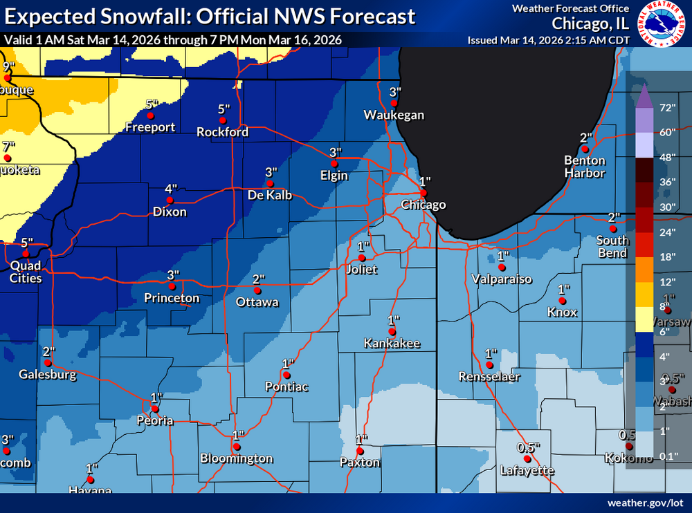
80 Degrees to Ripping Snow: March 12th
MillvilleWx replied to SnowenOutThere's topic in Mid Atlantic
I work at WPC, so I don't have any internal holdings with LWX. I do know multiple mets at the office though! - Today
-
Everything coated up about .75 here we take!!
-
...or use uber helicopter to my fly to my yard.
-
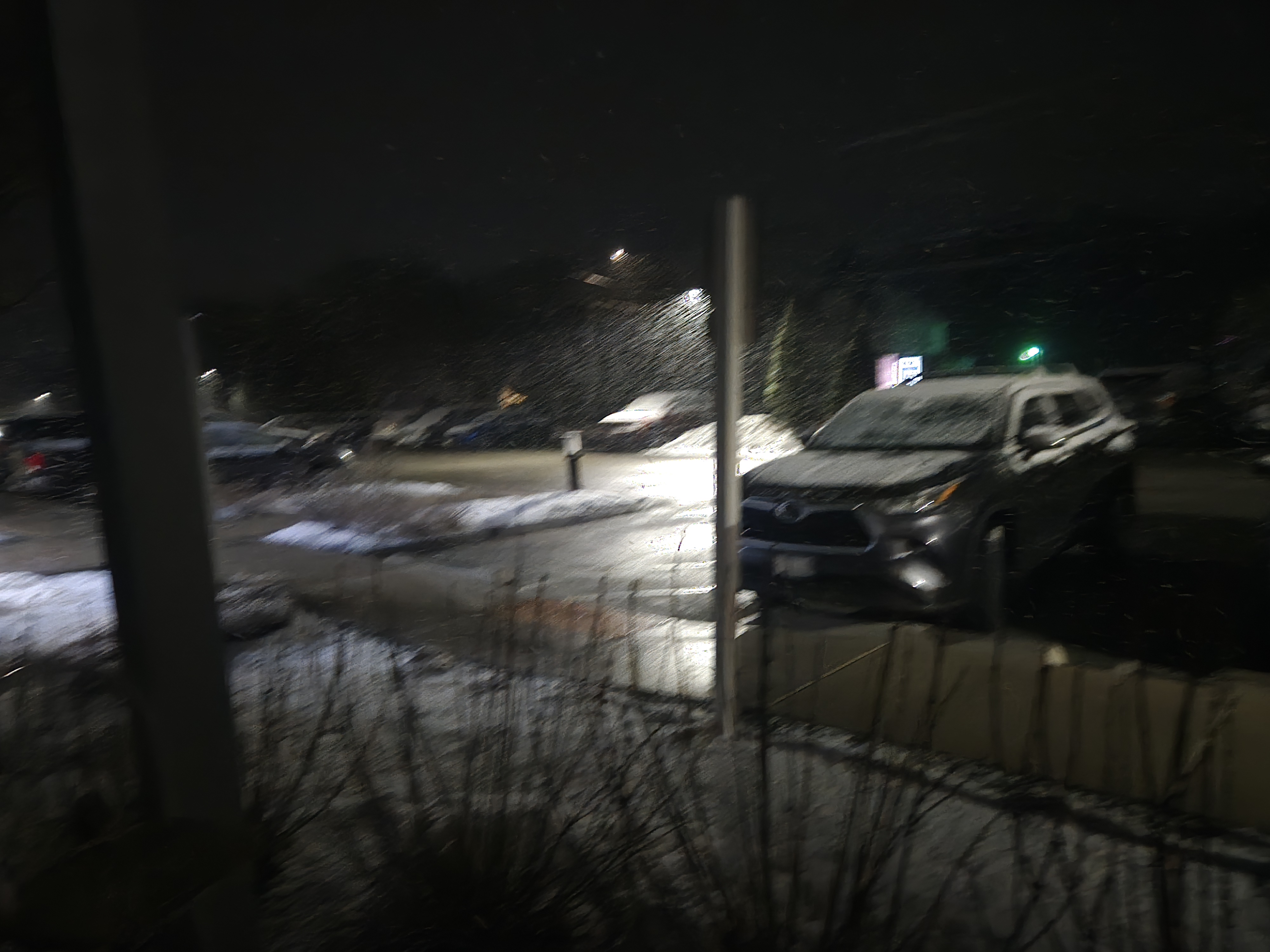
3/4" from midnight to 2AM.
-

Pittsburgh/Western PA WINTER ‘25/‘26
colonel717 replied to Burghblizz's topic in Upstate New York/Pennsylvania
Yeah here too. As I lay here with power out unable to sleep because my neighbors generator is obnoxiously noisy. He just got it installed last week. I can't believe how loud it is. My power just came back and his generator is still running. -

2025-2026 ENSO
Stormchaserchuck1 replied to 40/70 Benchmark's topic in Weather Forecasting and Discussion
Ok, I saw a different graph at another time. -
They have 3 inches. Average is 56 inches .
-
2025-2026 ENSO
Stormchaserchuck1 replied to 40/70 Benchmark's topic in Weather Forecasting and Discussion
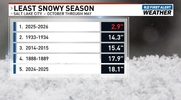
Salt Lake City, UT has 0.1" snow for the year. #2 lowest for them on record is in the 20's. That's going to hold through at least the 3rd week of March. -
Great news! It appears that BWI will be going with 1” for this event. I do think the airport may have gotten a few tenths more but this is good enough IMO. I don’t know if any LWX mets who are in charge of these records read this board (MillvilleWx maybe?), but I do appreciate them following through what I recommended and so I have to give them credit where it’s due. The reason why I cared so much is because this was an extraordinary event and I want the official record to reflect how it unfolded - from a midnight high of 76 to accumulating snow in the same day.
-
Alot of records will be broken in the west.
-
looks promising for a blizzard
-
1.6" and winding down.
-
.25” 30°
-
Blizzard in ORD come on guys lmao Enjoy your rainstorm. I will do the same. Unfortunate bust for pretty much all of us.
-
Maybe next October
-
2026-2027 El Nino
Stormchaserchuck1 replied to Stormchaserchuck1's topic in Weather Forecasting and Discussion
CPC increased El Nino chances by 15% Climate Prediction Center: ENSO Diagnostic Discussion -
2025-2026 ENSO
Stormchaserchuck1 replied to 40/70 Benchmark's topic in Weather Forecasting and Discussion
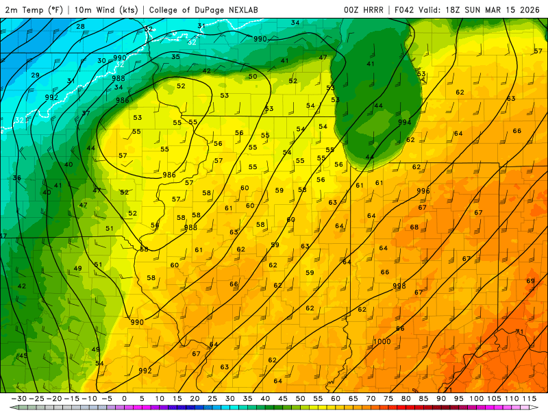
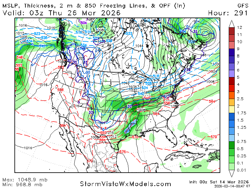
What a ridge in the West and Midwest! -
S tier, really. Hope we don’t pay too high of a price for it later.
-
Snowing
-
1.2" of snow in the last hour here. Definitely was not expecting this tonight.
-
Coastal signal past 300 but thats it for me.
-
Long range gfs but blocking continues. Lets see what happens here. Good to see blocking developing not only on gfs


.thumb.png.4150b06c63a21f61052e47a612bf1818.png)