All Activity
- Past hour
-

January 2026 Medium/Long Range Discussion
Stormchaserchuck1 replied to snowfan's topic in Mid Atlantic
End of the 6z NAM has a kicker diving into the Great Lakes It's close though -

First Legit Storm Potential of the Season Upon Us
ineedsnow replied to 40/70 Benchmark's topic in New England
Ya 6z GFS doesnt look as good at hr72 -
Lol I was thinking the same thing.
-

January 2026 regional war/obs/disco thread
Snowcrazed71 replied to Baroclinic Zone's topic in New England
Not after today..... Back to Winter from Friday on..... -
Why are we awake right now? Three days before and the models are still all over the place. lol.
-

E PA/NJ/DE Winter 2025-26 Obs/Discussion
Ralph Wiggum replied to LVblizzard's topic in Philadelphia Region
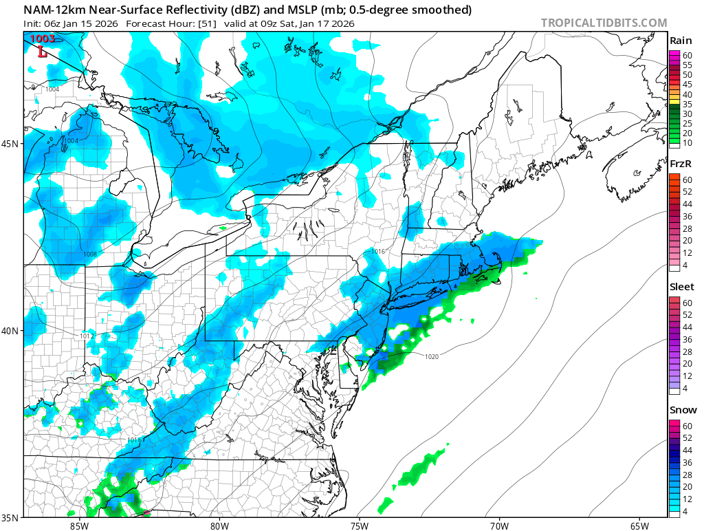
EPS also well offshore for Sunday.
-
E PA/NJ/DE Winter 2025-26 Obs/Discussion
Ralph Wiggum replied to LVblizzard's topic in Philadelphia Region
Euro didnt budge and is a good bit offshore. ICON ticked SE just a smidge with the Sunday system. Getting deja vu here with the GFS likely pulling a Lucy. -

First Legit Storm Potential of the Season Upon Us
WxWatcher007 replied to 40/70 Benchmark's topic in New England
I’m still extremely skeptical of this one. There’s still a reasonable scenario where this scrapes rather than hits most of interior NE. -
The Rufus was a big hitter along the 81 corridor and decent down to Knoxville.
-
Fwiw the Srefs looked like it would be good at the end.
-
The ICON has went from barely scraping far Eastern NC at 18z yesterday, to snow almost back to Charlotte at 06z.
-
6z Rgem a little better compared to 0z
-

Mid-Long Range Discussion 2026
gamecockinupstateSC replied to BooneWX's topic in Southeastern States
RRFS and Icon
-
The Rufus shifted probably 90ish miles w with the precip field vs 0z. It was mostly hugging the counties that border NC, now the precip shield is to the Plateau.
-
6z icon much improved from 0z
-
The RRFS A will save us!
-
Mid-Long Range Discussion 2026
gamecockinupstateSC replied to BooneWX's topic in Southeastern States
-

Central PA Winter 25/26 Discussion and Obs
Jns2183 replied to MAG5035's topic in Upstate New York/Pennsylvania
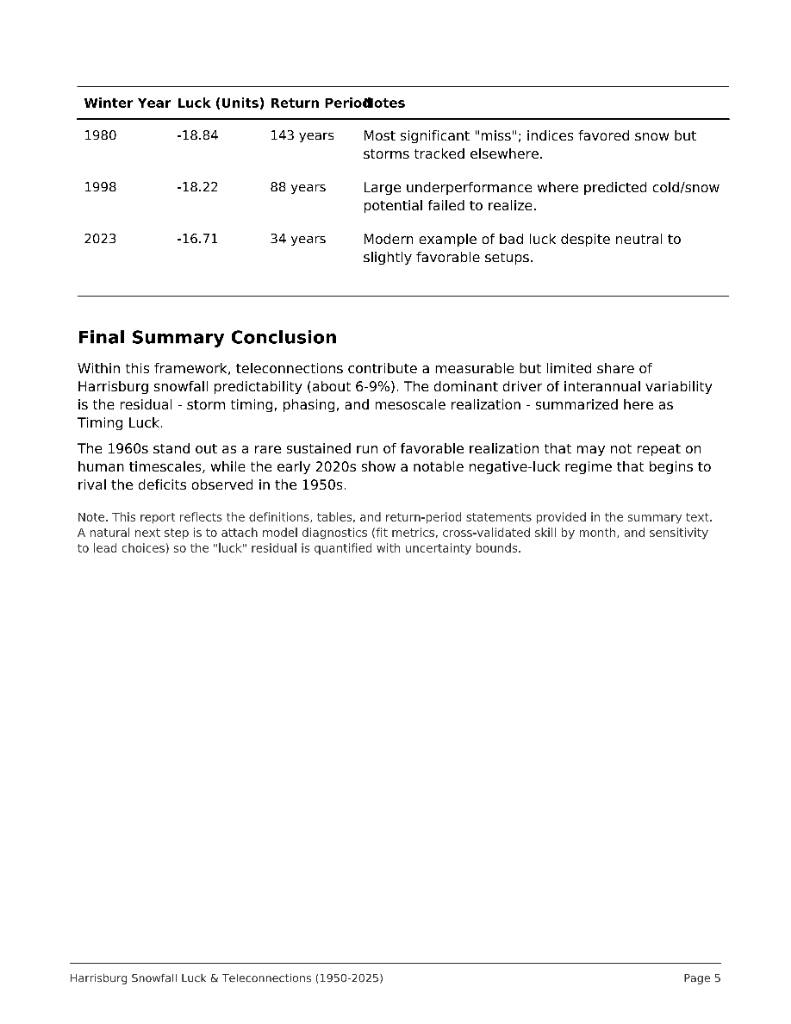
Final part Haha, I spent way too long on this to not put forth my pet theory regarding the 1960s. The absolute insane return periods for "luck" and just plain actual snow and it's correlation to some events has not been studied super well. I guess this is the sacrifice needed for us to get the winters we pray for. Sent from my SM-S731U using Tapatalk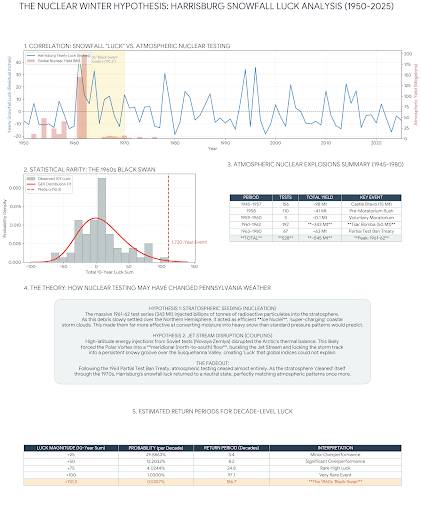
- Today
-
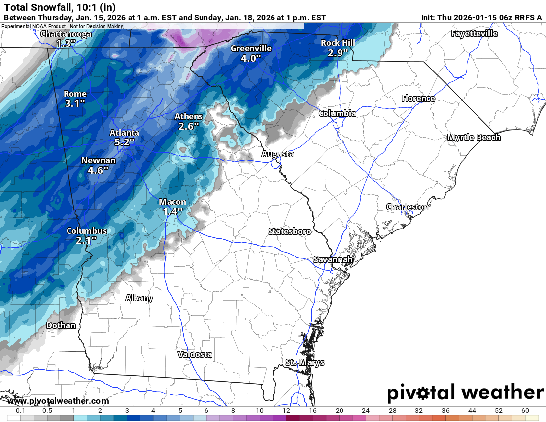
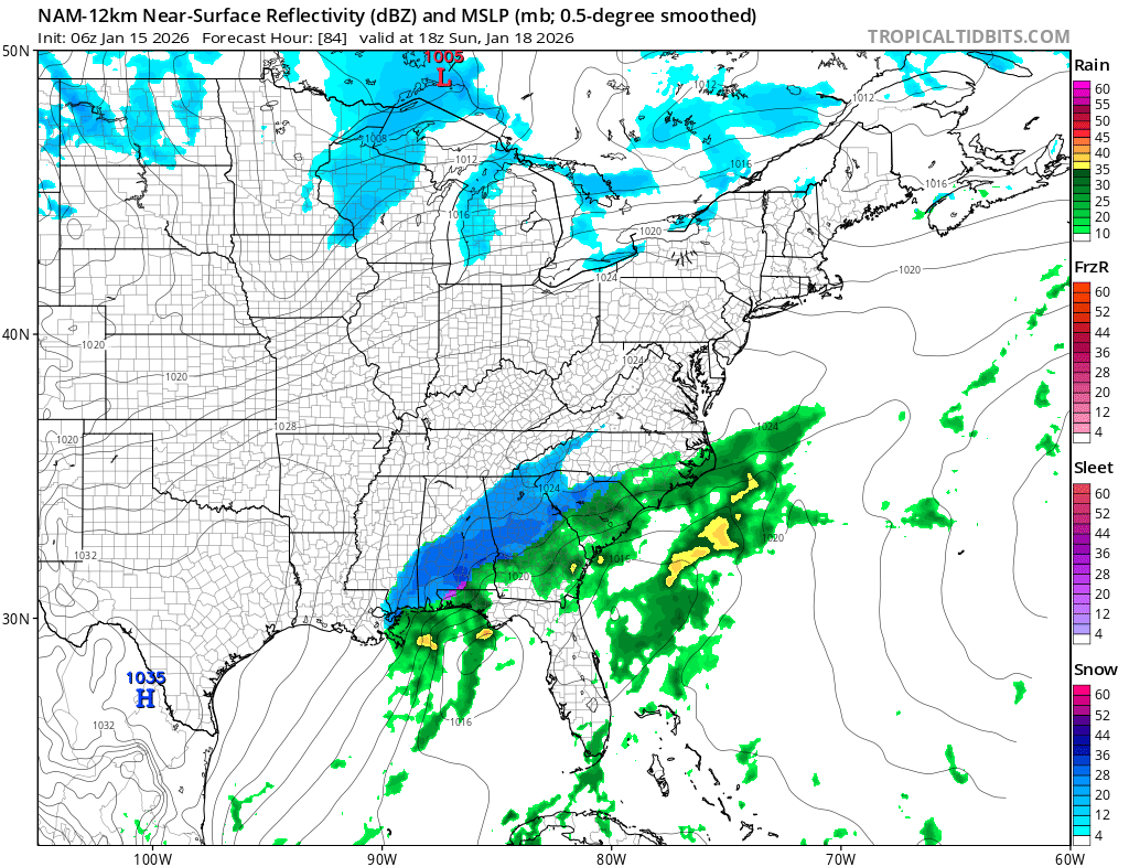
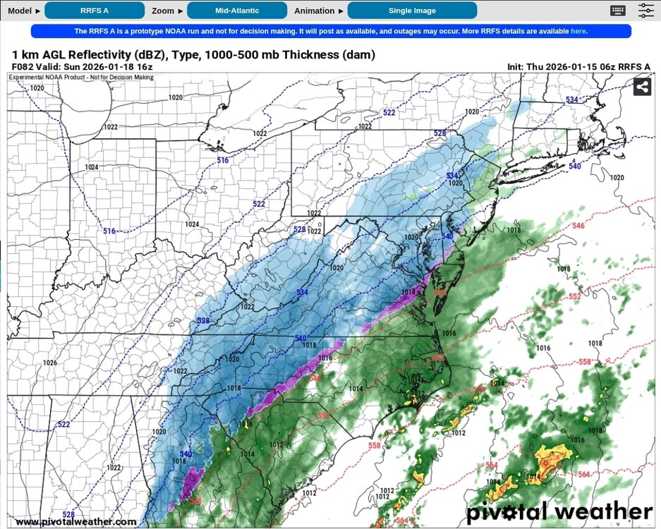
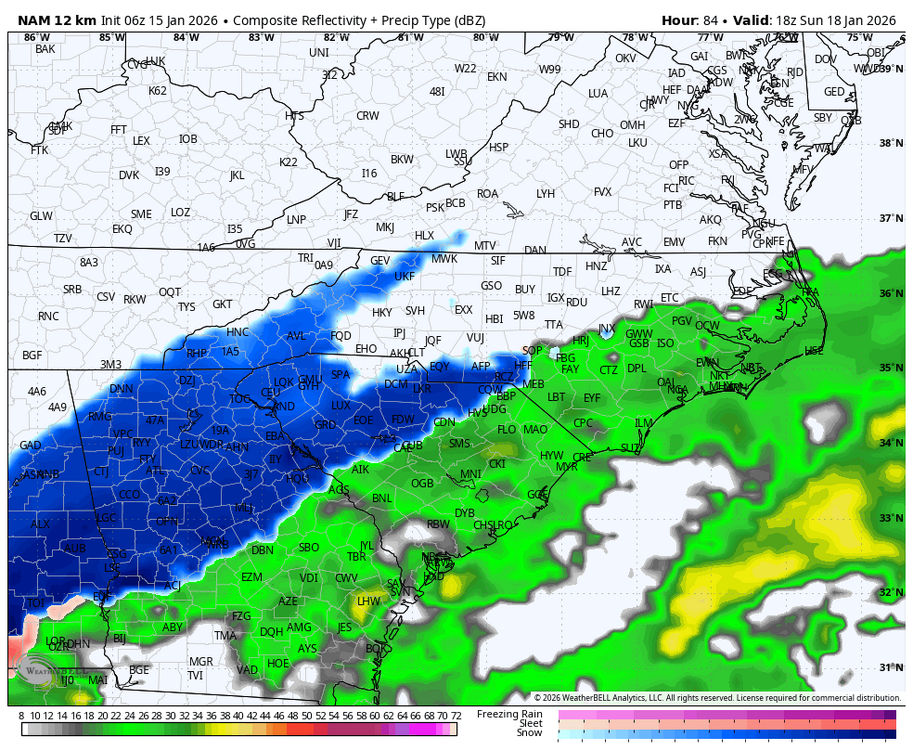
Wish this was a lot closer and not the 84hr NAM, was about to be a nice hit!
-
Central PA Winter 25/26 Discussion and Obs
Jns2183 replied to MAG5035's topic in Upstate New York/Pennsylvania
Part 2 Sent from my SM-S731U using Tapatalk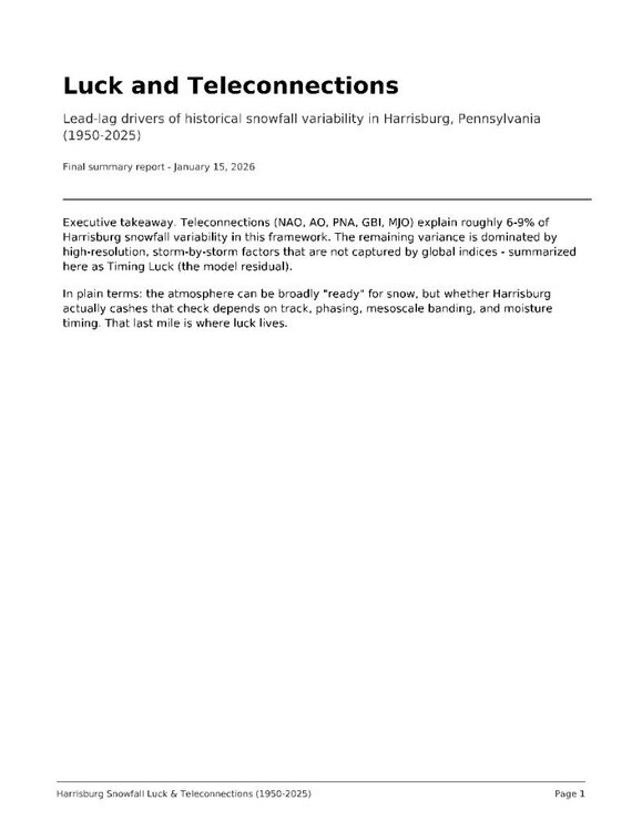

-
Euro can be wrong also
-
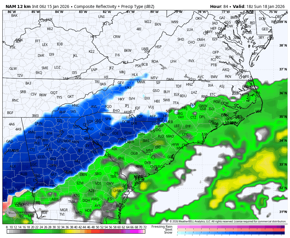
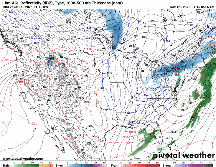
Agree. Euro is most likely wrong here. Here is the Nam. Saturday and then Sunday.


-
Central PA Winter 25/26 Discussion and Obs
Jns2183 replied to MAG5035's topic in Upstate New York/Pennsylvania
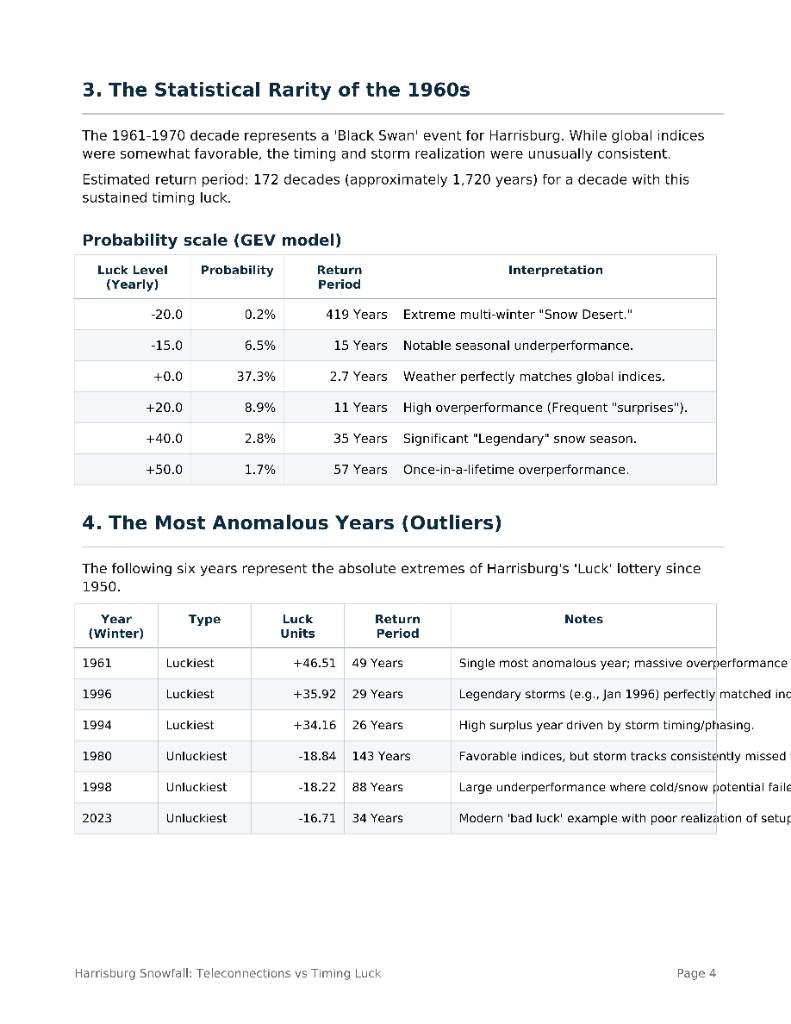
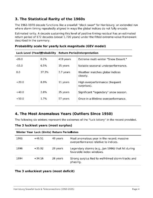
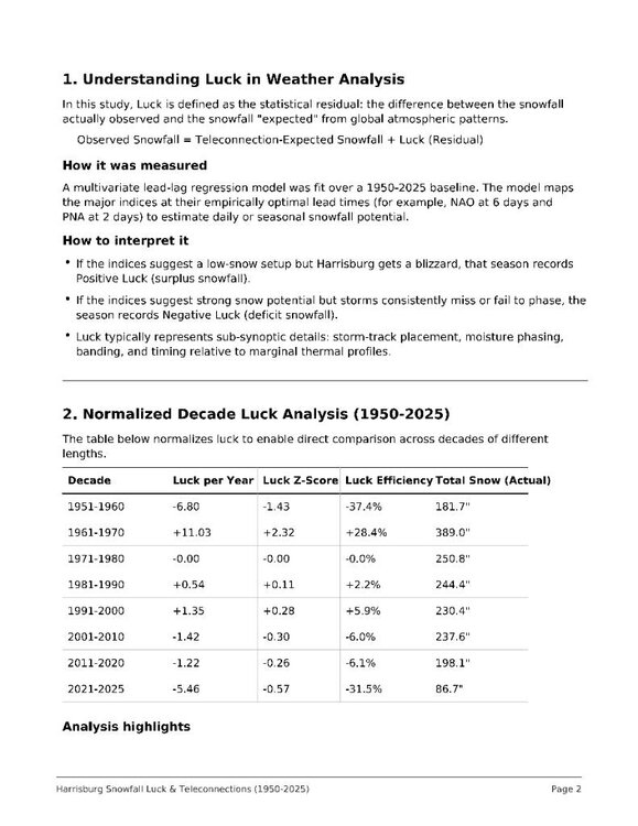
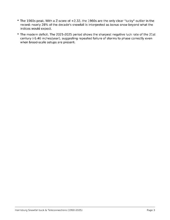
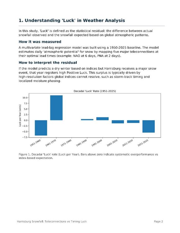
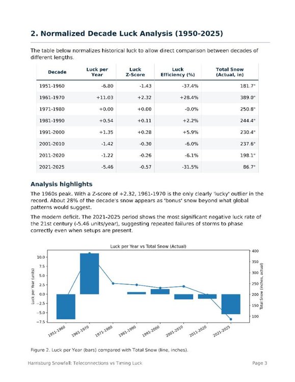
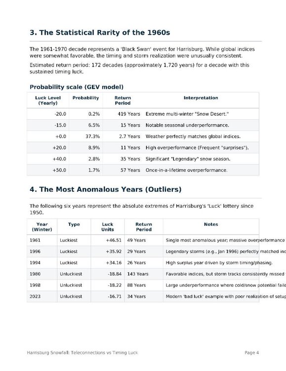
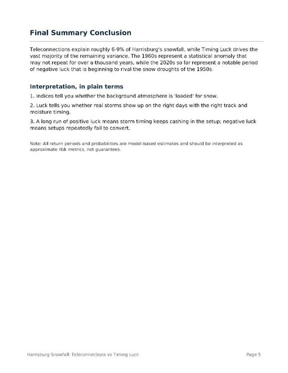
I have a super long post that will take a few separate post. The snowfall in Harrisburg is driven by a combination of global atmospheric patterns and what we call "Timing Luck"—the localized, chaotic meeting of moisture and cold air that large-scale indices like the NAO and PNA cannot predict. Our analysis identifies "Luck" as the residual snowfall surplus or deficit left over after accounting for these global drivers. While atmospheric patterns explain about 6–9% of the variability, the rest comes down to whether individual storms happen to "phase" correctly over our region. The 1960s (1961–1970) stand out as a once-in-a-millennium statistical outlier where Harrisburg received a massive +110-inch "luck" surplus, effectively gaining nearly one-third of its total snowfall through perfect timing rather than just favorable global setups. In contrast, the current period from 2021 to 2025 has been characterized by a deep "luck deficit," rivaling the extreme snow droughts of the 1950s. Even when atmospheric indices are neutral or slightly favorable, we are currently underperforming our "expected" snowfall by over 5 inches per year. Our modeling shows that while the 1960s were a ~1,700-year fluke of extreme overperformance, the current deficit represents a significant run of "bad luck" where storm tracks have consistently avoided the Susquehanna Valley. For those interested in the deep-dive statistics, including the return periods for our luckiest years (1961, 1996) and unluckiest years (1980, 1998, 2023), please see the attached images for the full distribution and decade-by-decade breakdown. Sent from my SM-S731U using Tapatalk
-
One or two more NW shifts would be nice. Webb keeps saying the Euro is out to lunch being so suppressed with really nothing in the Atlantic to keep it suppressed.
-

First Legit Storm Potential of the Season Upon Us
The 4 Seasons replied to 40/70 Benchmark's topic in New England
00Z AARP also looked like it would be an absolute nuke past 84. the 00z run, 6z is still coming out