All Activity
- Past hour
-
Is Thursday still looking like a possible flood risk? Sent from my SM-G970U1 using Tapatalk
-

July 2025 Discussion-OBS - seasonable summer variability
bluewave replied to wdrag's topic in New York City Metro
More record warmth today on the CT Shoreline following the June all-time high of 98° at HVN. Time Series Summary for NEW HAVEN TWEED AP, CT - Month of Jun Click column heading to sort ascending, click again to sort descending. 1 2025 98 0 2 1957 96 0 3 2012 95 0 4 2021 94 0 5 2008 93 0 - 1974 93 0 - 1964 93 0 - 1953 93 0 - 1952 93 0 RECORD EVENT REPORT NATIONAL WEATHER SERVICE NEW YORK, NY 441 PM EDT TUE JUL 29 2025 ...RECORD HIGH TEMPERATURE SET AT BRIDGEPORT CT... A RECORD HIGH TEMPERATURE OF 96 DEGREES WAS SET AT BRIDGEPORT CT TODAY. THIS TIES THE OLD RECORD OF 96 DEGREES SET IN 2002. ALL CLIMATE DATA ARE CONSIDERED PRELIMINARY UNTIL REVIEWED BY THE NATIONAL CENTERS FOR ENVIRONMENTAL INFORMATION (NCEI). -
For those thinking the heat and humidity is coming to an end, it’s only beginning
-

July 2025 Discussion-OBS - seasonable summer variability
Sundog replied to wdrag's topic in New York City Metro
I'm wondering if LGA hit 101 when the max temps are reported at 8PM. -

July 2025 Discussion-OBS - seasonable summer variability
doncat replied to wdrag's topic in New York City Metro
-

July 2025 Discussion-OBS - seasonable summer variability
Brian5671 replied to wdrag's topic in New York City Metro
if there's off and on rain there's no way you're in the mid 80's. -

July 2025 Obs/Disco ... possible historic month for heat
kdxken replied to Typhoon Tip's topic in New England
Looks like a lot of up and downs. Does look more active though. -
July 2025 Obs/Disco ... possible historic month for heat
kdxken replied to Typhoon Tip's topic in New England
Cooking on the Pike.
-

July 2025 Discussion-OBS - seasonable summer variability
LibertyBell replied to wdrag's topic in New York City Metro
0% chance of 90 on Thursday, it's going to be cloudy all day with off and on rain, mid 80s at most. -
July 2025 Discussion-OBS - seasonable summer variability
LibertyBell replied to wdrag's topic in New York City Metro
meh I'm sure it was 100 on some part of your property lol -
Seranthony is the first to be dealt. An easy walk over to the Jays clubhouse. Let’s beat him tonight and or tomorrow night.
-

July 2025 Obs/Disco ... possible historic month for heat
Torch Tiger replied to Typhoon Tip's topic in New England
Hell of a Stein run on the 12z Euro. Yikes -

July 2025 Obs/Disco ... possible historic month for heat
weatherwiz replied to Typhoon Tip's topic in New England
Gotta say…Margrave or whatever his name is is right about the pool stuff. Took a dip in the pool and surprised how warm even the bottom water is. I’ve submerged my body in the water and when I pop out…that evaporative cooling with the lower dews really yields a quick chill. -
July 2025 Discussion-OBS - seasonable summer variability
doncat replied to wdrag's topic in New York City Metro
Can't get any closer...high of 99.4°. -

July 2025 Obs/Disco ... possible historic month for heat
CoastalWx replied to Typhoon Tip's topic in New England
I don't see a cool August at all. Looks like a warm-very warm and potentially muggy month. -

July 2025 Obs/Disco ... possible historic month for heat
Baroclinic Zone replied to Typhoon Tip's topic in New England
Long day of driving today. Left at 630am for Stratton,VT. Temps were in the 76-77F area the entire drive. Finished site measure and hit the road just after noon. Was upper 80s at that time. By the time I hit Brattleboro it was in the mid 90s. Topped out in the 97-98F passing through central MA around 3-330. -

July 2025 Obs/Disco ... possible historic month for heat
Chrisrotary12 replied to Typhoon Tip's topic in New England
Friday's flooding slipping away. Stein'ng -

July 2025 Obs/Disco ... possible historic month for heat
Modfan2 replied to Typhoon Tip's topic in New England
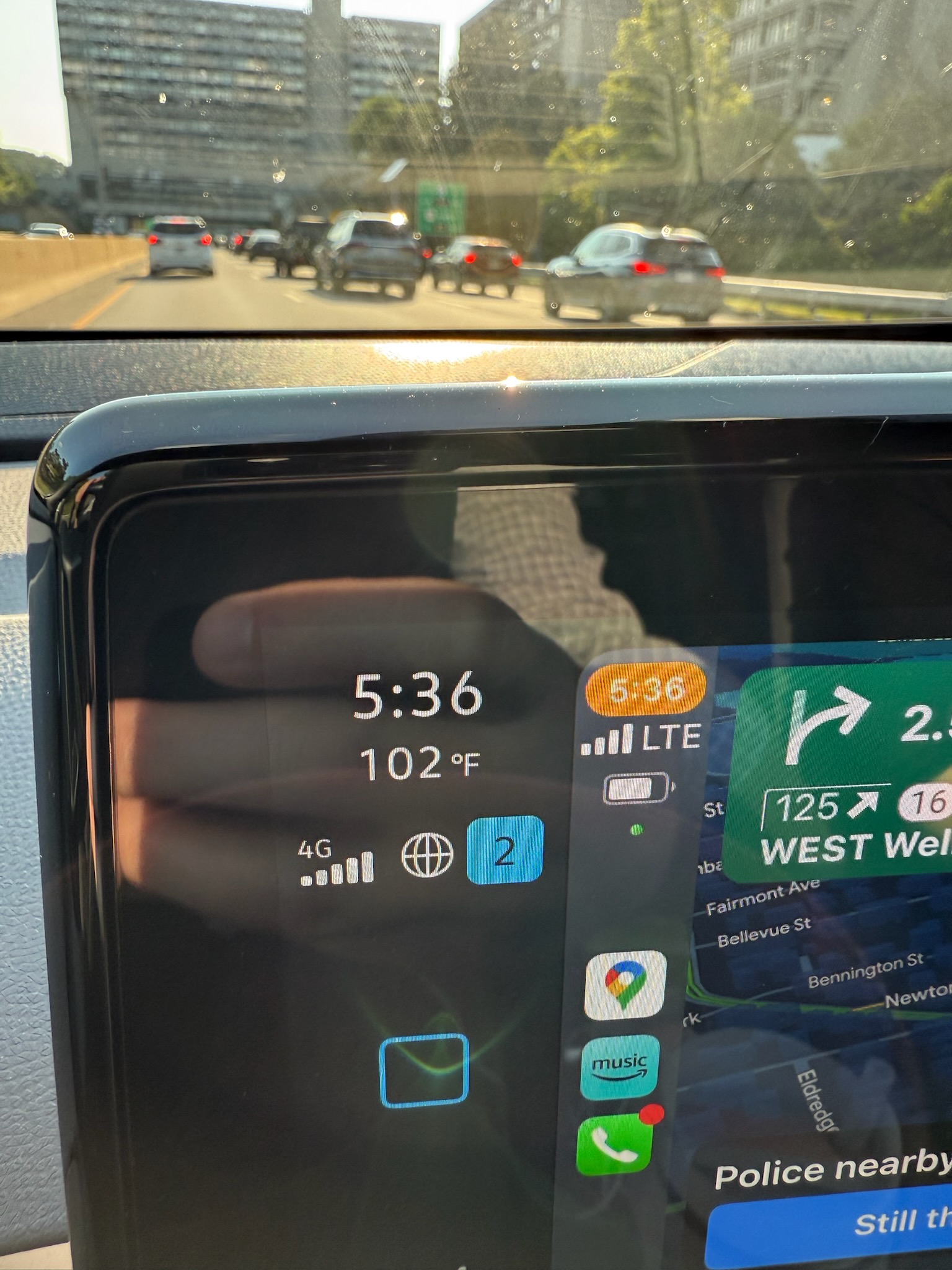
Still bouncing between 97/98F in E CT, although house is about to be shaded my weather station is at the property edge and will see full sun for another 2 hours. Thankful this is not FL with my block construction and barrel tile roof; holds the heat like a Dutch oven -
July 2025 Obs/Disco ... possible historic month for heat
Baroclinic Zone replied to Typhoon Tip's topic in New England
Popped 100F again. Summer of record continues.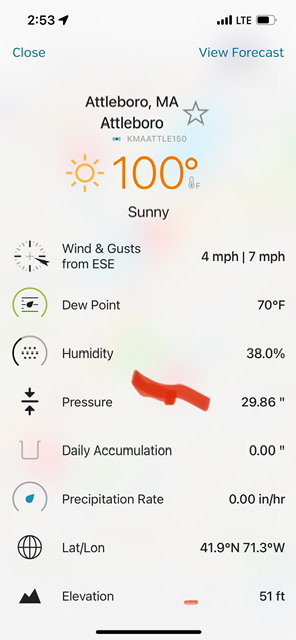
-
July 2025 Discussion-OBS - seasonable summer variability
LibertyBell replied to wdrag's topic in New York City Metro
yup, updated high temperatures EWR-101 LGA-100 NYC-97 JFK-96 ISP-96 -

July 2025 Obs/Disco ... possible historic month for heat
Typhoon Tip replied to Typhoon Tip's topic in New England
I'm a little leery of the cooler August ideas ... I see the cool-down as being typically oversold by longer range models. Something more seasonal/average, then fading into Act III .... then we "break back" Friday rain not included - It's just my personal sense of where this is going. Those pesky non-linear aspects ( trend and trend' ) keep trying to lower heights in the Pac NW as kind of rest state and every time we deflate the eastern ridge, that tends to force it back. So right now the linear structures happen to look autumnal but I'd like to wait that out and see -
July 2025 Obs/Disco ... possible historic month for heat
CoastalWx replied to Typhoon Tip's topic in New England
Kind of funny comparing height anomalies on the EPS from a week ago. Poor Moregarbage -
July 2025 Obs/Disco ... possible historic month for heat
Typhoon Tip replied to Typhoon Tip's topic in New England
mine was flopping 101 ... 100 -
July 2025 Discussion-OBS - seasonable summer variability
Sundog replied to wdrag's topic in New York City Metro
I guess some type of sea breeze has overtaken the area because I'm down to 92 degrees. - Today
-

July 2025 Obs/Disco ... possible historic month for heat
RUNNAWAYICEBERG replied to Typhoon Tip's topic in New England
A Ghost town at my local park.