All Activity
- Past hour
-
Below normal temps in the gulf stream? I wonder what that will do to the weather in Europe.
-
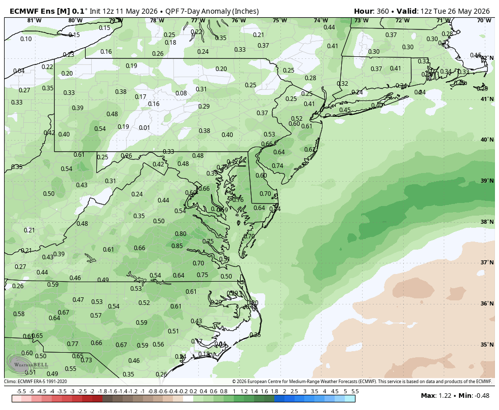
WB 12Z EPS supports a wetter forecast for May 20-26th period.

-
-
Your lawn will like it!
-
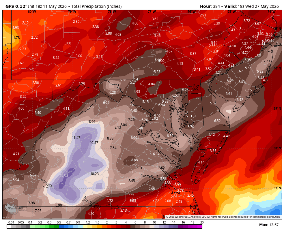
SPC storm reports says 4.50" near Hamilton! I wonder how many injuries there are per year from 2.75" plus hail. I know there are essentially no fatalities from hail.
-
Much of this week will see temperatures top out in the lower and middle 60s. Additional showers are possible on Thursday as a warm front moves northward. There remains a risk that the front could stall for a time. Friday could see temperatures return to the 70° or above should the front clear the region. It will turn warmer during the weekend. Parts of the area could reach or exceed 80° on Saturday and especially Sunday. In the long-range, there has been a shift in the guidance toward a near or somewhat warmer than normal second half of May. The probability of a warmer than normal second half of May has increased. The ENSO Region 1+2 anomaly was +1.6°C and the Region 3.4 anomaly was +0.9°C for the week centered around May 6. For the past six weeks, the ENSO Region 1+2 anomaly has averaged +1.50°C and the ENSO Region 3.4 anomaly has averaged +0.55°C. El Niño conditions are rapidly developing and will likely be in place in the next few weeks. The SOI was -9.25 today. The preliminary Arctic Oscillation (AO) was +0.922 today. Based on sensitivity analysis applied to the latest guidance, there is an implied near 50% probability that New York City will have a cooler than normal May (1991-2020 normal). May will likely finish with a mean temperature near 63.2° (near normal). Supplemental Information: The projected mean would be 0.7° above the 1981-2010 normal monthly value.
-
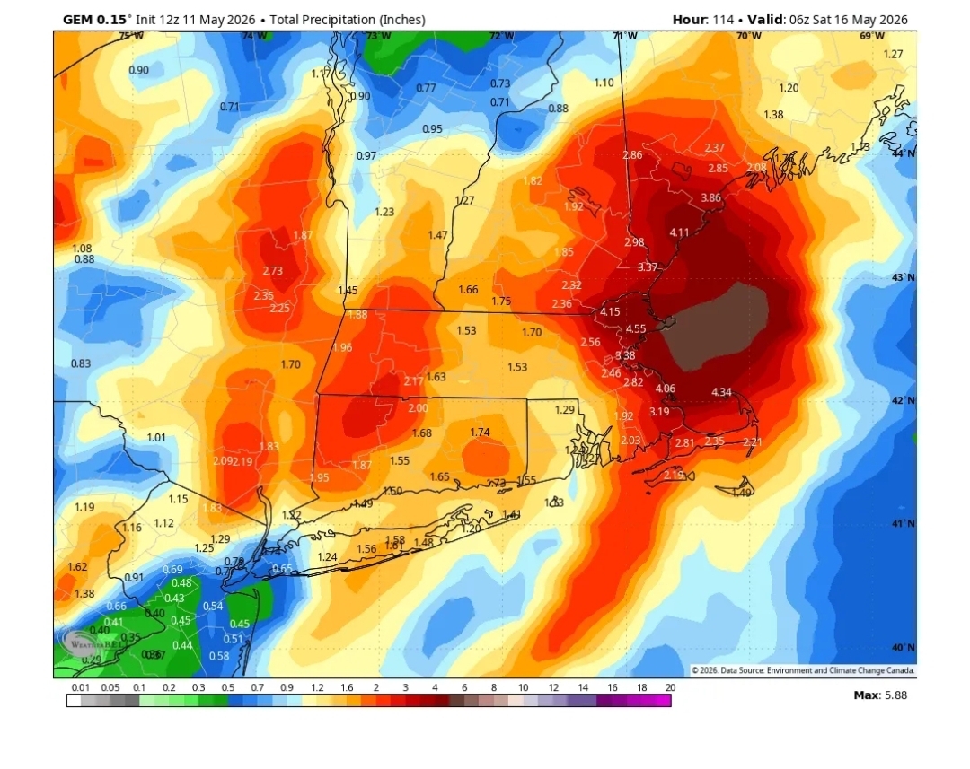
WB 18Z GFS went berserk with rain....maybe early but hopefully a sign of things to come with the El Niño.
-
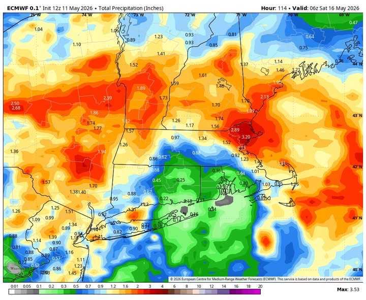
18z euro is over 2” here.
-
App has about a half inch in total .
-
Frost tonight and 90 by Sunday. The bimodal distribution continues
-
Whatever your app has
-
What's your forecast?
-
I’m assuming you’re as uninformed as most of your tweet and wx app posts and missed the Euro part
- Today
-
Looking to get cold up your way tonight and tomorrow night. Stick with the couch.
-
Killer sunset out there
- Yesterday
-
Accordion man won’t like that map
-
Yeah, Eastern Mass barely gets over 4"

-
Incorrect . It’s mainly over Friday in SNE other than a shower
-
Multiple pics of a big waterspout between Morehead city and harkers island
-
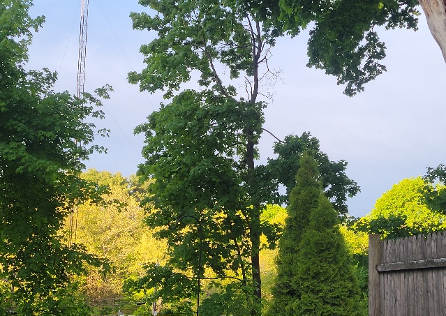
Not a big fan of spring but damn if it can't be pretty. Something about the new leaves and lighting.
-
Yeah its thu night-Friday. Euro has 2-5"
-

E PA/NJ/DE Spring 2026 Obs/Discussion
RedSky replied to PhiEaglesfan712's topic in Philadelphia Region
Slight chance of frost -
Storms missed me by about 5 miles. Only got .03" today. Big cool down though. Went from 82 to 66 in a matter of a few hours.
-
Euro only has .25-.30 river East for Thursday . Congrats west of River . Stein east
-
Wheel of rhea Thursday and Friday eh?


.thumb.gif.f92b16c631a1d15d405ed77b33f0710d.gif)