TellicoWx
-
Posts
2,632 -
Joined
-
Last visited
Content Type
Profiles
Blogs
Forums
American Weather
Media Demo
Store
Gallery
Everything posted by TellicoWx
-
That was when the Tellico River froze solid. My grandmother had pictures of someone driving their truck up the middle of the river on the ice, and people ice fishing at the old bar.
-
Got enough sleet in Madisonville to make a little slushy snowman lol
-
Turned into moderate slush balls here
-
Think you guys on the plateau and around Knox are golden..even HRRR has LP to The east in next 2-3 hrs. Backside on even it is showing more moisture, brings more of the southern valley into play are 3-4pm.
-
Mix bag of everything here in Madisonville
-
PWS above 2000' here seem to have hit a brick wall as far as temps...seems warm nose up there has stopped for now
-
15z HRRR took the 1" line down to Polk/Bradley line..think it's first time it's had me above the 1" line lol
-
Think you guys around 40 still could be ok.....nose doesn't seem overly stout here...just enough to make it a sleet/rain mess
-
This is a pws on Dayton Mtn (1250'), can see as the virga moved in, its pulling the 850s down (temp rising quicker)
-
Not until the center passes, but with this being a weak system not alot to work with on the back side..like Jeff said, start as a quick period of sleet maybe, then cold rain is what I'm looking at.
-
As far as my area, can confirm the 850s are rising. Valley areas here are sitting around 32, but the mountains are running 35-36 above 1500-2000'
-
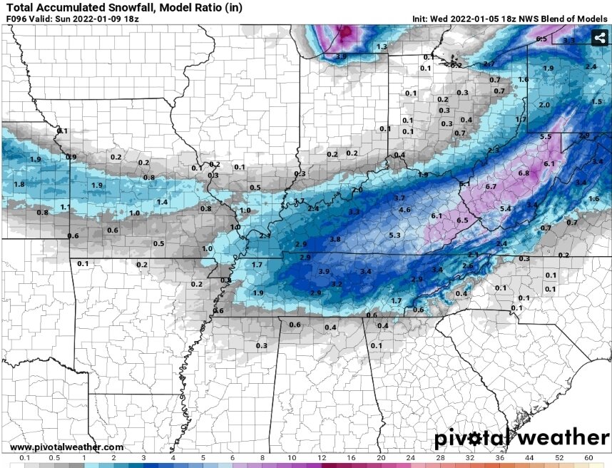
From SPC, 1"-2"+ HR rates
-
More than the warm nose, starting to get concerned with the low level dry air..especially eastern central valley/south
-
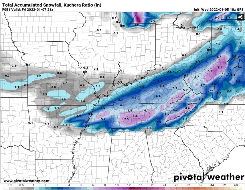
Here you go, Kuchera
-
I know personally for my area, if we haven't flipped to snow within the first half hour to hour...will punt this one, and watch it thru you guys.
-
There is going to be a very sharp cutoff it seems along that southern edge...could be where 15 miles or so means the difference between sleet mess and 2"-4"+
-
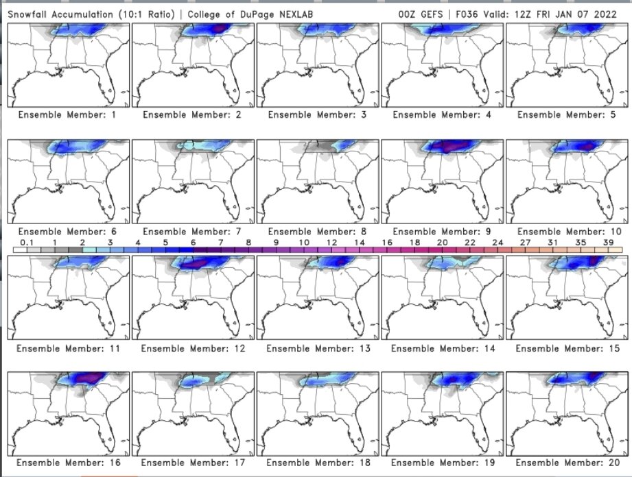
Once you get this close to an event, the mean starts moving with the OP. Better to look at the individual members to see if it has locked a solution or not...still quite a few different outcomes in the GEFS.
-
One thing about the GFS I can say 100% sure...that due east/west snowline across the southern counties isn't happening that way lol. About the oddest looking cutoff line I've ever seen at this close range.
-
Here's the 18z NBM...while I don't look at it much, it's been slowly trending toward the GFS throughout the day. Maybe something to keep an eye on.
-
As far as the NAM...rest of the CAMs looked more like GFS/Euro
-
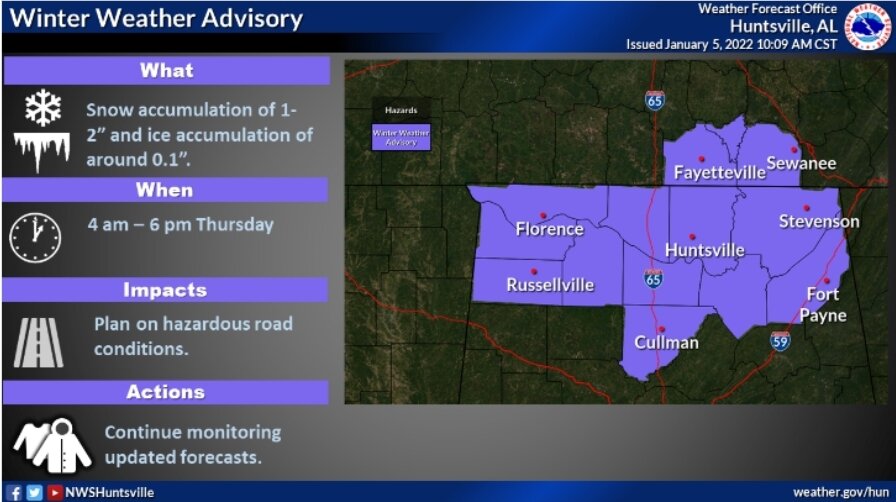
That consistency lead to places like MRX and HUN to pull the WWA south of 40
-
Think 95% of the board would cash out the GFS...have to admire the consistency
-
18z GFS doesn't budge on its track