TellicoWx
-
Posts
2,632 -
Joined
-
Last visited
Content Type
Profiles
Blogs
Forums
American Weather
Media Demo
Store
Gallery
Everything posted by TellicoWx
-
I say it needs drug tested lol...jumped my area to 11"
-
Changeover happening across Nothern AL as the tilt continues. Radar confirmation (pic from Gravelly, AL near Florence)

-
Definitely agree it's starting to tilt, which helps middle TN warm nose problem. MS/AL border has already switched to all snow
-
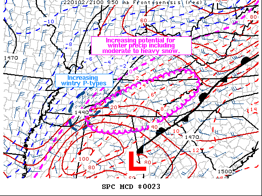
Areas affected...parts of the southern Appalachians and Southeast Concerning...Heavy snow Valid 030019Z - 030515Z SUMMARY...Periods of moderate to heavy snow will likely develop through this evening as temperatures begin to drop and forcing for ascent strengthens markedly. Snow rates of 0.5-1 in/hour will be possible with the strongest bands. Brief periods of mixed precipitation including sleet and freezing rain may also develop. DISCUSSION...As of 0015 UTC, a potent mid-level shortwave trough was analyzed via WV imagery across the eastern ARKLATEX. To the south, a 90-100 kt jet streak was beginning to round the base of the positively tilted trough moving onshore across southwestern LA. A broad area of low pressure at the surface was centered across western GA with an expanding precipitation shield noted to the northwest of the low and ongoing convection. Recent surface observations across southwestern TN and northern MS have shown an increase in the occurrence of snow and mixed precipitation types over the last few hours with diurnal cooling taking place. Strong height falls from the approaching trough are forecast to advect eastward over the next few hours as the trough becomes negatively tilted, augmenting surface mass response and deepening the aforementioned surface low. Low-level cold advection should follow suit, accelerating the change over, first to mixed precipitation, and then quickly to snow of parts of the expanding precipitation field. While temperatures remain mild, the rain/snow line should move eastward with time concurrent with increasing precipitation rates from strengthening 850-700 frontogenesis and the development of convective bands owing to subtle buoyancy aloft. Regional soundings show favorable profiles for periods of moderate and occasional heavy snow expanding northeastward with time from northern AL into eastern/central TN along the western slopes of the southern Appalachians. Snow rates of 0.5 to 0.75 in/hr will be possible for several hours resulting in reduced visibility and potential travel issues. Localized 1+ in/hr rates may also be possible beneath the heavier convective elements or near local topography favorable for orographic enhancement. Snow may linger for a few hours overnight before forcing and dry air to the west shift precipitation northeastward.
-
I know its nowcast time, but 18z Euro just had its best run for me...8". Better late than never I guess lol.
-
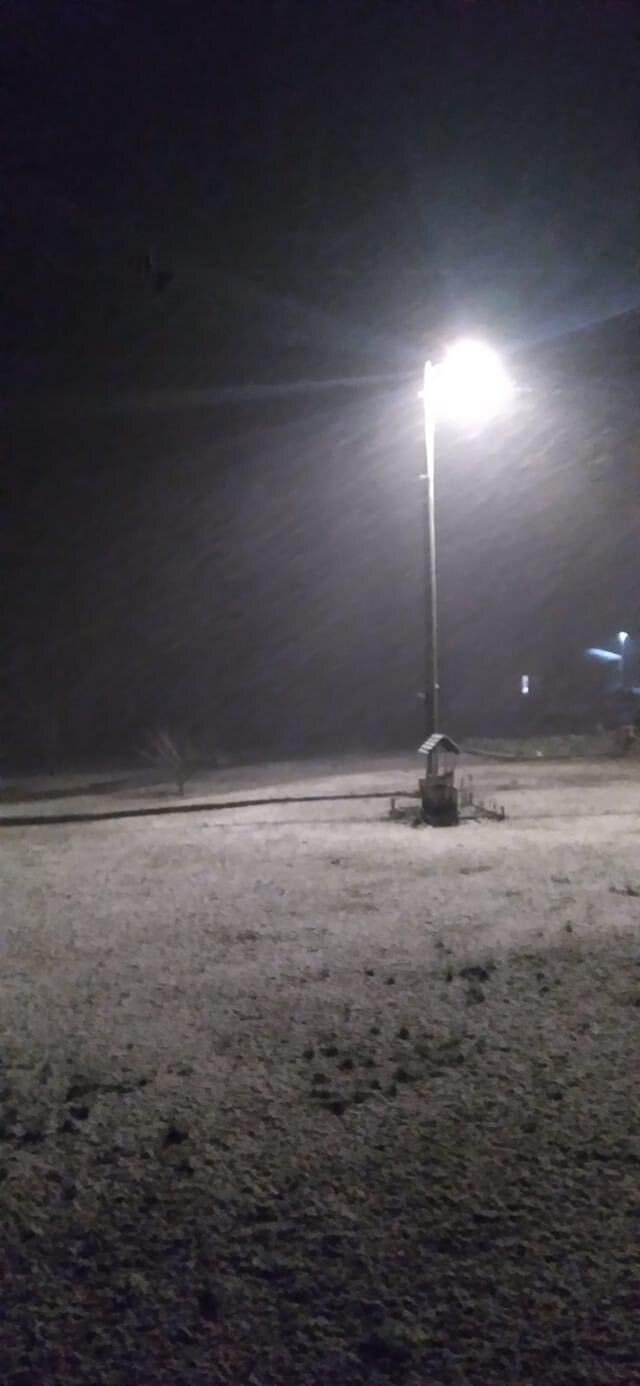
Goose Feathers falling in Jackson, TN
-
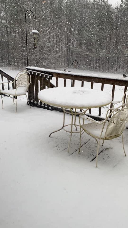
Fayette Co, TN from Twitter

-
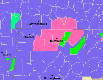
HUN
-
Interesting statement from MRX in that graphic...says visibility will be near zero at times early Mon morning
-
MRX:
-
Yeah thats the bad side of the LP position..downslopes the plateau..kinda like a half pipe effect created by the valley
-
With the position of the low pulling the deform band in, it creates extra upslope lift along the smokies.
-
Ridley, TN from Twitter:
-
It's all going to depend on where the deform band setups up when it pivots (12z suite has along and east of I75).
-
Good luck to you guys out west...basically nowcast time for yall. Alot of "surprise snow" and "did not expect this" tweets coming out of AR. Radar looks decent setting up between Memphis and Pine Bluff.
-
Yeah will be interesting to watch evolve east of the MS. The runs with decent amounts had that tounge of precip on them last night. Really takes off east of the river on those runs.
-
Lots of 1/2" to 1" pics coming out of AR in areas where no accum was forecast this morning
-
6z HRRR...
-
Only difference between the Euro and GFS is 1) Euro is a little south with SLP vs GFS and 2) Euro is about 4mb weaker on the SLP. Combine those two and it is just a tad slower with the changeover in the valley. At 30 (height of the precip in the valley), GFS has changed over and Euro is still mixed bag (about a 2° difference right at the surface)
-
Not quite like the rest of the models, but another step in that direction
-
0z Euro already better
-
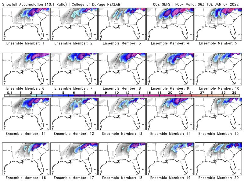
Some of these GEFS members....
-
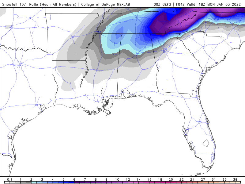
Forgot one....0z GEFS mean
-
0z CMC...(basically cut and paste every other 0z model and you will get the same result)
-
Tonight's power snowball numbers (for my town) 8, 8, 7, 6, 8, 9 (inches per each models 0z run)...I will like to cashout with 50% of those please lol