TellicoWx
-
Posts
2,632 -
Joined
-
Last visited
Content Type
Profiles
Blogs
Forums
American Weather
Media Demo
Store
Gallery
Everything posted by TellicoWx
-
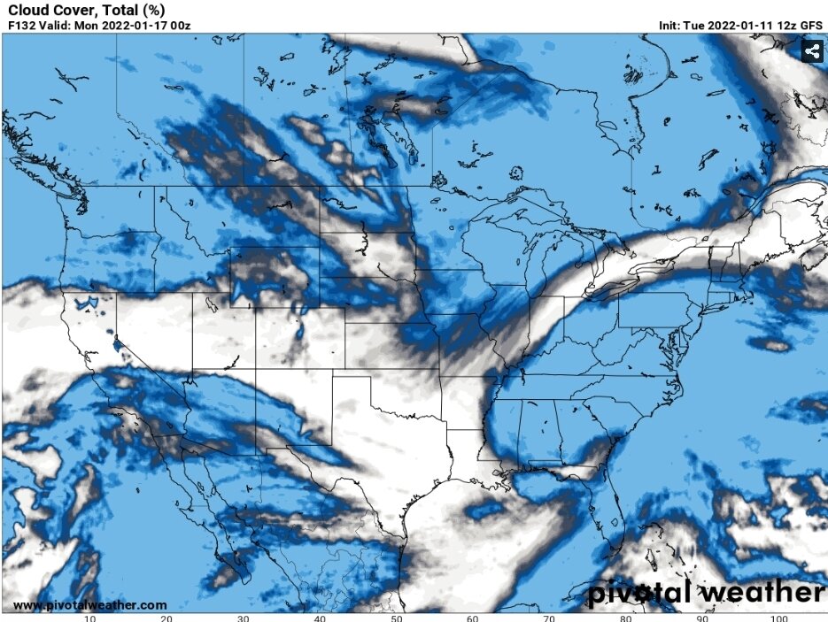
Not sure how the other 0z runs will go, but 0z ICON was a little further south...temp profiles seemed off tho on it
-
Would have definitely loved to see the next couple frames
-
Why do I feel like the Raiders head coach in the Oak/SD game lol...was all content with running out the clock on this one, and then bam, 18z GEFS has to call a timeout. Thats fine then, we do or die with this one GEFS...no tie.
-
For me I've sent the punt team out on the field. If it was only the GFS Op acting goofy would be one thing, but as WPC/Carvers/Webb/etc have noted...the snowy solution is losing the GEFs/EPS/CMC ensembles. The SLP can track however it wants, but 850 track has continuously got worse each suite across all modeling
-
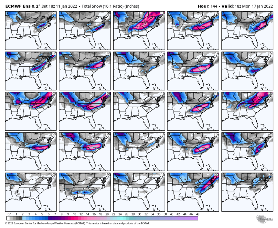
0z Euro is a mess...sleet/snow
-
It's banter, but that was one heck of an overall OP run
-
Only 34.7" at Andrews, NC lol
-
If you are in eastern valley and want to lift your spirits, look at the GFS LR clown map lol
-
A year or so ago I would have loved this map, but for what it's worth 0z Ukie
-
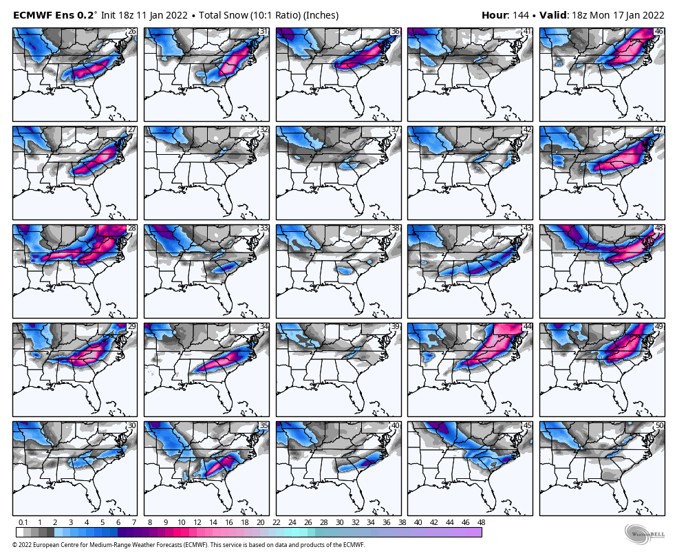
0z GEFS
-
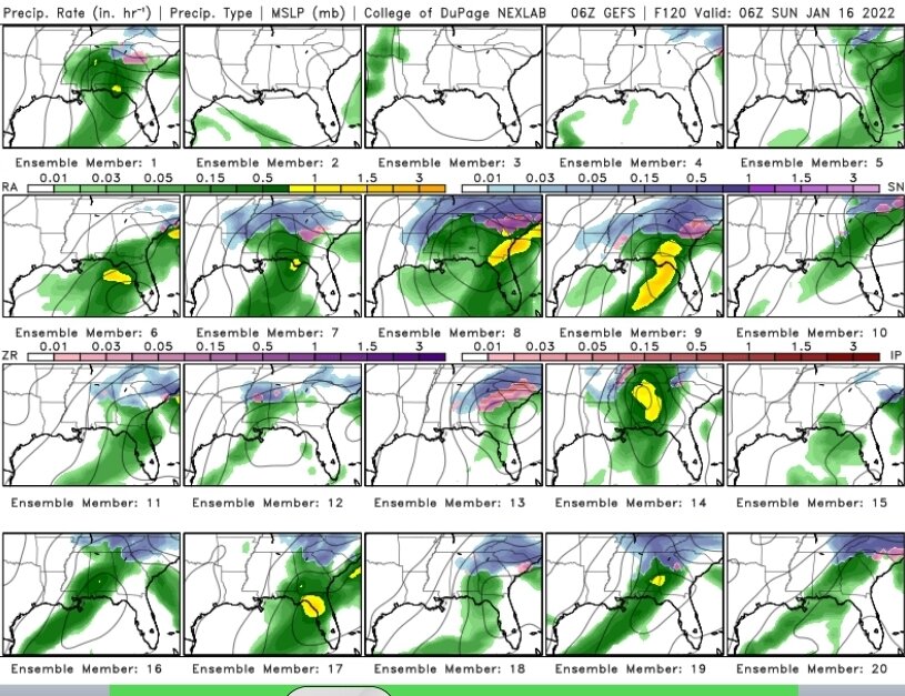
Feast or famine on the GEFS...mean doesn't tell whole story, some huge members in there
-
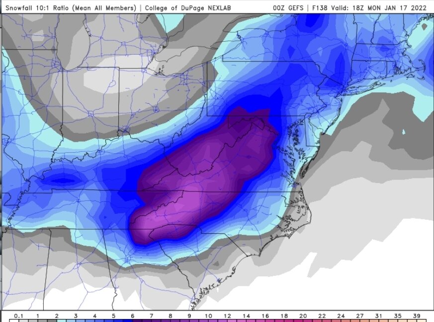
18z EPS

-
Largest majority of 18z EPS members keep the system to our SE
-
There is a huge difference between the Euro and the GFS...Euro is almost vertically stacked (850 digs basically Jackson to Birmingham w/SLP in same general area)...GFS is further North along I40 w/SLP bouncing between the gulf and closer to the 850. While the prior system was night and day compared to the strength, the GFS performed the worst as far as accurately tracking the 850 (which played into it under estimating the warm nose/incorrectly modeling the moisture feed).
-
For those south of 40, really need to watch the 850 on the GFS...need it to dig a little more. 12z was tip toeing the line (running it right on the southern border).
-
Can't remember the posters name, but was on the old boards years ago. He lived in Atlanta and had one of the best databases for that area I have ever seen. From what I remember (cause it surprised us then)..COD had actually produced alot of their big time storms.
-
12z GFS is a thing of beauty...you can see how the 12z Euro isn't quite as tightened up...definitely like where we are sitting. Anyone under that comma head on the GFS is in for a treat.
-
Don't want to be anywhere near the bullseye at this range lol
-
6z EPS
-
Think the Southeast guys are having a heart attack after the 6z EPS Control lol
-
WPC Overall the trend continues to be southward in the deterministic models especially, as shown by the 12/18Z GFS and ECMWF, while the 12Z CMC was well north (00Z CMC has come south). Guidance for the most part takes the surface low across the Southeast before turning northeastward over the Atlantic. Ensemble mean guidance is a bit farther north with the low center, and felt like following closer to their track for the surface low was a safer bet given the ensemble member spread. 6z GEFS
-
6z GEFS was a nice improvement over 0z GEFS. As WPC noted in their extended discussion, the GEFS was north of the OP with its tracking (only a couple members had any type of surface reflection near the gulf). 6z has almost half the members showing some type of reflection there now. With most of those cutting across the FL peninsula between Jacksoville and Orlando.
-
CMC is very close to a copy of the GFS
-
Oh Canada lol
-
There's so much energy flying around, I'm not even looking past 72 hrs lol. Just look at 18z GFS for example for NE TN folks Thurs...believe it will be model mayhem for next couple weeks. Wouldn't be surprised if something appears suddenly at close range.