brooklynwx99
-
Posts
6,215 -
Joined
-
Last visited
Content Type
Profiles
Blogs
Forums
American Weather
Media Demo
Store
Gallery
Everything posted by brooklynwx99
-
the fact that the CMC is a clear amped outlier and still delivers sig to borderline major snow is a testament to how favorable this setup is
-

Extreme Cold, Snow & Sleet: SECS 1/24 - 1/26
brooklynwx99 replied to TriPol's topic in New York City Metro
CMC looks like a clear amped outlier so far at 00z... even then, it's still 6-8" for the metro with some mix at the end, which shows how good this setup is -
Extreme Cold, Snow & Sleet: SECS 1/24 - 1/26
brooklynwx99 replied to TriPol's topic in New York City Metro
i doubt that happens with this kind of mid-level forcing moving in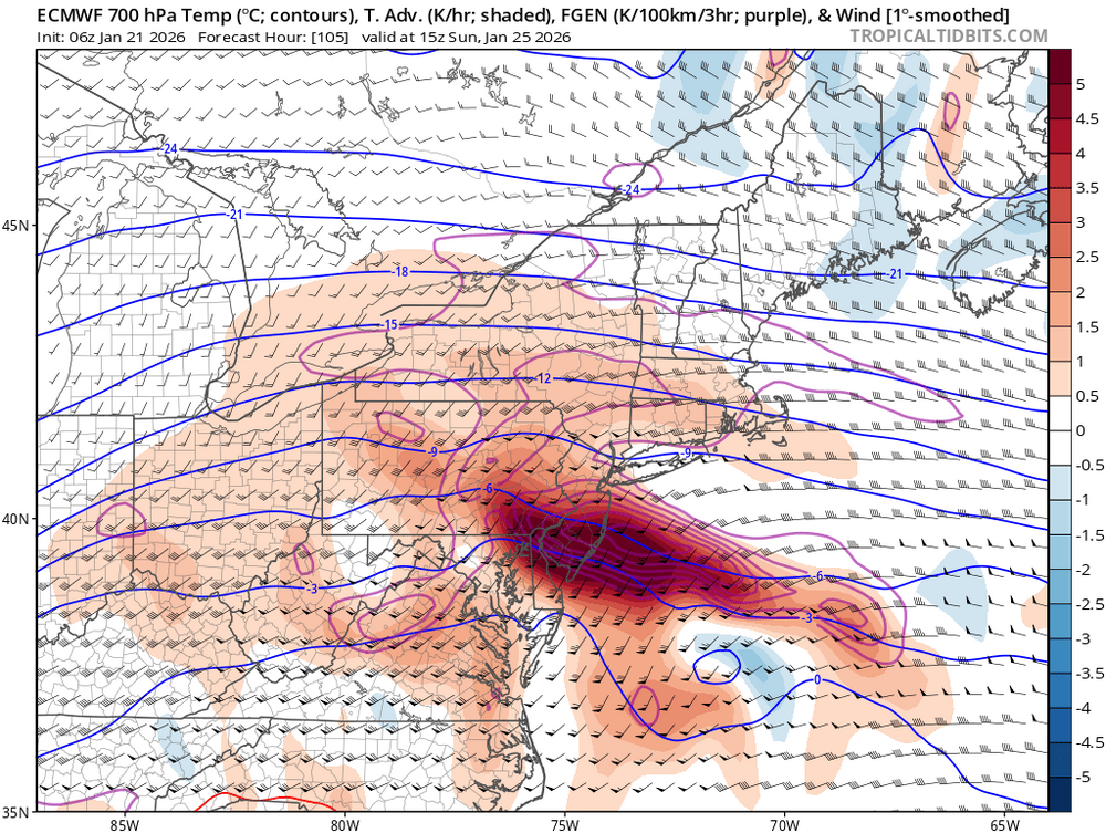
-
Extreme Cold, Snow & Sleet: SECS 1/24 - 1/26
brooklynwx99 replied to TriPol's topic in New York City Metro
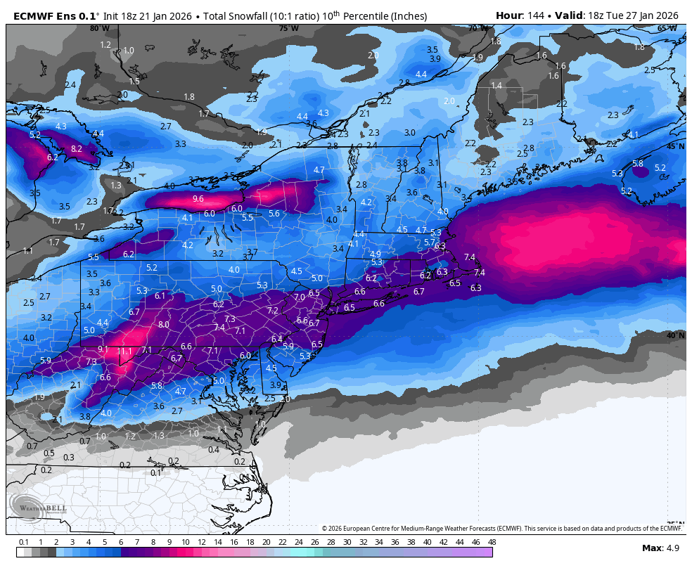
the 10th percentile on the EPS is a significant event. take a breath
-
exactly, the WAA is insane and i find it hard to believe you guys do without sig snowfall. it's just so cold going in and the 700mb FGEN will be off the charts
-
it's still uncomfy for you guys, but i still think most of the damage is done before any mixing... nobody should be complaining about 8" of snow in like 4 hours followed by some mix. if the mix does end up occurring at all
-
Extreme Cold, Snow & Sleet: SECS 1/24 - 1/26
brooklynwx99 replied to TriPol's topic in New York City Metro
everything still looks good here for a significant snowfall, some sleet potential at the end when precip is dying down notwithstanding -
Extreme Cold, Snow & Sleet: SECS 1/24 - 1/26
brooklynwx99 replied to TriPol's topic in New York City Metro
after like a foot of snow, yeah lmao -
Extreme Cold, Snow & Sleet: SECS 1/24 - 1/26
brooklynwx99 replied to TriPol's topic in New York City Metro
euro is a monster hit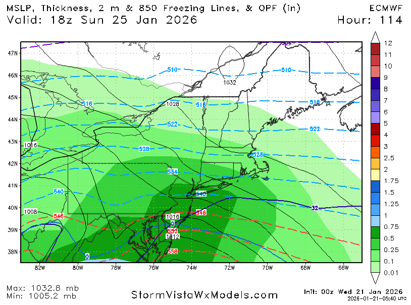
-
Extreme Cold, Snow & Sleet: SECS 1/24 - 1/26
brooklynwx99 replied to TriPol's topic in New York City Metro
tough to ask for better here. textbook aloft for significant impacts
-
Extreme Cold, Snow & Sleet: SECS 1/24 - 1/26
brooklynwx99 replied to TriPol's topic in New York City Metro
i couldn't care less if some pellets mix in after 8-12" of snow -
the WAA is so insane that this is really hard to fuck up for MD/DC. the UKMET drives the low to Buffalo and you still get 12" of snow
-
Extreme Cold, Snow & Sleet: SECS 1/24 - 1/26
brooklynwx99 replied to TriPol's topic in New York City Metro
lol if this hugs the coast it's because there's a blizzard ongoing -
Extreme Cold, Snow & Sleet: SECS 1/24 - 1/26
brooklynwx99 replied to TriPol's topic in New York City Metro
GEFS is going to come north, more phasing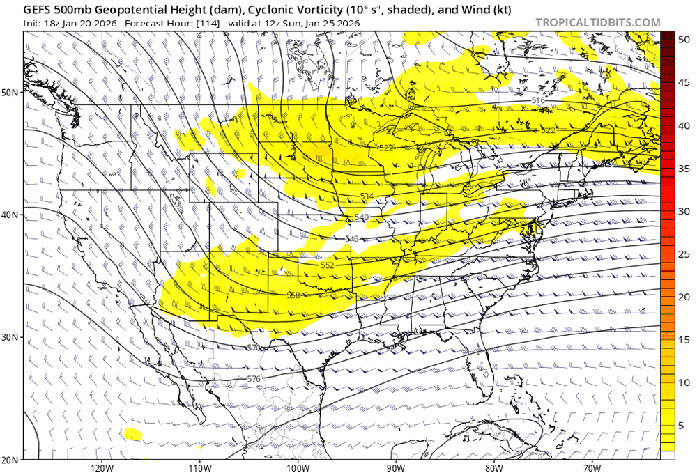
-
January 2026 regional war/obs/disco thread
brooklynwx99 replied to Baroclinic Zone's topic in New England
GEFS will be north, more phasing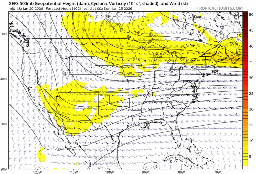
-
January 2026 regional war/obs/disco thread
brooklynwx99 replied to Baroclinic Zone's topic in New England
GFS is more in phase, going to be quite a bit better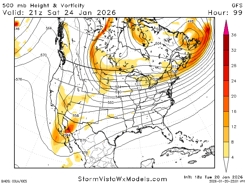
-
January 2026 regional war/obs/disco thread
brooklynwx99 replied to Baroclinic Zone's topic in New England
yeah, completely reversed the 18z shift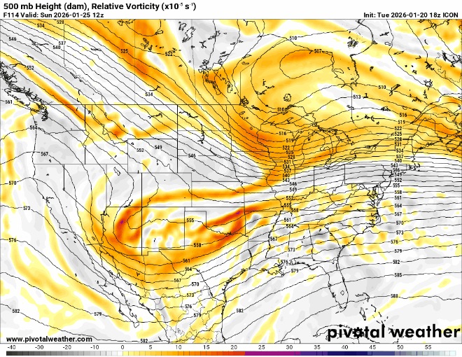
-
ICON is way better, not even close
-
January 2026 regional war/obs/disco thread
brooklynwx99 replied to Baroclinic Zone's topic in New England
this phasing trend has been happening for days now
-
Extreme Cold, Snow & Sleet: SECS 1/24 - 1/26
brooklynwx99 replied to TriPol's topic in New York City Metro
this is all you need to see. trend has been ongoing for two days now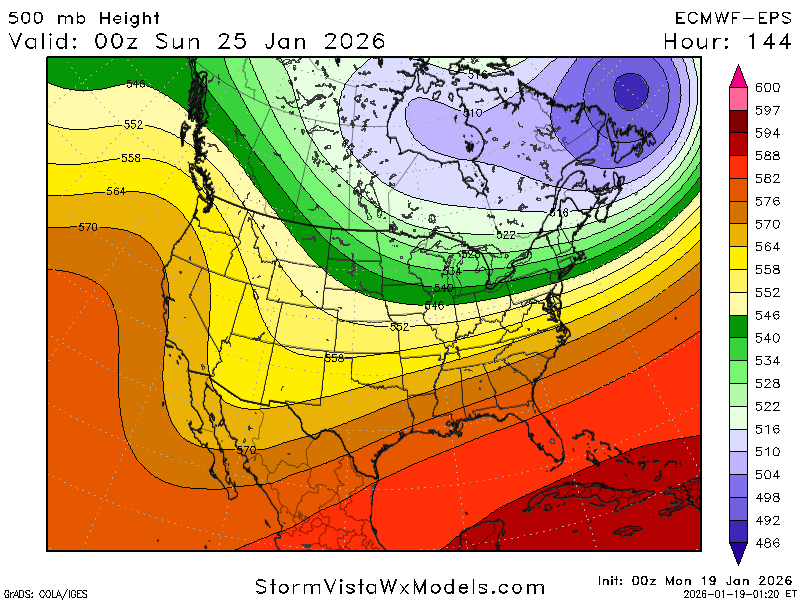
-
this is all you need to see. trend has been ongoing for two days now

-
January 2026 regional war/obs/disco thread
brooklynwx99 replied to Baroclinic Zone's topic in New England
we continue phasing
-
Extreme Cold, Snow & Sleet: SECS 1/24 - 1/26
brooklynwx99 replied to TriPol's topic in New York City Metro
EPS made the same shift towards more phasing and now has 0.75" liquid to NYC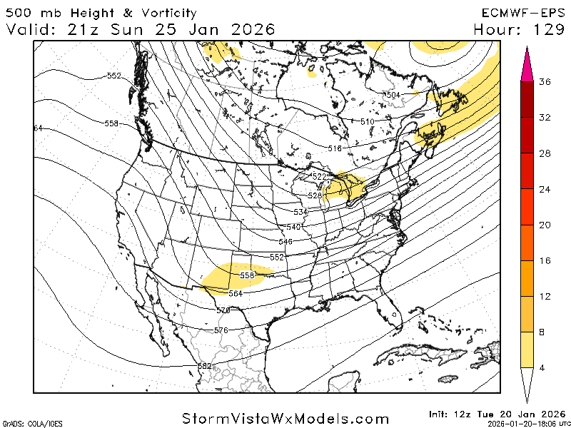
-
January 2026 regional war/obs/disco thread
brooklynwx99 replied to Baroclinic Zone's topic in New England
ECMWF is a full phaser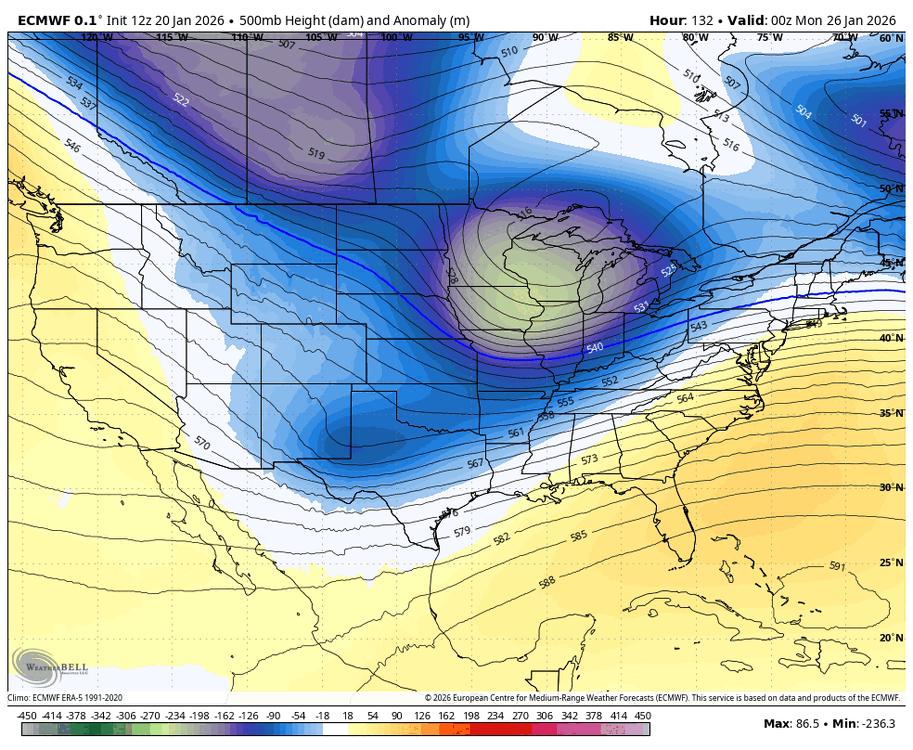
-
euro is a full phase. god damn