NorthArlington101
-
Posts
12,475 -
Joined
-
Last visited
Content Type
Profiles
Blogs
Forums
American Weather
Media Demo
Store
Gallery
Everything posted by NorthArlington101
-
 re: the above - pretty boom or bust
 -
Pretty much zippo But when you jump to 75% it gets impressive fast - probably only need a 60th percentile storm to be okay?
-
Promise you the decision was made with more data than you have!
-
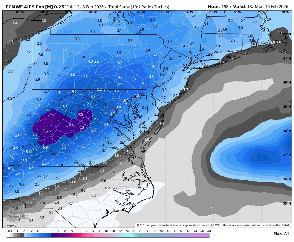
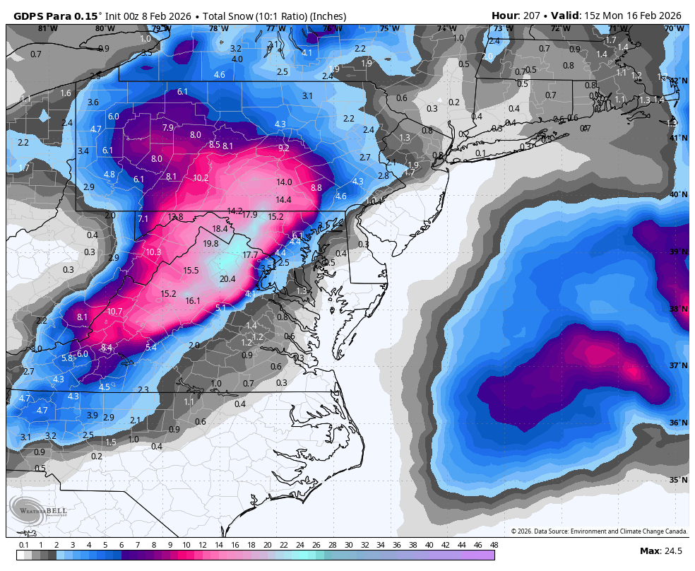
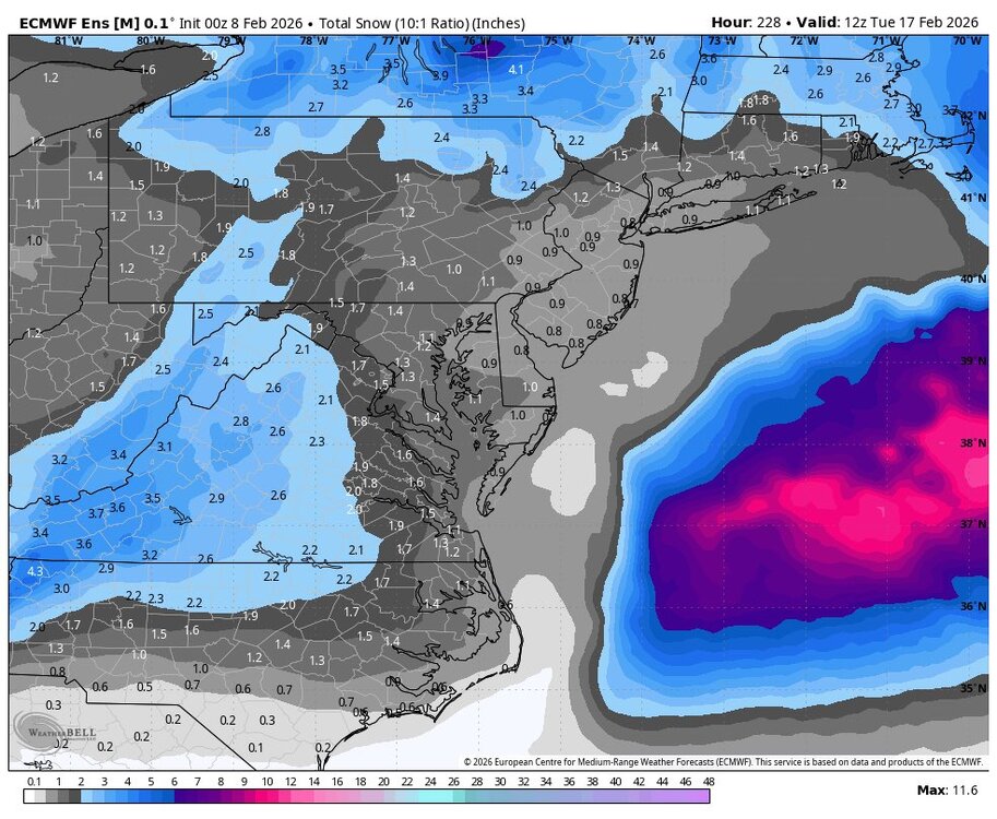
You have to view these only in the sense of mean total QPF that is borderline wintry, but…

-
EPS 00z

-
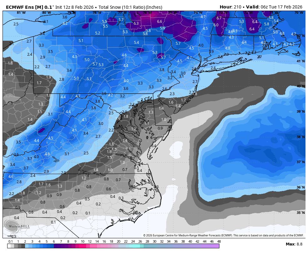
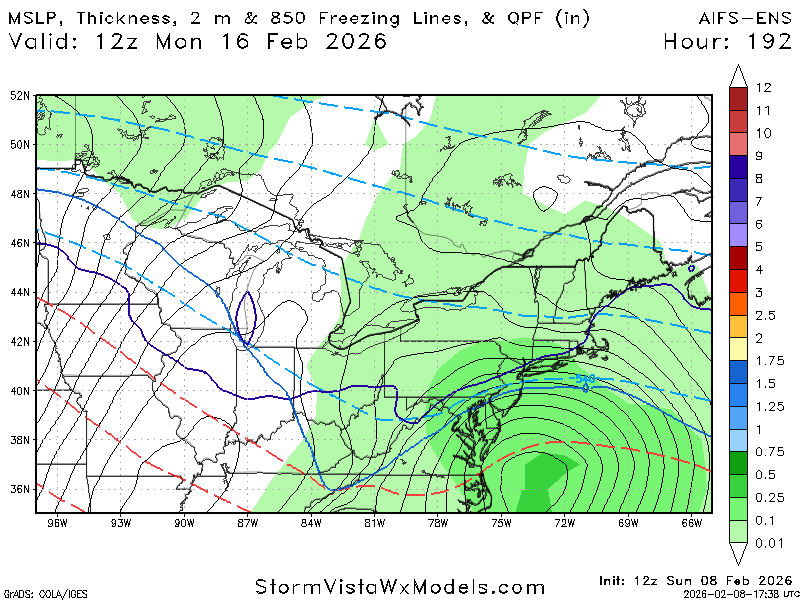
AIFS ens are close…
-
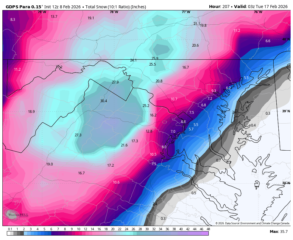
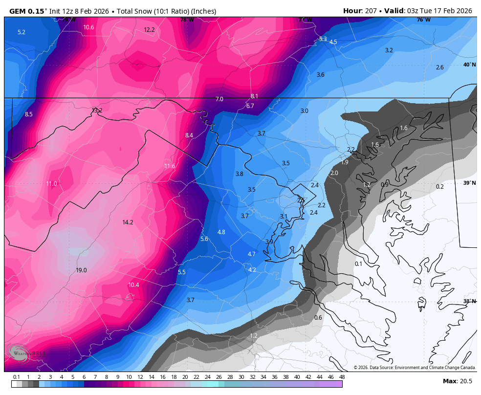
CMC Para 10:1 (paste bomb so Kuchera hates it)

-
I think it might at least start as snow but the WxBell temp maps aren’t out all the way Edit: sooo close at 850 and 925. Probably rain for most but n md
-
To be so cold for weeks and then end winter on a perfect track rainstorm would be pretty funny
-
If that thread is gonna stay they could at least crosspost the discussion. I’ve already explained that I don’t get it but it’s whatever
-
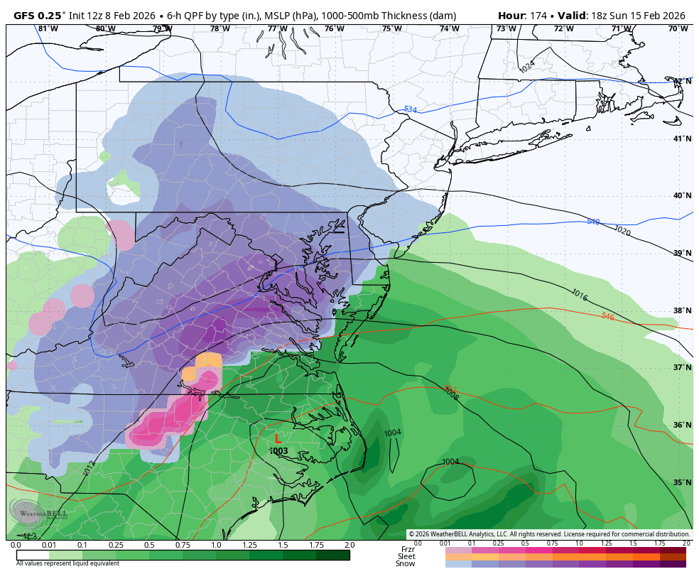
Surface temps are yucky for pretty much everyone but in theory it’s probably a quick paste bomb for most everyone* with the timing before it flips to rain. *I-81 wins
-
Normal CMC kinda looks like that at 12z. I-81 storm.
-
CMC snows at 12z. It’s para did this last night - very AIFS-esque

-
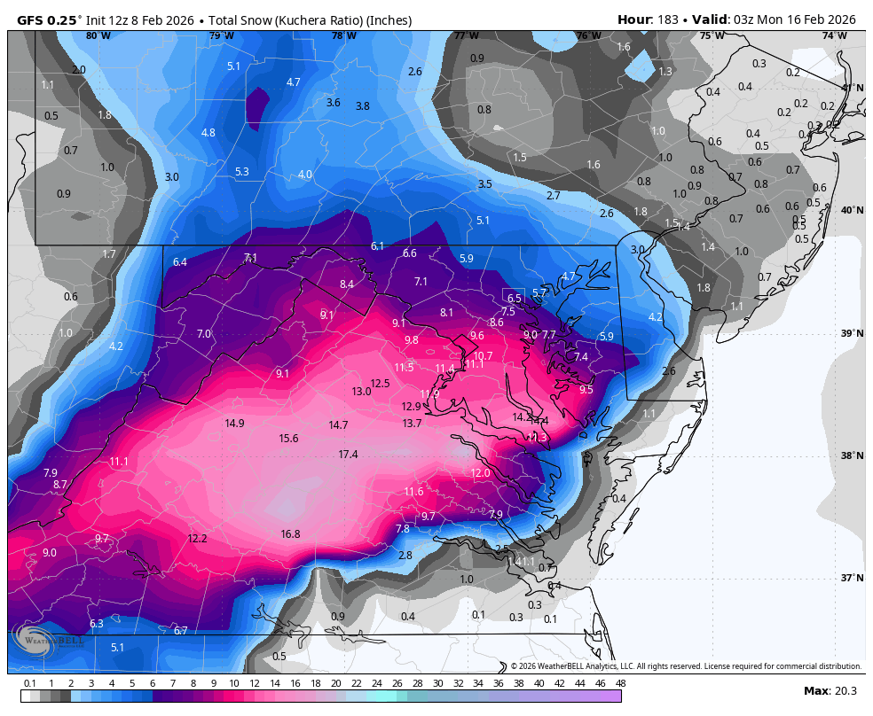
GFS and ICON at range is an awesome combo. Just have to hope they both got some good news in the 12z data. Probably not
-
Willing to blissfully ignore the surface temps at this range a little bit - not it’s specialty. Still not what you’d like to hear Edit: I’ll trust PSU
-
Have to dig into the thermals (hard) to see how much of that is sleet, but I’ve appreciated its general consistency for the period for sure. It’s the model I’d rather have on my side vs. anything else…
-
You only get heat when it’s a bad run. This is perfectly acceptable
-
Why are we ragging on a guy for failing to post an image properly? Not like he tried to give awful storm analysis
-
Reiterating my position from a month ago that having two long range threads is a miserable idea that will only serve to cause conflict and suck the life out of this board
-
Can’t believe the squall made it. I was lied to! Anything that fell yesterday must’ve been blown off my balcony because I can’t see it. Time to stay inside the rest of the day.
-
I only care if it’s gonna make it. Is it gonna make it? Do I set an alarm?
-
Hasn’t stopped snowing for about 90m in DC. Not sure we’ve added anything since the one moderate push but it’s stellar snow TV.