FXWX
-
Posts
1,431 -
Joined
-
Last visited
Content Type
Profiles
Blogs
Forums
American Weather
Media Demo
Store
Gallery
Everything posted by FXWX
-
That's going to be the issue as this pattern unfolds during December. Degree of old loading into southeast Canada will be critical. Too much assist from -NAO and we get suppression; too little and SNE gets screwed by warming, but ice potential increases? But if we get modest confluence locked in by weak to moderate -NAO and it could be a solid December; especially NOP! I would keep expectations low right now, but it's an active look with decent potential.
-

November 2025 general discussions and probable topic derailings ...
FXWX replied to Typhoon Tip's topic in New England
1000% agree... -
November 2025 general discussions and probable topic derailings ...
FXWX replied to Typhoon Tip's topic in New England
70-71 was exceptional for its almost wall to wall snow cover, and long running cold. But if it were to repeat at this day and age, this board would be filled with complaints of the lack of any true biggies! Lots more light to moderate events with a couple of +10" storms across CT... Feb. 1971 only saw 8.4" at BDL... December 70 was great month with 27", but only 1 big event. -
November 2025 general discussions and probable topic derailings ...
FXWX replied to Typhoon Tip's topic in New England
That's because they are almost unheard of! Getting a stretch like in 14-15 is about as good as you can hope for... A solid 6 week period is what I'd be happy with. Wire to wire here SNE is almost impossible to achieve... -
November 2025 general discussions and probable topic derailings ...
FXWX replied to Typhoon Tip's topic in New England
As modeled and shown on these 2 graphics, do not represent a very cold pattern from eastern NY on across New England. More of a normal to slightly colder than normal conditions. The bulk of the cold will be centered well to the west, which is typical of weak La Nina events. Some of the cold will bleed eastward but no guarantee it bodily comes eastward??? It is common for weak La Ninas to see the core of the cold anomaly stretching from western Canada southeastward into Northern Plains / Great Lakes with lessening impacts as you approach New England. from Canada southeast -
Wow!
-
Even with lots clouds, widespread arc of dull white plume across northwestern quarter of the sky here...
-
November 2025 general discussions and probable topic derailings ...
FXWX replied to Typhoon Tip's topic in New England
First sub 32 degree high of the season for me here in Burlington, CT....1,240' -
Lots of backing down by 00z model runs...
-
November 2025 general discussions and probable topic derailings ...
FXWX replied to Typhoon Tip's topic in New England
Oh, I like the higher end potential for a variety of reasons, I'm just noting the Euro is relatively low-grade compared to much of the guidance. I would and am hitting this potential hard regardless of the Euro. But I always look to see why a particular piece of modeling is not onboard with an event when most others are? But as we all know, small deviations in the pattern can screw up high-end wind event! Caution is always advised 36 hours out? -
November 2025 general discussions and probable topic derailings ...
FXWX replied to Typhoon Tip's topic in New England
Out of all the 12z guidance runs, Euro looks to be the least bullish? At least for interior SNE... -
That's the deal... 1200' plus will do it.
-
51 mph gust here!
-
1,000%
-
Can she be gone if she was never here?
-
Yep
-
Lol... Sooner or later there has to be a major bust in our favor... I love Kevin... He goes all in and one of these days he will be able to spit in our faces...
-
Agree... And yes! Would love to track a one in every 20 - 30 year storm...
-
While it is always fun to fantasize about extreme events, this setup is still a long shot for New England! Signal for a violent Atlantic system is strong, but right now I think the chance it has direct impacts for most of the Northeast is low. It is not like the ensembles show a clustering into New England. The Canadian has always been good for weather porn, but rarely leads the way. After a while, chasing the one or two outlying ensemble members gets old. I would love to see a late October monster hybrid, but until I see a wholesale change in where the main ensemble cluster sets up, I would recommend keeping expectations very much on the low side. Although if I were living in NS I'd keep close tabs.
-
What a worthless piece of fake long range forecasting... If it were as simple as using sst anomalies to predict the winter jet stream pattern, every winter forecast would be perfect! It's all modelology with no meteorology. All click bait; headline stating a brutal winter lies ahead, but almost zero support discussed in the video. So typical of today's social media driven weather industry.
-
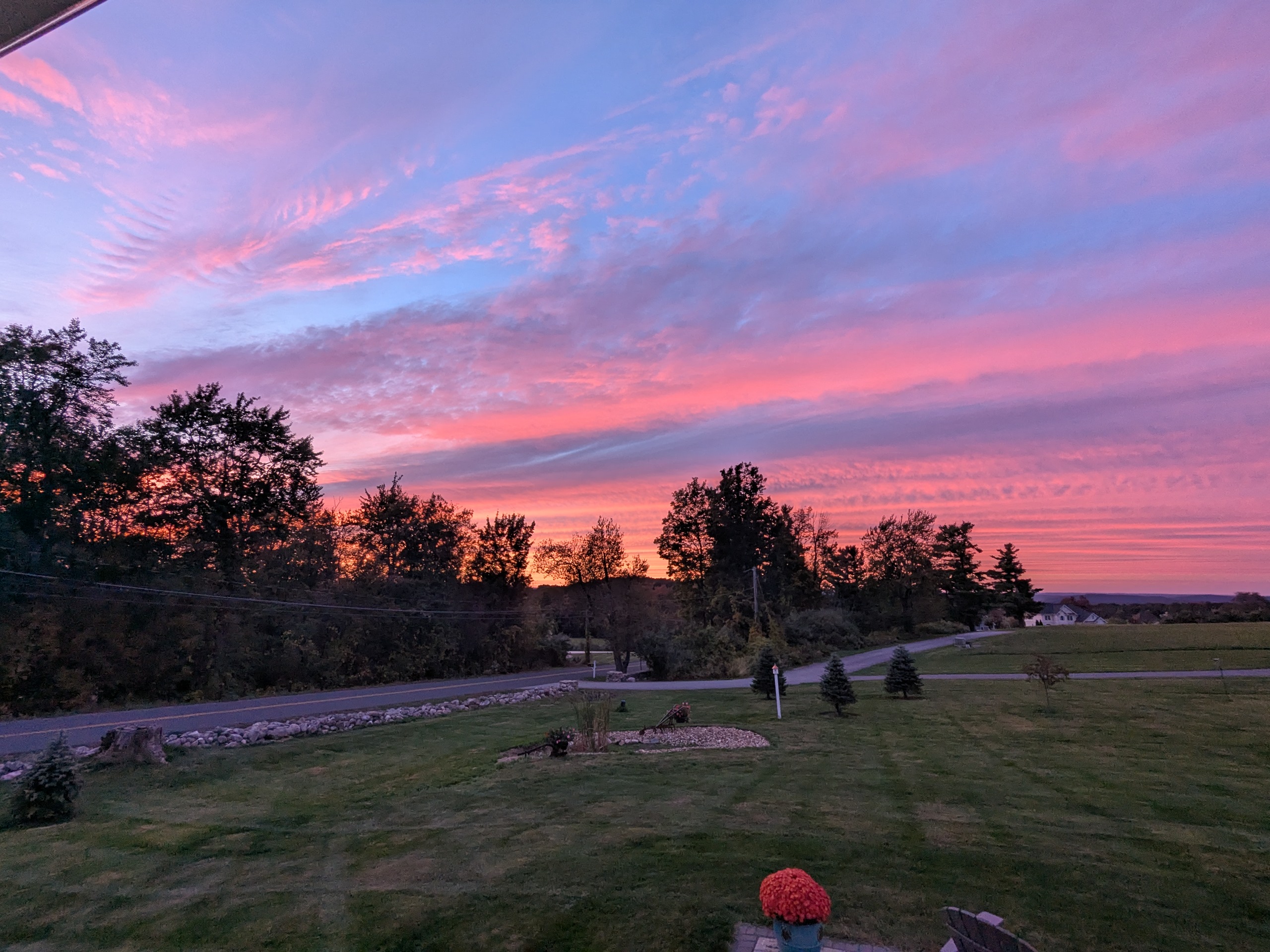
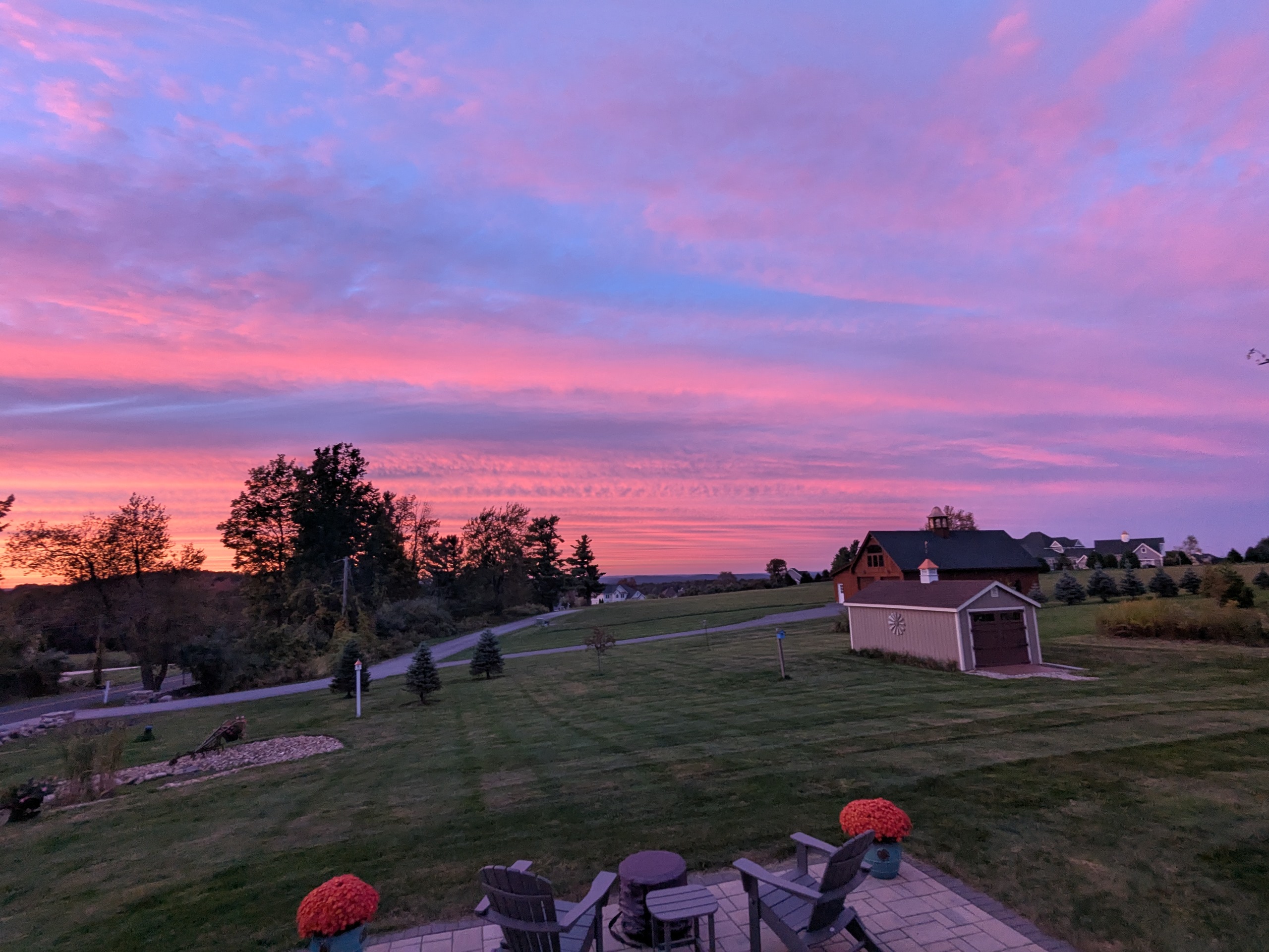
Great sunset tonight in Burlington CT...PXL_20250929_224815675.RAW-02.ORIGINAL.dngPXL_20250929_224815675.RAW-02.ORIGINAL.dngPXL_20250929_224815675.RAW-02.ORIGINAL.dng


-
I'm talking about upper climo... Pattern aloft has to have a semblance of a known pattern that has in the past allowed for a landfall? We can certainly have some odd tracks when 2 circulations interfere with each other. But their tracks still will be controlled by the upper levels.
-
100%. Agree... As we have said a million times, there is a well established large scale climo pattern for a New England hit! Once again this not it! Show me a past storm that made landfall with our current pattern several days out? Every winter folks love to chat about how a pattern is favorable or not favorable for a Kocin storm, but when it comes to hurricanes, so many folks just follow modeled surface tracks without ever mentioning the total lack of upper support?
-
Strong Agree!
-
Emphasis on "a little".... Large-scale feature placement still argue against it... Just one of those years to date. Still time to get something threatening but certainly nothing obvious at this time. Maybe once (if) fall pattern grows more amplified we might get a Gulf or Caribbean system to pop and get get yanked northward?