FXWX
-
Posts
1,444 -
Joined
-
Last visited
Content Type
Profiles
Blogs
Forums
American Weather
Media Demo
Store
Gallery
Everything posted by FXWX
-

July 2025 Obs/Disco ... possible historic month for heat
FXWX replied to Typhoon Tip's topic in New England
Got that right -
July 2025 Obs/Disco ... possible historic month for heat
FXWX replied to Typhoon Tip's topic in New England
Couple of trees down in Waterbury -
July 2025 Obs/Disco ... possible historic month for heat
FXWX replied to Typhoon Tip's topic in New England
Agree! While there are a handful of great Mets on here that apply actual forecast techniques to their outlook comments, many posters are just regurgitating whatever the newest model run shows, regardless of its likelihood of occurrence... -
July 2025 Obs/Disco ... possible historic month for heat
FXWX replied to Typhoon Tip's topic in New England
Congratulations... Amazing how often folks are out of their area when a good storm finally pops up -
July 2025 Obs/Disco ... possible historic month for heat
FXWX replied to Typhoon Tip's topic in New England
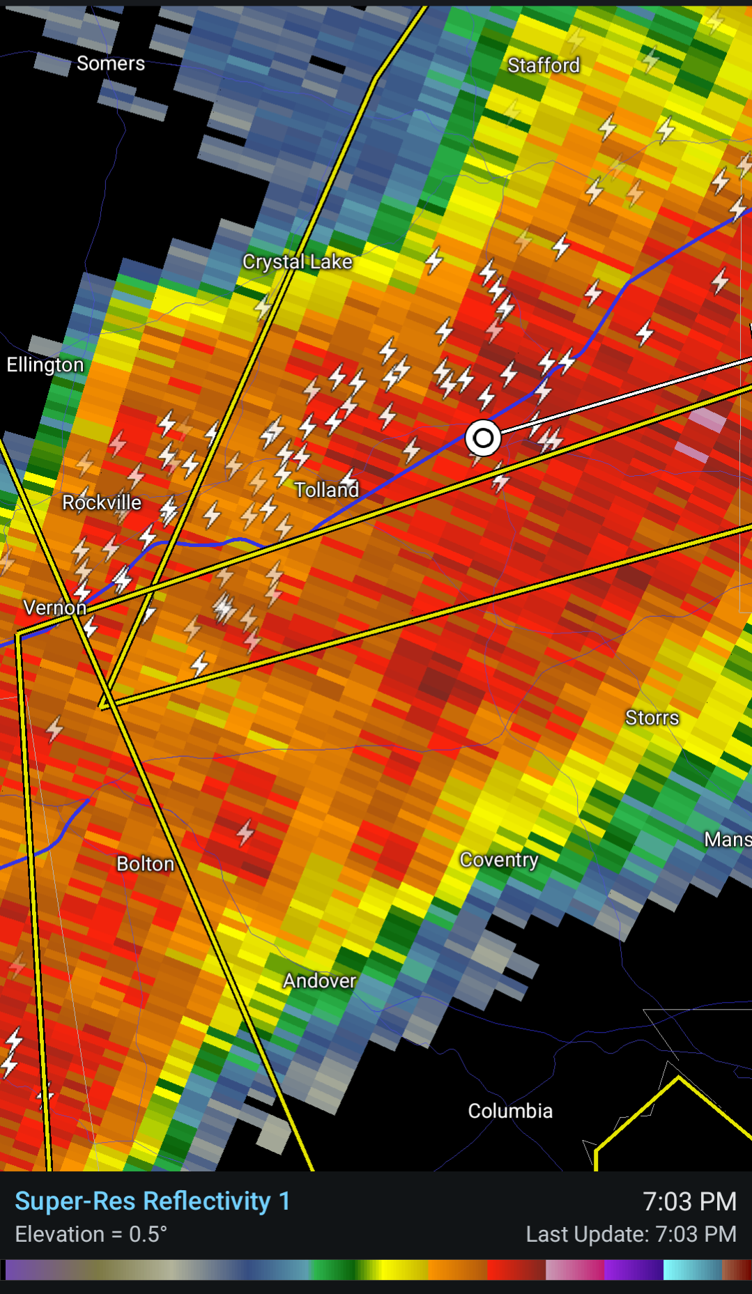
South side of storm as seen from Burlington CT PXL_20250720_220618455.RAW-02.ORIGINAL.dng -
July 2025 Obs/Disco ... possible historic month for heat
FXWX replied to Typhoon Tip's topic in New England
Kev should get his camera ready; might be able to see a dangling funnel? Hail? -
July 2025 Obs/Disco ... possible historic month for heat
FXWX replied to Typhoon Tip's topic in New England
Fog bank continues to teaser the beaches of Ogunquit...
-
July 2025 Obs/Disco ... possible historic month for heat
FXWX replied to Typhoon Tip's topic in New England
The short distance variability associated with these systems always amazes me. Lots of reports of sun with frequent lightning but no rain... While I had r+++, less than a mile away only a spit rain but a burst of pea sized hail. -
July 2025 Obs/Disco ... possible historic month for heat
FXWX replied to Typhoon Tip's topic in New England
Yep... Constant thunder here as it approaches -
July 2025 Obs/Disco ... possible historic month for heat
FXWX replied to Typhoon Tip's topic in New England
Report of Multiple trees and wires down in Kent CT... Also tree and wires down in Bantam.. -
July 2025 Obs/Disco ... possible historic month for heat
FXWX replied to Typhoon Tip's topic in New England
I've had a couple of those in the last 4 years living on Johnnycake! Exhilarating, but scares the crap out of you! -
July 2025 Obs/Disco ... possible historic month for heat
FXWX replied to Typhoon Tip's topic in New England
I've had a couple of those in the last 4 years living on Johnnycake! Exhilarating, but scares the crap out of you! -
July 2025 Obs/Disco ... possible historic month for heat
FXWX replied to Typhoon Tip's topic in New England
I have the same magazine... Found it in a bookstore in Watch Hill, RI about 30 years ago! I never pass up the chance to browse through local bookstores when traveling. -
July 2025 Obs/Disco ... possible historic month for heat
FXWX replied to Typhoon Tip's topic in New England
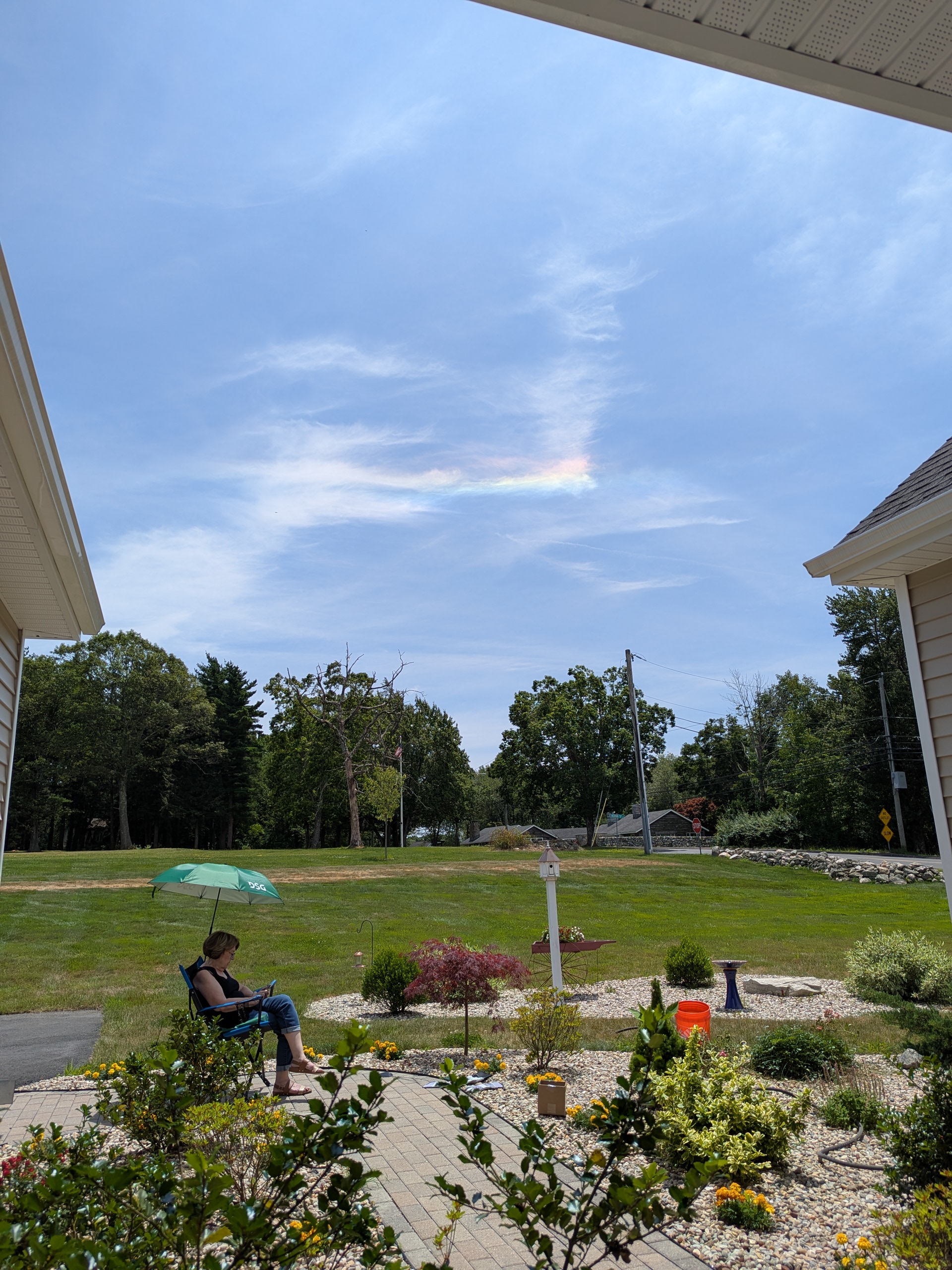
Iridescent cloud formation underway over Burlington CT... PXL_20250705_171709996.RAW-02.ORIGINAL.dng
-
July 2025 Obs/Disco ... possible historic month for heat
FXWX replied to Typhoon Tip's topic in New England
Agree... -
July 2025 Obs/Disco ... possible historic month for heat
FXWX replied to Typhoon Tip's topic in New England
SPC has decided to tease the setup a bit more! -
July 2025 Obs/Disco ... possible historic month for heat
FXWX replied to Typhoon Tip's topic in New England
Nice... -
July 2025 Obs/Disco ... possible historic month for heat
FXWX replied to Typhoon Tip's topic in New England
Looks a bit active! Lol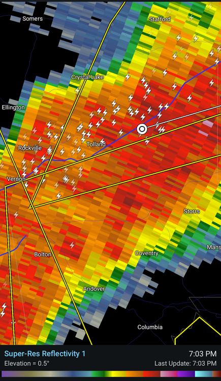
-
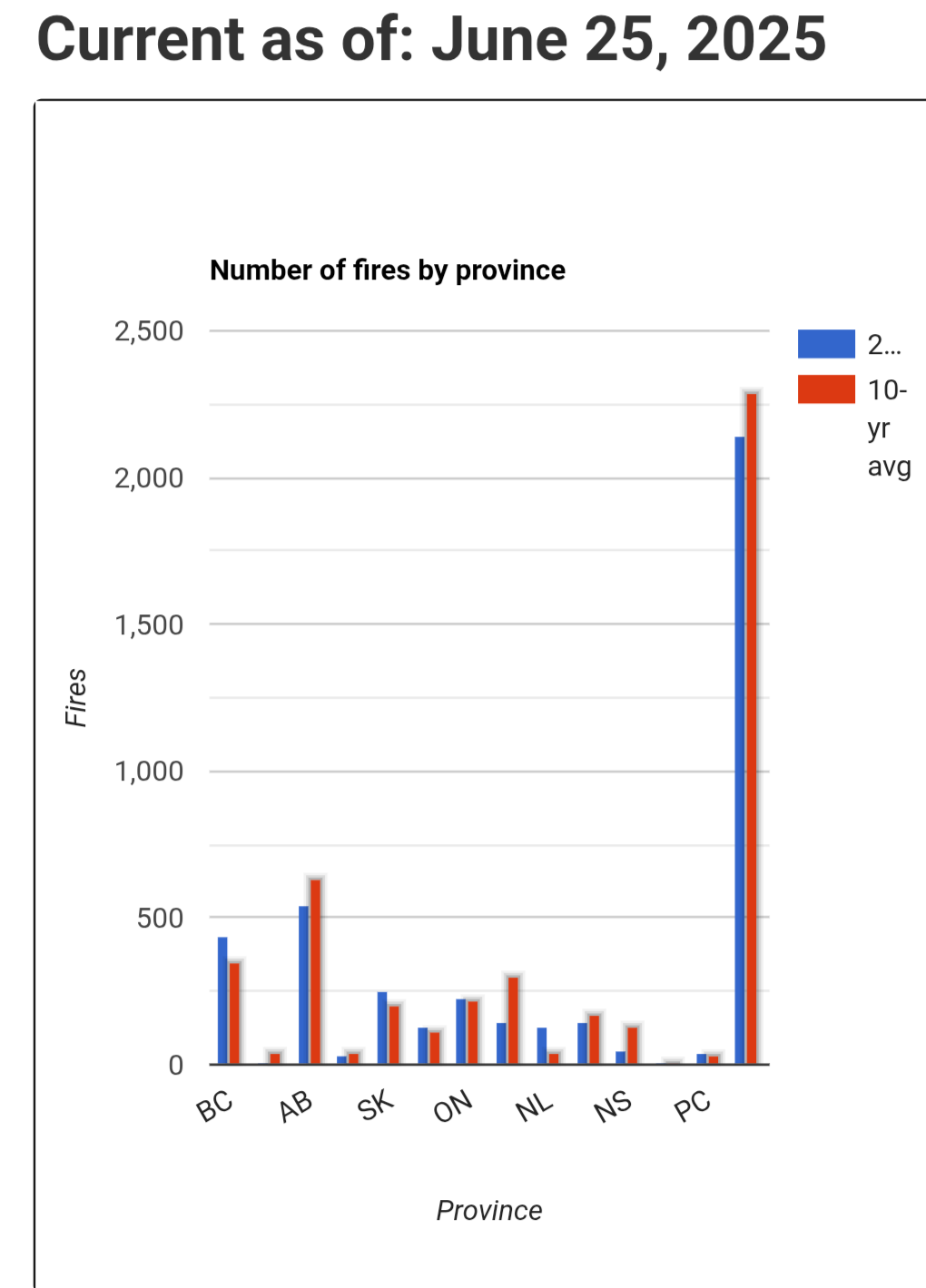
Latest summary indicates several large fires still out of control... Upper level winds have not been favorable from large transport of smoke into the US recently.

-
Lol... Not new but occasionally forget the rules!
-
Cherry picking the 2 am time period?
-
Thanks for the detailed history info... I often incorporate it into short term (24 hr.) storm trends forecasts... Have found its winter precip products quite useful.
-
Would not want to lose the HREF...
-
July 2025 Obs/Disco ... possible historic month for heat
FXWX replied to Typhoon Tip's topic in New England
I for one have grown to have great respect for Tip's ability to decode the long lead tea leaves, when it comes what the tele index trends are implying! His ability to discern heat burst potential is something we should pay attention to? He would be the first to tell you nothing is a lock, but knowing he sees the potential is reason enough pay attention. -
Actually climate summary I saw shows 100. Last 90 was July 2022; I think. Could be wrong