FXWX
-
Posts
1,444 -
Joined
-
Last visited
Content Type
Profiles
Blogs
Forums
American Weather
Media Demo
Store
Gallery
Everything posted by FXWX
-
 I'm at ~1,200 ft in Burlington CT and twice say lightning flashes over Rutland VT... About 135 miles away.
 -
No you're not... definite mid-level rotation
-
Yes!
-
Google New England dark days... Also David Ludlum has a section on dark days in his New England Weather book.
-
That's what I'm thinking!
-
I'll be in the Ogunquit / Wells area... What are you thinking? Might be able to see great light show off to the north?
-
No way! Drought all the time... Lol. There will be folks complaining by Thursday!!!
-
By a matter of only a few miles...
-
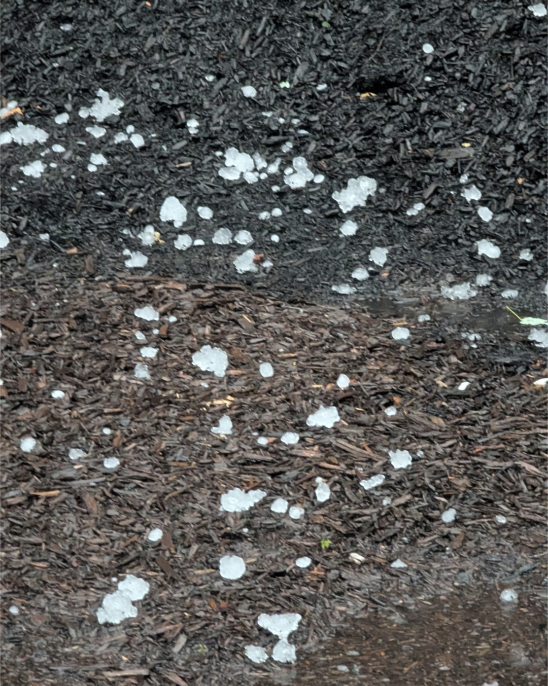
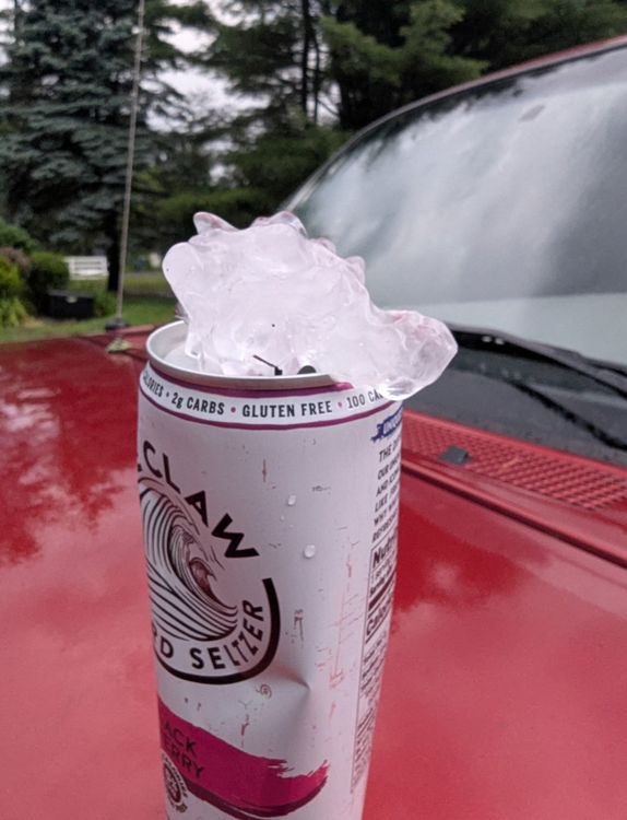
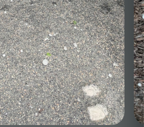
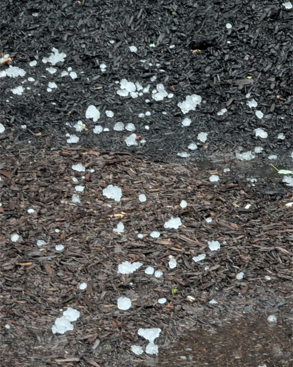
Terryville CT
-
Golf ball sized hail Terryville CT... Numerous trees down in Harwinton, as well parts of Burlington.
-
Here in Burlington CT... 0.75 inch hail; max gust 56 mph...
-
Hey Ryan... If you have a minute text me the link to that product?
-
Lol... I love it John... Spot on!
-
The trailing tor warned cell has a better couplet
-
Agree
-
We've seen this "too much of a good thing" before? Crazy shear values shredding updrafts before they can mature and do any damage. But certainly, an interesting setup with close monitoring needed for fast moving; low-level spin-ups???
-
Some of the best lightning shows I've had have come from nighttime elevated cape events! Not a lot of CGs but lots of CC / CA.
-
It looks like an attempt at some early activity during the 1:30 pm to 3:00 pm period, probably not strong or widespread, followed by a more significant early / mid evening cluster... Lots of folks looking for a perfect forecast from an imperfect science related to thunderstorm initiation & intensity.
-
Yes to all...
-
Monitoring and handling several outdoor high school graduation ceremonies across western CT today; and am wary of my districts near the NY/CT border region... Always a tough call since folks want to know hours in advance whether or not a cell is going to go directly over the event area! Lol. Yesterday we had to send and keep folks in their cards for an extended period until cells cleared the area and lightning was at least 10 miles away... Nerve-wracking as hell... I will monitor your page for any local obs of interest out in that area today... I thought the RRFS did the best job yesterday and is the most bullish again today... not my favorite model, but it appeared to have the best handle on things late yesterday.
-
I saw National Guard tanker trucks racing northward on I-95... They are heading to Tolland to water the lawns..
-
100%...
-
The index was called DAX... Differential Advection Index.
-
Just some added info. Dr. Mel Goldstein (who passed away in 2012?) developed a Severe Weather Index in the 1970's that was used to gauge severe weather potential in SNE. The index ranged from 1 to 5; 1 little or no severe wx potential, 5 was strong potential for tornadoes. He worked closely with region electricity suppliers to gauge the threat for power outages. In his morning update on October 3rd his index came in as 5!!! He issued updates during the day indicating the tornado potential was high, and in fact called the Office of Emergency Management several times about his concern. As a side note, I was living on the western edge of the Farmington Valley then, and observed obvious large scale low-level rotation racing northeast about 10 to 15 minutes prior to touchdown in Windsor Locks.
-
https://x.com/i/status/2061189526874169417