
WxWatcher007
-
Posts
33,181 -
Joined
-
Last visited
Content Type
Profiles
Blogs
Forums
American Weather
Media Demo
Store
Gallery
Everything posted by WxWatcher007
-
7.96 met summer here.
-
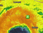
Just so we're all working with the same facts. Not all from Debbie but you get the picture. WPC
-
Bear in mind though that you look to long range heading for landfalling TCs because wobbles are natural. Center fixes from recon will be extremely helpful.
-
There’s no nuance on Twitter (and sometimes here) too. A lot of people think RI means a doom scenario TS to cat 4, but there are plenty of instances like this one where you go from a minimal TS to a higher end one or whatever. We talk about categories and wind, but retirement of this name will hinge on the extent of rainfall along the coast and inland. Hard for a lot of folks to be objective (not throwing shade, it is what it is).
-
It’s pretty unusual. The NHC track tells us where we think this is headed though. I really do think it’s a close call on whether this gets back into the Atlantic long enough and in a structural condition that allows for meaningful reintensification. Where this makes landfall I. Florida probably has downstream impacts for the Carolinas.
-
Love this
-
It looks like it. The organizational trend has been consistent through the day after the earlier dry air intrusion. Still don’t quite have deep convection fully wrapped but that’s probably not as much as an inhibitor as earlier. Meanwhile on the model front the GFS keeps driving this well south of other guidance. Very big spread at a fairly short lead. They’re going in opposite directions lol.
-
It’s incredible how last year my area was nearly ground zero for big rains and this summer rain has evaded my location in seemingly new ways.
-
We need this to gain more latitude if we want anything more (rain wise) than a run of the mill 2-4” January rain event.
-
The banding does look good. I’d just like to see more wrapping around the center. I do think this has a good shot at reaching a two before landfall as well and as folks should remember from Beryl, rapidly intensifying at landfall is nothing to scoff at.
-
Until it can fully close off an eyewall it’ll be susceptible to dry air intrusions and organization happening in fits and starts. Going to take some time. Edit: meanwhile, coastal flooding ongoing
-
For now perhaps. Problem with east ticks of that they could keep going lol.
-
This. Even a substantial portion of its ensembles have disagreed with driving it that far inland. It seems synoptically unlikely.
-
So weird that after taking the other models to the woodshed early the GFS decides to do shrooms halfway through the exam.
-
What a cut off.
-
I’d roll the dice with an icon like track
-
-

2024 Atlantic Hurricane Season
WxWatcher007 replied to Stormchaserchuck1's topic in Tropical Headquarters
That’s the wave? Yikes, that’s robust. We’re not in the basin wide favorable period yet. -
Sorry if I’m late but we have a D3 High risk for excessive rainfall in coastal SC and GA.
-
Even the GFS, which drags Debby over the SE, brings it back over the Gulf, and raises it from the dead to rocket up the coast gives us significant rain in the coming week. The details have varied, but the rain signal has not. This is a prolific hydrological bomb brewing in the Gulf and the multiple troughs this week will wring out as much moisture as the east coast has seen in a while. To say nothing of the actual track. Wind obviously unlikely to be a big issue but I’d watch in case the euro trend toward more of a coastal scrape allows for a more coastal scraper track. Not saying a hurricane is coming LOL.
-
It tried very early this morning and failed, but it looks like it’s getting further along in this attempt. We’ll see if the radar look is reflected in a tighter RMW on the next recon pass. Still a fair amount of work to do on the western and southern side. Hope your area ends up ok. The most consistent signal with this one continues to be rainfall. It seems like the global models get it into the Atlantic even though the longer range tracks diverge. The Euro with a more progressive track (less prone to fully collapsing the steering pattern) keeps it offshore longer before a second landfall. Not only is this important for the longer range track and intensity, but also coastal flooding.
-
It couldn’t get convection upshear so it collapsed on radar, but it does look more organized on the eastern side.
-
Yeah I’m not really sure what to think. The ensembles were split between the op and a more progressive track.
-
Some odd runs tonight. It looks like the GFS loops it back into the Gulf and regenerates its remnants before taking it up the coast. The wildly different solutions don’t create a lot of confidence.
-
The radar and satellite presentation has improved dramatically. Convection trying to wrap into an eyewall now.


