
WxWatcher007
-
Posts
33,154 -
Joined
-
Last visited
Content Type
Profiles
Blogs
Forums
American Weather
Media Demo
Store
Gallery
Everything posted by WxWatcher007
-
Tropical storms being retired is exceptionally rare, but this could qualify given the obscenely destructive nature of its remnants—though it being a post tropical low may hurt its case. Allison 2001 and Erika 2015 are the only two retirements.
-

July 2025 Obs/Disco ... possible historic month for heat
WxWatcher007 replied to Typhoon Tip's topic in New England
I'm not fully sold, but tomorrow does seem like a day to watch in SNE. There could be some localized flash flood risk. Maybe higher end. Here was BOX and WPC this afternoon: BOX Models still indicate favorable ingredients for heavy rainfall. Broad anticylonic flow will advect high PWATs into the region. In some instances values will approach 2.5 inches. Values this high are around +2.5 STD above climatology and are certainly a significant signal for heavy rain. Unsurprisingly model soundings have also hinted at favorable conditions for localized flash flooding. The most notable signals include weak winds through the column, deep warm cloud depths, and tall skinny CAPE profiles. HREF ensembles have started highlighting areas in our CWA with 5-15% probabilites for 6 hour precipitation totals to locally exceeding the 100 year annual return interval. Not every area will see heavy rainfall tomorrow, but any storm that forms in this environment will be capable of producing rainfall rates of 1-2 inches per hour. Communities most at risk include poor drainage and urban areas with little in the way of permeable surfaces. WPC ...Mid-Atlantic and Northeast... Post-tropical cyclone Chantal will be exiting east of Cape Cod to start the period as it continues to get caught up in increasing southwesterlies downstream of a trough approaching from the Great Lakes. This trough will continue to translate eastward through the day, but will be slow to advect due to downstream Bermuda-type ridging. Between these two features, SW flow will remain prevalent over the area, with 850-500mb winds being nearly unidirectional from the W/SW at 15-20 kts. This will result in a continued extremely moist environment with PWs likely eclipsing 2" from eastern VA through southern New England Tuesday afternoon, coincident with a plume of SBCAPE exceeding 2000 J/kg. Into these impressive thermodynamics, a shortwave embedded within the mean flow will traverse northeast ahead of a cold front and along a surface trough, providing additional ascent atop the already impressive convergence on these boundaries. This suggests showers and thunderstorms will become widespread, which is additionally supported by high-res CAM simulated reflectivity. Storms that develop will move very slowly, and Corfidi vectors collapsed to just around 5 kts will support backbuilding and training echoes along the surface trough and front. With warm cloud depths potentially eclipsing 14,000 ft, this will support efficient warm-rain processes and rain rates above 2"/hr at times. Where training occurs, this could result in total rainfall in excess of 3", with instances of flash flooding possible across much of the I-95 corridor from Richmond, VA to Portland, ME, and a slight risk has been added for this area. -
2025 Atlantic Hurricane Season
WxWatcher007 replied to BarryStantonGBP's topic in Tropical Headquarters
And even with such low ACE, the two landfalling systems brought catastrophic impacts to relatively localized areas of the country. -
Barry and Chantal are reminders that under the right conditions tropical systems and their remnants can bring catastrophic impacts.
-
Pretty wet day for the easterners
-
July 2025 Obs/Disco ... possible historic month for heat
WxWatcher007 replied to Typhoon Tip's topic in New England
It seems like the timing is just a bit off too. If the remnants were plowing in a bit later tomorrow to sync with the front we’d really be in business. -
July 2025 Obs/Disco ... possible historic month for heat
WxWatcher007 replied to Typhoon Tip's topic in New England
Maybe there’s a touch of a signal on the high res, but I wonder if it’s underestimated? Although Chantal’s remnants are a shell of what they were in NC, a boundary and tropical remnants are usually a good mix for heavy rains. -
Thank you!
-
So… Yesterday was my birthday, and one of the gifts I found for myself was a magazine that documented the 1938 hurricane here in New England. The destruction is jaw dropping.
-
July 2025 Obs/Disco ... possible historic month for heat
WxWatcher007 replied to Typhoon Tip's topic in New England
Yeah that’s not how tropical works. -
July 2025 Obs/Disco ... possible historic month for heat
WxWatcher007 replied to Typhoon Tip's topic in New England
Wasn’t he the guy who said Michael was really a cat 2? -
July 2025 Obs/Disco ... possible historic month for heat
WxWatcher007 replied to Typhoon Tip's topic in New England
Was at an antique store and hit the jackpot. Found a magazine from 1938 documenting the Great Hurricane. The images are unbelievable. Happy birthday to me!- 985 replies
-
- 17
-

-

-

-

-
Looks too broad based on what we have right now, but they need to sample that north side.
-
Plenty of westerlies and early hints of FL and SFMR over 34kt. Not enough sampling yet to confirm a closed circulation but it’s probably there.
-
Recon descending now
-
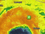
It’s hard to tell via radar but there looks like there’s a fairly well defined low level circulation.
-
After casually watching a window for TC genesis in the Gulf or off the SE coast the last week, the signal began to focus on disturbance spawned by a stalled frontal boundary off the SE coast. A weak area of low pressure has developed and Invest 92L has rising odds to become at least a moisture laden tropical depression as it meanders the next few days. Recon is scheduled to investigate later today. Tropical Weather Outlook NWS National Hurricane Center Miami FL 200 AM EDT Fri Jul 4 2025 For the North Atlantic...Caribbean Sea and the Gulf of America: Near the Southeastern United States (AL92): Satellite wind data indicate that a weak area of low pressure has formed about 100 miles east of Jacksonville, Florida, and is accompanied by disorganized showers and thunderstorms. Environmental conditions are forecast to be marginally conducive for further development, and a tropical or subtropical depression could form near the southeastern United States late today or over the weekend if the low remains offshore. Regardless of development, heavy rainfall is possible across portions of west-central and southwestern Florida through early Saturday, and across coastal sections of the Carolinas beginning later on Saturday. An Air Force Reserve Hurricane Hunter aircraft is scheduled to investigate the system later today. * Formation chance through 48 hours...medium...50 percent. * Formation chance through 7 days...medium...60 percent. $$ Forecaster Blake
-
July 2025 Obs/Disco ... possible historic month for heat
WxWatcher007 replied to Typhoon Tip's topic in New England
Still skeptical of anything meaningful up this way. -
Area of interest right off SE coast now has 60% development odds. Most models are on board with something coming together.
-
July 2025 Obs/Disco ... possible historic month for heat
WxWatcher007 replied to Typhoon Tip's topic in New England
Summah -
July 2025 Obs/Disco ... possible historic month for heat
WxWatcher007 replied to Typhoon Tip's topic in New England
1.25 and counting. Nearby house is over 1.5 -
July 2025 Obs/Disco ... possible historic month for heat
WxWatcher007 replied to Typhoon Tip's topic in New England
Good light show -
91L became a short lived TS, and the signal today has gotten stronger for some type of homebrew development with the lemon. The euro is also keying in on another low possibly forming further off the SE coast after.
-
2025 Atlantic Hurricane Season
WxWatcher007 replied to BarryStantonGBP's topic in Tropical Headquarters
Homebrew area of interest odds up to 30% -
2025 Atlantic Hurricane Season
WxWatcher007 replied to BarryStantonGBP's topic in Tropical Headquarters
I mean recon was in there. It checked all the boxes. It was slop, but def a classic early season short fuse TC.

