hudsonvalley21
-
Posts
4,276 -
Joined
-
Last visited
Content Type
Profiles
Blogs
Forums
American Weather
Media Demo
Store
Gallery
Everything posted by hudsonvalley21
-
remnants of zeta and potential first flakes for some areas
hudsonvalley21 replied to forkyfork's topic in New York City Metro
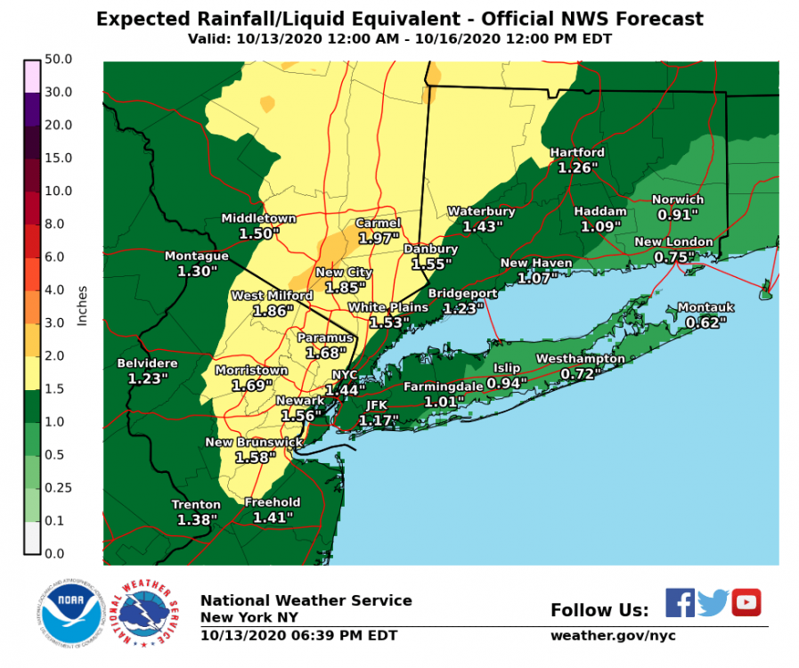
46/46 currently with 1.39 in the bucket so far today. -
remnants of zeta and potential first flakes for some areas
hudsonvalley21 replied to forkyfork's topic in New York City Metro
0.70 here. -
I think the elevation around the peak of storm king is around 1,200’. The hiking trails around black rock are around 800 or so. Still some leaves in the trees around that area. Like gravitylover mentioned you will have too see where the ra/sn line sets up. Elevation will definitely have a factor. Good luck 47 degrees with 0.70 so far in the bucket.
-
0.29 here.
-
Wonder if they will lay down the beet juice
-

-
La la lock it up. Fo sho

-
Great find thanks for sharing Rob!
-
33 for the low here.
-
0.75 here
-
There is a history for those late October nor’easter/tropical systems. Some have performed very well. The battle for the change of the season.
-
Next round
-
Definitely. Hopefully we can keep this pattern going for awhile especially into snow measuring board season.
-
-
0.45 today, event total = 0.73
-
.28 here
-
0.26 in the Davis so far.
-
Yup
-
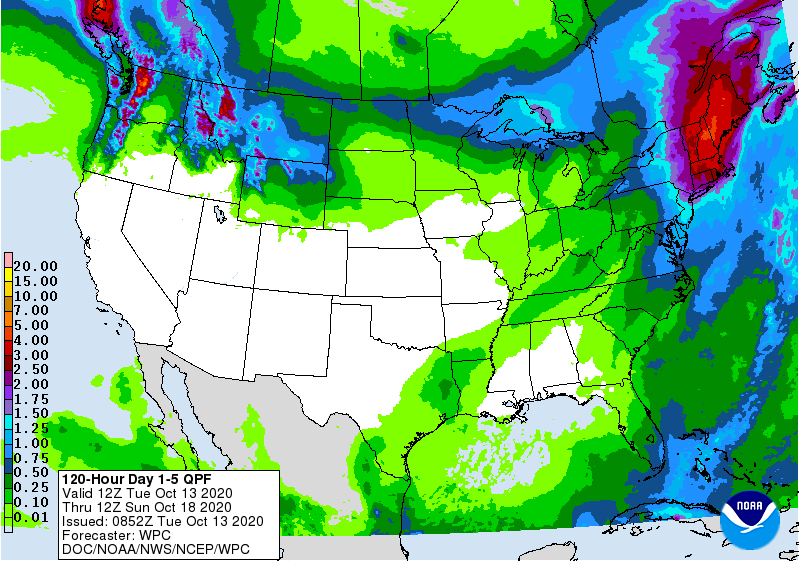
Upton has backed off on the QPF
-
October 2020 General Discussions & Observations Thread
hudsonvalley21 replied to uofmiami's topic in New York City Metro

-
October 2020 General Discussions & Observations Thread
hudsonvalley21 replied to uofmiami's topic in New York City Metro
-
Totally agree, being along the Hudson River at lower elevations is a micro climate. Up on Storm King at 1,000 ft is a totally different world along with going further inland westwards towards Montgomery/Goshen the fall leaf colors are more in swing. Then when the winter type precipitation occurs, the type and accumulations can vary in short distances. It’s very accurate when doing winter forecasts by many they use 84 as a dividing line for precipitation type and accumulations.
-
I was at weeds orchards 3 weeks ago. It was a total madhouse with non local morons walking around and a few walking around with wine bottles and their masks down. Staff was consistently on them. In addition, at the end of the day they were selling their last batch of cider donuts and some rude non mask wearing non local was giving the poor girl behind the counter a hard time because she wanted to buy all of them even with a sign limiting customers to 1 dozen. They made the poor girl cry, I went over to the local police officer that was nearby and sicked his ass on them. It’s not the same that it used to be for all the local farms. So sad.
-
October 2020 temperature forecast contest
hudsonvalley21 replied to Roger Smith's topic in Weather Forecasting and Discussion
DCA _ NYC _ BOS __ ORD _ ATL _ IAH ___ DEN _ PHX _ SEA + 0.6 +1.2 + 0.4 +0.3 +0.3 +0.5 +1.9 + 2.3 +1.7 -
1.85 here.