hudsonvalley21
-
Posts
4,276 -
Joined
-
Last visited
Content Type
Profiles
Blogs
Forums
American Weather
Media Demo
Store
Gallery
Everything posted by hudsonvalley21
-
Have you tried both methods on the same board? 1/2 of the board one method and the other 1/2 the other method? that might be interesting too see the results with different snow ratios and P type changes thru different events.
-
About an 1/3”on grassy surfaces. Temp 35 with light snow.
-
Hi Jay, hope all is well, good to hear from you.
-
Yup the old days, a couple of days out you seen the Northern bump trend. For us folks north of the city it’s the high pressure up in Canada, hopefully it’s not too strong causing suppression and dry air. We’ll see.
-
After the Monday system moves thru there will be a better idea. All about timing and placement. I’d say 00z runs Tuesday will be telling.
-
Totally agree.
-

-
Nice write up Walt. Thanks for you time and effort’s. It will be fun to see how it all evolves! Definitely some interesting time’s a head
- 3,762 replies
-
- 4
-

-

-
- heavy snow
- heavy rain
- (and 3 more)
-
Agree, I would wait till Monday and we see what the first system does over the weekend before pulling the trigger. Some event is looking likely mid-week hesitant to jump on board just yet.
-
We’ll see over the next few days what happens. Tis the season for model runs.
-
From the New England thread
-
December 2020 General Discussions & Observations Thread
hudsonvalley21 replied to bluewave's topic in New York City Metro
Light snow showers for the last couple of hours, no accumulation. -
Low of 24 here at 11pm. Light snow showers currently. No accumulation, just adding to the late fall mood.
-

-
-
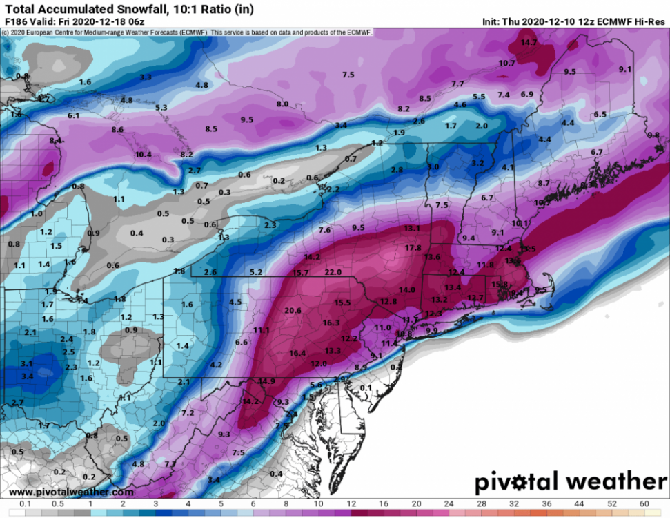
Dec 5/6th major coastal/ west Atlantic cyclogenesis ...?
hudsonvalley21 replied to Typhoon Tip's topic in New England
Weekend rule is there. -
Here too, enjoyed it while mowing the lawn for the last time this season.
-
Not good. The ones that have generators are the lucky ones. Cold there all week.
- 212 replies
-
- 1
-
-
- wind damage
- heavy rain
- (and 1 more)
-
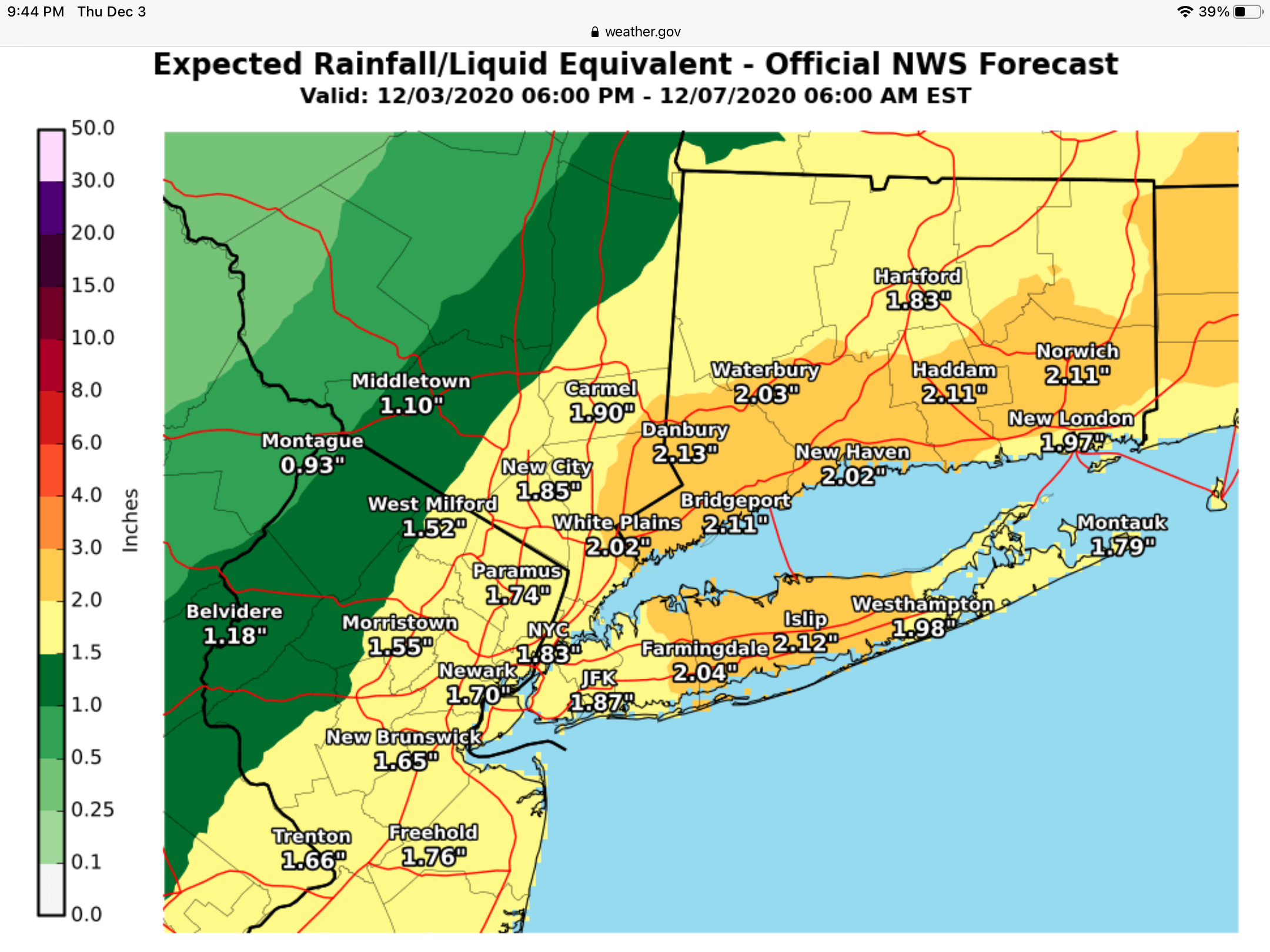
1.63 is the total here.
-
1.04 in the Davis so far today.
-
1.04 in the Davis so far today.
-
DCA: +1.3 NYC: +1.6 BOS: +1.5 ORD: +1.8 ATL: +0.2 IAH: +0.2 DEN: +2.1 PHX: +2.1 SEA: +2.3