hudsonvalley21
-
Posts
4,277 -
Joined
-
Last visited
Content Type
Profiles
Blogs
Forums
American Weather
Media Demo
Store
Gallery
Everything posted by hudsonvalley21
-
5.5” otg. 21/21
-
5.5 otg 21/21
-
You get under a deform band that might overcome that n/e flow. Hope it works out for you.
-
That’s strange. Had very light snow falling here for over an hour now. 19/10
- 1,932 replies
-
- 2
-

-
- heavy snow
- wind damage
- (and 1 more)
-
First flakes now falling. 19/10
-
First flakes now falling. 19/10
-
I’m thinking about clearing about 12 every hours. I will also try to measure some wind sheltered areas after the event ends too see the difference. If we end up with around 20” or so it will be interesting too see the compaction.
-
Hopefully you got it back up and running
-
DCA: +0.3 NYC +1.1 BOS: +0.1 ORD: - 0.3 ATL: - 0.2 IAH: - 0.2 DEN: +1.3 PHX: +1.7 SEA: +0.9
-
In their AFD, They were leaning towards the NAM.
-
I’m sure you have an emergency backup.
-
Agree to the criteria that’s defined below. They could be thinking that the sustainable winds won’t occur for another 24 hours. Blizzard Warning A Blizzard Warning means that the following conditions are occurring or expected within the next 12 to 18 hours. 1) Snow and/or blowing snow reducing visibility to 1/4 mile or less for 3 hours or longer AND 2) Sustained winds of 35 mph or greater or frequent gusts to 35 mph or greater. There is no temperature requirement that must be met to achieve blizzard conditions.
- 2,426 replies
-
- 1
-
-
- heavy snow
- ice pellets
- (and 3 more)
-
Cloud deck lowering, 19/9
-
Interesting, for the few days it was showing rain for next weekend. Oh well, let’s keep it going
-
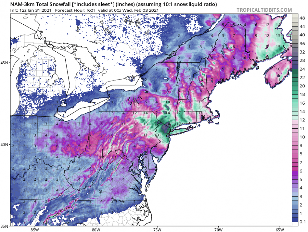
We could have areas with variations of several inches in short travel distances. All depends on those ccb mega bands where they set up too. Would be cool to have some thundersnow too.
-
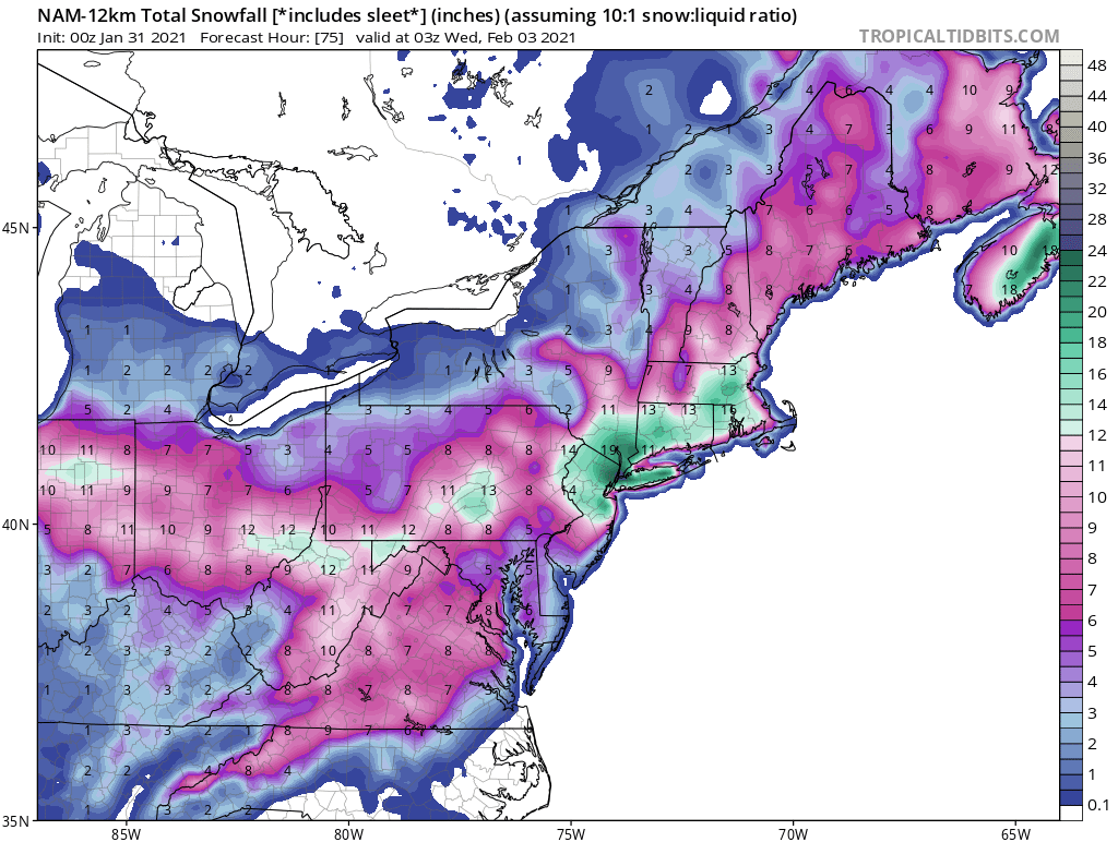
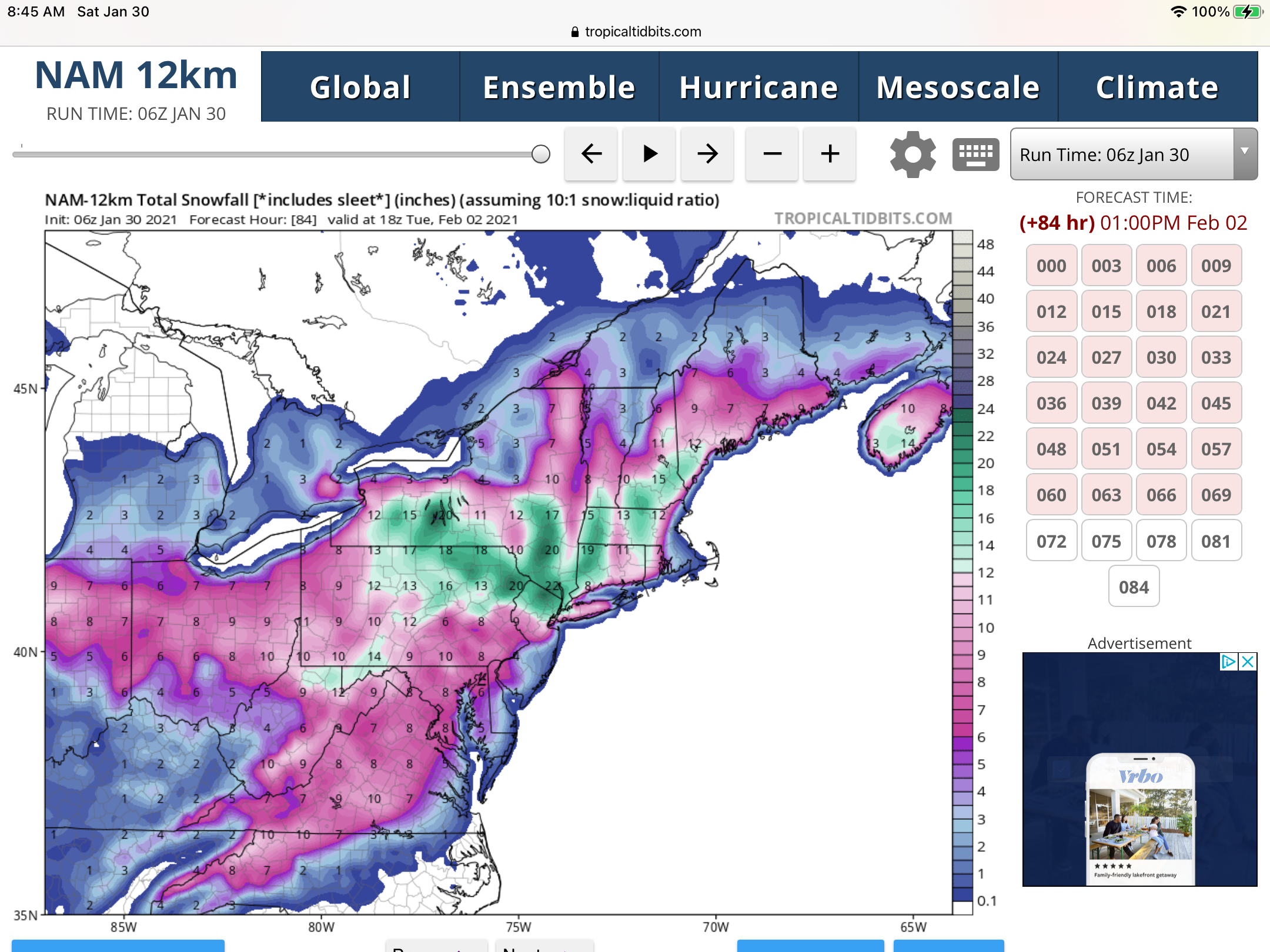
3k NAM is pure porn, well juiced most of the models are a jackpot for our neck of the woods. Hopefully the winds aren’t too high, would cause some incredible drifting.
-
How much for philly Crazy numbers for us folks up this way.
- 2,426 replies
-
- 1
-
-
- heavy snow
- ice pellets
- (and 3 more)
-
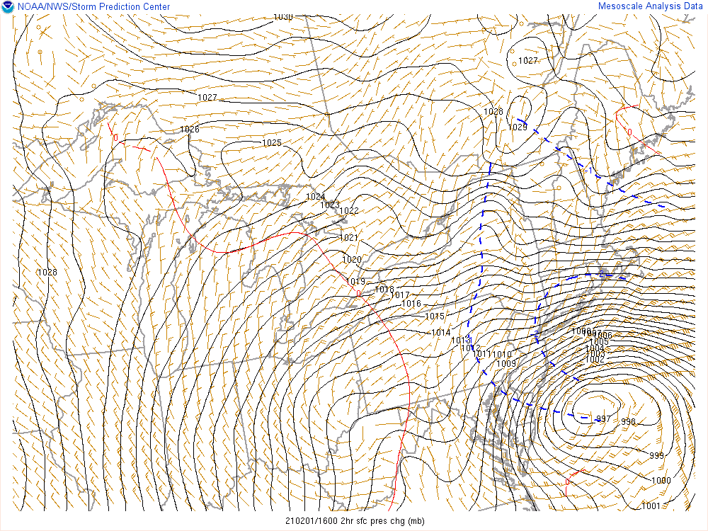
Another thing that could be a factor is what Wdrag mentioned the other day in reference to the above normal SST’s off the NJ/DE coasts.
-
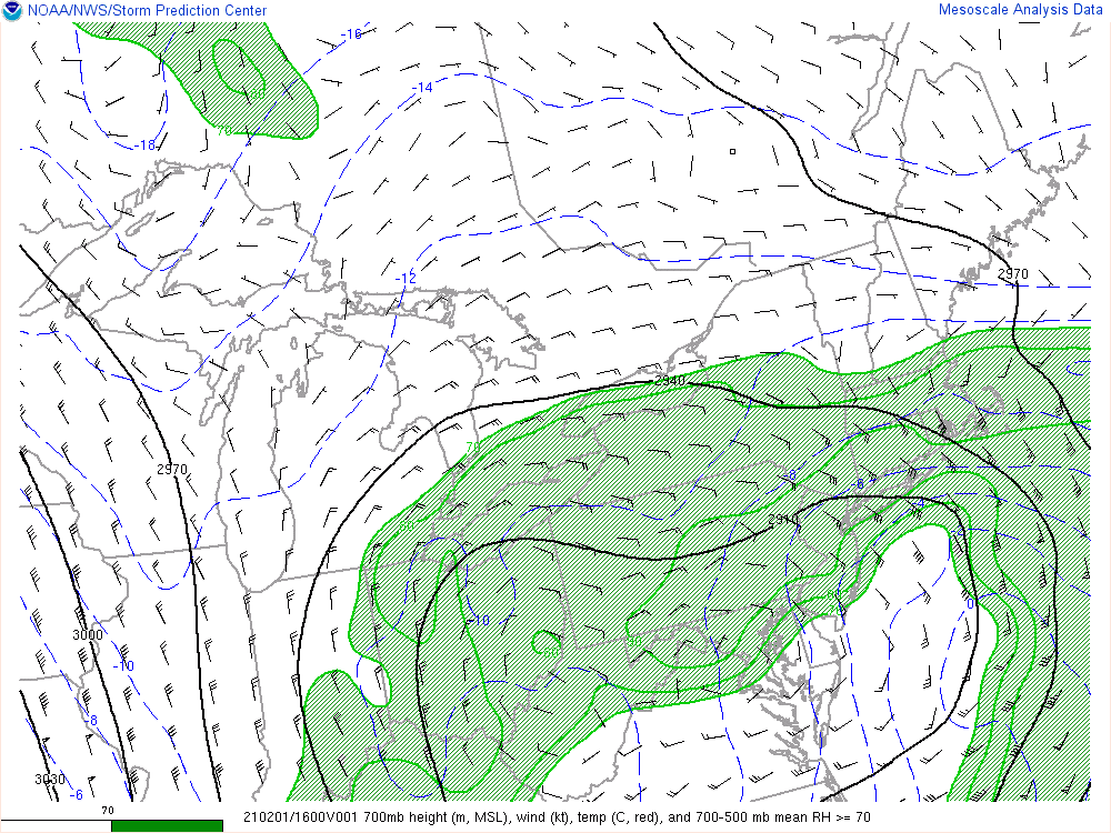
Thru 60 hrs with 24 more to go.
-
I second that
-
You can take this as an Advil

-
Absolutely, and sometimes it comes down to now casting.