-
Posts
4,473 -
Joined
-
Last visited
Content Type
Profiles
Blogs
Forums
American Weather
Media Demo
Store
Gallery
Everything posted by olafminesaw
-
-
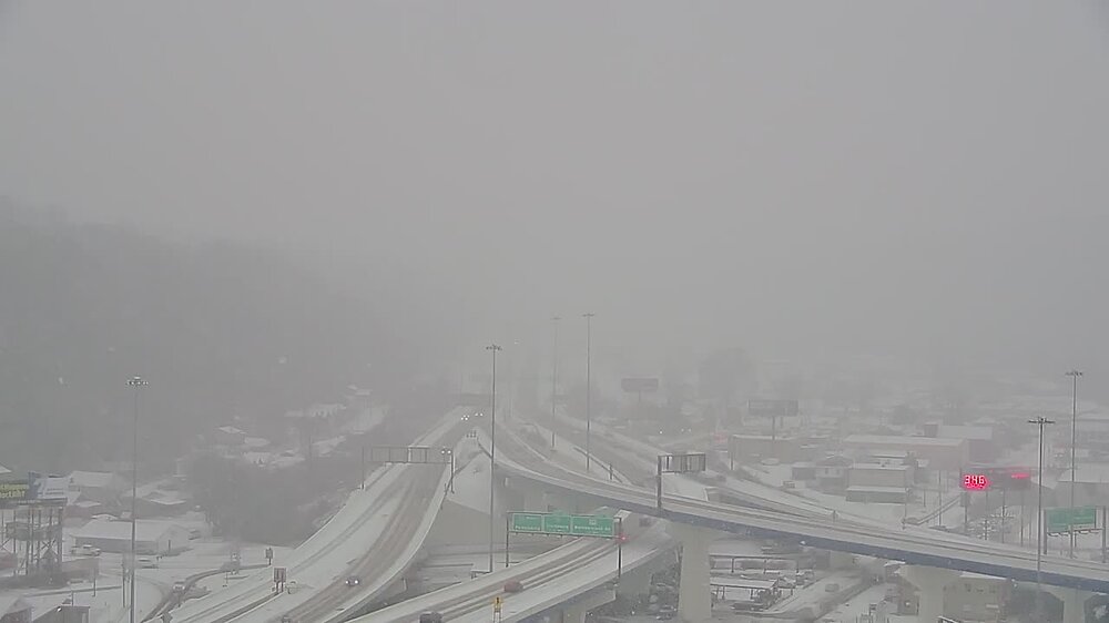
Charleston WV is getting blasted this morning. Too bad all the moisture will be wrung out before getting to us
-
-
-
Just a couple flurries in stokesdale. Doing much in Winston or pretty light?
-
Your frustration is totally justified. A lot easier to be optimistic when we've already scored big time out this way. I have a feeling something funky is going to happen last week of February or first week of March and all here will be off though
-
Some models showing a little burst of snow from the clipper riding the arctic front Friday evening. Something to watch, but not very impactful with surface temps lagging
-
El nino is a bit overrated IMO
-
The remainder of the winter remains long shots, but some of us enjoy tracking. Just a few more spins of the slot machine, hoping for three cherries
-
-
-
Yep, those two max zones have been showing up on a lot of guidance. Feels familiar (although this time the boom zones will be around an inch)
-
Big wedge, sleet to ice to rain potential on this one I fear
-
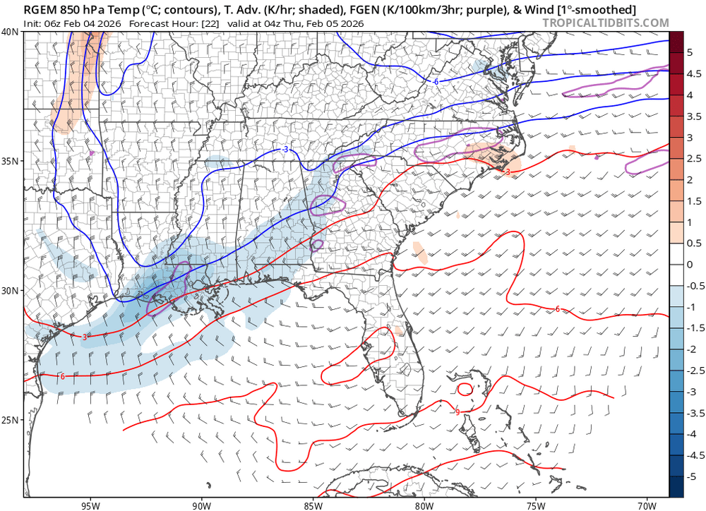
Hires models conceding to King Hires-RGEM and showing very little moisture East of 77
-
We should have known. It can only snow on the weekend
-
-
Wet bulb temp running 4 degrees below forecast at GSO
-
We are relying on lift from the WAA to wring moisture out after the frontal passage. Since our system remains weak, it only will produce light precip
-
N and West of 85 looking pretty dry. My gut is somewhere between Raleigh/Rocky Mount/Greenville will do well as well as the northern foothills. Hires models this morning have trended in that direction as well
-
-
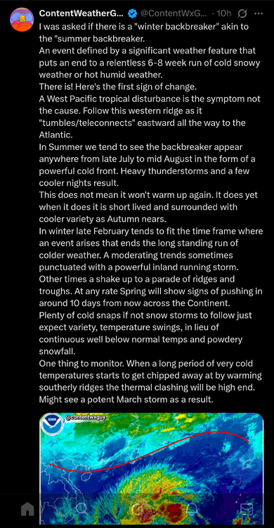
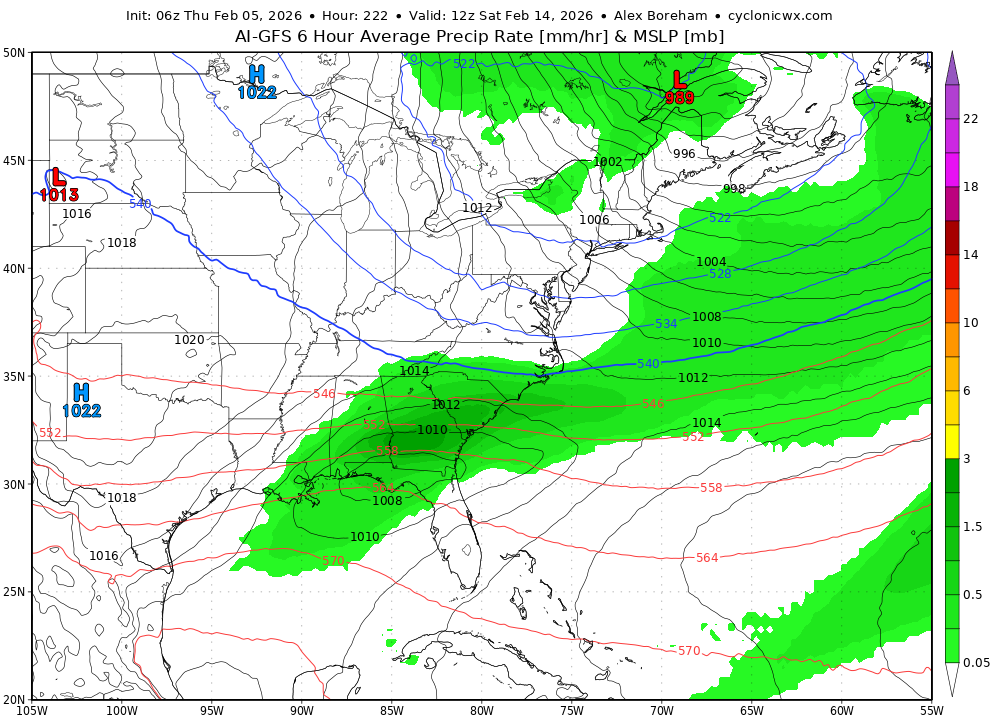
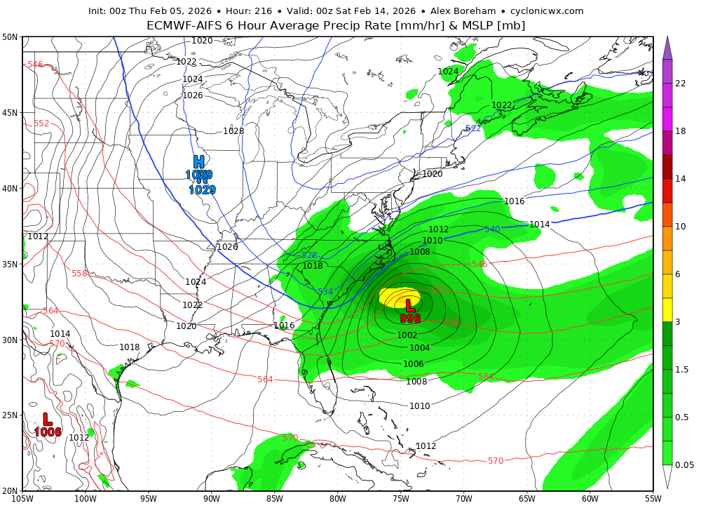
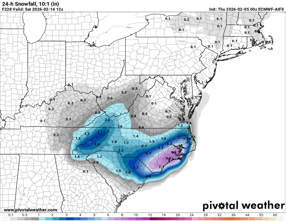
Around Valentine's Day features a cutter on all models. Seems like some potential for CAD/messy ice situation depending on track/ridge placement. Also could feature borderline severe if the low tracks across New England instead of PA
-
The latest GRAF is also super light with precip. I don't think that the triad is going to get more than a dusting, based on the trend on the short range models
-


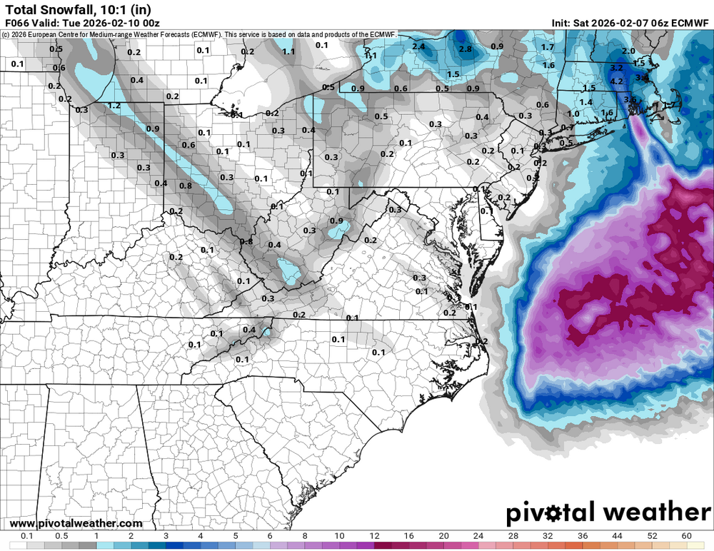
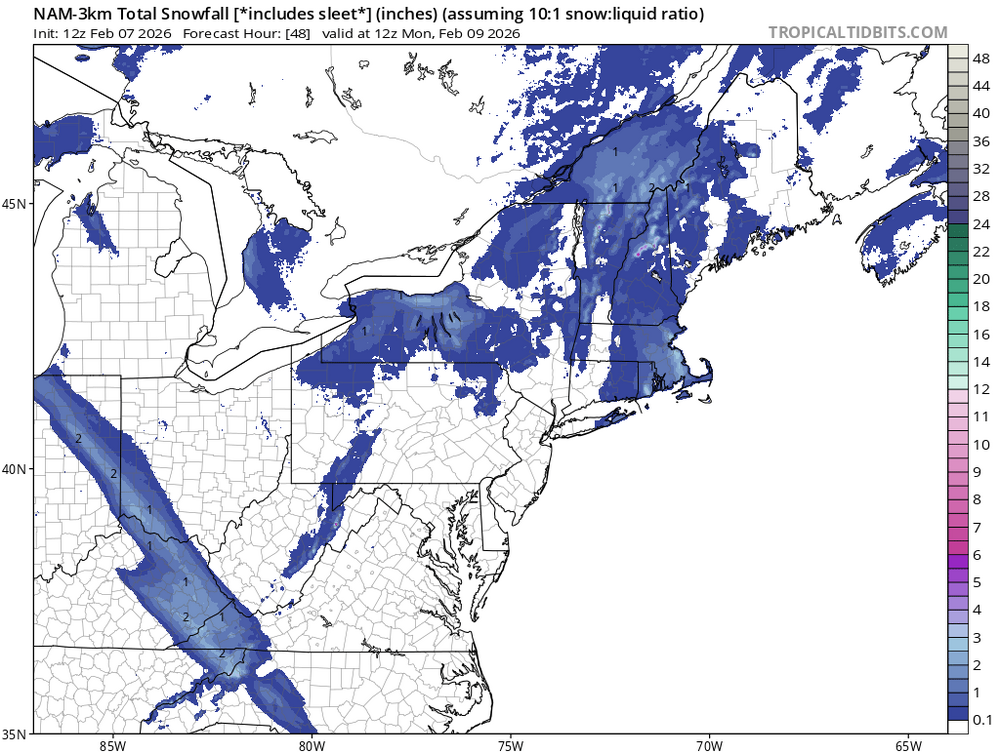
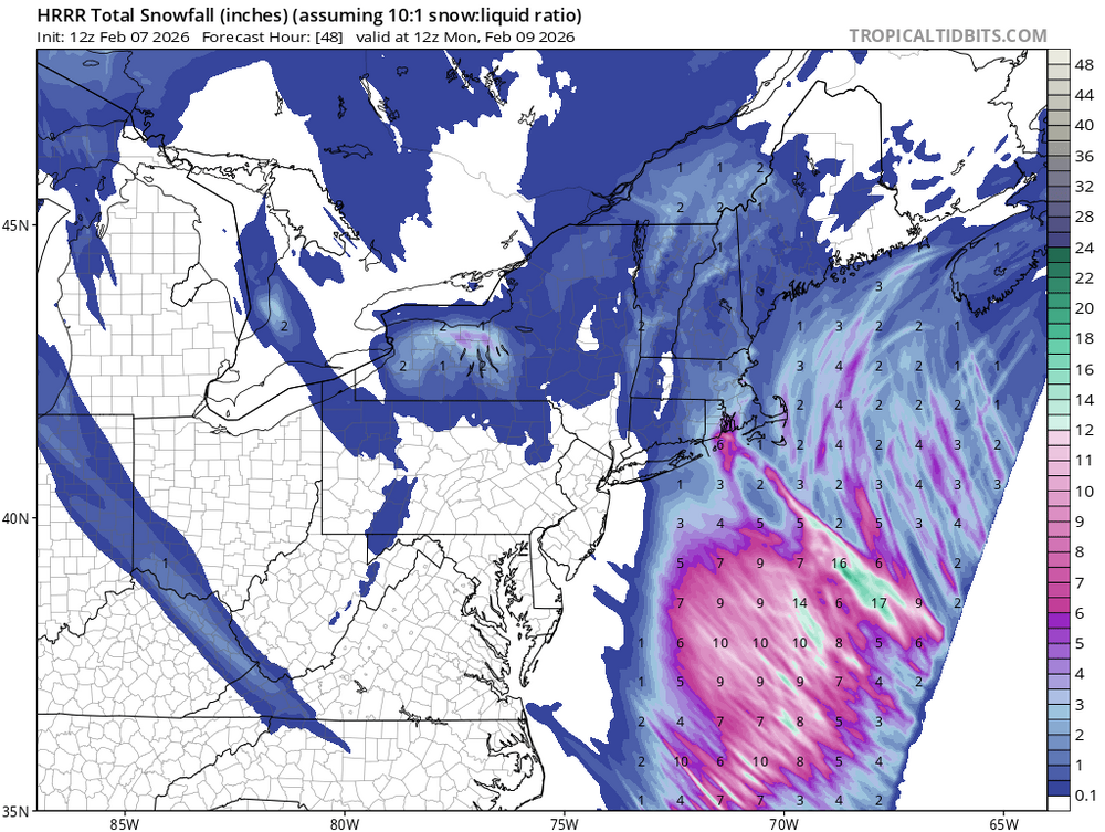

.thumb.png.bb894bfb10e1b6c6a675c615965bf11e.png)


.thumb.png.6a1b7e4bcb7451665576749b6facd02b.png)