olafminesaw
-
Posts
4,602 -
Joined
-
Last visited
Content Type
Profiles
Blogs
Forums
American Weather
Media Demo
Store
Gallery
Everything posted by olafminesaw
-
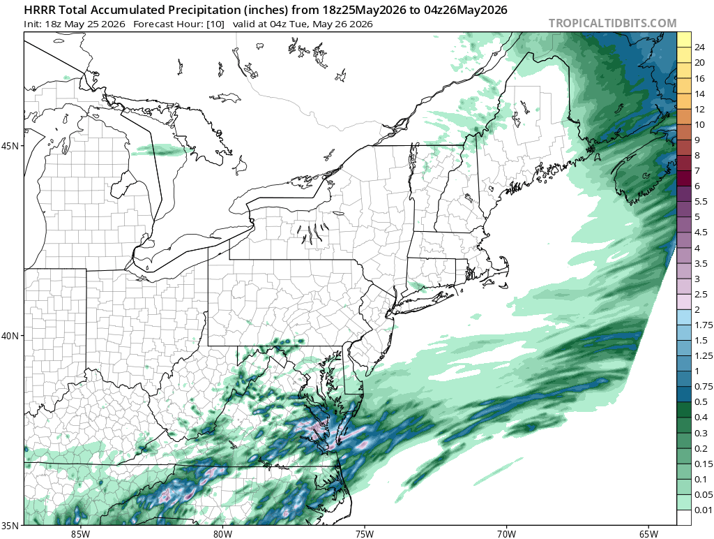
If the HRRR is to be believed the Triad is going to be the big loser today after rain slid to our SE earlier. We did get enough to get the ground wet anyway, but clearing up again for now

-
I think more meaningful rainfall will have to wait until the wedge breaks down Tommorow morning. At least that's what the short range models are showing and I think the wedge is what killed the rain around here
-
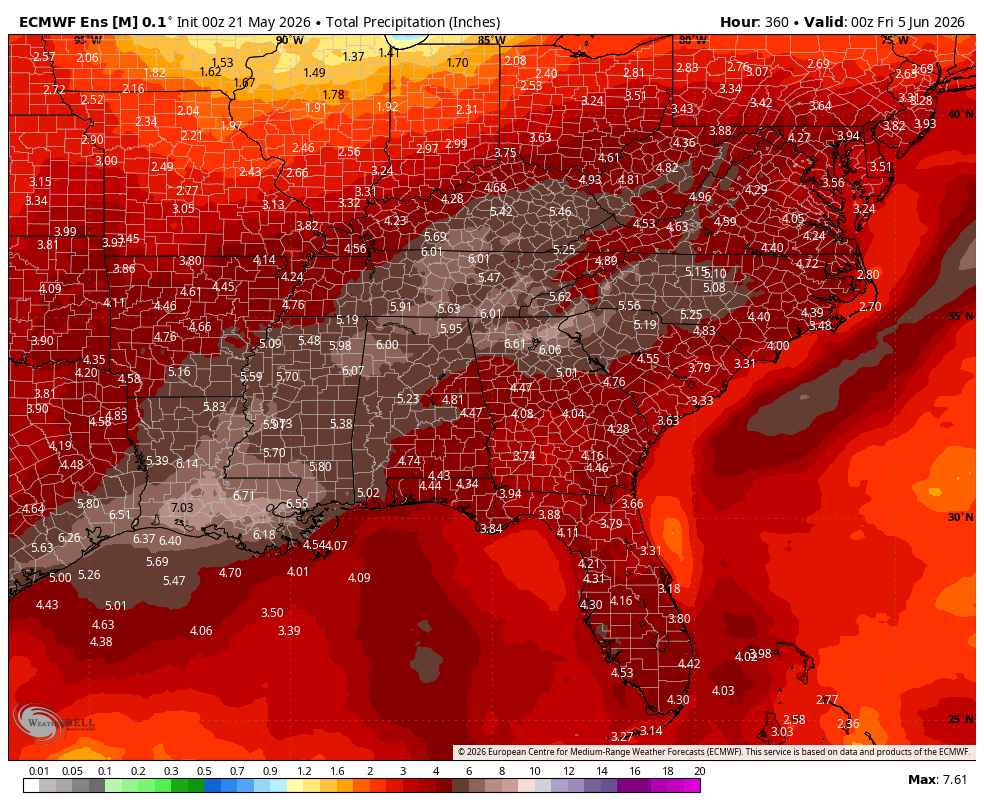
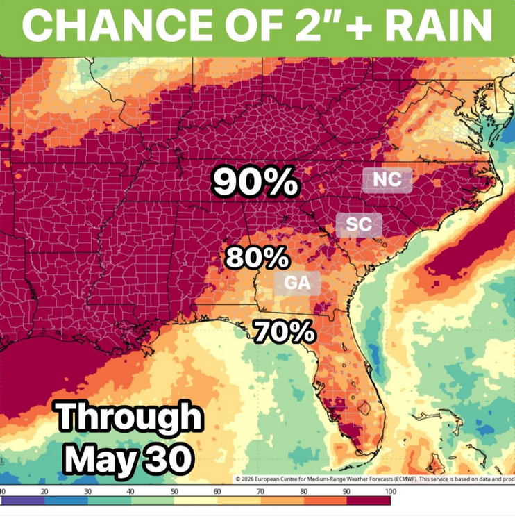
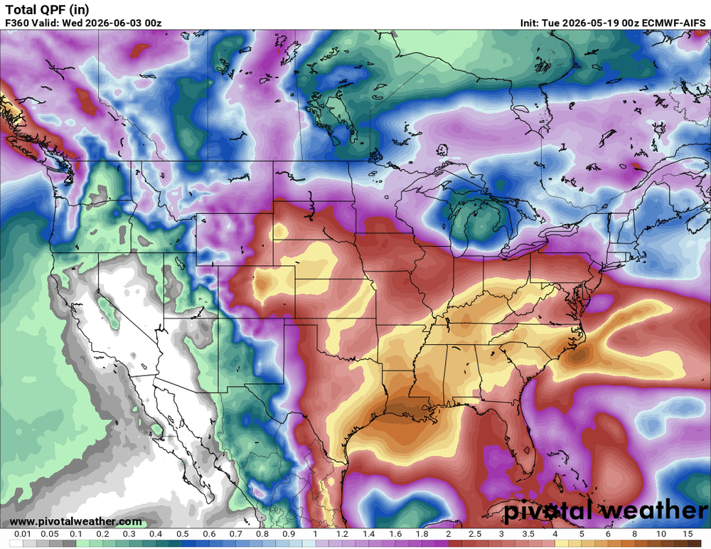
I gotta say, despite the totals being underwhelming so far, this is the kind of rain you want to bust a drought. Spread over multiple days, coming in batches to soak in effectively, drizzle in between the more moderate rain and little sun/cool temperatures to keep any rainfall from evaporating quicky
-
This evening through the middle of next week is when the main slug of moisture should come through for you. This is a marathon not a sprint
-
Pop up storms starting to fire up in the western Piedmont and cumulus clouds building. Cap seems to be breaking down a little ahead of schedule
-
Not sure, but I wouldn't bank on much more than 1:1 ratios
-
-
-
Agreed. The nature of pulse thunderstorms is there will be winners and losers so some of us may need to wait until the weekend/next week to get significant rainfall
-
What a drop in about 6 hours
-
Eps
-
I also saw a tweet that mid/long range forecast accuracy has increased dramatically over the last couple weeks as expected as we begin to move out of meteorological spring.
-
-
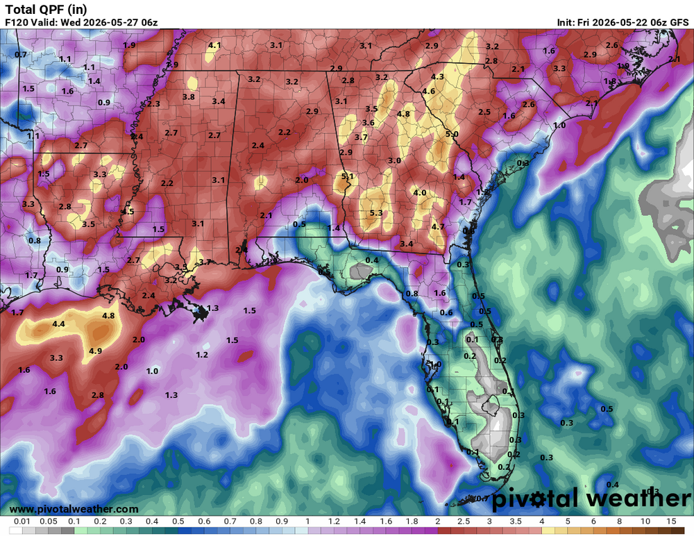
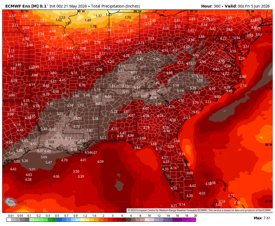
As of now, precip being focused to our west means flooding/flash flooding W of the Apps and just run of the mill above average rainfall with daily storm chances here.
-
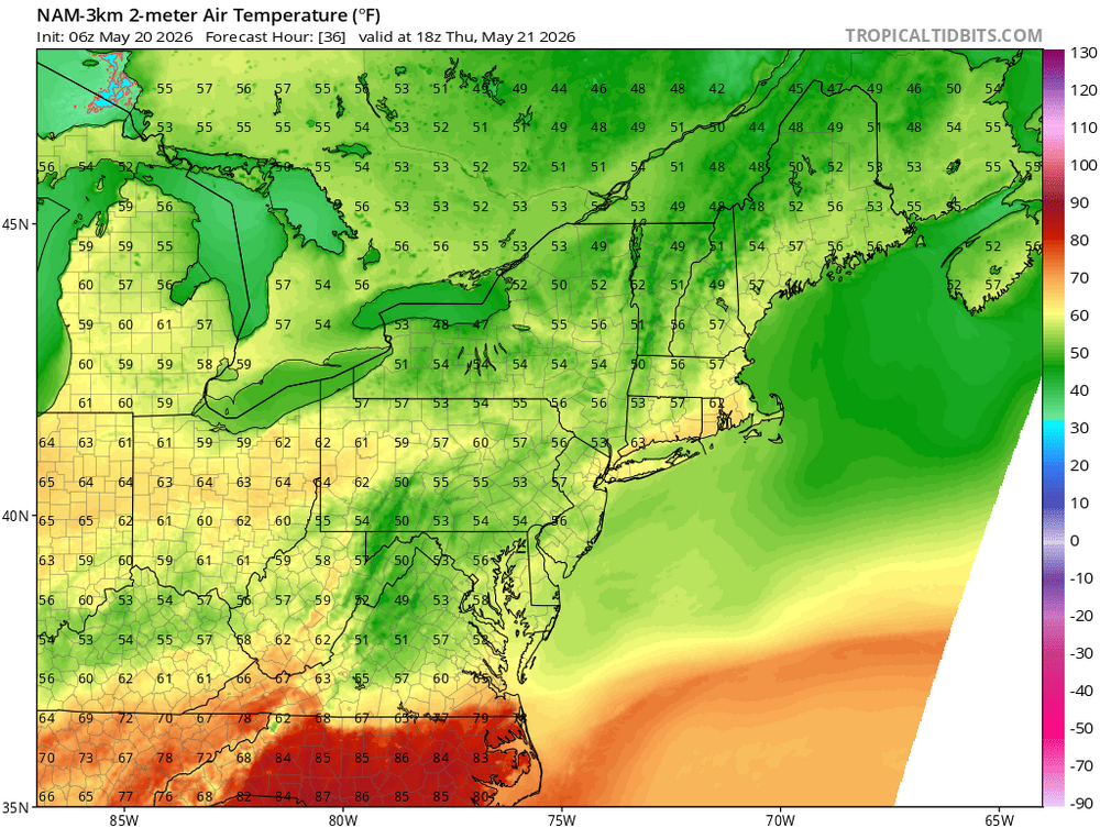
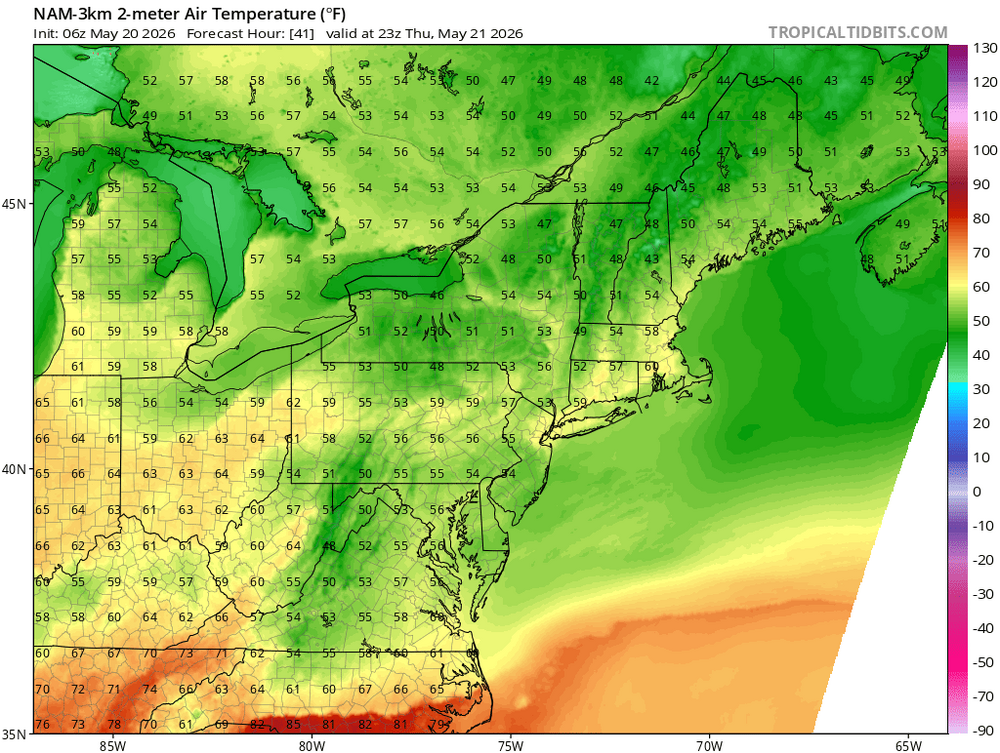
Still no 90 degree high at GSO, just short at 89
-
A sight for sore eyes
-
-
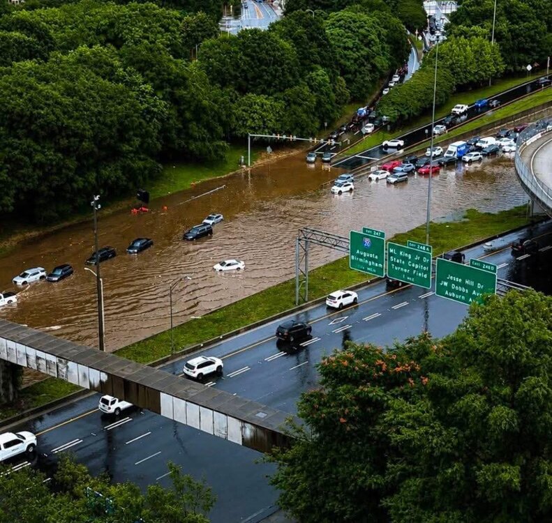
Continues to worsen across the northern Piedmont/ mountains
-
Yeah, not good the next week or so. May be entering a wetter period after that as the ridge breaks down
-
Agreed. Something delicious about short sleeves in the 40s this time of year
-
It has been a good spring for backdoor cold front enthusiasts
-
We are so not back
-
-
A quarter inch of rain never felt so wet.