

olafminesaw
-
Posts
3,754 -
Joined
-
Last visited
Content Type
Profiles
Blogs
Forums
American Weather
Media Demo
Store
Gallery
Everything posted by olafminesaw
-
Precip departures For June: GSO -.25 RAH -.42 FAY -.15 Charlotte +1.39 Greenville +1.88 Asheville +2.16 Wilmington +.67
-
89/73 with not a pop up in sight
-
A bunch of stationary storms parked right over 95, would make for an interesting drive
-
Also this mornings sounding smashed the all time record for ML cape for the 12z soundings data set at GSO: 3,632 vs the old record of 3,588 set in 1983. In fact only four soundings have ever exceeded 3,000
-
Current ML lapse rates at 8+ and ML cape around 4500 near Fayetteville along with a touch of shear. Gotta watch out for popcorn storms with nasty microbursts, especially in the sand hills.
-
Already at 88/73. That Excessive heat warning may be needed after all at this rate
-
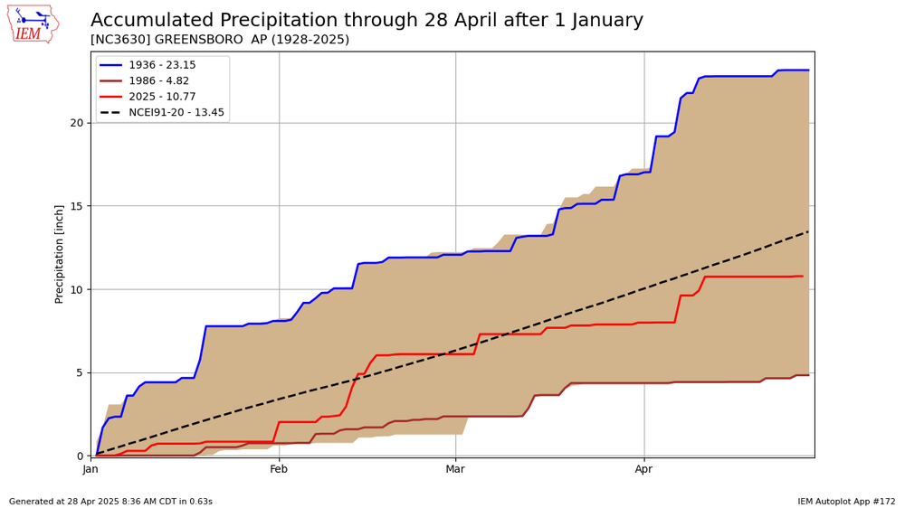
GSO has managed to record at least a trace of precip for the past 15 consecutive days going back to June 5th. Somehow that amounted to a MTD precip anomaly of only +.16, with the highest single day total being .64. Raleigh is at +1.02, Fayetteville +1.04, Asheville +1.28, Charlotte +.86, Danville -.49, Wilmington +.31
-
Likely to be the first major hurricane to make landfall in Mexico in the month of June for either basin. Also an unusual track for the time of year with only handful of hurricanes to ever have made landfall along that stretch of coastline this early.
-
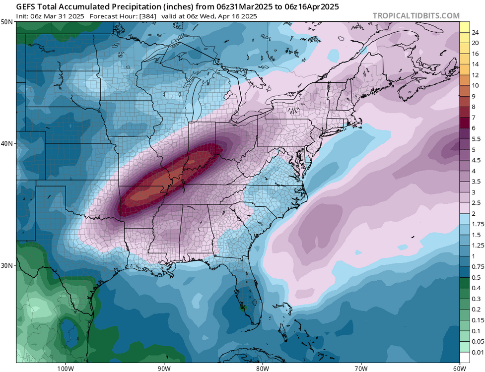
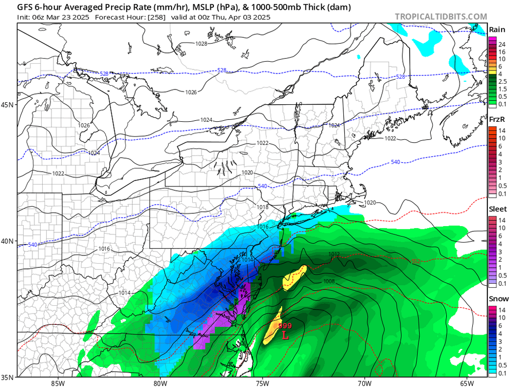
Sounds like Friday could be a decent severe day Mid-Atlantic and Southeast... Pattern amplification will occur Friday as one shortwave trough progresses from the Mid-South to the southeast Atlantic/Mid-Atlantic coast, in advance of another wave digging southward over the Great Lakes. An associated surface cyclone will develop east-northeastward across the Mid-Atlantic late Friday and to the southern New England coast by Saturday morning, while a trailing cold front crosses the Gulf coast, north FL and the southeast Atlantic coast. Within cloud breaks the warm sector will consist of afternoon temperatures near or above 80 F and boundary-layer dewpoints in the 60s, which will drive MLCAPE of 1000-2000+ J/kg and minimal convective inhibition by early-mid afternoon. Increasing midlevel flow with time and forcing for ascent along and just ahead of the front will support storm initiation with the potential for storm clusters and some supercells capable of producing damaging winds, large hail and a few tornadoes. If wave timing and thermodynamic profiles remain favorable, some portion of this area may warrant an upgrade in later updates.
-

May 17th-20th severe weather discussion
olafminesaw replied to Chinook's topic in Central/Western States

-
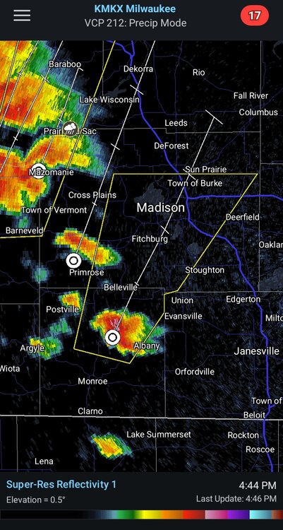
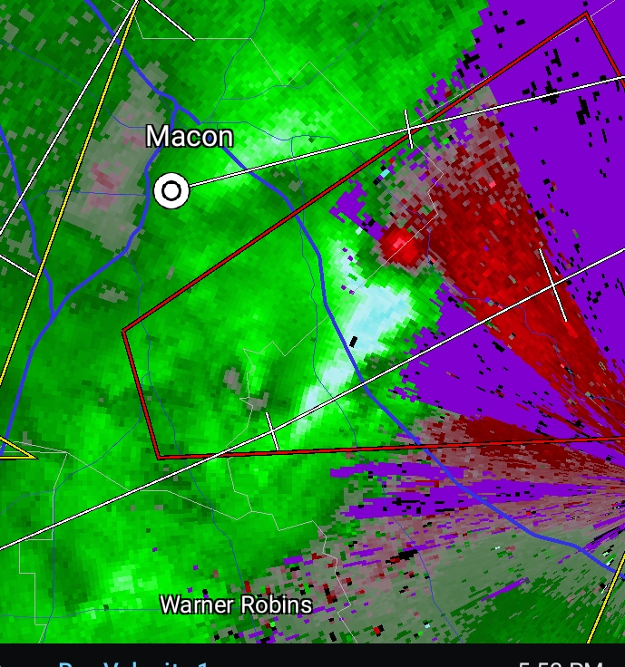
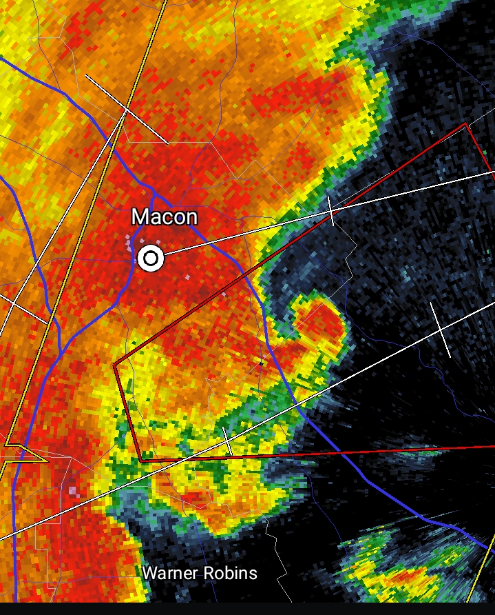
This cell headed towards Madison is trouble
-
Entering the time of year when below average temps are very much welcome. Seems like a cool stretch is likely in about 10 days
-
Classic convergence. It's a good thing that LP has remained pretty weak
-
This year has really been marked by notable dry stretches
-
It's awfully quiet out there!
-
If we don't manage to reach freezing this spring it would tie the earliest lasts freeze on record. Dropping to freezing in this next cold snap would be right around average, so I would say it shouldn't take "Barney" cold to get there. Models sometimes under do cold from radiative cooling, especially for the Sandhills, which typically would come the morning after the coldest day on models.
-
It really busted bad in NC. Just seems like we have less active posters in GA & SC
-
Wow! We have certainly entered the time of year when precip distribution tends to vary considerably across the region. .11 for GSO
-
Precip drying up east of the Apps? Who'd have thunk
-
Do the local stations actually determine that,or do they rely on whatever service they get all their products from? I just noticed a lot of channels across the SE use this designation along with the same graphics, so wasn't sure what all that entails
-
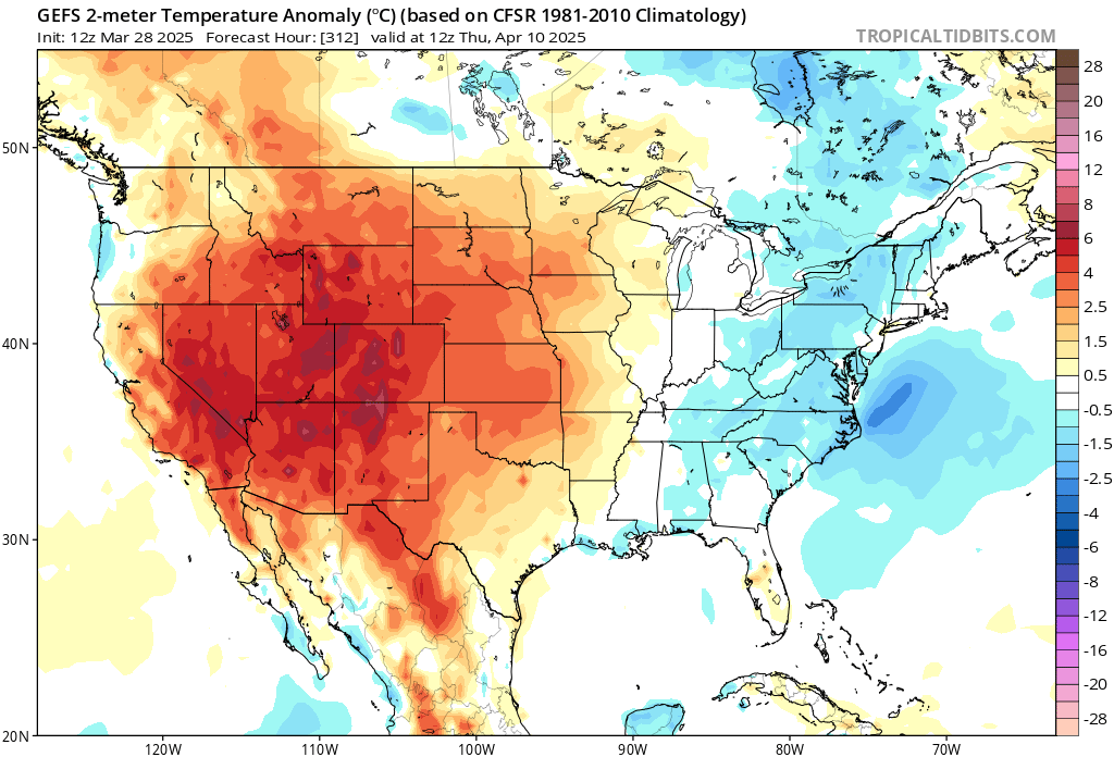
The GEFS is hinting at a cool stretch around that time.

-
I agree! Perfect temps for not having to run the HVAC at all, while also getting to enjoy a nice warm afternoon
-
-
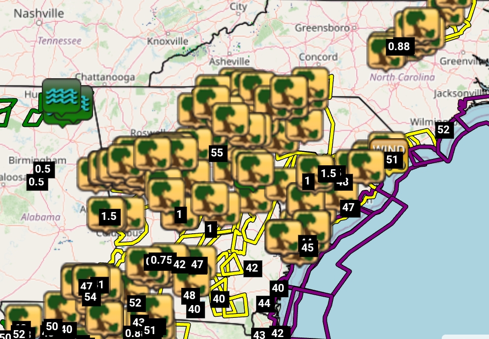
Pretty good verification on this one. Didn't quite reach the magnitude people feared (far from a generational outbreak), but that's a good thing
.thumb.jpeg.572194a3f62a47be6d9a3b7681d0b787.jpeg)


.jpeg.7ca4f43377100c63bb90e2f3d307b5ee.jpeg)