olafminesaw
-
Posts
4,602 -
Joined
-
Last visited
Content Type
Profiles
Blogs
Forums
American Weather
Media Demo
Store
Gallery
Everything posted by olafminesaw
-
Getting nervous because some models showing a cutoff to the NW of the heavier precip as far south as I85. I assume this is the GRAF
-
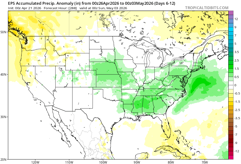
Seems to be good model agreement on a subforum-wide soaking rain
-
May has a non-zero shot at being cooler than April. Can't imagine that happens too often
-
This one maybe is a little more accurate?
-
-
Womp womp
-
Hmmm. What gives them confidence in high winds that far out? Seems odd. Doesn't seem to be a particularly strong storm signal or anything.
-
Lol, are we sure it's not January? A model battle between GFS CMC ICON vs Euro, UKMET, RGEM, north trend south trend disagreement, low tracking of the coast of Florida? But what about sun angle?
-
Not liking the northern cutoff. Often sharper than modeled
-
Still running near record low precip since October
-
-
Thought y'all might get a kick out of this
-
Ensembles people. Also the rainfall potential this weekend was always paltry (few models more than .25), the wetter period starts later next week and has mostly held the course
-
I agree to a point, but it seems likely we will get multiple opportunities over the next two weeks. Sometimes a few .5" rainfalls is better than one big 2" rainfall for busting drought. Hopefully we can stop the bleeding anyway
-
-
Not way out in fantasy range anymore

-
-
Last few runs of the Euro AI have just been comical
-
Euro vs EL nino climo. I think slightly below normal starting in May is a good bet. Which honestly isn't the worst outcome to keep the drought from accelerating.
-
-
More like :
-
King Euro AI would have to agree
-
Ties the all time DSCI record for the SE region previously set 12-18-2007
-
How many inches in my back yard?
-