olafminesaw
-
Posts
4,571 -
Joined
-
Last visited
Content Type
Profiles
Blogs
Forums
American Weather
Media Demo
Store
Gallery
Everything posted by olafminesaw
-
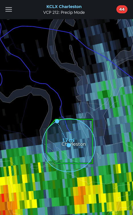
It's the world's smallest flash flood warning
-
About three more weeks until we start the slow descent towards fall
-
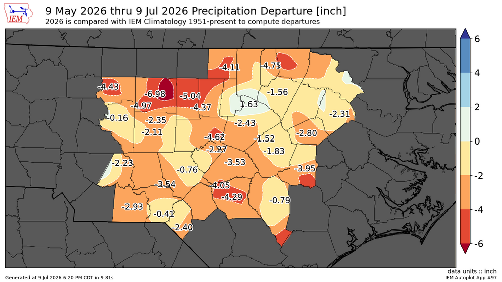
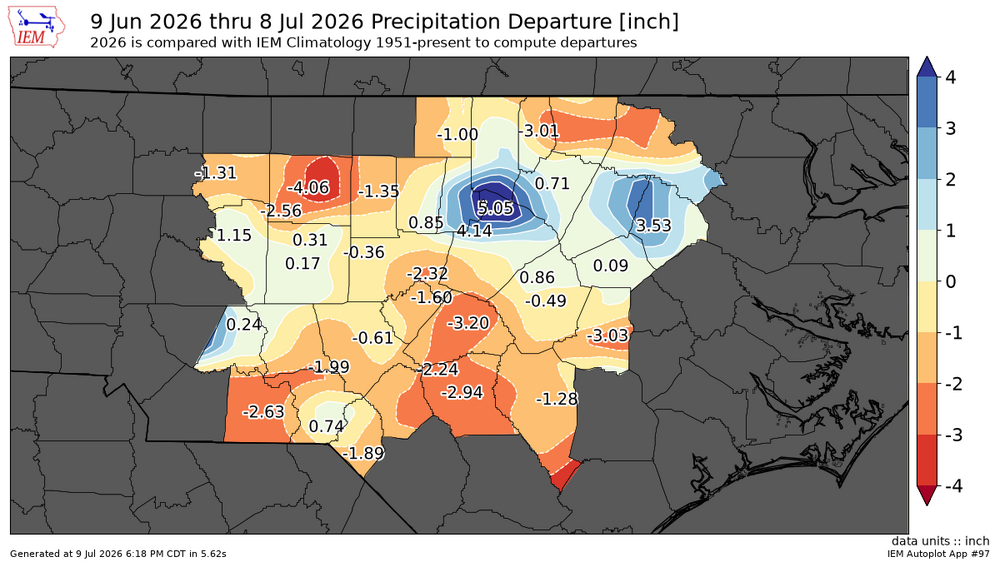
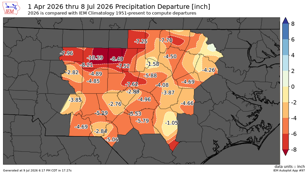
30 60 days and since April 1st departures
-
While we enjoy temps in the low to mid 80s this weekend (albeit still a bit sticky), the West bakes with temps as high as 110 at lower elevations and all time records possibly broken
-
A New Orleans special
-
-
Feels like El nino has finally forced the pattern change, storms developing nicely again today. Going to have to mow the lawn for the third time this summer
-
Today is again looking promising for downpours across the area
-
Also should start to see some cumulus start to form in the next couple hours. Already popcorn storms over the higher elevations
-
Round 2 in 10 days?

-
-
The DC swamp ends it's influence at the Triangle I guess.
-
Yeah, it's really strange, because you would expect downsloping to produce lower DPs in the western Piedmont not higher
.thumb.png.b822878da2da249afac8b29cfd045e25.png)
-
This may well be the hottest day of the heat wave by heat index, Dewpoints holding in the low 70s and heat index climbing into the mid 90s
-
Philly seems to be ground zero. Tommorow 104 with Dewpoints in the high 60s/low 70s, heat index near 115
-
In some ways the NE does heat better than us. Greensboro has reached 100 only in 5 of the last 50 summers (12 days total). Boston has hit 100 in 9 of those years (9 days total)
-
Yes, definitely accurate for that particular strip of concrete
-
I've noticed RAH does a poor job of picking up on the warm bias the GFS and Euro have. Always seem to be a few degrees warm
-
Maybe they went after Americanwx too

-
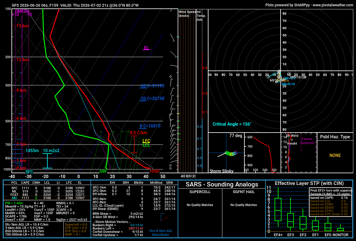
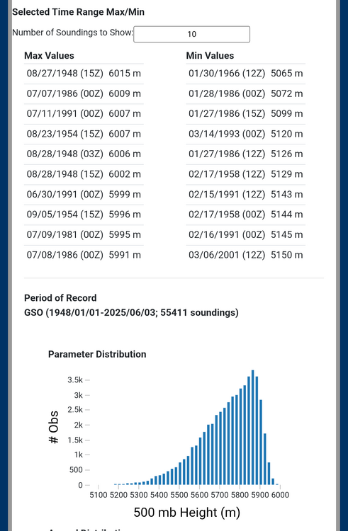
Looks like Top ten. Here's the data https://www.spc.noaa.gov/exper/soundingclimov2/
-
Yeah it seemed to be working somewhat better before mid-morning but now it's as bad as ever
-
Temps busting big time for those near/under the slow moving showers
.thumb.png.265748db7ba99c5c87e3f4e045427cf1.png)
-
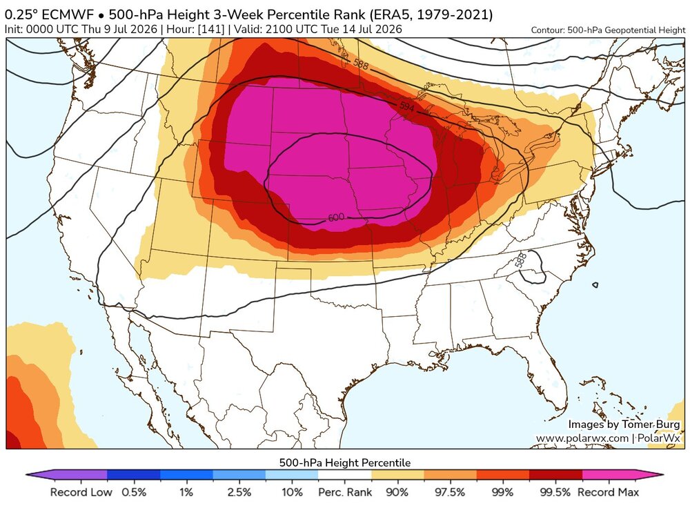
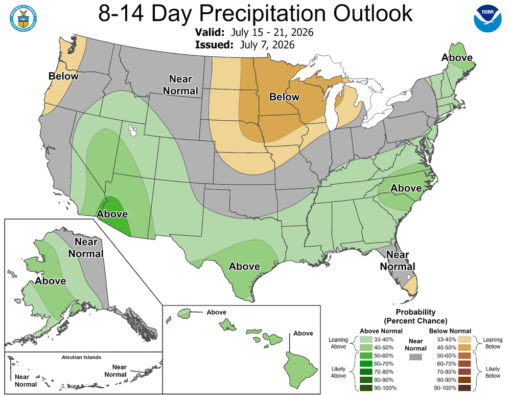
This is why the drought monitor did not show improvement. There were some improvement to short term drought (shallow soil moisture, levels of small creeks etc.), but long term drought has no meaningful dent made and the heat/moderate humidity will only worsen water levels over at least the next couple weeks
-
More of a (relatively) dry heat/strong cap to prevent convective complexes.


.png.96974298f8ec1a279f53f6b2cdbe468e.png)


.png.b1b3f604df0fc9f676793872cb8fae11.png)