-
Posts
4,019 -
Joined
-
Last visited
Content Type
Profiles
Blogs
Forums
American Weather
Media Demo
Store
Gallery
Everything posted by olafminesaw
-
The 12z OP was an amplified outlier to it's ensemble to some degree, so it makes sense that the op and mean split the difference and became aligned at 18z
-
-
At 84 the RGEM looks good with respect to the trough orientation, but again, not quite in range
-
Third the of weather club: toss the 84 hour NAM in the garbage and wait for the RGEM to run
-
I thought more in line with the Euro than the GFS, but somewhere in between. Not worth dissecting the 84 hr NAM though
-
FWIW the Euro AI looked better than the OP at 500 mb, while the GFS AI generally supports the OP GFS
-
Ironically, unless all other models fold to the GFS, warm air aloft could be the savior of many with this system
-
Looks like 10-15% support the GFS
-
-
Not a disaster but not a step towards the GFS either.
-
Yeah, some big differences in surface low location to resolve. Unclear if along 85 or the coastal plain will be the spot to be just yet
-
As does the HRRR. As with the Sunday event, jet stream dynamics coming into play, often only gets picked up by short range models. Not saying something will happen on Thursday, but just something to keep an eye on
-
Being near the left entrance region of the jet streak is favorable for us, and I would not be surprised to see some good trends at the surface as we get closer
-
To be pedantic, it's not really overrunning since there's no warm air advection and no warm air aloft. The northern stream is squashing any warm air from the gulf but also squashing moisture
-
And some of it's timing, further west means slower means more spacing between the waves and more ability to develop and for the trough to tilt negative
-
Right, I'm thinking minor threats and then as the cold eventually collapses an overrunning threat. Not super optimistic on Sunday for anything significant with the way the first system trended.
-
My main takeaway from the Euro is it does little to add clarity to the Sunday storm. It, the GFS and the UKMET all look way different from each other. Again, once we get to around mid-week we should get a clearer picture with all the energy flying around
-
I think we need to resolve this cluster-**** before we can even begin to resolve the evolution of our potential Sunday system
-
A step backwards with a weaker wave though. It looks nice at the surface anyway
-
Model spread six days out is pretty wild. Basically there's two camps, energy breaks free from primarily trough (GFS, ICON, UKMET) and everything else that keeps the upper level energy consolidated to our North
-
A really fascinating ULL evolution. Energy diving over the plains, stalls out and stretches, lobe breaks off and dives south. Not something you see too often. The fast flow and dominant Northern stream limits the ceiling on this event, but if everything goes just right it's a good set up for the best kind of storm: cold temps, heavy snow
-
The Euro had the same general idea, just didn't quite get it done with the phasing
-
A word of caution: I've noticed over the years the GFS has a tendency to over amplify the back side of late phasing storms for the Piedmont. This feels to me like more of a coastal VA threat, although we normally don't get the trough to dig down to the Gulf Coast in these scenarios, so that helps
-
Yeah, basically the more the trough digs on the first storm the more it sets up the second storm to take a favorable southerly track. For once I'm not overly concerned about suppression after the cold air is established
-
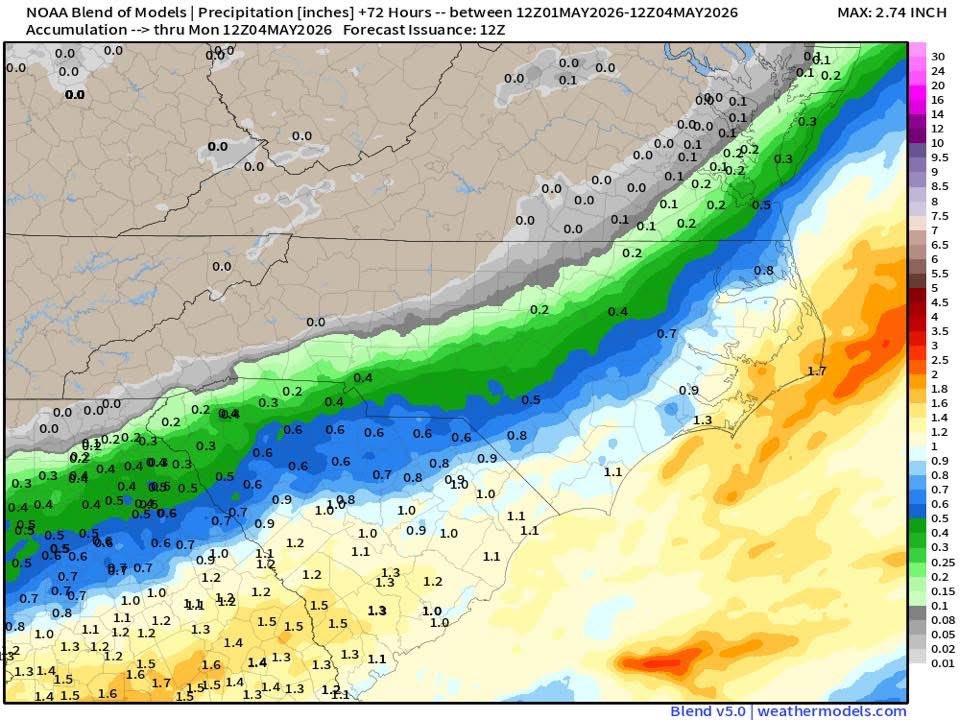
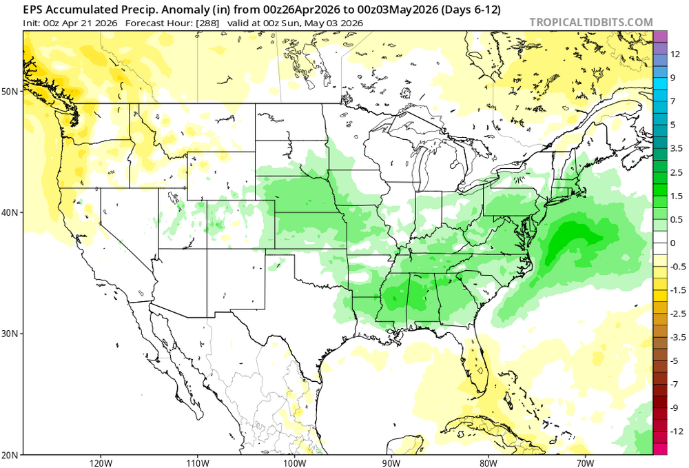
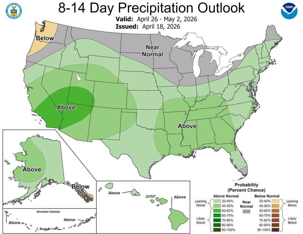
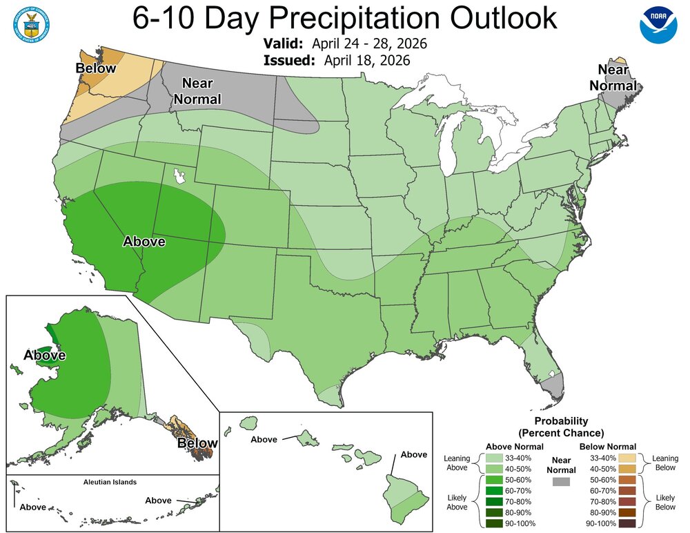
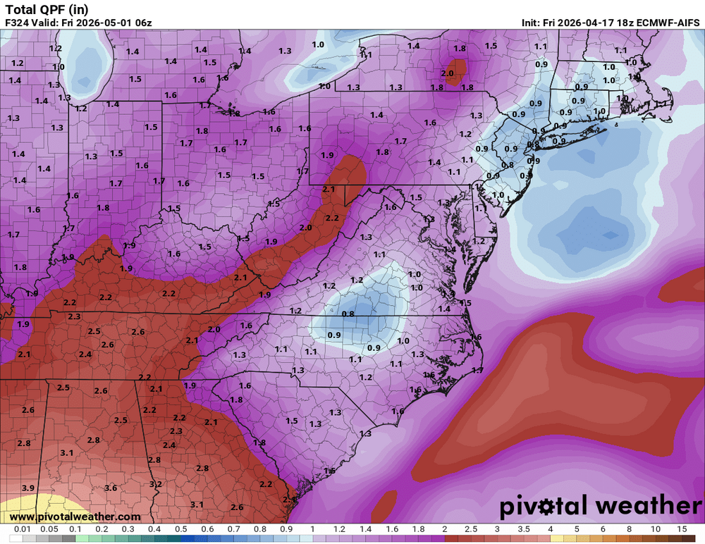
DESI has a phenomenal dashboard that allows you to generate custom graphs and maps for models, including using the national blend of models(below), AI models etc.