David-LI
-
Posts
1,439 -
Joined
-
Last visited
Content Type
Profiles
Blogs
Forums
American Weather
Media Demo
Store
Gallery
Everything posted by David-LI
-

Two Mdt to high impact events NYC subforum; wknd Jan 6-7 Incl OBS, and mid week Jan 9-10 (incl OBS). Total water equiv by 00z/11 general 2", possibly 6" includes snow-ice mainly interior. RVR flood potential increases Jan 10 and beyond. Damaging wind.
David-LI replied to wdrag's topic in New York City Metro
Hoping we get NAM'D soon!- 3,610 replies
-
- 2
-

-
- snow
- heavy rain
- (and 5 more)
-
Two Mdt to high impact events NYC subforum; wknd Jan 6-7 Incl OBS, and mid week Jan 9-10 (incl OBS). Total water equiv by 00z/11 general 2", possibly 6" includes snow-ice mainly interior. RVR flood potential increases Jan 10 and beyond. Damaging wind.
David-LI replied to wdrag's topic in New York City Metro
February 2013. rain and drizzle for hours before the big show- 3,610 replies
-
- 2
-

-
- snow
- heavy rain
- (and 5 more)
-
Two Mdt to high impact events NYC subforum; wknd Jan 6-7 Incl OBS, and mid week Jan 9-10 (incl OBS). Total water equiv by 00z/11 general 2", possibly 6" includes snow-ice mainly interior. RVR flood potential increases Jan 10 and beyond. Damaging wind.
David-LI replied to wdrag's topic in New York City Metro
Yes, NYC never saw a storm start as pouring rain and warm then switch to snow in the end. /s- 3,610 replies
-
- 1
-
-
- snow
- heavy rain
- (and 5 more)
-
Two Mdt to high impact events NYC subforum; wknd Jan 6-7 Incl OBS, and mid week Jan 9-10 (incl OBS). Total water equiv by 00z/11 general 2", possibly 6" includes snow-ice mainly interior. RVR flood potential increases Jan 10 and beyond. Damaging wind.
David-LI replied to wdrag's topic in New York City Metro
Enlighten us why CMC is right and GFS wrong?- 3,610 replies
-
- 3
-
-
- snow
- heavy rain
- (and 5 more)
-
Two Mdt to high impact events NYC subforum; wknd Jan 6-7 Incl OBS, and mid week Jan 9-10 (incl OBS). Total water equiv by 00z/11 general 2", possibly 6" includes snow-ice mainly interior. RVR flood potential increases Jan 10 and beyond. Damaging wind.
David-LI replied to wdrag's topic in New York City Metro
GFS with stronger system and more backend snow for city metro -
When was the last date that NYC metro area saw more than 2 inches of snow?
-
Wait a second, it has been two years since NYC saw more than 1 inch of snow?
-
How come?
-
Is this rain?
-
I can see a lightning show to my west from my bedroom window in Nassau county.
-
Any updates on the wildfires? Are the fires being put out or are they increasing? I'm really hoping to go to the beach on Sunday.
-
Damn what phone is that
-
That's a nice shot.
-
Are winds supposed to increase or decrease from now?
-
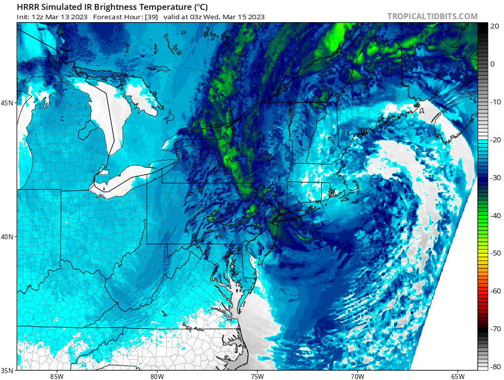
Noob question if a pro can answer. How come the IR sattelite map seems to show heavy clouds over the area but it doesn't reflect on the surface precipitation map? Same with GFS IR and surface precipitation maps. Compare both images.

-
-
Anyone have any info on the 18z euro?
-
I’m hoping we get NAMed
-
Anyone have NYC total snowfall on this euro run?
-
Coppied from NE forum
-
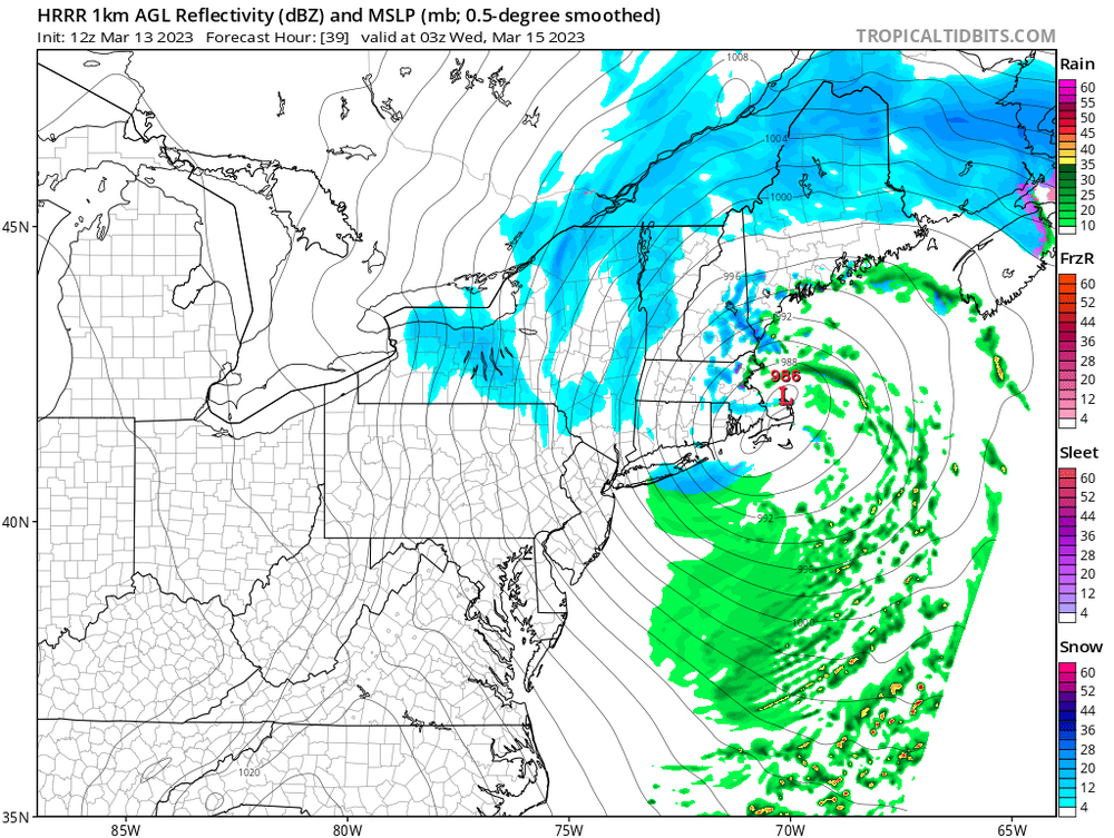
The last hurrah? Putting all the eggs in the Tuesday 3/14 basket
David-LI replied to Ginx snewx's topic in New England
annyeonghaseyo? -
The last hurrah? Putting all the eggs in the Tuesday 3/14 basket
David-LI replied to Ginx snewx's topic in New England
King is running -
The last hurrah? Putting all the eggs in the Tuesday 3/14 basket
David-LI replied to Ginx snewx's topic in New England
How’s the 12z GFS looking?