David-LI
-
Posts
1,439 -
Joined
-
Last visited
Content Type
Profiles
Blogs
Forums
American Weather
Media Demo
Store
Gallery
Everything posted by David-LI
-

Extreme Cold, Snow & Sleet: SECS 1/24 - 1/26
David-LI replied to TriPol's topic in New York City Metro
What if they have a secret extremely accurate AI model that we don't know about ? -
Extreme Cold, Snow & Sleet: SECS 1/24 - 1/26
David-LI replied to TriPol's topic in New York City Metro
I dont see that on the run. Wraps up Monday afternoon / evening. 24hr event nonetheless. -
Extreme Cold, Snow & Sleet: SECS 1/24 - 1/26
David-LI replied to TriPol's topic in New York City Metro
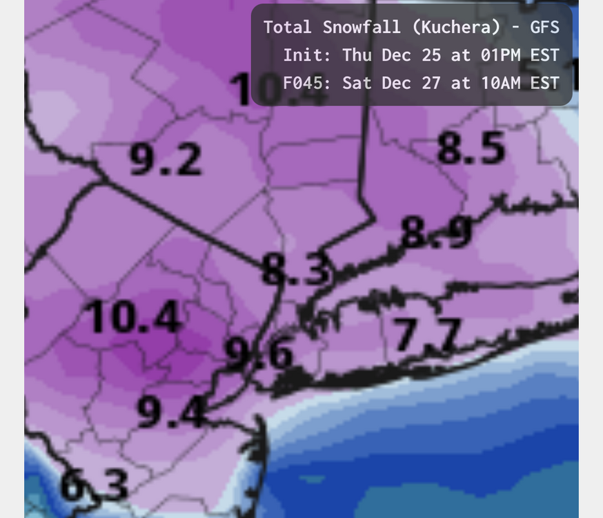
00z GFS Kuchera
-
Extreme Cold, Snow & Sleet: SECS 1/24 - 1/26
David-LI replied to TriPol's topic in New York City Metro
If this verifies, no school on Monday. -
Extreme Cold, Snow & Sleet: SECS 1/24 - 1/26
David-LI replied to TriPol's topic in New York City Metro
GFS rolling -
Extreme Cold, Snow & Sleet: SECS 1/24 - 1/26
David-LI replied to TriPol's topic in New York City Metro
Has this always been a Miller A storm? That's what it looks like on the ICON. Someone correct me. -
Extreme Cold, Snow & Sleet: SECS 1/24 - 1/26
David-LI replied to TriPol's topic in New York City Metro
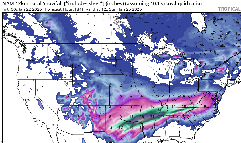
not our region and FWIW, 00z NAM has a lot more precipitation than the GFS in southern states, compared to the 18z GFS at hour 84. GFS NAM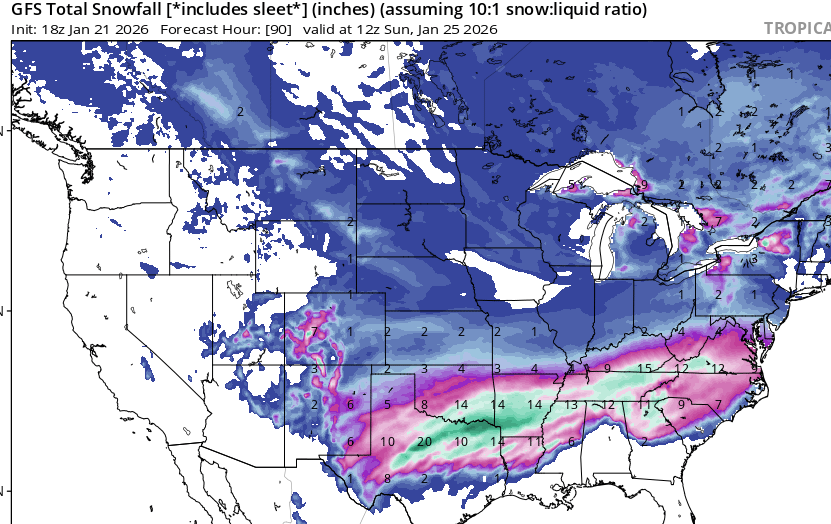
-
I don't think the media is taking these freezing rain totals as seriously as they should. Vast areas of some states with 1 to 2 inches of freezing rain is very dangerous.
-
Extreme Cold, Snow & Sleet: SECS 1/24 - 1/26
David-LI replied to TriPol's topic in New York City Metro
what do you mean by making? There are free websites that offer premium services, like pivotalweather, and tropicaltidbits to view weather model maps. Not sure about making one. -
Extreme Cold, Snow & Sleet: SECS 1/24 - 1/26
David-LI replied to TriPol's topic in New York City Metro
I see it often being posted here. Not all of us have premium subscription for the maps. -
Extreme Cold, Snow & Sleet: SECS 1/24 - 1/26
David-LI replied to TriPol's topic in New York City Metro
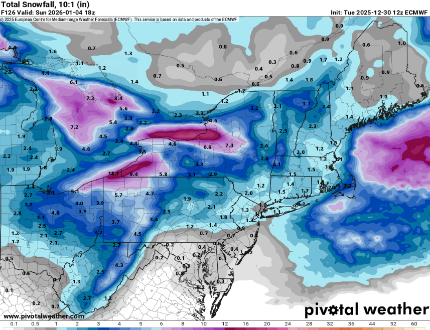
AI Euro 12z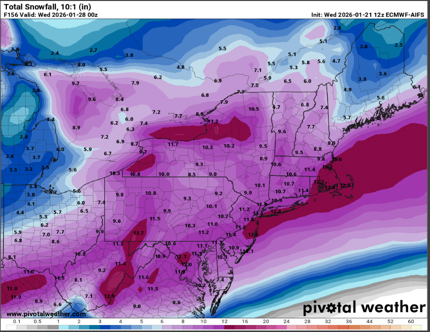
-
Extreme Cold, Snow & Sleet: SECS 1/24 - 1/26
David-LI replied to TriPol's topic in New York City Metro
yeah not buying it until we get NAM'D! -
Extreme Cold, Snow & Sleet: SECS 1/24 - 1/26
David-LI replied to TriPol's topic in New York City Metro
If this verifies, can it be considered a historcical snowstorm for some states?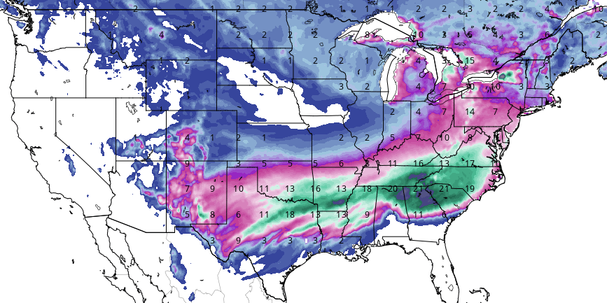
-
MO/KS/AR/OK 2025-2026 Winter Discussion
David-LI replied to stormdragonwx's topic in Central/Western States
Anyone got a freezing rain model map for the entire event? -
Extreme Cold, Snow & Sleet: SECS 1/24 - 1/26
David-LI replied to TriPol's topic in New York City Metro
You already have the 12z run?? -
Storm potential January 17th-18th
David-LI replied to WeatherGeek2025's topic in New York City Metro
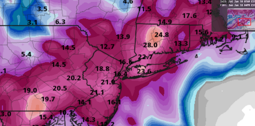
euro for tomorrow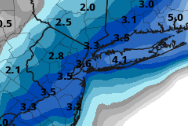
-
18z euro is basically a non event for next weekend.
-
12z GFS
-
Fantasy But if it happens looks like an overrunning?
-
Can we ban posts with model maps beyond hour 200?
-
aren't these phantasy output by the model at that range?
-
euro 12z
-
I think it was January 2016 or 2019
-
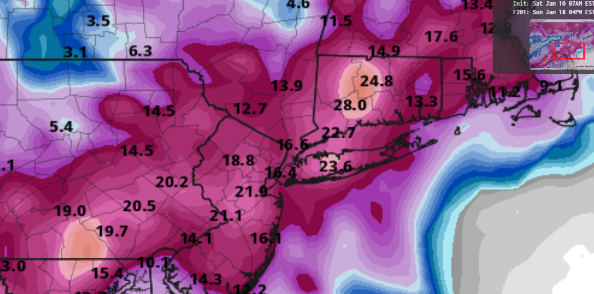
GFS soundings show no mixing or warm nose issues at all. Entire column is below freezing, higher kuchera ratios are possible here
-