

Typhoon Tip
-
Posts
43,298 -
Joined
-
Last visited
Content Type
Profiles
Blogs
Forums
American Weather
Media Demo
Store
Gallery
Everything posted by Typhoon Tip
-
I dunno ... +5 SD easterly anomaly moving into and up underneath an intensifying frotogenic axis ... all of which is slant wise tapped into the left and right entrance 300 mb extraction jet has a tendency to drop 30” (Dec 17) 2” QPF has more potential than we may over think; and this thing’s duration anyway with all that morphing into a CCB has over cooked doubter-ham bust written all over it in the interest /respect of consensus I grudgingly capitulate to 12-18” but I’m in the deep end of the pool for this adult swim ...
-
It's snowing 20" ORH-BED-YOU
-
Stepping back ...however, I'd put that at dubiously over evolved.. The flow being so fast in that pattern means the timing of the N/ stream/SPV subsuming down through the Upper Midwest earlier on D7 has to be pristine to pull that off, and at this range ? unlikely to prevail thru to verification. It can ...sure - just unlikely ..
-
I think in this case that may be needed ... These -NAO is behaving kindly wrt climate, in that these are modest permutations ... fluctuations in the neutral to -1 ...maybe brief 2 before relaxing ... pulsating on a 5 day periodicity. And with a steady diet of Pac energetics rippling through middle latitudes of the continent - very good petridish... Only, we don't need 504 dm super nadirs parked over JB because that's "too much of a good thing" - I saw the GGEM 's 12z ...It really was close to a very substantial event from the lower OV-NE regions because of the same governing reasons ... narily missing a subsume phase because the separate stream velocties are too excessive.. The Euro is about 20% ( ediit: actually much more than 20 ...) more stream fused/harmonic .. and we see a bomb there.. Really, the ensembles of the GEFs hint a fast mover too - Something is there for Feb 8-11 .. .but in this renewal of a faster hemisphere S of 55 N ... it probably biases on the front half of that range. Hints were there 2 days ago in the GEFs btw...We've been distracted by shenanigans in the foreground.
-
What a fantastic bomb on the Euro!
-
I'm seeing a Euro solution that's 'denting' the 850 mb isotherm SE more so than priors and that - as I've outlined before,...- is climate friendlier than that warm intrusion look. Considering having 1030+ polar high draped through Ontario/ N/NE of Maine...and already entrenched in the region, a correction and closer discrete handling of the isotherm/compression toward SE zones ... pretty much has to happen here - sorry. Also, again .. again .. again .. + 1C at 850 with sub above between that level and the growth region of the sounding, and isothermal beneath that... inside of which is a saturated cauldron of dense falling snow is only going to cause parachutes to 1/4 visibility .. You really have to be +2 C through perhaps 100 mb to get all the way to cat paws, if/when fall rates are heavy.. in that sort of UVM parked over isothermal sounding - This crushed the 1997 Dec 23rd forecasters when the 850 was +1 then... I remember that as the then, "ETA" FOUS had +3 at the SFC, and +2 and -1 at 980, 900, 800 mb levels respectively, ... how did that turn out.
-
I'm seeing nuanced reasons ... more and less valid, to not trust any guidance' singular handling of this system really - For now I am taking the 48 hour EPS and the 72 hour EPS, and using those to canvas this. out of those standard metric(s)/synopsis 101. This following/below is a collage of the 00z EPS' sfc/500mb heights, 850 mb temperatures... and personal experience/climatology ... that translation of 500 mb heights and surface cyclone track, while that 500 mb deepens that dramatically, with 850 mb therms never exceeding 0C NW of extreme coastal NJ to KBED up in Massachusetts ... is typically 10+" ( as conservative entry -) from N NJ to SE NH ... and closer to 20" is frequent throughout history wrt to those two canvasing metric/behaviors therein. I almost want to just say, 'period, case closed,' draw off my pipe and reengage the slow rocker -but I'm a bloviator and you know I can't resist lol Adding or subtracting from that canvas ... based on meso this... or whatever that, but there's too much data flying around that is obfuscating the picture of this thing at this point. More so than any blizzard it may or may not cause. Sometimes the simpler explanation turns out to be the truth.. I don't know if I buy these QPF gaps. This is not 1992 wet snow with a lower growth region in a CCB sounding that's going up and over orographic striations inland ... imposing systemic lee-side drying... I don't see that. This is mid level bonkers! There's likely to be a compression of the thermal field along an elevated frontal slope as it escapes slantwise polarward ...as the 500 mb initial flow begins to veer aloft and up-glides that interface ... I admit to wanting to see more 300 mb difluence but there is some...Both left and right entrance regions of accelerating jet at that level is moving NE out of central NE ...~ 48 hours, so that helps.. That's your elevated WAA instability burst - all snow even to the Borne Bridge at onset.. Then, the models are closing off the 700 mb in tandem with the height falls above that ( abv ) and when that happens, the whole column destablizes with these direct feed, saturated inflow jets ongoing beneath and in that level. There should be almost synergistic returns out of that and if anything this should be over-achievably proficient in this look - I comment in snark ( but sort of privately meant it...), how we have been witnessing in the Global scales, all precipitation events being prolific as anomalous - that appears to be primarily relative to climatology, but I suspect that the models are doing this shorting' too. Why? Because we are witnessing that, empirically. The Dec 17 ..easy example: 30 to 40" NY state to CNE? No, wasn't modeled... These "flukes" are more common because [ enter denial of truth here ]... Here we are faced with a synoptic circumstance screeeeaming for over production.. . 8-12" ...I don't know if I buy that, when the climo for that look described above in that collage is really color-by-numbers for snowstorm idiots. I guess we'll see.. But, I think the Euro is too warm in eastern zones with that 1030mb + high antecedent and entrenched. And when the pressure falls E of the Del Marva, the flow in the interior up here will lag respond, but when it does, we'll have a NNE wind and [probably] much better defined and locked CF somewhere over SE Mass/ Scotts back yard...or thereabouts. I could see Boston mid way bouncing 35 to 29 and then back to 34 ...back to 30 ... as this feature wavers there ... I would also not worry about the 850 mb getting to +1 C ... in fact, with heavy fall rates, that's probably parachuting right through that layer, because in this scenario it is isothermal near-enough to 0C beneath that level to the surface ... not warm enough to melt dense mass falling frozen phase states through it. That's wrt to the EPS above.. .But, I have to admit, I've been through enough of these and given these orbital perspective/synoptic inidcators leading this...the 00z/06z/12z NAM FOUS SFC-800 MB temperature profile at BOS tends to be right ... well, here: OUTPUT FROM NAM 12Z JAN 31 21 TTPTTR1R2R3 VVVLI PSDDFF HHT1T3T5 BOS//682122 -3318 283306 22869192 06000581844 -1418 260102 25929493 12000652846 -0319 271602 27949493 18000796833 -0619 260809 29969393 24000807532 00618 220717 32999295 30000898861 00521 180726 34009596 36050989136 13314 100537 39009996 42094975022 02016 020438 40009699... this means 32F at 980mb ( basically mid way up the Prudential..), ~26F @900mb, ~30F @800mb, 9.5" of snow! 48019974808 -0306 960328 39019900 54007945222 02005 943620 38990000 60006946420 -0307 943617 36980099 If these grid were incongruous wrt to the total synopsis ..okay, but it dead f'n fits in my mind and I actually think even the higher res Euro is not really hitting the local/studies/ and meso shit that that the old salts yarn how, "we used to have a saying - "
-
It’s not the first run of a model across the saga of this thing that has done that… The icon at 06Z also implicated a blizzard. It’s just these last to run cycles since then it’s done weird fercokta things. This run it’s ever so slightly weaker aloft so it fails to pin the capturing ...then forms a new low far out at sea and hooks it toward the Maine coast - that’s why we’re getting the QPF split. Not that anyone asked ...my feelings are this is trying to get to a major impact. I just think that it’s almost like you guys are being f’ed with just doesn’t want to give it to you because the machine intelligence of the models have become self aware and know how much you want it lol
-
It’s inching since 0Z last night
-
Nice collage and effort here ! no not trying to nit pick ( seriously ...) but I have such vivid memories of the week leading and throughout that 1996 event to confidently argue, it is/was really only similar as it landed on the EC in that 7am window of the 8th that year. The frames leading got there differently and that very much matters in my mind - what that sort of signifies to me is this storm is relatively unique ..if that's 96 variant is a top dawg comparison - although that QPF distribution (presently...) looks similar. 1996 was a close roller that ran into a cold loaded damming event ... This is closing and deepening in the other direction - just sayn' But I do think hemispheric and "super synoptic" ( mean synergistic effects ) this system is rather unique. It's formulating in the R-wave seam ... which is why it is moving so slow. The one 1996 was in a slower medium/flow rate. Perhaps it doesn't matter "how" we get there - agreed... I mean it is what it is. If it does similarly when it's there who is gonna care. Lol. But, ... this one I think has a bit of dark uncertainty to it because of that "Lagrangian" wave space.
-
Rightful to be skeptical of that ...heh... yeah - but the thing is, someone - I feel - in this is getting their ass handed to them. I don't know where. The GGEM cluster has been closing off the mid level centers earlier and thus that appears mid-level dosing down there... Because the surface reflection and pressure arc already has them on a N/NNW wind... I think that's even a borderline d-slope trajectory there.. It's like when we see a 60 hour NAM putting out 1.13" of 6 hourly liq equiv QPF at Logan on a NW ( 330 deg wind) in the FOUS...? Never happens.. by the time that interval is 24 hours, it's like .21, with RH of 38 .. which means that .21 was on the front edge and it's actually clear during most of that 6 hours. ..And all that 1.13" glory is pummeling D.E.M.
-
that's a good way to put that in this scenario - It's like booking a cathedral conference hall for a little-people convention
-
It's just I ..yeah, it's got enough to go big, even exceptionally so .. ... but nothing is... huh - I don't know if I have that much sack -
-
that's a crazy story man - wow. Someone is manipulating the modality of the market ... lots of set up triggers on shorts - too many and it seem dubious to me.
-
Heh.. I'm a eye-rolling at times, frustrating at other times ... complimented mash up between creative rhetoric and technical terms - best to try and not follow me in any academic sense. I don't wanna be responsible for your flunking any essay exam questions. hahaha
-
Something that's bugging me about these snow products ...other than the usual eye-rolling. It's that we've been living in this multi-decadal climate bubble were everywhere it snows on the planet, it does so at a greater proportion than expected - its a matter of how much. Dec 17 ? just one out of a hundreds events that can be used to exemplify this. We knew there was a whopper CSI signature in that thing - personally I thought it was rt 2 but it positioned where so ... meh, fine. But, 30 inches? Hell, the entire month of 2015 Feb .. list is deeper than the snow ... No one saw that coming - nope... Yet we have a closed deep layer anomaly and easterly fetch clear to 300 mb and difluence above that fanning away from the region ... over top a sfc - 850 mb that's blue cold 12" okay - It's not a complaint... I'd be happy with 5" .. I don't nee to have trouble getting to the gym and store to get the point across personally...but, that seems like it should be a 24" glacier from PWM to N Jersey ..
-
Welp ... in 1987 this would be a 4th period rare blizzard watch ...
-
Yeah I dunno. This looks like an above moderate event at this point. Matter of how much so - that will iron in time. Could be bigger than some think.. But too bad! Some will lose-out, relative to that. Someone, somewhere, always will. 'Name of the game... And to them this will be moderate...pedestrian...pick the woe-is-me adjective. They'll dust off and live to witness the next boning somewhere else while they get the EOF3 tornado later that summer... And the SE zones cry and bitch their way into a Hurricane Bob scenario while the 30" Orange MA snow storm gloaters will have just spent 4 months in a drought and half to watch green tropical-mode rain curtains miss to their SE for being just out of reach... It's a dumb engagement if one is in here for e-tropic highs - like any addictive behavior... but I'm wondering...wait, what the fu was I talking about... Yeah, so, yesterday, I was concerned that this might try to gather around a more coalesced/potent look once additional less-than-noticed mechanics relayed off the Pacific during the day today and here we are. That/its influence on this thing may not be done? We could have seen the beginning of a two cycle modulation and actually ...the cross-hairs on the hemispheric signal isn't over NJ with the closed 500 mb..it's more like SE of ISP ... NJ works ..sure. But if this whole structure did what you said there above...nah, it's within the framework -
-
I start to wonder at times if this engagement is really about wanting or seeking an arena that enables one to be where they truly want to be: in a neurotic crisis mode - ...something like that. I mean, we pine and hand-ring for fun in the models, "fun" shows up on the models. Then it's 10X's more energy expended nit-picking reasons to go, "OH god! not again " Hey, that JMA solution was insane ... It has a 20 dm of height reduction spanning 24 hours, and parks the nucleus over Worcester 12z Wed morning... If that happens, that low it has 983 outer GOM is actually going to be southwest where those isobars are stressed/oblong, and that's a raging choke blizzard. Course...the JMA -
-
I wonder of this will do that rare sky before a coastal, where you see virga bulbs and tendril moving actually WSW aloft ... Normally, that virga phase/entry into the event, the evaporation is pre-closure up around the 700 mb level, so the motion isn't west yet... it's still SW--> NE.. Meanwhile, town flags wobble or taut NE down low with whipping grains just before the first aggregates dance beneath the lamp lights in the blue tinted dusk.. You're like, this feels big - But roughly around 18z on Monday... across the area, look to those skyware features. I bet they're moving WSW early ... because the modeling ( as you've noted wrt to the GGEM ..etc..) are closing off earlier, and deeper, and I suspect the 700 disk is about to do so quickly ...maybe prior to the saturation below.. There's some argument as to whether that arc moving N in the bevy of guidance is an initial IB ... But it also looks to me like this thing is establishing a CCB conveyor in tandem, so it's difficult to know what is sort of a quasi trowal/instability axis, versus - fascinating. Maybe collocating multiple processes
-
things is ... ( and it offers you a defense anyway ..- ) I don't personally think the we are in a moderate to strong planetary-conductive mode of La Nina... I think we are in a low amplitude mode ( and NCEP is repeatingly referring to it as just that.. "low amplitude La Nina" - some one down there in DC is on to this). From there ...I have a my John-ism supposition that the HC ..which mimics, may ( and I believe does frankly - ) be constructively interfering with the La Nina, because both distribute the SST metric similarly; sea surface stressing/increases in the HC's easterly Trade wind mass balancing/ at low latitudes, to counter the insane speeds at west vectors/mid latitudes...etc... strongish HC circulation general eddy logic .. I think the HC is fuggin with the ENSO climo by exaggerating cool regimes and attempting to bury warm ones ...Not absolute - god I hate that... These are spectrum'ed influencers ..( I know you get that, just in general). But I've also talked about this super-position hypothesis before ...and also still believe that it is almost impossible to parse out the relative forcing contribution of either... I do wonder though ...if the La Nina mode was assume bigger in amplitude based upon SSTs alone, that may not reflect in the total hemispheric mode(s) if the SSTs were assumed to be entirely La Nina driven - the latter may be over-assessed in that spirit.
-
I just find it so ironic that here we are in the midst of an empirically/verified fastest hemispheric mode ...probably the most so ever observed - maybe even associated with GW/climate change pressing against boreal winter climate... whatever - And this? This thing could be a 30 hours of steady > median impact ... with 12 hour embedded at major. Could be - there's time.. Even I find this difficult to contain honestly. I mean I won't lie - Meteorological stuff is built into my soul and this is a passion ( among others I have...) ...anyway, depending on the pervasive nature that realization pans out will determine ... historic? I don't know - cannot be ruled out, though. I cannot impress enough, this was never fully realizing the synoptic/super -synoptic hemistphere. They don't have to, is the thing...sometimes you only get 40 .. 60 ... 70% returns ... At this thing's governing hemispheric signal, even 80% efficiency/return would be historic ( and you can never really get 100% - that's a theoretical limitation and entropy makes it an asymptotically approached limit ) I think we are getting close ( obviously estimating...) to the 2/3rds, may 3/4 return threshold as is, where prior was about 50 ~ The problem is... the EPS mean 500 mb height for 5 straight clicks ( c/o TT's access) have shown two things: -- this is steadily deepened/ positioned S toward the historically infer -able bull's eye for stalled/protracted events... being one; -- but earlier in this thread I discussed the slow/duration-al aspect of this as [probably] rooted in the fact that it is a teleconnector "Lagrangian region" ( rhetorical license) ... where it is caught in amber in the planetary seam, between ridge waves... Thus, the system in total may move along at the R-wave modulation timing - that's code for quite slow. When looking at the EPS mean ...that gives the "look" of being a stable scenario from west of California to S of NS ...? That's why that looks that way. It's like the thing pauses for a while .. Another artful observation .. it seems like the Earth does this once in a while ... regardless of the system. If a given system over longer-termed observation is dominated by one characteristic ( in this case 'speed' ) .. when something comes along and offsets/perturbs that constancy ( anomaly relative to the longer term anomaly) it goes on to disproportionately f* the shit out of the system as punishment for the prior stasis - hahah... Like it's our fault we enjoyed of a smooth winter for 5 weeks - now we're gonna pay. Muah hahaha... No but seriously, the other way some times seems to yaw violently. Interesting.. Like, that marathon runner in the 1970s the wrote that book about heart health, had a pulse rate of 40 beats per minute while relaxed...was cut up and svelte and veiny in shape... found on the side of the road having died instantly from a massive coronary while out on one of his 10 mile stints - like what
-
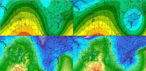
( made it to page 76 of this marathon but stopping at a hydration station - phew...) Wow ...not a big fan of these type of products ( my contribution over the years elucidates that - I almost never post anything based upon them tho rarely...). That image on the left ( more recent ..) is a flat out K.U. ...guessin' leve 2 approaching 3 NESDIS impactor. It's multi-regional, and this thing's under-footing hemispheric support had those that look to it all along...and we should note that models have been relaying ownership of more eastern PA pummeling back and forth during the pick-and-choose earlier ranges of this system's model monitoring .. .I think we'll see a consensus more in line with the left panel going forward, with one, two .. or four cycles worth of one or two models trying but failing to f it up... But another 3-5" tacked on to that distribution ( which I'm thinking is more plausible than not...) in that mean coverage and we move the NESDIS to a 3/4 contention... But 2/3 is probably major by virtue of regional inclusion - that's massive up there folks... Mammoth envelopment to realize 12" ...that's hard to do ... Usually ( think about this..) you get a regional 8-11" with a band or two approaching 24 ... Dec 17 kept the big daddy goods focused along that axis.. but, that mean distribution like that means you gotta have a few individual members blowin' the top of the climate books on this thing.. .but more importantly atones to aforementioned orbital perspective of this thing...as we get closer, the model blends, ens means, and individual members are trending toward the erstwhile unrealized maximization of this... that's usually a red flag - In principle alone ...that trend it gushing!!
-
Yeah me too - I did a 6.2 .. though only ran 5.75 of it.. But I only had modest right hamstring discomfort this time so I think that's finally improving. Man, those things linger for ever and ..oh wait -
-
Looking at the 00z EPS/GEFS means in their respective handling ... I would be inclined to ask, 'how about now'? I will hold off pending both this 12z suite, but also because that sounds douchy - lol ( Also- I am presently on page 69 of this thread and can see it's ballooned by another 12 clicks ...so I am behind, so taken with a grain - ) I would not toss the 06z ICON solution's trend for robuster 500 mb depth ... The hints that are carried through those frames suggestive that the model "wants" to truly stall and protract a CCB in the area, is highly supported by the general tapestry of the EPS/GFS means... I feel the 00z Euro was the right idea in bumping back NW but I am a little non-plussed that it's 500mb hgt depth went the other way by 4 or 6 dm after the close/quasi closure - the EPS mean being deeper is still the better fit for the larger orbital telecon/super-synoptic and observed synoptic surrounding hemisphere, and this thing has been shirked for realization of that offers the region between 90W-60W and ~ 35N and 55 N boxed region along. I have maintained that ...altho admittedly, pounding the moderate snow + duration)/2 = bootleg major sort of Broadway production, but I'm seeing attempts by the above ens means to get this more fully realized. The 00z/06z ICON blend actually looks like a better surface featured physical representation of what this thing should do... It seems every model is carrying something that seems more reasonable withing a bag of their own idiosyncratic distractions. Take the NAM ...I agree with the 06z solution that keeps the QPF arc in tact around the NW arc, but it seems to be too progressive with the lower troposphere in general ..given the 500 mb is also trending toward a NY Bite anchor point. about that - notice the 500 mb 522 dm height core in the ICON!! Over NY, ...implodes than pivots SE under LI toward 96 hours... That type of motion usually means there is a F- wara effect going on with a lower tropospheric vortex that is pivoting W temporarily... Yet we're not quite seeing that depicted ...that's uneasy and I thnk this overall situation could modulate toward a major event anyway from NYC-PWM ... Hammer's cocked and the psycho is gently squeezing the trigger - it's that close The title of this thread can be changed from watching closely to Immanent, with 'major characteristics looking more possible' or something to those affects.


