

Typhoon Tip
-
Posts
44,568 -
Joined
-
Last visited
Content Type
Profiles
Blogs
Forums
American Weather
Media Demo
Store
Gallery
Everything posted by Typhoon Tip
-
Yeah ..that's more than less how I lean as of this moment ... I don't have any horses in the race here though so if it butt-bangs the weekend pan-dimensional fuggit. - I think I remember that once happening in my whole life, where all three days were miserable... -
-
Wednesday, May 26, 2021 Convective/Severe Weather Potential
Typhoon Tip replied to weatherwiz's topic in New England
It is only just the 1pm hour but ..heh, the timing is just off by that much ... We may see propagation mechanics come east this evening ( meaning east of the Berkshires ...etc..), but that's contingent upon how organized the upstream activity gets. If it stays small clustered and discrete is may not pool outflow with W-E momentum ... Lapse rates are so so, and I think if one bothered to look at severe events ... they tend to scatter plot denser in the side of the graph with steeper lapse rates. Granted, we don't normally get >1500 CAPEs cooked up around here ...so with some synoptic forcing with a mid level wind acceleration passing astride to the N...this may help/offset. Not sure - -
Yeah...I typically credit the home stations of Wunder's network 2 pts for rube calibration - hahaha... Still, the acceleration isn't finished... Seems the "bust max" should be 93 if we get an 850 mb lapse ceiling - not sure tho... Actually, shit - forgot to check the machine numbers...ah well
-
I wanna see the Euro to be blunt - ... short answer? I'm thinking the rains/wet may be Friday night into Saturday morning, with option to sell on Sunday/Monday dreariness, because that could still end up okay, pending - I think the 12z Euro is inside of 4.5 days for that mid weekend period ... and I'm not completey sold on a punt ... I think these models look over-wrought with development and maintaining baroclinic activity/cyclongen given to the paltry mechanics aloft - the flow around that weakly closing mid level activity is all of 30 kts most quadrants and that surface evolution looks disproportionately forced - the Euro was guilty of it too at 00z but it's 12z yesterday seemed a better fit ... oy
-
Well ... regardless of convection we got us a scorcher out there today. As was warned ... if perhaps only unto myself heh, this is the first time we've intermingled this kind of theta-e density with the sort of temperatures we got going on out there. The lack of acclimation to this point this season is making that an arresting experience walking out there. Ooph ...just sort of stand there looking around bewildered. 92 at several homes stations around town with DPs between NWS ASOS and here 62 to 65 scattered about ... The HI is what it is but it's plenty and it' only 1pm
-
Wednesday, May 26, 2021 Convective/Severe Weather Potential
Typhoon Tip replied to weatherwiz's topic in New England
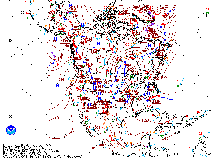
Fwiw - https://www.spc.noaa.gov/products/md/md0745.html -
Mm... it depends. I think there's a soupcon of oversell on the dreary side LOL..... I get it - best to be defensive and have one's heart broken now ...so that when the fated she/he shows up at the airport to stop you from getting on the flight to oblivion, the music swells and all's well ... But, the 00z GFS operational run was over with Saturday by noon and fair skies and light enough wind that under solar max sun and 552 thickness ( +6 at 850 mb) on Sunday/Monday that's still pleasantly mild. The 18z was opposite, granted. But what does that tell you ?? It tells you the continuity is off line. This could go either direction still... Seeing as the period is also beyond 4 days, the Euro is not infallible either. In fact, it's previous 12z run was more similar to the the 00z GFS... yet, it's 00z run, tries to inflict all this lower tropospheric impact off a mere sag in the height contours left in the wake of phase it shouldn't have tried to do in the first place... It's like the models never really did give up thinking it is winter still. If these guidance can demo a modicum of continuity, while agreeing ... I'd be more personally sold on drear-out weekend loss. For now, I think the Friday pm into early Saturday has the overrunning aspect to it and we may be wet..But I think the NAM is too far N with that ... ( cat paws and whitens the 1200 els up there) ... Then, I'm inclined to think that the subtle cutesy phasing the models are trying to handle is unlikely to actually succeed, and then the skies tend more fair like the 12z Euro/0z GFS ...sort of blend or at least in concept, suppressing the 2nd spin up. Tell ya though, if this analysis turns out wrong and we douse the weekend - meh... Keep the lawns green.
-
I didn't even know the man was ailing... Or was this something sudden? RIP James. This really hearkens back for me. I was at work when the iPhone vibrated across my desk. My sister had called to inform, 'Last night Tom was found unconscious.' She led on that the EMTs tried in vein but ...he was pronounce officially upon arrival. Cardiac arrest is printed on the DC ... which, is kind of uninformative, really ... I mean, all hearts ultimately stop beating at the end. Seeking some semblance of realism that didn't require supernatural forces poaching a kid in their hay-days ... the autopsy did surface indication that anabolic steroid use, even in one's late teens and early 20s, can manifest irrecoverable organ damages ... left unknown or checked, failure. - the family was cagey beyond that as to what precisely did him in, but ... one doesn't probe at that point. The parents would have preferred apoplexy to what they were going through, no doubt so ...that as they say, is that. Congestive heart failure; he was just 32. Thirty f'n two.
-
I think the overrunning rain Friday night is okay but that winter handling later in in the weekend doesn’t have much support ...
-
How often do BDs get so pernicious they start moving west thru the TV valley
-
Mmm... not as in, 'coming down the proverbial street toward America' no - But they are also biding time while maintaining an impression of global involvement, while coveting [ most likely ... ] partisan and non-cooperative intent - don't kid our selves. There is a history of that form of deception from those cultural heritages over there. That's not a problem ...for now. But their pattern of other observed behavior is suggestive of exclusionary policies toward the world. You know? building man-made islands that potentially serve as strategic pinch points in Military and/or international trade route contentions that are easy geodesic predictions. Nor is launching missiles recently that targeted, successfully, and destroyed, ( first time successfully by the way - ) their own communication satellite as a [ don't kid ourselves ] bicep demo for the rest of the techno-spoken world. It's like ... we need to play, but we know this game can't last forever, either - then what? Those activities are hard to explain otherwise. They smack as preemptive, self preservationist tactics ...in a world of increasing scarcity, that give them credit - they are planning for long before the convenience and presumptive West really seems to be taking seriously enough. I dunno.. with their particular resume of humanitarianism, historically ... it is not a giant leap to see them being blithely resolved, disconnected and detached, while sitting upon probably the last bastion of raw resources and know that the 6 billion people not a part of Chinese sovereignty...will come calling when the non-sustainability of the global population as a dilemma becomes an acute problem for the world.
-
Okay -
-
The problem here is 'null data space' Say we're faced with a infection illness that needs per capita bodies to actually infect - You cannot prove, 100% assurance, that not inoculating would result is say X numbers of casualties - in the same vein, you cannot prove 100% assurance, that the inoculating is why there are Y infection rates. See how that works ? It doesn't lend to the argument of "needing" to inoculate when in hind-site...looking at the case totals and death totals and present daily new case loads...etc...etc... we don't in fact know whether not inoculated would mean more victims - we can guess that it would ... duh, with reasonable confidence. But the space between not acting to prevent, and the end result numbers being what they are, is a gap that cannot be proven either way. Here's something to consider: "IF" there were no vaccines and a lax societal scaffolding of measures evolved to have combated this thing... that means that its mutation rate/variance potential is much greater. That really adds a kind of 'dire' prospect/spectrum of realizing horrors. The 'null space' is actually filled with possibilities in that sense...just nothing real. Who's to know or could say no, on the mutation being part of this ? No one can. Maybe in such an alternate -plausible - reality, the mutated version is a baby killer. You don't know the null space. You don't .... So, yeah, ...it's always a dumb idea to get into arguing hypotheticals because it quickly devolves into a non-winnable debate ...ultimately, evasive for the side that may be wrong - if one can even be ascertained...and on and so on... But there is an element of plausible truth to this, that letting a virus run rampant from host to host ... carries secondary and tertiary emergent scenarios that by virtue of null-space, cannot be determinantly proven one way or the other. What the vaccines may do - is protect us from an uncertainty curve that ...mmm most likely doesn't end well should the curves become reality.
-
The PNA at CPC gave me pause this morning... +1 isn't a warm look. However, the 'tendency' of the operational runs, Euro, GGEM and 06z GFS ... ( some lesser degree, the 00z version of the latter ), are out of phase with that... having a postive rest state SE height footprint throughout the D7-15 range. And the AO and NAO are trying to hike the index positive, too, which is also competing indicators. Now... granted, we are sort of losing the PNA credibility as a telecon correction usage turning the page into June. Also, the wave lengths ( r-wave number and identification) do actually appear more nebulous out there...so perhaps the PNA --> PNAP orientation may be a faux assumption. I you know these things don't just turn off like at neat behaved boundaries in the atmosphere. They 'smear out' of forcing ...then smear back in during October..etc... So, you can have correlations still work even in mid summer. It's just matter of how often. blah blah Anyway, said footprint and the +AO/+NAO hemisphere actually matches said SE height tendencies better. It could all lean the early gamble toward a warmer June. I haven't seen the EPS indexes.
-
Wednesday, May 26, 2021 Convective/Severe Weather Potential
Typhoon Tip replied to weatherwiz's topic in New England
Kidding... of course - But the gist of the mid week 'potential' is a specter that's been looming on the charts for a week now actually - I remember commenting on this literally last Wednesday. It's just interesting that these open wave scenarios seem like they are better performers - so we'll see. Heh, just think, Wiz' ... you may actually get a severe event in May like you seem to think you should, IN MAY lol -
Wednesday, May 26, 2021 Convective/Severe Weather Potential
Typhoon Tip replied to weatherwiz's topic in New England
Mm hm... takes an EF4 tornado vortex up the western side of Mt Monadnock, over the bald rocky summit, and right down the other side, too - ...pretty cool, huh - -
I'm just looking at the individual GEF members at the coarse rendering over at PSU ... The short version ...I wouldn't be surprised if it Sat/Sun/Mon are all just seasonally cool to mild with partly to mostly sunny days, any more than I would not be surprised if the opposite happens just because this post makes sense Longer version.. you know - 2/3rds of those 33 members don't even really have any kind of Mem -Day weekend inclement weather even there. Some of them even have a flat ridge where the operational run keeps trying to crinkle the flow into a single, one-contoured power bomb .... ugh I think the Euros notion of complete suppression is a trend that may not even be done suppressing ... - until this 12z comes in nucleating a 974 mb cat-paw nor'easter - heh.. .kidding. The models have been over selling shit weather in the mid and extended range since last October. Consummately disturbances are some half the magnitude and impact, having been eroded in signficance until in short term, compared to what they were when they first emerged out of the chaotic ether of longer range model visions. We came to bank on that - Not sure that's not doing that here.... I mean there are reasons to argue that it should be weaker and less meaningful - as snarked above, it's weak anyway. What is the GFS (GGEM) for that matter, creating all that QPF bluster out of one contour at 500 mb. Plus, all models are trying to actually lop over an anticyclonic wave-break pushing toward western Ontario with said weakness underpinned. The Euro suppression/trend seems a better fit.
-
I'm guessing that (bold) matches the anecdotal consensus of 'bus stop America' too. I mean ...we've said this over and over again, but nocturnal elevated lows kind of "cheats" warm enthusiasts LOL ... bootlegging the season into contention when no one is looking. I know just personal account ... it has not seemed very warm - but I am also scientifically aware of weather metrics and parameters, and keep a running tally of oddities ...most Mets and advancing enthusiasts do - nothing new. But we had 4 days 71 to 76 F afternoons, in a thickness ambience that was below 540 dm in May. sub 540 dm thickness in May, is not in and of itself that unusual. Sustaining it for 4 days is, however. But, what is even MORE unusual ...( and no one's really commenting on, which I find interesting... ), is 75 F at 534 thickness is an exceptionally rare lower troposheric to mid troposphere, coincident metric to observe. So it's like I'm perhaps bias around the 530s thickness sustained deliveries as a cold metric. But, ...obviously I know it was 75 in February and March, and April ...yet again, which cannot be argued as f-ed up heat so early. The reason I'm honing these idiosyncrasies, is because it just fits the overall weird spring this has been...
-
Deep range hints of an interesting heat signal - ... way out there... Kind of like the signals is the early neutrino surge in the days before LIGO detects the actual calling card gravity waves from some million light-year away event.
-
I think we are actually already in a climate paradigm that is "trying" to snow on June 21 - ...Oh it won't succeed. Lol... But it's tryin' I bet if it that ever happened...fuggit - call it snow in June, period, it will happen when the ensuing July NASA state of the climate publication bulletins that same June as the 2nd hottest in global history, too. It has nothing to do with the sun. Nor any current celestial mechanical nuances of Earths orientation with respect to the sun ( orbit eccentricities ). Nor is it volcanism... It's purely a circulation change, forced as an "emergent" result that is brought about by climate change - As the Hadley Cell expansion has carried on insidiously over the last 30 years, ... people need to get this straight: it doesn't necessarly mean tall heights. Although some of that may be identifiable. Increased thermal residence in the atmosphere can be expressed by velocity of geostrophic wind. The gradient has increased the westerlies wind velocities. The surplus energy is going into the mechanics of speeding of the atmosphere through that geophysical interplay. But ... in more expansive discussion, it's really because the polar domain spaces ...albeit warming the most rapidly, have a vast chasm of thermal sink to fill before total integrated gradient relaxes. When that threshold approached- incidentally - winters express a discerned tendency to have shifted N everywhere .. The next aspect that won't be understood ... is a concept in wave- mechanics known as 'non' -linearity. Those/that's when are implied forces getting 'transmitted' from the actions of one location, to another location, without really observing very readily any circuitry between the two points that directly evinces (reveals) the causal relationship. There is a non linear tendency for heights to "fold over" western N/A because of the mass- balancing from a fast spring-season Pacific. Think of it as a standing kind of "invisible" Kelvin Hemholtz wave, where the curl axis is over Quebec ... at times higher lower, left or right across eastern continental mid latitudes. Snow in May. Snow in October. It's happening right under our noses ... These weird cold plumes getting rattled around in that "super-synoptic-scale" - meaning virtual synopsis that occasionally does physically manifest... - in that eastern N/A region due to faster than normal Pacific mean flow early, and late ...spanning respective seasons. And in fact, ...counter-intuitively ... the heat in May is also related to that... for subsidiary set of complex synoptic reasons that people will just up and stop reading if I bother waste more life explaining to an empty room. Because said "gestaltic" emergent property of larger scaled behavior is also not fixed in latitude and longitude - it, in itself, repositions occasionally... such that if it is S, the tuck ends up with SE Atlantic humid/cooler flow into DCA-PHL while the "over top heat" phenomenon/frequency has been consequential... I mean there's probably all kinds of weirdness from this shit. Like the sudden increase in commercial airline intercontinental flight-speed records in the last 20 years.
-
Yup ... I added to that ( editing...) after the fact... " ... I suspect the model's maybe hyper sensitively environmentally aware .." It may be that it is attempting to 'see' too many limitations on heating based on NCEPs dream of having superior BL resolution- but it's like what Mike Ekster and I discussed leaning over a stairwell back in the Providence Easter BB get together days...It's like the model sees too much and it creates its own destructive interference - so to speak...
-
Agreed over all with implied/explicit limitations vs oddities in various guidance. NAM is weirdly cold biased for tomorrow imho - I personally don't believe the NAM is right about the T1 temp over Logan between 18z to 00z tomorrow. It's T1 ( 980 mb sigma ...about mid way up the Prudential Tower in eye-ball sense) is too cold in the FOUS grid.... given/relative to its own synoptic layout even. It appears overly conserving the 900 to surface lapsing rate from today brief cool down.. It'll be interesting to see if the NAM succeeds here... I suspect the model's maybe hyper sensitively environmentally aware of the Long Island sound? not sure tho - I was wondering/considering if the wind direction might be mixing in cold oceanic boundary layer from the S, over eastern zone as culprit. ALB is warmer at 19C and that's a red flag for this - the impetus being there is no vomit cold shelf waters upstream of that location. Labrador current condemns this climate to hell in the spring and summer. ...I really almost want to relo out of New England...the older I get, the more I resent this geo anus.
-
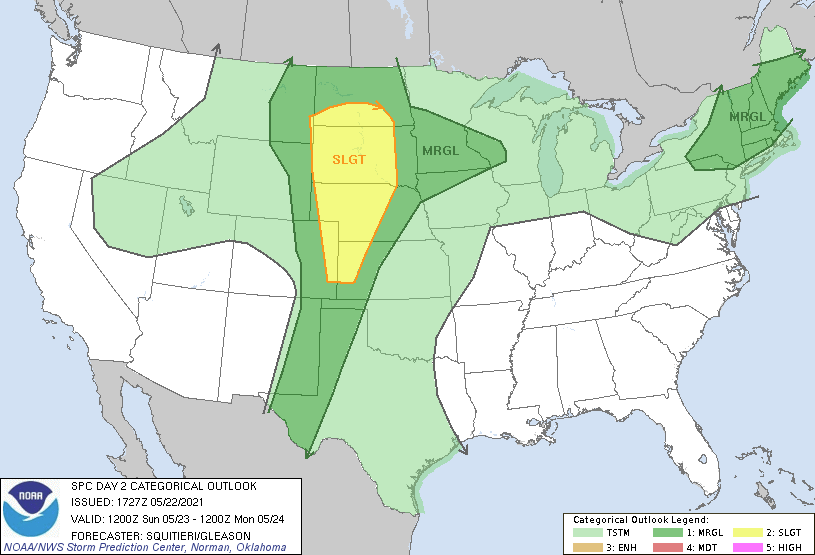
A Friday rain-out wouldn't be the worse moral-ethical thing to "suffer". Most guidance worth using are opening skies to sun, with light wind by dawn on Saturday... Cool drink of water morning vibe to the atmosphere. But +5C 850mb by Saturday afternoon, amid a N flow that is sort of d-slope, most MOS will probably be over assessing the cool complexion at this range - guaranteed. They'll be assuming a lapse mixing depth of 900 mb which is too shallow under solar max. Now, if it stayed cloudy ... different setting. It's interesting the polar jet is getting more dominating in the guidance ... it's that super synoptic "tuck" tendency f up summer again - but ironically..it's confluence big bubble no trouble us. Otherwise, would be about perfect timing for making ends meet with hydro maintenance, while not f'ing up everyone's weekend - ... Or, we can go back to the runs from two days ago that put all that mess on Sunday/Monday... I agree the GFS is not likely to succeed over the late weekend. I also think there's potential convective rain in the fore' here on Wednesday. Descent theta-e/SB CAPE, ..in a well mixed deep SW flow boundary layer with ample heating through 18z. Sending an open mid troposphere impulse with a wind max's right exit region nosing into the area may find sufficient triggers in Lake boundaries and/or hill tops over PA/NY and send some activity quickly E ... I think lapse rates may only be so-so just judging by the more modest height falls.. But 90/72 bath is high octane with even subtle height falls collocated with an approaching jet max toward 00z ... we'll see. SPC does have the eastern Lakes/OV and NE in "MRGNL" ... That smacks as the type of scenario where they wait until the morning of that day to upgrade.
-
-
A few strong to severe thunderstorms are possible later Sunday with the primary hazard being brief locally damaging wind gusts. Greatest risk will be across Eastern Massachusetts and Rhode Island, including Cape Cod and the Islands.

